I have been driving, walking and fairly often standing in the rain around this country for the better part of twenty years, and I still cannot hand you a single winner for the most beautiful places in Scotland. What I can hand you is the thing the photo galleries leave out: where exactly to stand, what it costs to park, which month makes the place look like the picture, and how many other people will be there when you arrive.
Because that gap matters. Somewhere can be extraordinary at seven in the morning in late May and a car park scrum at midday in July, and no amount of drone footage tells you which one you are walking into. So I have grouped this by region rather than ranking it one to thirty, which means it doubles as a route planner. I have also been straight about the handful of spots that photograph far better than they feel in person.
The short answer
Glen Coe, the Trotternish ridge on Skye, Assynt in the far north-west, the beaches of Harris and the cliffs at Dunnottar are the five I send people to first. Visit in May, June or late September, be on site before nine in the morning, and commit to one region instead of trying to cover the lot.
The most beautiful places in Scotland at a glance
| Place | Nearest base | Best months | Access & rough cost | How busy |
|---|---|---|---|---|
| Glen Coe | Fort William (30 min) | May, October | Free roadside car parks on the A82 | Heaving 11am–4pm, empty at dawn |
| Old Man of Storr | Portree, Skye (20 min) | April–May, September | Council car park, around £6 for six hours | Very busy; overflow parking is banned |
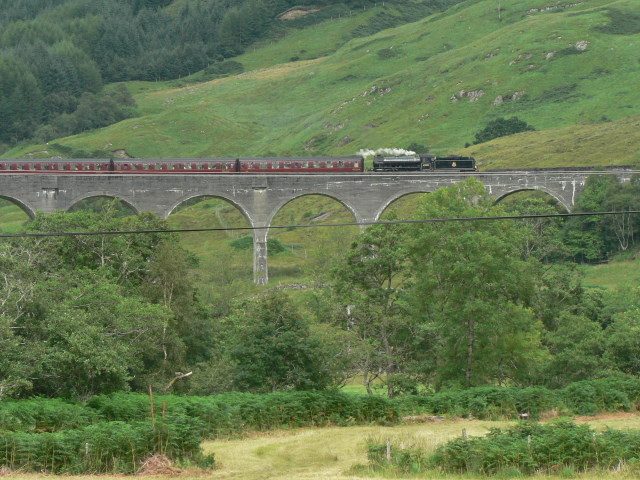
| Glenfinnan Viaduct | Fort William (30 min) | June–October | NTS car park around £5; monument £5 adult | Chaos 40 min either side of the steam train |
| Luskentyre, Harris | Tarbert (25 min) | May–September | Free car park; ferry crossing needed | Quiet, even in August |
| Suilven & Assynt | Lochinver | May–June, September | Free parking at Glencanisp Lodge | You may see nobody all day |
| Dunnottar Castle | Stonehaven (10 min) | April–October | Pay-and-display; the best view is free | Busy 11am–3pm, fine before 10am |
| Sandwood Bay | Kinlochbervie | May–September | Free car park, then 4 miles on foot each way | A handful of people at most |
| Loch an Eilein | Aviemore (10 min) | October | Pay-and-display at Rothiemurchus | Steady but never crushed |
Prices and opening details move around, so treat every figure here as “roughly” and check the official site the week you travel. If you want the wider picture first, start with our overview of things to do across Scotland and work down into the regions.
The West Highlands: Glen Coe, Glenfinnan and the road to the isles
This is the corridor most first-timers drive, and rightly so. From Glasgow you are on the A82 within the hour, and by lunchtime you are somewhere that looks nothing like the rest of Britain. Route note: Loch Lomond to Glen Coe to Fort William to Glenfinnan to Mallaig is one long day, or a much better three.
Glen Coe and Buachaille Etive Mòr
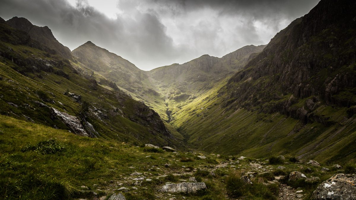
Glen Coe does the thing very few landscapes manage: it is genuinely better than the photographs. You drive south-east to north-west across Rannoch Moor, the road tips downhill, and the mountain walls close in on both sides at once.
The famous pyramid is Buachaille Etive Mòr, and the shot everyone wants is taken from the small parking area on the old military road at Altnafeadh, or from the wooden footbridge at Lagangarbh cottage a few minutes’ walk away. Get there before eight and you will have it to yourself. The Three Sisters viewpoint further down the glen has the bigger car park and, in July, the bigger crowd.
Best light is early morning from late September onward, when the sun is low enough to rake across the ridges. In midsummer the sun is too high by nine and the whole glen goes flat. If you want to walk into it rather than look at it, the Lost Valley path starts from the Three Sisters car park and takes roughly three hours return over rough, rocky ground.
Rannoch Moor
Fifty square miles of peat bog, lochans and not much else, and one of the few places in Britain where you can stand and see no building in any direction. The lay-bys along the A82 near Loch Bá are the obvious stops.
The trick with Rannoch Moor is weather, not season. It is dull under flat grey cloud and remarkable when the light breaks through in strips, which happens most often in April and October. There is a second way in that almost nobody uses: take the train to Corrour, the highest station on Britain’s rail network, and step off into open moor with a station house restaurant and no road access at all.
Glenfinnan Viaduct and Loch Shiel
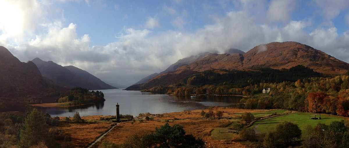
Twenty-one concrete arches curving above a glen, with Loch Shiel stretching away behind. It has been famous since the Harry Potter films, and the National Trust for Scotland car park charges around £5 and fills completely on summer mornings.
The viewpoint is a ten to fifteen minute uphill walk on a signed trail from the visitor centre. The steam train is the whole point for most visitors: the Jacobite runs Fort William to Mallaig, roughly June to late October in 2026, and a standard adult day return was around £76 when I last checked, booked months ahead in high summer. If you only want the photograph, arrive forty minutes before a scheduled crossing and check the operator’s timetable rather than a blog’s.
The monument itself, an 18-metre tower built in 1815 to the Jacobite dead, costs around £5 for an adult and the climb inside is narrow and not for anyone unsteady. The Trust openly asks visitors to come by bus or train because the parking cannot cope, and that is sound advice in August.
The Silver Sands of Morar and Loch Morar
Keep going west past Glenfinnan and the road drops to a stretch of white sand and shell beaches looking out to Rum and Eigg. Camusdarach is the one most people photograph, with a small car park and a five-minute walk over the dunes.
Go two hours before sunset on a clear evening between May and August and the light off the water is the best on the west coast. Behind the beaches sits Loch Morar, the deepest freshwater loch in Britain, which almost nobody bothers to look at.
Eilean Donan Castle and Glen Shiel
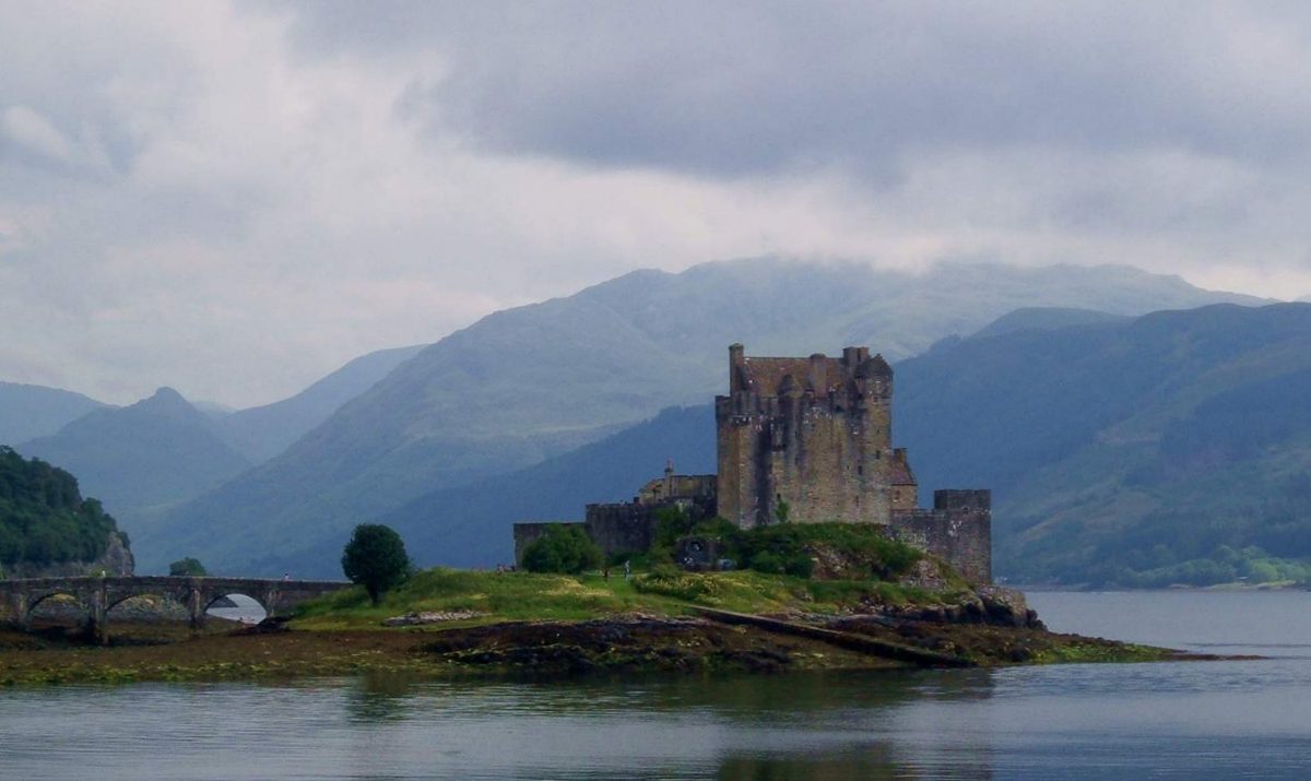
Eilean Donan sits on a tidal island where three sea lochs meet, reached by an arched stone bridge, and it is on more shortbread tins than any building in the country. It is also genuinely well sited, which is not always true of famous castles.
You do not need to pay to get the view. The lay-by on the A87 just east of the castle gives you the classic angle, and the free-to-walk shoreline path below the visitor centre gives you a better one. Pay for the interior only if you like restored Edwardian rooms, because the building you see is largely a 20th-century rebuild.
The approach through Glen Shiel is the underrated half of this drive. The Five Sisters ridge rises straight off the road, and the Mam Ratagan pass to Glenelg, single track with hairpins, gives you the best view of the Cuillin from the mainland. More on this area in our guide to the Highlands region in depth.
Glen Nevis and Steall Falls
Everyone comes to Fort William for Ben Nevis and most of them are disappointed, which I will come back to. The glen at its foot is the better half of the deal. Drive to the end of the Glen Nevis road, park in the pay-and-display at the top, and walk the gorge path for about forty minutes to reach a hanging meadow with a 120-metre waterfall at the back of it.
There is a three-wire bridge across the river if you fancy it. The path is rocky and exposed in places and genuinely unsuitable in ice. April to October is the sensible window, and after heavy rain the falls are at their most impressive.
The Isle of Skye: exactly where to stand, and when
Skye is the most photographed part of Scotland and the most mishandled. People give it a day, drive a hundred-odd miles of it, queue at three car parks and leave disappointed. Give it three nights minimum and stay north of Portree if you can. Route note: Trotternish loop on day one, Glen Brittle and Elgol on day two, Waternish and Neist on day three. Our full Isle of Skye guide goes into the driving in more detail.
The Old Man of Storr
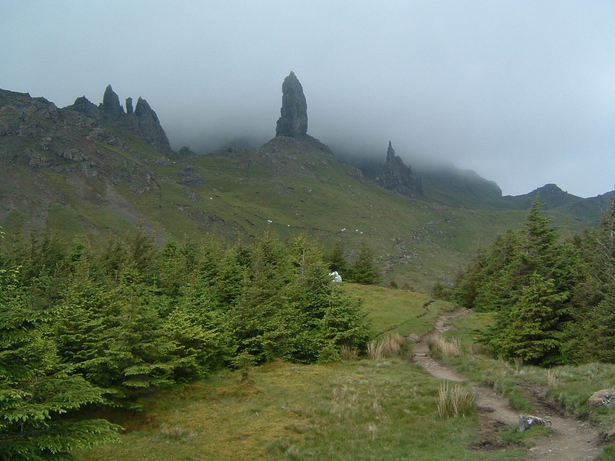
A 50-metre rock pinnacle below the Trotternish ridge, about twenty minutes north of Portree on the A855. The Highland Council car park charges roughly £6 for up to six hours and about £8 for twelve, payable at the machine or through a parking app, and verge parking is enforced.
The walk up is a well-built path, steep, and takes forty-five minutes to an hour each way for most people. Sunrise between April and September is when the Storr earns its reputation, because the light comes off the sea behind it and the pinnacles are backlit. My full guide to walking the Old Man of Storr covers the parking charges, the three timing windows and where that classic photograph is actually taken from. By ten in the morning you will be sharing the path with several hundred people. In October the crowds thin out and the low sun lasts most of the morning.
The Quiraing
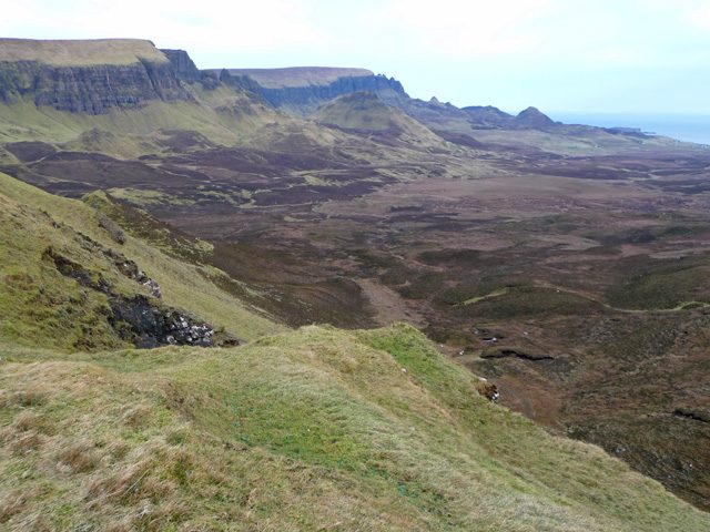
The finest twenty minutes of walking in Scotland, and my personal answer if someone forces me to pick one place. It is a still-moving landslip on the northern end of the Trotternish ridge: green terraces, hidden plateaux and towers of rock stacked at improbable angles.
The car park sits at the top of the single-track road between Staffin and Uig. It is small, perhaps seventy spaces, charges around £3 for three hours or £5 for six, and is full by mid-morning from June to August. The full circuit takes about two and a half hours and involves one narrow, exposed traverse that I would not do in high wind.
You do not have to do the circuit. Walk the first twenty-five minutes to the point where the Prison and the Needle come into view, and you have seen the best of it. Late afternoon light in May or September, when the grass is at its greenest, is the version you have seen online.
Elgol and Loch Coruisk
Elgol is a fourteen-mile dead end off the Broadford road and worth every minute. The shore at the bottom gives you the Black Cuillin ridge across the water, which is the single most dramatic view on the island and one most day-trippers never see because it is not on the loop.
Small boats run from the slipway to Loch Coruisk, roughly April to September and weather dependent, dropping you for an hour or two beside a freshwater loch ringed by the Cuillin. Book ahead in July and August. Late afternoon is when the ridge is lit rather than in silhouette.
Neist Point
Skye’s westernmost tip, a lighthouse on a green headland with cliffs dropping away on both sides. The car park is free, small and appalling at sunset in July, when cars park along the verge for half a mile and the single-track road becomes unpassable.
The path down is concrete steps and then a grass track, about twenty-five minutes to the lighthouse and a harder twenty-five back up. The best view is not from the lighthouse at all: turn right at the top of the steps and walk five minutes along the clifftop for the classic profile shot. May to September for sunset, and go on a weekday.
The Fairy Pools
A chain of clear pools and small waterfalls on the burn coming off the Black Cuillin at Glen Brittle. The community-built car park has 120 spaces, charges around £6 a day for cars by card or coins, and has toilets. The walk is 2.4km return on a good gravel path, forty minutes to an hour and a half depending on how long you spend photographing.
Honestly, this one is over-sold. The water only turns that vivid blue-green in bright direct light after a dry spell; after rain it is peaty brown and running hard. The car park is at its worst between 11am and 1pm in summer. Come at eight in the morning and it is lovely; come at noon in August and you are queueing to stand on a rock.
The far north-west: Assynt, Applecross and the emptiest coast in Britain
If you only have time for one region and you are prepared to drive, make it this one. The mountains here stand alone rather than in ranges, the beaches are white sand, and outside the two peak months you will have most of it to yourself. Much of it forms the western leg of the North Coast 500 driving route, which is both a blessing and, in July, a curse.
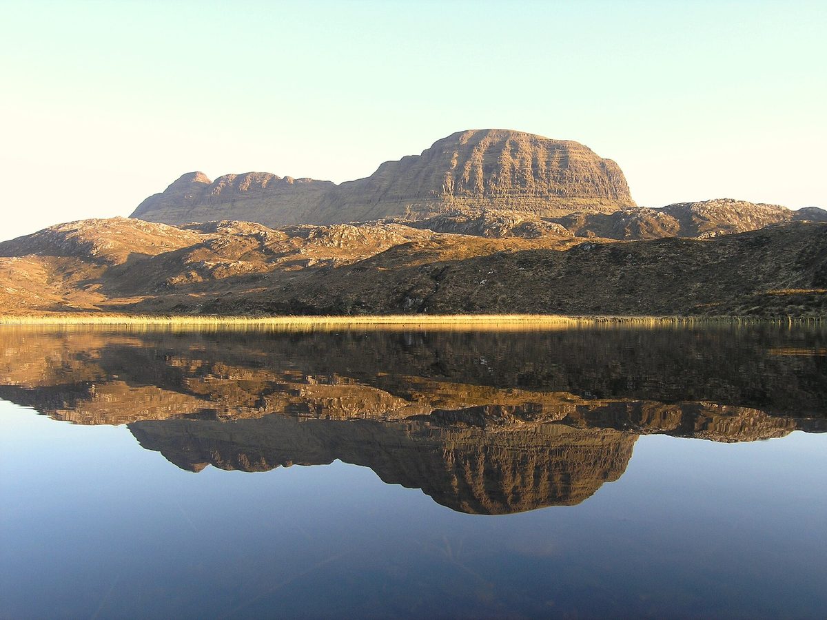
Suilven and the Assynt skyline
Suilven looks less like a mountain than a whale surfacing out of moorland, and the run of peaks around it — Stac Pollaidh, Cul Mor, Canisp, Quinag — is unlike anything else in Britain. They rise straight off a flat, loch-scattered plateau because the sandstone sits on much older rock that has weathered away around it.
For the view without the effort, drive the single-track road along Loch Assynt on the A837 or park at the free Glencanisp Lodge car park outside Lochinver and walk twenty minutes up the track. For a summit with a modest outlay, Stac Pollaidh is a two to three hour circuit from a small pay-and-display car park on the Achiltibuie road and delivers a view out of proportion to its 612 metres.
May and June give you long light and fewer midges than July. September gives you russet moorland and the best reflections in still weather.
Achmelvich and Clachtoll
Two small white-sand bays a few miles north of Lochinver on a road that is barely a road. Achmelvich has a campsite, a car park and water so clear on a bright day that visitors regularly assume the photographs are edited.
Go at low tide, mid-morning, between May and September. The water is cold enough to hurt in any month, so bring a wetsuit if you plan to be in it for more than a minute. There is a beautiful walk north from Achmelvich to Alltanabradhan and the ruined mill, about an hour return, that almost nobody does.
Sandwood Bay
The one that takes commitment. A mile of pink-tinged sand backed by dunes and a sea stack called Am Buachaille, with no road access whatsoever. You park free at Blairmore, past Kinlochbervie, and walk about four miles each way across moorland on a path maintained by the John Muir Trust. Allow two hours in and slightly longer out.
Take waterproof boots regardless of forecast, because parts of the path stay wet all summer. Go between May and September, set off by nine, and take everything you need — there is nothing there at all, which is the point. I have been three times and never seen more than six other people.
Bealach na Bà and the Applecross peninsula
The most dramatic drive in Britain, and I do not say that lightly. The Pass of the Cattle climbs from sea level to 626 metres with hairpin bends and gradients touching twenty per cent, laid out in 1822 and barely widened since. It is the steepest road ascent in the UK.
Large motorhomes and caravans are not permitted and should not attempt it. Drive it in daylight, in decent visibility, and stop at the top — the view across to the Cuillin of Skye on a clear evening is worth the sweaty palms. Come back along the coast road via Applecross village and Shieldaig instead of retracing your steps; it is slower and better.
If the pass is closed in snow or cloud, which happens from November to March, the coast road is the alternative. Do not attempt either in a hurry.
Kylesku, Quinag and the Old Man of Stoer
The curving Kylesku Bridge is the photo, taken from the lay-by on the south side, but the better use of an hour is the road out to the Stoer lighthouse and the walk along the cliffs to the Old Man of Stoer sea stack, roughly two hours return on grassy clifftop with no shelter.
Puffins and other seabirds are on these cliffs from around April to early August. The whole peninsula is exposed, so pick a settled day.
The Outer Hebrides and the west coast islands
The islands are where people’s expectations of Scotland get rearranged, mostly because of the beaches. Getting there takes planning: ferries need booking weeks ahead for a car in summer and they cancel in weather, so build in slack. Our guide to Scotland’s islands covers crossings in more detail, and there is practical ferry and driving advice in getting around Scotland.
Luskentyre and the beaches of South Harris
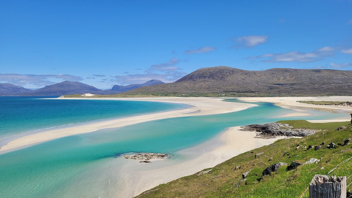
Luskentyre is the beach that appears in every “you won’t believe this is Scotland” post, and for once the caption is fair. It is a wide tidal estuary of pale shell sand with turquoise shallows and the hills of North Harris behind. The car park is free, small and signposted off the A859.
Timing matters more here than anywhere else on this list. Go two hours either side of low tide, when the sandbars are exposed and the water is at its most vivid, and go on a bright day — the colour depends entirely on sunlight hitting shallow water over white sand. May to September, and even in August I have walked a mile of it without passing anyone.
Seilebost across the estuary gives you the elevated view from a lay-by on the main road, and Scarista further south is quieter still with a better sunset.
The Golden Road, South Harris
The east coast of Harris is the opposite of the west: no beaches, no green, just bare Lewisian gneiss, some of the oldest rock in the world, folded into a moonscape with tiny crofting settlements wedged into the gaps. The single-track road threading through it is called the Golden Road, after what it cost to build.
It takes about an hour to drive twenty miles and you will want to stop constantly. Go in either direction, in any month, in any weather — this one is arguably better under cloud than sun.
Callanish, Isle of Lewis
A cross-shaped setting of standing stones on a low ridge above a sea loch, raised around 5,000 years ago and, unlike Stonehenge, free to walk among at any hour of the day or night. There is a visitor centre and car park, and no barrier between you and the stones.
Go at first or last light. In midwinter the sun barely clears the horizon and the shadows run for metres; in June you can be there at eleven at night with the sky still pale. Two smaller circles, Callanish II and III, sit within a mile and are usually deserted.
Iona and Staffa
Iona is a ten-minute ferry from Fionnphort at the far end of Mull, and the crossing to Mull itself is another forty-five minutes from Oban, so this is a long day from anywhere. Cars need a permit, so leave yours at Fionnphort.
What you get is a small island of white beaches, machair and a restored medieval abbey, with a quality of light that people write books about. Stay overnight if you can; the day-trip window is about four hours and the island empties completely at teatime. Boat trips from Iona, Fionnphort or Oban run out to Staffa and Fingal’s Cave between roughly April and September, weather permitting, and that is the trip I would prioritise if the sea is calm.
Tobermory, Isle of Mull
The painted houses along Tobermory’s harbour front are the most photographed street scene in the islands. It is a working fishing harbour rather than a film set, which is why it holds up.
The best angle is from the far end of the pier or from the Aros Park path on the south side of the bay, about twenty minutes’ walk. There is a distillery on the waterfront if you want a stop with a roof, and our guide to Scotland’s whisky distilleries covers which island ones are worth the detour.
The east and north-east coast
The drier, sunnier side of the country, and the one most visitors skip entirely on their way north. Route note: Edinburgh to the East Neuk to Dundee to Stonehaven to the Moray coast makes a fine four-day loop with far better weather odds than the west.
Dunnottar Castle
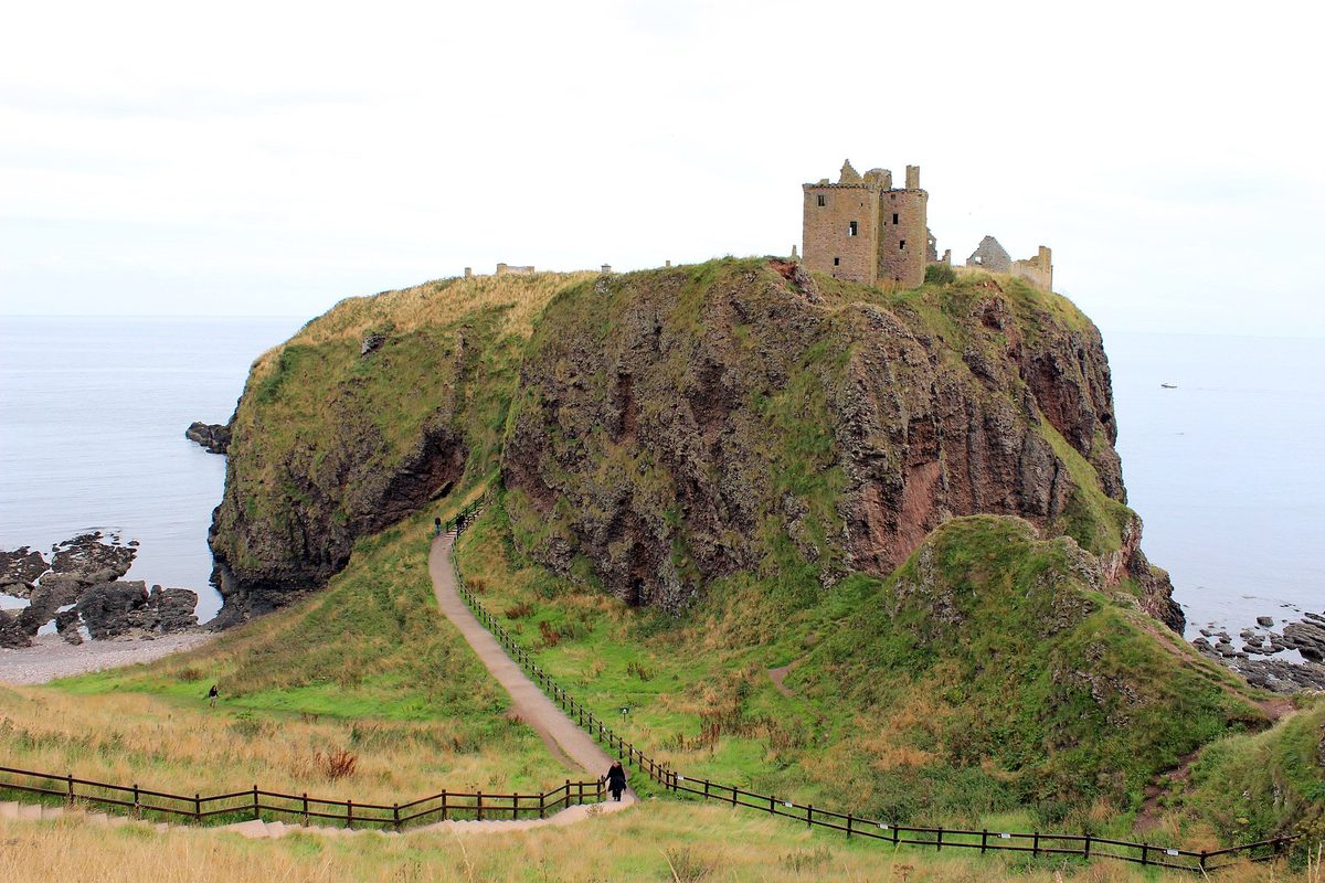
A ruined fortress on a flat-topped sea stack joined to the mainland by a narrow neck, two miles south of Stonehaven. It is the most dramatic castle setting in the country and one of the few places on this list that looks better in real life than on screen, because photographs flatten how far down the sea is.
Here is the useful part: the view costs nothing. Park in the clifftop pay-and-display and walk five minutes along the coastal path for the classic angle. You only pay if you want to walk down the steps and around the ruins themselves, which means a steep couple of hundred steps down and the same back up. Morning light comes off the North Sea and hits the castle face on; by mid-afternoon it is in shadow. April to October, before ten if you want the path to yourself. Our roundup of Scotland’s best castles has more in this part of the country.
Bow Fiddle Rock, Portknockie
A quartzite sea arch shaped like the tip of a violin bow, sitting just offshore from a Moray fishing village. Park at the end of the village where the road runs out and it is a five-minute walk on a grass path.
The coast here faces north, so around midsummer the sun rises far enough round to the north-east to sit almost behind the arch. That is the shot people chase. Nesting seabirds are on it from spring to midsummer. Free, quick, and a good excuse to eat Cullen skink in the village it is named after, a few miles west along the coast.
The East Neuk of Fife
A string of small harbour villages — Crail, Anstruther, Pittenweem, St Monans, Elie — with pantiled roofs, crow-stepped gables and boats still landing lobster and crab. It is an hour and a half from Edinburgh and the prettiest coastline in the Lowlands.
Crail harbour is the postcard, best at high tide when the boats float rather than sit in mud. Walk a section of the Fife Coastal Path between villages rather than driving each one; St Monans to Pittenweem takes about forty minutes. Boats run to the Isle of May from Anstruther between roughly April and September for puffins. St Andrews is twenty minutes north if you want to combine it with a round on a links course, and the seafood here is some of the best in the country — see our guide to eating and drinking in Scotland.
St Abb’s Head
An hour south-east of Edinburgh, and the best sea cliffs on the east coast: red rock rising close to 100 metres, a lighthouse, and a seabird colony that runs from around April to early August. There is a National Trust for Scotland car park at Northfield with a cafe, and a circular walk of about four miles.
The village of St Abbs stood in for New Asgard in Avengers: Endgame, which brought a wave of visitors and, to be fair, has not spoiled it. Go in June for the seabirds, on a clear day, and take a windproof layer even in July.
Orkney: Yesnaby and the Bay of Skaill
Orkney is a ninety-minute ferry from Scrabster or a short flight, and it does not look like the rest of Scotland at all: low, green, treeless and enormous under the sky. The west coast is where the drama is.
Yesnaby has free parking at the end of a farm track and a clifftop walk of about an hour to the Yesnaby Castle sea stack. The Bay of Skaill, a few miles north, has Skara Brae above it — a 5,000-year-old village exposed by a storm in 1850, ticketed and worth pre-booking in summer. Go May to August for long days and nesting birds. Bring more layers than you think.
Perthshire, the Trossachs and the Cairngorms
The middle of the country, within ninety minutes of both cities, and the answer for anyone who has a long weekend rather than a fortnight. Route note: Loch Lomond, Loch Katrine, Dunkeld and Aviemore string together neatly on a three-day loop from Glasgow or Edinburgh.
Loch Lomond and Conic Hill
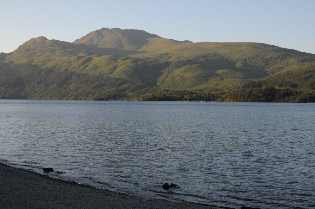
The largest expanse of fresh water in Britain by area, and the closest properly beautiful place to Glasgow — Balloch is forty minutes from the city centre. The trouble is that the southern shore is the busiest bit and the least attractive.
Do this instead: drive to Balmaha on the eastern shore and walk up Conic Hill. It is about two and a half hours return, steep in places, and puts you above the island-scattered narrows of the loch with the Highland Boundary Fault running away in both directions. The National Park car park fills early at weekends. October gives you colour and space; June gives you long evenings and a lot of company.
Loch Katrine and the Trossachs
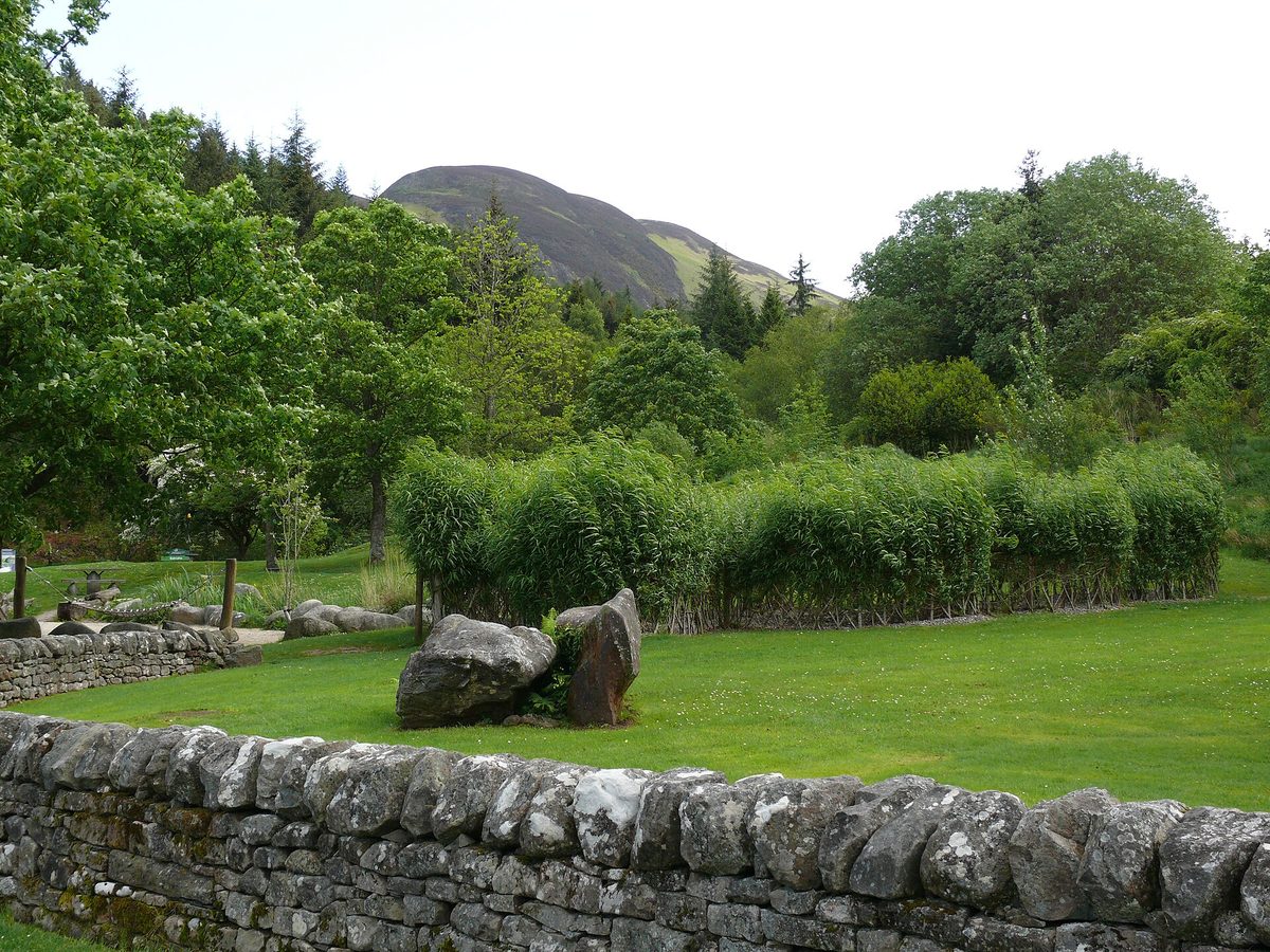
Twenty minutes east of Loch Lomond and considerably quieter. A steamship and a modern boat sail from Trossachs Pier — check current sailings and prices before you commit — and the lochside road is closed to traffic, so you can walk or cycle a dozen miles of shoreline without a car passing.
Hire a bike at the pier and ride an hour out and back for the view down the loch. Ben A’an, from a car park a couple of miles east, is a steep hour to the top and gives an outlook that embarrasses hills twice its size. Autumn is the season here.
Glen Lyon
Scotland’s longest enclosed glen, reached from Fortingall, and the single most underused beautiful drive in the country. Twenty-five miles or so of single track along a river gorge, through oak and birch, past a stone circle and a couple of farms, to a reservoir at the end.
Late October is the reason to come, when the birch turns and the whole glen goes gold. There are passing places and very little else — no fuel, patchy signal, one small tearoom that keeps its own hours. Allow two hours each way if you stop, which you will.
The Hermitage, Dunkeld
A short woodland walk in Perthshire that punches far above its size: Douglas firs among the tallest trees in Britain, a river gorge, and a folly called Ossian’s Hall built specifically so that visitors would be startled by the waterfall behind it. It still works.
The National Trust for Scotland car park just off the A9 charges for non-members, and the main loop takes about forty-five minutes on good paths. October for the colour, or November after rain when the Black Linn falls are at full volume. Salmon leap here in autumn if you are patient.
Loch an Eilein, Cairngorms
A loch with a ruined castle on an island in the middle, ringed by ancient Caledonian pine forest, ten minutes from Aviemore. The circuit is about five kilometres on a flat, well-surfaced path and takes an hour and a half at a stroll.
Go in late October when the birch is yellow against the dark pine, or in February after snow when the reflections are perfect and there is nobody about. Pay-and-display at the Rothiemurchus car park. If you want to walk further into these hills, our guide to hiking and hillwalking in Scotland covers routes and safety.
Glen Affric
Often called the most beautiful glen in Scotland, and the claim holds up: a chain of lochs, remnant Caledonian pinewood and a track running west into genuinely remote country. It is forty minutes west of Drumnadrochit, which makes it an easy escape from the coach traffic around Loch Ness and Inverness.
Park at Dog Falls or the River Affric car park, both pay-and-display, and walk the loch circuit for about three hours. Peak season is the second half of October, when the birch and the pine set each other off. Midges are bad here in still weather from June to August.
The cities and the Lowlands
Not everything worth looking at is a mountain, and the two big cities are more attractive than their reputations suggest.
Edinburgh: Calton Hill, Dean Village and Arthur’s Seat
Edinburgh is the only capital in Europe with an extinct volcano in the middle of it, and the skyline of Old Town spires seen from Calton Hill at dusk is the best free view in any British city. Calton Hill is a ten-minute walk from Waverley station and about the same again uphill.
Dean Village, a former milling hamlet on the Water of Leith fifteen minutes from Princes Street, is the other one everyone photographs. It is residential, so keep the noise down and stay off the private steps. Arthur’s Seat is an hour up and back for a 360-degree view over city, sea and hills.
Come in May or September rather than August, when the festivals fill every bed in the city — our guides to visiting Edinburgh and Scotland’s festival calendar explain the trade-off.
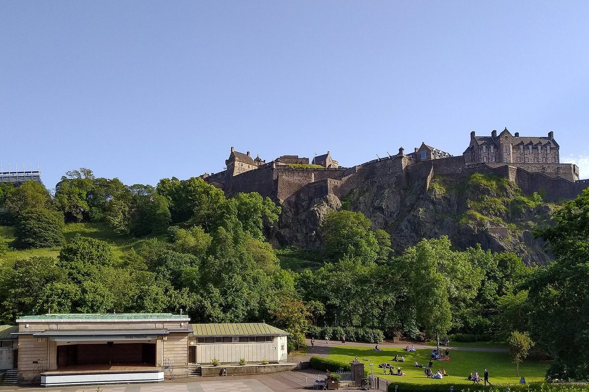
Glasgow’s West End and the Necropolis
Glasgow is not conventionally pretty and does not try to be, but the West End around Kelvingrove and the Botanic Gardens is Victorian terrace architecture at its most confident, and the Necropolis above the cathedral gives you the whole city laid out below a hill of monuments. Both are free.
Kelvingrove Art Gallery is free to enter and is worth an hour on a wet afternoon. There is more in our Glasgow city guide.
Galloway Forest Park and the Solway coast
The forgotten corner. Galloway Forest Park was Britain’s first Dark Sky Park, which tells you what the nights are like, and the Queen’s Way road between Newton Stewart and New Galloway runs through hills, lochs and forest with a fraction of the traffic of the Trossachs.
Loch Trool has a small car park and a walk of about five miles round the water. Come between October and March if the stars are the point, because in June it barely gets dark. It is around two and a half hours from Glasgow and almost nobody makes the trip, which is rather the appeal.
Planning a route: how long you need and what to book
The single most common planning error is distance. Scotland is small on a map and slow on the ground. A hundred miles of A82 takes two and a half hours in good conditions; a hundred miles of single track on Harris or Ardnamurchan takes four. Assume an average of 40mph on Highland A-roads and half that once the passing places start.
As a rough guide to time: a long weekend gets you one region well — Perthshire and the Trossachs, or Glen Coe and Fort William. A week gets you Edinburgh plus the West Highlands and Skye, or the whole of the north-west. Ten days to two weeks gets you the mainland loop plus one island group without rushing. If you want a day-by-day framework, our Scotland itinerary planner lays out several.
Book these ahead, in this order of urgency. Car spaces on CalMac ferries to Harris, Lewis, Mull and Islay, and on the Orkney crossings: six to twelve weeks in summer, and note that foot passengers rarely need to. Accommodation on Skye, in Glen Coe, along the North Coast 500 and on the islands: three to six months for July and August, and much less elsewhere. The Jacobite steam train: months ahead. Car hire out of Inverness or Glasgow in summer: as early as you can, because supply is genuinely tight. There is more on beds and bases in where to stay in Scotland.
On timing, May and September are the best all-round months: long days, moderate crowds, fewer midges than midsummer. June has the longest light of all — it is barely dark north of Inverness — but the midges arrive with it. October is my favourite for colour and empty roads, with the caveat that daylight is shrinking fast and some seasonal cafes, boats and ferries stop running. Our page on the best time to visit Scotland breaks this down month by month.
If you would rather not drive single-track roads yourself, small-group operators run multi-day trips from both cities; see guided tours around Scotland. And a few practicalities are worth reading before you go, which we have collected in our Scotland travel tips.
Honestly, these ones disappoint — and the mistakes I keep seeing
I would rather tell you this now than have you drive four hours to find out.
Loch Ness itself. The loch is 23 miles of straight, dark water with wooded slopes either side, and from the A82 it is monotonous. Urquhart Castle is genuinely good and the Great Glen has fine corners, but the loch does not deliver the scenery people expect and Fort Augustus in August is a coach park. Drive it if you must, then head into Glen Affric, which is twenty minutes away and ten times the landscape.
Ben Nevis. Britain’s highest mountain is a long, stony, relentless slog with an ugly summit plateau that is in cloud roughly two days out of three. People climb it for the certificate rather than the view. Glen Nevis at its foot, or the Ring of Steall for experienced walkers, is far more rewarding.
The Fairy Glen at Uig. A small area of grassy cones on Skye that looks otherworldly in a wide-angle photograph and is much smaller in life. It has been badly worn by visitors, and the community has repeatedly asked people to stop building stone spirals, so please do not.
Luss on Loch Lomond. A tidy estate village that receives coach parties all summer, with a paid car park and about fifteen minutes of actual content. Balmaha on the other shore does the same job better.
The Royal Mile in August. Beautiful architecture, unwalkable pavements. Come in the morning before ten or in a different month.
The mistakes, meanwhile, are consistent. Trying to see Skye, Glen Coe and Loch Ness in one day from Edinburgh — that is a fourteen-hour bus day and you will see car parks. Arriving at a west-coast beach at high tide and wondering where the sand went. Chasing sunset in June, when it is close to eleven at night, or in December, when it is quarter to four in the afternoon. Underestimating midges, which are at their worst on still, damp, overcast evenings between June and August on the west coast; wind is your friend and a head net costs a few pounds. And booking nothing until three weeks out, then discovering that every bed on Skye is taken. If you are building a shortlist rather than a route, our Scotland bucket list is a useful cross-check.
Frequently asked questions
What is the most beautiful place in Scotland?
If I have to pick one, the Quiraing on the Isle of Skye — a still-moving landslip of green terraces and rock towers with a walk that delivers its best view inside half an hour. Glen Coe runs it very close and is far easier to reach, requiring no ferry, no single-track road and no early start.
What is the prettiest part of Scotland to visit?
For concentrated scenery per mile driven, Assynt and Wester Ross in the north-west. For prettiness in the softer sense — harbours, pantiled roofs and good food — the East Neuk of Fife. For a first trip with limited time, Glen Coe and the road west from Fort William gives you the most recognisable landscapes with the least driving.
When is the best month to see Scotland at its most scenic?
Late May and September are the sweet spots: long daylight, moderate crowds, and fewer midges than midsummer. August gives you purple heather across the moors, which peaks that month and lingers into September. Mid to late October gives you golden birch woods and empty roads, at the cost of shorter days and some seasonal closures.
Do you need a car to reach the most beautiful places in Scotland?
Not for all of them. The West Highland Line to Mallaig, the train to Kyle of Lochalsh and the Glasgow to Oban line all run through excellent scenery, and Edinburgh, Glasgow, Stirling and St Andrews need no car at all. But Assynt, Applecross, Glen Lyon and most of Skye’s viewpoints are effectively unreachable on public transport, so hire something for those legs.
How many days do you need to see the best of Scotland?
Ten days is the honest minimum for the mainland highlights plus one island group without living in the car. A week covers Edinburgh, the West Highlands and Skye at a reasonable pace. A long weekend is enough for one region done properly, which is a far better trip than three regions done badly.
Which Scottish island is the most beautiful?
Harris, for the beaches on the west and the rock landscape on the east, and because it stays quiet even in August. Skye has the most dramatic single features but also the crowds and the traffic. Iona is the one people come back changed by, though it is a long journey for a small island.
Is the Isle of Skye overrated?
Overcrowded rather than overrated. The landscape absolutely justifies the reputation; the problem is that most visitors arrive between ten and four, in July and August, at four car parks. Stay three nights, walk in the early morning or late evening, and go to Elgol and Waternish as well as the Storr, and it reads very differently.
Where can I find beautiful places in Scotland without the crowds?
Head for Assynt and the far north-west, the Ardnamurchan peninsula, Glen Lyon, the Angus glens, Galloway Forest Park or the Outer Hebrides. All of them carry a fraction of the traffic of Skye and Glen Coe. The general rule holds everywhere: an hour off the main tourist route, or an hour earlier in the day, halves the number of people.
Final thoughts
The places on this list have not changed much in a thousand years. What changes is you turning up at the right hour with the right expectations, and that is almost entirely within your control.
So pick one region. Get up early at least twice. Accept that you will lose a day to weather and plan a distillery, a museum or a long lunch for it rather than fighting it. And when the light does break across Rannoch Moor or the tide pulls back off Luskentyre, put the phone down for the first two minutes. The photograph will still be there afterwards.
Not everything worth looking at is in the Highlands. The real interest of the Royal Mile is the network of closes and courts running off it — Dunbar’s Close garden, Advocate’s Close, Tweeddale Court — nearly all free to walk into, and nearly all walked straight past by people looking at the shops.
Two entries here deserve a guide of their own. Glencoe repays being driven in the right order, because the good stops are unsigned and several are on the wrong side of the A82 for the direction you are going. And the lochs are a category rather than a place — our loch roundup gives the viewpoint, the car park and the season for each one.
Dunnottar earns its place on almost every list of this kind, but the practical side catches people out. Our guide to visiting Dunnottar Castle covers the steep walk down, the parking that fills by mid-morning and the light that actually works for photographs.
Some of these places are better still when you wake up in them. Our guide to lighthouses, bothies and glamping in Scotland covers the stays worth planning a trip around, with prices and release windows — and an honest word about what a headland cottage is like in a gale.
About the author: This guide was written and is maintained by the ScotlandTourism.org editorial team — travel writers who’ve spent years exploring Scotland’s cities, Highlands and islands, from bagging Munros to chasing the perfect dram. We update our guides regularly to keep prices, opening details and advice current.
Last updated: August 2026. Prices and opening times change — always check the official site before you travel.
Photo credits
All images are used under their respective Creative Commons or public-domain licenses:
- Glen Coe Valley — Thomas Haid, CC BY 3.0, via Wikimedia Commons
- Glenfinnan Viaduct — Conorm2002, CC BY-SA 4.0, via Wikimedia Commons
- Eilean Donan — Dave Conner from Inverness, Scotland, CC BY 2.0, via Wikimedia Commons
- Old Man Of Storr — Jörn Albring, Public domain, via Wikimedia Commons
- Quiraing Ridge — John Allan, CC BY-SA 2.0, via Wikimedia Commons
- Suilven — Andrew Tryon, CC BY-SA 2.0, via Wikimedia Commons
- Luskentyre — Scotboy19, CC BY-SA 4.0, via Wikimedia Commons
- Dunnottar Castle — Mimihitam, CC BY-SA 3.0, via Wikimedia Commons
- Loch Lomond — Ad Meskens, CC BY-SA 3.0, via Wikimedia Commons
- Edinburgh Castle — Matti Blume, CC BY-SA, via Wikimedia Commons