Most lists of Glencoe things to do read like they were written from a car window at 50mph. Drive the A82, photograph the Three Sisters, have a pint at the Clachaig, done. I have done that version of Glencoe myself, on a wet Tuesday in 2013, and I came away thinking I had seen it. I had not. I had seen two laybys and a lot of windscreen wiper.
The thing nobody tells you is that Glencoe is linear. It is roughly ten miles of road between Rannoch Moor at one end and Loch Leven at the other, and the good stops come in a fixed order that you cannot reshuffle. Some of them are unsigned. Several are on the wrong side of the road for the direction you happen to be travelling, and turning round on the A82 is not a casual manoeuvre. Get the sequence right and Glencoe is a properly good day. Get it wrong and you spend an hour doing three-point turns in front of coaches.
The short answer: what to actually do in Glencoe
Drive the A82 through the glen and stop, in order, at Altnafeadh for Buachaille Etive Mor, the Study layby for the Three Sisters, the Three Sisters car park, the Meeting of Three Waters, Loch Achtriochtan and the National Trust for Scotland visitor centre. Add Glencoe Lochan for an easy woodland loop. Allow a full day.
Glencoe things to do at a glance, in road order
| Stop | What it is | Time needed | Parking |
|---|---|---|---|
| Rannoch Moor laybys | Wide peat plateau, lochans, the approach view | 10–15 min | Small unsigned laybys, free |
| Glencoe Mountain Resort | Ski centre, chairlift, cafe, toilets | 1–2 hrs | Large free car park |
| Altnafeadh / Blackrock Cottage | The classic Buachaille Etive Mor shot | 20–30 min | Free car park, around 50 spaces |
| The Study (Am Meall) | Best free viewpoint for the Three Sisters | 15 min | Small layby, free, easy to miss |
| Three Sisters car park | Main viewpoint and the Hidden Valley trailhead | 15 min, or 3 hrs if walking | NTS, charge applies |
| Meeting of Three Waters | Roadside waterfall on the River Coe | 10–20 min | Tiny laybys, both sides |
| Glencoe Visitor Centre | Massacre exhibition, cafe, toilets, turf house | 45–60 min | £4 per car, free to NTS members |
| Glencoe Lochan | Flat woodland loop, Canadian conifers | 45–90 min | Small car park, charge applies |
How the glen is laid out, and why the order matters
Think of Glencoe as a corridor with two doors. The eastern door is Rannoch Moor, a huge saucer of peat bog and lochans that the A82 crosses on its way up from Bridge of Orchy. The western door is Loch Leven at Ballachulish, sea water, tidal, with the bridge over the narrows. Between them the road drops through the pass and runs beside the River Coe for about ten miles.
Everything worth stopping for is strung along that ten miles. There are no side roads to speak of, other than the Glen Etive turn-off, which is a dead end. That means your only real decision is which end you start from, and that decision changes the whole day, because roughly half the pull-ins are only safely accessible from one direction.
If you are coming up from Glasgow or from the central belt, you arrive from the south and cross Rannoch Moor first. That is the better introduction, and it is also the direction in which the viewpoints line up most conveniently. Coming down from Fort William and Lochaber, you enter from the north and the glen opens up gradually rather than hitting you all at once. Neither is wrong, but they want different plans. Glencoe sits in the western half of the Scottish Highlands, roughly 83 miles north of Glasgow and 20 miles south of Fort William, so most people reach it as part of a longer loop rather than as a standalone destination.
One more piece of geography that saves confusion. Glencoe the village is not Glencoe the glen. The village sits at the western end, past all the mountains, and it is small: a shop, a couple of cafes, a petrol station, a folk museum currently shut for rebuilding. The scenery people come for happens in the eight miles before you reach it.
Driving the glen south to north: the sequence that works
Rannoch Moor and the first laybys
You will know you are close when the trees stop. Rannoch Moor is around 50 square miles of blanket bog, granite knolls and black lochans, and the A82 crosses its western edge on an embankment. It is bleak in a way that photographs badly and feels enormous in person.
There are several unsigned laybys on this stretch, mostly on the west side of the road. The most useful one for a northbound driver is the pull-in near Loch Ba, which gives you water in the foreground and the Blackmount hills behind. Do not stop on the carriageway itself. This is a fast, exposed road with a lot of overtaking, and the verges are soft peat that will swallow a wheel.
Fifteen minutes is plenty here. The real point of Rannoch Moor is the contrast: you cross open nothing for ten miles, and then the mountains rear up on both sides at once.
Glencoe Mountain Resort and the Kingshouse
The turning for Glencoe Mountain Resort is on your right, signed, about a mile before the Glen Etive junction. It is generally reckoned to be Scotland’s oldest ski area, and it is worth pulling in even in August. The base station cafe does hot food, the toilets are free and clean, and the car park is large and free, which cannot be said for much else in the glen.
The chairlift runs in summer as well as winter. At the time of writing a return ride is around £20 for adults, £15 for juniors and £65 for a family of two adults and two children, with the summer season running from mid-May to late October, weather permitting. It takes you up onto the shoulder of Meall a’ Bhuiridh for a view back over Rannoch Moor that you cannot get from the road. Whether that is worth £20 depends on the cloud base. On a clear day, yes. On a day when the top station is in the murk, save your money and have the soup instead. Check their snow report page before you commit, because they post live webcam images from the summit.
Just past the resort turning, the old Kingshouse Hotel sits below the road at the head of the glen. Red deer hang around the car park there, habituated and unbothered by people. It is the easiest wildlife sighting in Scotland and also, honestly, a slightly sad one: these are wild animals that have learned to beg. Look, photograph, do not feed them. You will see wilder deer on the hill paths at dusk, and they will be gone before you get the camera up.
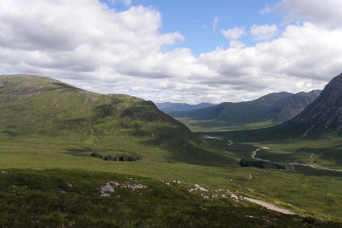
Altnafeadh and Blackrock Cottage
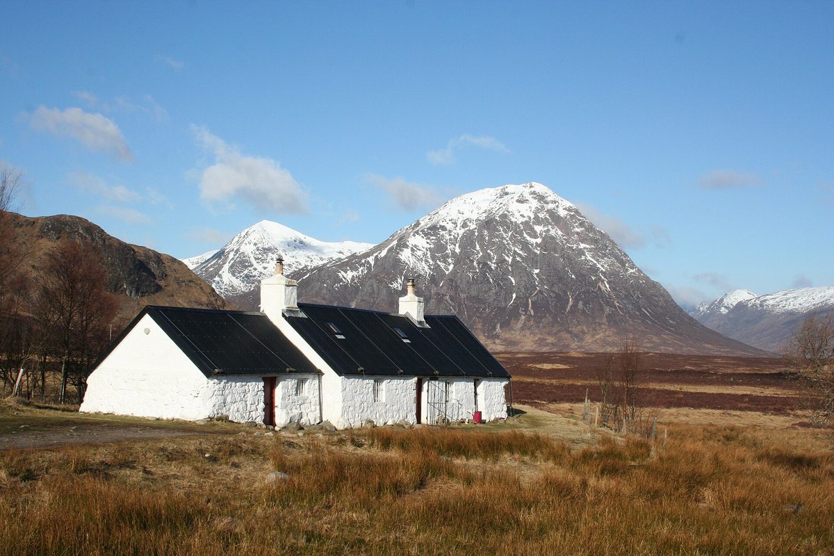
This is the first stop I would call unmissable. Altnafeadh is a small free car park on the north side of the A82, roughly two miles west of the Glen Etive junction, with space for around 50 cars. From it you get the view that sells Scotland: Buachaille Etive Mor, the Great Herdsman of Etive, a 1,022-metre pyramid of rock that looks designed rather than eroded.
The famous foreground is Blackrock Cottage, a small white climbing hut with a black roof owned by the Ladies’ Scottish Climbing Club. It sits on the access track to the ski resort, on the opposite side of the A82 from Altnafeadh. You can drive up that track a short way and park considerately, or walk across. Do not photograph it from the middle of the road, which people do constantly and which is how the glen generates its casualty statistics.
Two practical notes. First, the light. The Buachaille faces roughly north-east, so it takes early sun beautifully and goes flat and grey by mid-afternoon. If you only have one sunrise in the most photogenic corners of Scotland, spend it here. Second, this car park is also the trailhead for the Devil’s Staircase, so it fills with West Highland Way walkers from about eight in the morning.
The Study, or Am Meall
Here is the stop that separates people who have researched Glencoe from people who have not. About two miles west of Altnafeadh, as the road begins its descent into the glen proper, there is a small layby on the left (southbound side) beside a rocky knoll. There is no brown sign. There is no name board. Locals call it the Study, said to come from an old Scots word for an anvil; the Gaelic is Am Meall.
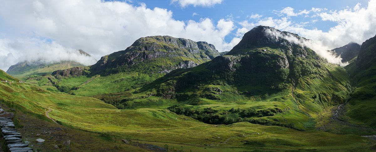
Walk fifty metres onto the knoll and you get the classic head-on view down the glen with all three of the Three Sisters ranged in a row and Aonach Eagach walling in the far side. It is a better composition than the official viewpoint, it is free, and on most mornings there will be two cars there instead of eighty.
The catch, and it is a real one: the layby is on the south side of the road. Northbound, you cross traffic to get in and cross it again to get out. Southbound it is a straightforward left turn. If you are driving north to south, this is one of the stops that gets easier; if you are driving south to north, slow down early and be patient. The old military road runs past here too, so you can walk a short section of it if you want to stretch.
The Three Sisters car park
A mile further on, the big one. The Three Sisters viewpoint is the largest car park in the glen, resurfaced in recent years, on the south side of the road facing the mountains. The Sisters themselves are Beinn Fhada, Gearr Aonach and Aonach Dubh, and they are not three separate mountains at all but three ridges running north off the bulk of Bidean nam Bian, which at 1,150 metres is the highest point in Argyll.
Two things to know. It is run by the National Trust for Scotland and it no longer operates as a free-for-all: charging has been introduced here and reports put it at around £5 for the day, with the smaller of the two laybys now reserved for coaches. Charges and signage in Glencoe have changed more than once in the last few years, so read the board and the machine when you arrive rather than trusting anything you read online, including me.
The other thing: it fills. In July and August it is effectively full by nine in the morning and stays that way until early evening, with cars circling and coach parties spilling across the tarmac. If you want the view without the scrum, be there before eight or after six. The glen faces roughly east–west, so evening light down here is often better anyway.
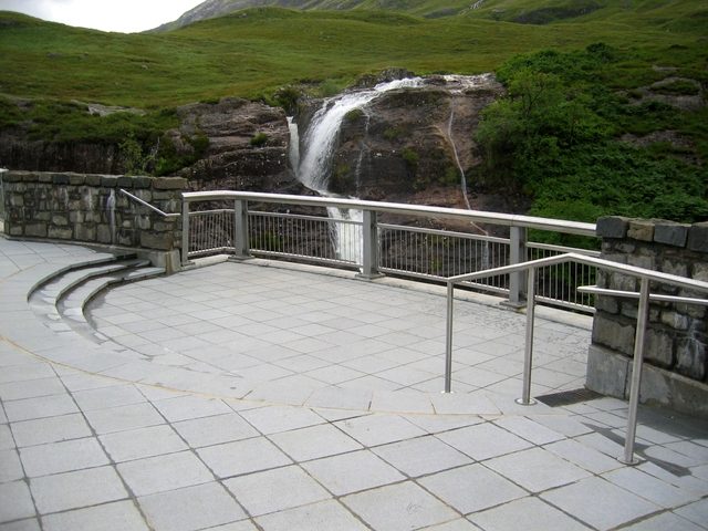
The Meeting of Three Waters
Half a mile down the road, on a bend, water comes off the flank of Beinn Fhada in a series of falls and joins the River Coe. It is signposted on some maps as Glencoe Waterfall and locally as the Meeting of Three Waters, and Monty Python fans will recognise the gorge from the Bridge of Death sequence.
The falls are genuinely good after rain, which in this glen means most of the time. There is a stone viewing platform at the Lairig Eilde bridge that gets you above the water without any scrambling, and it is one of the few places in Glencoe with a proper railing rather than a sheep track.
The parking is the problem. There are small laybys on both sides of the road, on a bend, and you will very likely end up crossing the A82 on foot with limited sightlines. Traffic here does 60mph. If the layby on your side is full, drive on and come back rather than stopping opposite and walking over. This is the single most dangerous stop in the glen and it is not close.
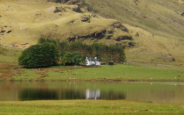
Loch Achtriochtan and the Clachaig turn-off
The valley floor flattens out and the River Coe pools into Loch Achtriochtan, a shallow lochan with a solitary white house, Achnambeithach, sitting under the crags on the far side. There are laybys along here, and on a still morning the reflection of Aonach Eagach in the water is the best mirror shot in the glen.
This is also where the old road branches left towards the Clachaig Inn. The Clachaig has been serving hillwalkers for roughly three centuries, keeps hundreds of malts behind the bar in its Boots Bar, and still displays a sign reading “No Hawkers or Campbells”, which is either a good joke or a three-hundred-year grudge depending on how you look at it. The food is decent pub food rather than anything clever, and the atmosphere on a wet evening after a day on the hill is hard to beat.
From the Clachaig you can also walk the An Torr and Signal Rock loop, about 1.5 miles through birch woodland, and reach the outcrop used as the location for Hagrid’s hut in Prisoner of Azkaban. There is nothing built there now, which is worth knowing before you set off. If film locations are the point of your trip, our guide to Harry Potter filming locations across Scotland covers which ones still have something to look at.
Glencoe Visitor Centre
The National Trust for Scotland’s visitor centre sits a mile east of Glencoe village, set back in woodland so you barely see it from the road. Entry to the building is free. The car park is £4 per car at the time of writing, £6 for a small motorhome, and free if you are an NTS member. Opening is daily, 09.30 to 17.30 through the main summer season, dropping to 17.00 in October and 16.00 through the winter, with closures around Christmas and New Year. Check the current times on the NTS site before you rely on them.
Is it worth it? Yes, for two specific reasons, and I would not oversell the rest. The first is the massacre exhibition, which includes a ten-minute film narrated by the actor Rory McCann that handles 1692 with restraint rather than melodrama. The second is that these are the most reliable toilets in the glen, and there is a cafe. On a day of horizontal rain, that combination is worth more than £4.
The reconstructed seventeenth-century turf house in the grounds is genuinely interesting and takes ten minutes. The wider exhibition on mountaineering history has some wonderful photographs of early climbers in tweed. If you arrive by bike or by bus and show your ticket or helmet, they give you a free hot drink, which is a nice touch and one of the few concrete rewards for travelling Scotland without a car.
Glencoe village and the Lochan
The village itself takes fifteen minutes to look at. There is a memorial to the massacre victims, a shop, a petrol station worth using because the next one north is in Fort William, and the Glencoe Folk Museum, which at the time of writing is closed for a roughly £3 million redevelopment with reopening pushed back to around spring 2027. Check its website before you build a wet afternoon around it.
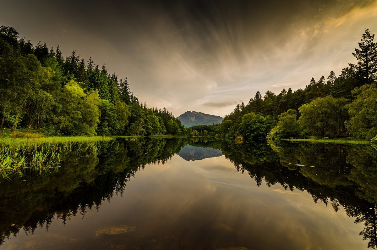
Behind the village, up a rough single-track road, is Glencoe Lochan, and this is the odd little gem of the glen. Lord Strathcona, born Donald Smith in Forres, made his fortune in Canada with the Hudson’s Bay Company and the Canadian Pacific Railway. He brought his Canadian-born wife Isabella home to Glencoe, she was homesick, and so in the 1890s he had a lochan dug and planted the surrounding hillside with North American conifers to remind her of British Columbia.
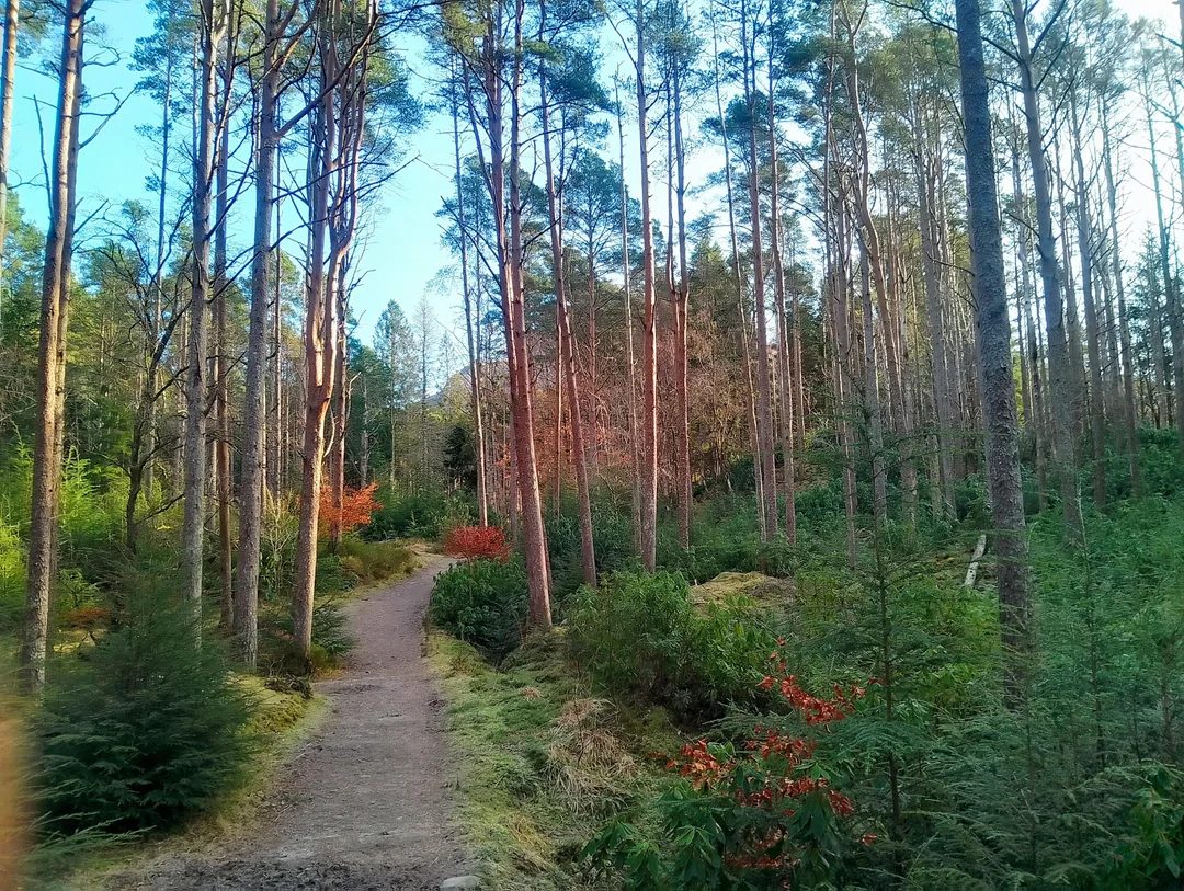
It did not work. She never settled and they eventually left. What remains is a small loch ringed by Douglas fir and Scots pine that looks nothing whatsoever like the Highlands and everything like Vancouver Island, with the Pap of Glencoe rising behind it to spoil the illusion. There are three waymarked trails: the flat Lochan Trail of about a mile, a longer Woodland Trail and a steeper Mountain Trail. The car park is small and charges apply.
Ballachulish and Loch Leven
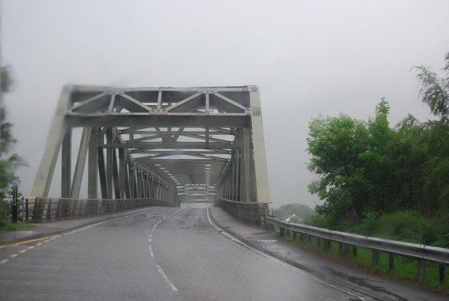
Most people floor it through Ballachulish towards Fort William and miss the best twenty minutes of the western end. Loch Leven is a sea loch, tidal, and the A82 crosses its narrows on a bridge that replaced the old Ballachulish ferry in the mid-1970s.
Ballachulish itself was a slate village, and the old quarry is now a flooded pit with turquoise water and a short walk around it. There is a visitor centre with parking and toilets. From the north shore road towards Kinlochleven you get the view back into the mouth of Glencoe with the Pap on the left, which is the shot most people never take because they are already looking the other way.
In Loch Leven there is a small burial island, Eilean Munde, where the MacDonald chiefs were laid to rest. Maclain, killed first on the morning of the massacre, is buried there. You cannot land on it without a boat, but you can see it from the shore, and knowing what it is changes how the view sits.
Driving it north to south: what changes
If you are coming down from Fort William, the whole sequence inverts, and three things get easier while two get harder.
Easier: the Study layby becomes a simple left turn, which is worth a lot. The Meeting of Three Waters layby on the north side is on your left. And the glen reveals itself gradually rather than dumping the Three Sisters on you in one go, which some people prefer.
Harder: the Three Sisters car park is on your right, so you cross oncoming traffic to enter and again to leave, and in summer you will be doing that with a queue behind you. Altnafeadh is also on your left going south, which is fine, but the Blackrock Cottage track is on your right.
My honest recommendation, if you have the choice, is to drive the glen twice. It takes 20 minutes end to end without stops. Run it north to south early in the morning to catch the Buachaille in first light and get the awkward crossings done while the road is empty, then work back south to north through the day doing the stops on your left. Nobody ever regrets driving Glencoe twice. This is also the stretch that anchors most Edinburgh to Highlands road trips, so if you are on a bigger loop, build in the extra half hour.
Walks you can do in trainers
A lot of Glencoe coverage blurs the line between a stroll and a mountain day, and people get caught out by it every summer. Here is the honest split. These four you can do in ordinary shoes with no navigation skills.
Glencoe Lochan Trail
About a mile around the water on a well-made path, mostly flat apart from a short pull up from the car park. Forty-five minutes at an amble. Buggy-friendly on the main loop, and one of the few genuinely easy walks in the area, which makes it useful if you are travelling Scotland with children who have had enough of the car.
An Torr and Signal Rock
Roughly 1.5 miles from the Signal Rock car park near the Clachaig, an hour at most, through mossy birch woodland to a rocky knoll. Tradition says the signal to begin the massacre was given here. The National Trust for Scotland now says it almost certainly was not, since no warning appears to have been given at all. The walk is still lovely and the woodland is full of deer at dusk.
The Lochside and river paths near Achtriochtan
Short, flat, unofficial paths along the River Coe and the shore of Loch Achtriochtan. No fixed route, no signage. Twenty minutes of wandering that gets you away from the road noise and gives you the mountains reflected in still water. Wear something waterproof on your feet; the ground is boggy more often than not.
The first twenty minutes of the Devil’s Staircase
From the Altnafeadh car park, the West Highland Way climbs north in a series of zigzags. You do not have to do the whole thing. Twenty minutes of steady uphill gets you high enough for a superb view back over the Buachaille, and then you turn round.
The full crossing is a different proposition: it climbs to about 548 metres, the highest point on the 96-mile West Highland Way, and descends to Kinlochleven, roughly seven miles with no shelter and no easy escape. It got its name from the soldiers who built the military road here, and later from the labourers at the Blackwater Dam who walked it to the Kingshouse for a drink and had a considerably worse time walking back. If you are planning the whole route, our overview of hiking routes across Scotland puts it in context.
Proper hillwalking: know what you are signing up for
Now the other half. These need boots, a map, a forecast and the ability to turn back.
Coire Gabhail, the Hidden Valley
This is the one that catches people. It gets described as “a short walk from the car park”, and technically it is only about 2.5 miles there and back, but that number is deeply misleading.
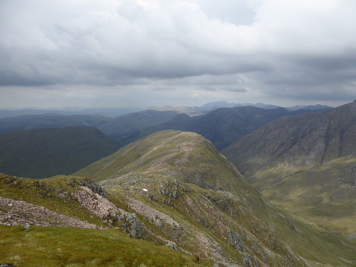
You start from the Three Sisters car park, drop steeply to the River Coe, and cross it. There is no bridge at the crossing most people use. After heavy rain the river can be impassable, and every year somebody tries anyway. Then you climb a rough gorge path between Gearr Aonach and Beinn Fhada, gaining around 340 metres over ground that is loose, rocky and eroded in places, with a couple of short sections where you will use your hands. Near the top you cross a boulder field left by an ancient landslip.
Budget two and a half to three and a half hours. It is a genuine hill route, not a stroll, and the descent is harder than the ascent because the loose ground goes downhill under you. What you get for it is remarkable: a flat, grassy amphitheatre hanging above the glen, ringed by cliffs, completely invisible from the road. The MacDonalds hid cattle here, and some of them fled here in February 1692.
Go in boots. Take a map. If the river is high, do something else.
Buachaille Etive Mor
Stob Dearg, the pyramid you photographed from Altnafeadh, is a Munro at 1,022 metres, and the standard route up Coire na Tulaich involves a steep scree gully and a short scramble near the top that is genuinely serious in winter conditions. It is not a first Munro. Have several under your belt before you look at it.
Aonach Eagach
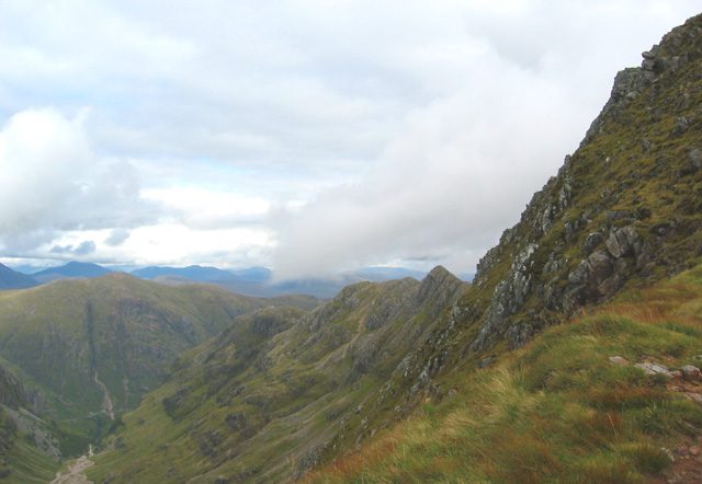
The ridge forming the north wall of the glen is the narrowest mainland ridge in Britain and a grade 2 scramble with real exposure. The crucial point, and the reason it appears in mountain rescue statistics year after year: once you are on it there is no safe escape route down either side until the far end. You commit at the start. If you are not comfortable with sustained scrambling above long drops, do not start it. Go with a guide if you want it and are not sure.
Pap of Glencoe
At 742 metres the Pap is the conical hill above the village, and it is the best value-for-effort climb in the area: a steep, well-marked five-mile round trip with a view over Loch Leven, the glen and out towards Mull on a clear day. Three to four hours. Still a mountain, still needs boots, but no scrambling.
Beinn a’ Chrulaiste
An 857-metre Corbett opposite the Buachaille, unremarkable to look at and therefore quiet, with what may be the single best view of Buachaille Etive Mor anywhere. Pathless in places and steep from the start. Two to five hours depending on how far you go; even a kilometre up the flank gets you the view.
The 1692 massacre, told straight
You cannot write about visiting Glencoe honestly and skip this, and you also should not sensationalise it, which a lot of coverage does.
After the deposition of James VII and II in 1688, William III demanded that Highland chiefs swear an oath of allegiance by 1 January 1692. The practical difficulty was that the clans still considered themselves bound to James, who only released them from that obligation in mid-December. Word reached the MacDonalds of Glencoe on 28 December, leaving three days.
Their chief, Alasdair MacIain MacDonald, went to Fort William, where there was nobody with authority to take the oath. He was sent on to Inveraray, 60 miles away in midwinter, and swore on 6 January. He went home believing his people were safe. The decision to make an example of Glencoe had already been taken.
In late January, around 120 soldiers of the Earl of Argyll’s regiment, commanded by Captain Robert Campbell of Glenlyon, arrived and were quartered on the MacDonalds for nearly a fortnight. Highland custom obliged hosts to feed and house them; in practice the villagers had little choice either way. On the evening of 12 February the officers received written orders to “fall upon the Rebells, the McDonalds of Glenco, and putt all to the sword under Seventy”. At five the following morning the attack began. MacIain was the first killed.
The National Trust for Scotland records 38 men, women and children killed in the attack itself, with more dying of exposure in the hills as they fled in February weather. A Scottish parliamentary commission later found the killings to be “murder under trust”, the aggravating factor being that the soldiers had been given hospitality. Only around a dozen of the men involved were actually Campbells; the driving force was government policy and Lord Dalrymple, the Secretary of State, who faced no meaningful consequences.
What you can actually see today: the memorial cairn in Glencoe village, the Inverigan ruins (a later building on a site where several MacDonalds were killed), the reconstructed turf house and the film at the visitor centre, Coire Gabhail where some escaped, and Eilean Munde in Loch Leven where MacIain lies. Government troops coming from Fort William came over the Devil’s Staircase that morning, delayed by blizzards, and arrived after it was over. Signal Rock, despite the name, almost certainly played no part.
Film locations, without the fantasy
Skyfall and Glen Etive: say no
This is the one I feel strongly about, because it sends people down a fourteen-mile round trip of single-track road for something that does not exist.
The Skyfall lodge was never in Scotland. It was a full-scale set built from plywood and plaster at Hankley Common in Surrey, on Ministry of Defence land, and it was blown up at the end of filming. The Highland mountains behind it were composited in. What was actually shot in Glen Etive is the driving sequence: the Aston Martin on the single-track road, and the shot of Bond and M standing beside the car.
So the honest position is this. If you want the exact spot where two people stood next to a car for eleven seconds of screen time, it is roughly a mile and a half down the Glen Etive road and you can be there and back in half an hour. If you drive the full twelve miles to Loch Etive expecting a lodge, you will find a dead end, no turning circle worth the name, and in June a determined cloud of midges.
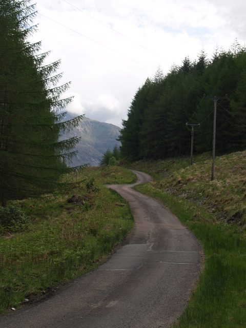
Glen Etive is a beautiful road on its own terms. But it is a single track with passing places that are increasingly signed as no-parking clearway, it is genuinely unsuitable for motorhomes, and in July and August it becomes one slow queue of cars that cannot get past each other. If you have half a day spare and it is quiet, go. If you are on a schedule, the A82 through Glencoe is the better road and I would spend the two hours somewhere else.
Harry Potter
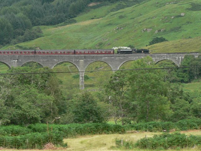
Exterior shots for Hogwarts grounds in Prisoner of Azkaban were filmed around the Clachaig, and the outcrop that stood in for Hagrid’s hut is a twenty-minute walk from the inn, near Torren Lochan. There is no hut. There are some large rocks and a good view. Manage expectations accordingly. The Glenfinnan Viaduct, which does still have a steam train crossing it, is 45 minutes further north and covered in our guides to Scotland’s scenic railway journeys.
Everything else
The Meeting of Three Waters gorge appears in Monty Python and the Holy Grail as the Bridge of Death. Glen Etive and Glen Nevis both feature in Braveheart. Highlander used the glen extensively in 1986. In all these cases what you are looking at is landscape rather than a set, which is the point: the scenery is the thing that was actually there.
Glencoe in winter, and the A82
Glencoe in snow is better than Glencoe in summer, and I will die on that hill. The mountains get definition, the light is low all day, the car parks are half empty and accommodation drops in price. The drawback is daylight: in late December you get roughly seven hours of usable light, and that is if the cloud lifts.
The A82 through the glen is a trunk road and is gritted, but it climbs to about 300 metres at the pass and it ices, particularly on the descent past the Study where the road is in shadow for much of the day. Black ice on that section catches people out every winter. Traffic Scotland publishes live camera feeds and closure notices for the route; check them the morning you travel, not the night before.
Practical winter kit for a day trip: a proper ice scraper, a torch, warm layers you can put on if you stop, and enough fuel to get to Fort William if the road south closes. Winter tyres are not a legal requirement in Scotland but they change the experience of that pass completely. Our month-by-month look at Scotland in winter covers the wider trade-offs of a cold-season trip.
The ski season at Glencoe Mountain Resort typically runs from around late December to April, but it is entirely snow-dependent and Scottish ski centres open and close week to week. Their snow report is the only source worth trusting.
Planning your visit: time, transport and what to book
How long do you need?
A drive-through with three stops takes an hour and a half. That is what most coach tours give it, and it is not enough, but it is not nothing either.
One full day gets you the whole viewpoint sequence, the visitor centre, one easy walk and a pub meal. That is the sweet spot for most people and it is what I would recommend if Glencoe is one stop on a longer week-long Scotland itinerary.
Two days lets you add a real hill: the Hidden Valley or the Pap of Glencoe on day two, with the weather as your tiebreaker. Three or more days only makes sense if you are here to walk, in which case you could stay a fortnight and not run out of Munros.
Getting there
By car, Glencoe is roughly two hours from Glasgow via the A82 along Loch Lomond, and about two and three quarter hours from Edinburgh via Stirling and Crianlarich. Both approaches are scenic and both involve long stretches where overtaking is difficult, so add contingency. From Glasgow the drive up Loch Lomondside is itself worth the trip.
Without a car it is more awkward but far from impossible. Scottish Citylink coaches between Glasgow and Fort William run several times a day and stop at the visitor centre junction on the A82 and in Glencoe village. The nearest railway station is Fort William on the West Highland Line, with Bridge of Orchy closer to the southern end of the glen but with very little at it. Our guide to getting around Scotland goes into the connections properly.
Guided day trips from Edinburgh and Glasgow do reach Glencoe, usually combined with Loch Ness or Fort William, which means a very long day with maybe forty minutes in the glen. If that is your only option it is better than not coming, but go in knowing what you are buying. There are more considered options among organised Scotland tours.
What to book, and how far ahead
Nothing in the glen itself needs booking. The viewpoints are free or pay-on-arrival, the visitor centre does not require tickets, and the chairlift you can buy on the day.
Accommodation is the exception and it is a big one. There is very little of it, because the National Trust for Scotland has owned much of the glen since the 1930s specifically to prevent development. The Clachaig Inn, the Kingshouse, Glencoe House, the youth hostel and a handful of campsites and pods are essentially it, and in summer they sell out months ahead. Ballachulish and Kinlochleven give you more options a few miles away, and Fort William more still. If you are working out the geography of a longer trip, our overview of where to stay across Scotland is a useful starting point.
Timing-wise, May and September are the sweet spots: long days, fewer coaches, and either side of the worst of the midge season, which in Glencoe runs roughly June to early September and is at its worst on still, damp evenings near water. October brings the bracken colour and empty car parks. If you are still fixing dates, the best time to visit Scotland weighs it all up.
What underwhelms, and the mistakes people make
Some candour, because it saves time.
Glencoe village is not the attraction. People book accommodation “in Glencoe” imagining they will step out into the mountains. The village is at the far western end, past the scenery, and it is a quiet residential place with limited eating options. Lovely to stay in, not somewhere to spend a day.
The Glen Etive drive is a two-hour commitment for a photograph. Covered above, but it bears repeating because it is the most common way to waste half a day here.
Arriving at eleven in the morning in August. Every car park will be full, the Three Sisters viewpoint will be three deep, and the light will be flat. The same visit at seven in the morning is a different place entirely. If you can only do one thing differently, do this.
Underestimating the Hidden Valley. It appears on lists of “easy walks in Glencoe” and it is not one. River crossing, loose ground, three hours.
Treating the A82 as a viewpoint. Stopping on the carriageway, opening doors into traffic, crossing on blind bends. The road carries lorries, coaches and a lot of frustrated locals. Use the laybys and cross where you can see.
Expecting whisky. There is no distillery in Glencoe. The nearest is Ben Nevis in Fort William, twenty miles north. If drams are part of the plan, see our guide to Scotch whisky distilleries and build the day around Lochaber instead.
Assuming one visit is enough to see it. Glencoe in cloud is a completely different glen from Glencoe in sun, and there is no version of it that is bad. But if you get a day where the tops are in and it is raining sideways, the honest answer is that you have seen a mood rather than a view, and it is worth coming back.
Frequently asked questions
How long does it take to drive through Glencoe?
About twenty minutes end to end without stopping, covering roughly ten miles of the A82 between Rannoch Moor and Glencoe village. With the main viewpoints, allow two to three hours. With a walk and the visitor centre, allow a full day. Traffic in July and August can add half an hour on its own.
Do you have to pay to park in Glencoe?
It depends where. The National Trust for Scotland visitor centre charges £4 per car (£6 for a small motorhome), free to members. Charging has been introduced at the Three Sisters car park and at Glencoe Lochan. Altnafeadh, Lairig Eilde and most Rannoch Moor laybys are free. Read the machines on arrival, as charges change.
What is the best viewpoint in Glencoe?
For the Three Sisters, the small unsigned layby at the Study (Am Meall), which is free and quieter than the official car park. For Buachaille Etive Mor, Altnafeadh with Blackrock Cottage in the foreground. For the glen as a whole, twenty minutes up the Devil’s Staircase from Altnafeadh, looking back.
Is the Hidden Valley walk suitable for beginners?
Not really. It involves an unbridged river crossing, around 340 metres of ascent on loose, rocky ground, some hands-on scrambling and a boulder field, and takes two and a half to three and a half hours. Fit, sensible beginners in boots manage it in good conditions. Do not attempt it after heavy rain or in trainers.
Can you see the Skyfall house in Glen Etive?
No. The lodge was a temporary set built at Hankley Common in Surrey and destroyed during filming; the mountains behind it were added digitally. Glen Etive supplied the road in the driving scene. The spot is about a mile and a half down the Glen Etive turning, not at the far end.
Is Glencoe worth visiting in winter?
Yes, and arguably it is at its best. Snow gives the ridges definition, the low sun lasts all day, and the car parks are empty. The trade-offs are seven hours of daylight in December, ice on the pass, and shorter opening hours at the visitor centre. Check Traffic Scotland before you set off.
Where should you stay to explore Glencoe?
Inside the glen, the Clachaig Inn and the Kingshouse are the classics and book out months ahead. Ballachulish and Kinlochleven put you within ten minutes with more choice, and Fort William, twenty miles north, has the most beds and the most restaurants but adds a daily drive.
Do you need hiking boots for Glencoe?
Not for the viewpoints, the visitor centre, Glencoe Lochan or the Signal Rock woodland loop; trainers are fine for all of those. You do need boots, waterproofs, a map and a forecast for the Hidden Valley, the Devil’s Staircase crossing, the Pap of Glencoe or any of the Munros.
Final thoughts
Glencoe rewards a plan more than almost anywhere else in Scotland, precisely because it looks like it does not need one. It is one road. How hard can it be?
Hard enough that most people leave having seen a third of it. Work out your direction of travel before you arrive, note which side of the road each stop is on, be there before nine or after six in summer, and be honest with yourself about which walks you are actually equipped for. Do that and you get a glen that is dramatic, sobering and genuinely one of the best days out in any Scotland bucket list. And if you are putting a first trip together from scratch, our advice for first-time visitors will save you a few of the other classic mistakes.
Take the extra twenty minutes and drive it twice. You will not regret it.
About the author: This guide was written and is maintained by the ScotlandTourism.org editorial team — travel writers who’ve spent years exploring Scotland’s cities, Highlands and islands, from bagging Munros to chasing the perfect dram. We update our guides regularly to keep prices, opening details and advice current.
Last updated: September 2026. Prices and opening times change — always check the official site before you travel.
Photo credits
All images are used under their respective Creative Commons or public-domain licenses:
- Blackrock Cottage at Altnafeadh with the snow-covered cone of Buachaille Etive Mor… — Dave.Dunford, CC BY-SA 4.0, via Wikimedia Commons
- The Three Sisters of Glencoe seen from the A82 viewpoint car park — Colin, CC BY-SA 4.0, via Wikimedia Commons
- Loch Achtriochtan on the floor of Glencoe, with the white house at Achnambeithach — John Taylor, CC BY-SA 2.0, via Wikimedia Commons
- The waymarked woodland trails around Glencoe Lochan behind Glencoe village — Rowyn flowerdew, CC0, via Wikimedia Commons
- The single-track Glen Etive road, a 12-mile dead end off the A82 — Chris Eilbeck, CC BY-SA 2.0, via Wikimedia Commons
- Ballachulish Bridge over the narrows of Loch Leven at the western end of Glencoe — N Chadwick, CC BY-SA 2.0, via Wikimedia Commons
- Looking down over Glencoe and the A82 from the West Highland Way near the Devil’s… — dan kearney, CC BY-SA 3.0, via Wikimedia Commons
- High ground on the Beinn Fhada ridge above Coire Gabhail, the Hidden Valley of Glencoe — Espresso Addict, CC BY-SA 2.0, via Wikimedia Commons
- The stone viewing platform beside the falls at the Lairig Eilde bridge in Glencoe — John Allan, CC BY-SA 2.0, via Wikimedia Commons
- Looking along the high ridges that wall in Glencoe, above the Aonach Eagach path — Alan O’Dowd, CC BY-SA 2.0, via Wikimedia Commons