
I have been rained on horizontally in Glencoe in July, eaten alive by midges beside Loch Ossian, and stood on the summit of An Teallach on a day so clear I could see the Outer Hebrides. I would not trade a single one of those days. Hiking in Scotland is, for my money, the best walking in Europe: 282 Munros to climb, a legal right to roam over almost the entire country, free stone bothies to sleep in, and landscapes that go from gentle lochside paths to scrambles that will make your palms sweat. This guide covers the lot — the best hikes, Munro bagging, the long-distance trails, the law, the midges, and what it all actually costs.
The short answer: the best hiking in Scotland splits into three camps — iconic day hikes (the Quiraing, the Lost Valley, Ben A’an), Munros (Ben Nevis and 281 others over 3,000ft), and long-distance trails, led by the 96-mile West Highland Way. Go in May, June or September, learn the Scottish Outdoor Access Code, and pack for four seasons in one day.
Hiking in Scotland at a Glance
| Essentials | The detail |
|---|---|
| Munros (peaks over 3,000ft) | 282 — Ben Nevis is the highest at 1,345m |
| Most famous trail | West Highland Way, 96 miles, Milngavie to Fort William, 5–8 days |
| Best months | May, early June and September (fewer midges, drier, long daylight) |
| Right to roam | Yes — Land Reform (Scotland) Act 2003 + Scottish Outdoor Access Code |
| Wild camping | Legal almost everywhere; permit zones on Loch Lomond Mar–Sep (£4.30/tent) |
| Midge season | Late May to early September, worst July–August on the west coast |
| Typical costs | Parking £2–9, hostel dorms £17–30, bothies free, guided Ben Nevis from £40pp |
| Maps & forecasts | OS Explorer 1:25,000, Walkhighlands route guides, MWIS mountain weather |
Why Scotland Is One of the World’s Great Hiking Destinations
Three things make walking here different from anywhere else I have hiked. First, the access law: since the Land Reform (Scotland) Act 2003, you have a legal right to walk, camp and swim across almost all of Scotland’s land, provided you behave responsibly. There is no “private — keep out” culture, no permit lotteries, no trailhead quotas. The hill is simply yours to walk.
Second, the sheer density of mountains. Scotland packs 282 Munros, 222 Corbetts and around 29 waymarked long-distance Great Trails — over 1,700 miles of them — into a country smaller than the state of Maine. From Glasgow you can be at the foot of Ben Lomond in just over an hour; from Edinburgh you can climb an extinct volcano, Arthur’s Seat, before breakfast.
Third, the wildness is real. The Scottish Highlands hold some of the last genuinely empty country in western Europe — glens where the only shelter is a one-room stone bothy, maintained by volunteers and free to anyone who turns up. I have had entire mountain ranges to myself on a Saturday in May. Try that in the Alps.

The trade-off is the weather, and I will not sugar-coat it: Scotland will rain on you, probably sideways, possibly in every month of the year. The mountains here are small on paper and serious in practice. Treat a 900m Scottish hill with the respect you would give a 3,000m alpine peak and you will have the time of your life.
Munros, Corbetts and the Addictive Sport of Munro Bagging
What is a Munro?
A Munro is a Scottish mountain over 3,000 feet (914.4m), named after Sir Hugh Munro, who published the first list of them in 1891. The current tally is 282, and “Munro bagging” — ticking off the full list — has become a national obsession. Fewer than 7,000 people have ever “compleated” the round, a lovely archaic spelling the Scottish Mountaineering Club insists on. Some take a lifetime; the fastest have run the lot in under a month. My full beginner’s guide to Munro bagging explains how the game works and why it gets under your skin.
Below the Munros sit the Corbetts (222 hills of 2,500–3,000ft with at least 500ft of drop on all sides) and the Grahams (224 hills of 2,000–2,500ft). Do not write these off as consolation prizes — some of Scotland’s finest hills, including Stac Pollaidh and the Cobbler, never reach Munro height.
The best first Munros
Start sensible. These five are the classic first Munros, and I have ranked them in my guide to the best Munros for beginners:
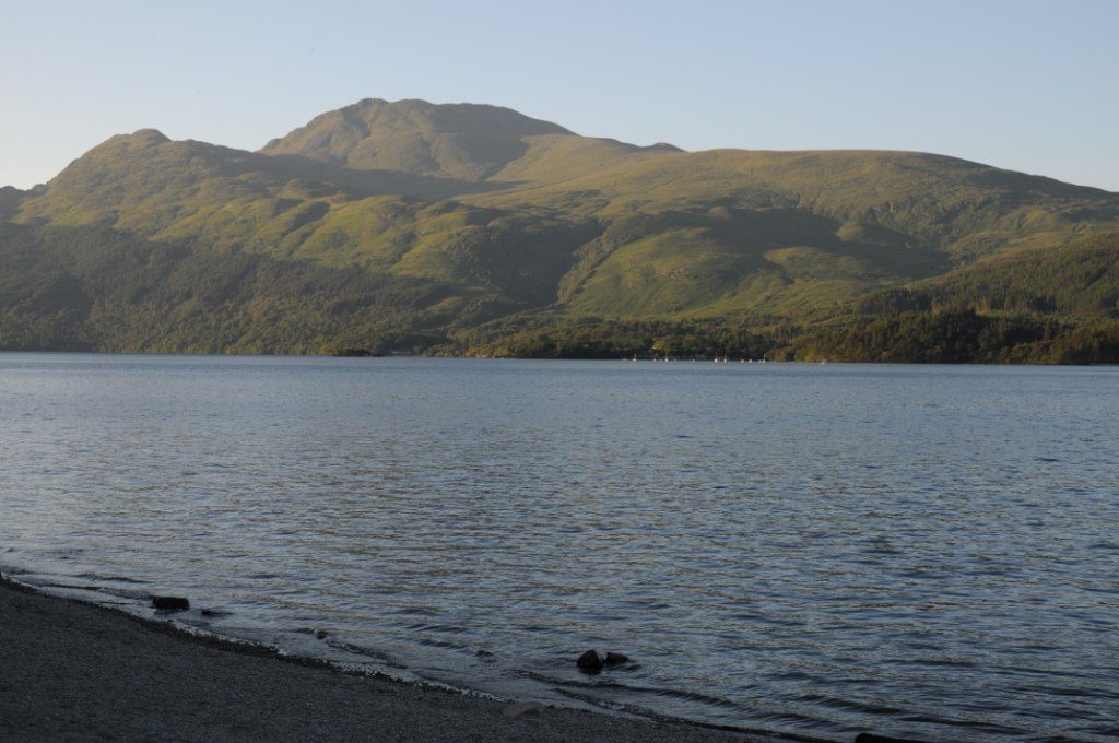
- Ben Lomond (974m) — an hour from Glasgow above Loch Lomond, a clear path all the way, around 30,000 ascents a year. 5 hours up and down.
- Schiehallion (1,083m) — the “fairy hill of the Caledonians,” a broad ridge walk from the Braes of Foss car park (£2). 4–6 hours; the summit boulder field is rougher than the guidebooks admit.
- Ben Chonzie (931m) — gentle tracks from Glen Lednock, often busy with mountain hares.
- Ben Vorlich (985m) — the Loch Earn one; a straightforward out-and-back with a satisfyingly pointy summit.
- Buachaille Etive Beag (958m) — the “wee Buachaille” in Glencoe gives you two Munros in 5–6 hours and a grandstand view of its bigger, scarier sibling.
The hard end of the list
At the other extreme sit hills that stop conversations in Highland pubs. The Aonach Eagach above Glencoe is the narrowest ridge on the British mainland — two Munros, 7–9 hours, and no escape routes once you commit. An Teallach’s traverse adds around 600m of scrambling on weathered Torridonian sandstone. And the Inaccessible Pinnacle on Skye is the only Munro that requires an actual rock climb and an abseil to descend — most baggers hire a guide for that one day. There is no shame in it.
Climbing Ben Nevis: Britain’s Highest Mountain
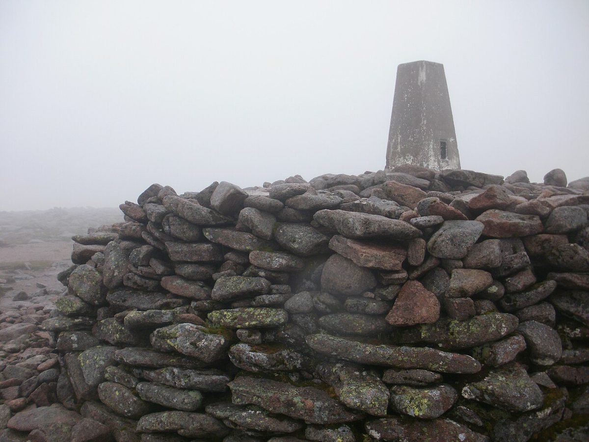
At 1,345m (4,413ft), Ben Nevis is the roof of Britain, and around 130,000 people attempt it each year. Most underestimate it. The standard route, the Mountain Track from the Glen Nevis Visitor Centre, is 17km there and back with 1,352m of ascent — a 7–9 hour day for most walkers, with 3.5–4.5 hours of relentless uphill before you touch the summit trig point. I cover routes, timings and parking in detail in my complete guide to climbing Ben Nevis.

Two things first-timers should know. One: the summit plateau is ringed by gullies that have killed experienced mountaineers in mist, and cloud sits on the top around 300 days a year. The classic escape bearings off the summit — 231 degrees grid for 150m, then 282 degrees for about a kilometre — exist because GPS phones die in cold rain. Learn to use a compass before you go, not on the way up. Two: “fit beginner” genuinely is enough in summer on the Mountain Track, but from November to April Ben Nevis is a full winter mountaineering objective requiring ice axe and crampons.
Experienced scramblers should skip the Mountain Track entirely and traverse the Càrn Mòr Dearg Arête — a Grade 1 scramble linking two 4,000-footers that turns Britain’s most over-walked hill into one of its great mountain days. Guided ascents run from around £40 per head in private groups to about £100 for open group walks; see my guide to Scotland tours for picking a reputable operator.
The Best Day Hikes in Scotland, Region by Region
You could fill several lifetimes here — the Walkhighlands database alone holds thousands of routes, and AllTrails lists 320 trails in Loch Lomond & the Trossachs National Park and 453 in the Cairngorms. These are the walks I send friends on, organised by region. For a deeper dive, start with my round-up of the best day hikes in the Scottish Highlands.
Glencoe and Lochaber
Glencoe is the most dramatic roadside scenery in Britain, and its walking matches the view. The Lost Valley (Coire Gabhail) is the best short hike in Scotland: 5km return, around 250m of climb, 2–2.5 hours through a gorge and boulder field into a hidden glacial valley where the MacDonalds once hid stolen cattle. The Pap of Glencoe (6.2km, 670m of ascent) is a short, steep classic with a stupendous view down Loch Leven. And Buachaille Etive Mòr — the great pyramid that guards the entrance to the glen — goes at around 8.4km and 760m of climb via Coire na Tulaich; allow 5–6 hours, whatever a fit friend’s GPS moving time tells you. All three are in my guide to the best walks in Glencoe.

Isle of Skye
Skye’s Trotternish peninsula has the two most photographed walks in Scotland, and they deserve every shutter click. The Old Man of Storr is a 3.8km round trip to a 50m rock pinnacle — go at dawn to beat the coaches; the car park costs around £7 these days. The Quiraing circuit (6.5km, 375m of ascent, 2–3 hours) threads through a landslip of cliffs, hidden plateaus and weird pinnacles; parking is £3 for three hours. For something quieter and bigger, Blà Bheinn is the finest standalone Munro on the island. My full Isle of Skye guide covers where to stay and how to dodge the crowds.


Loch Lomond and the Trossachs
Ben A’an (454m) is the best small hill in Scotland — a steep 2–4 hour mini-mountain with a summit view over Loch Katrine that belongs on a hill three times its size. Car park £3, and it fills by 9am on weekends. Conic Hill above Balmaha (about 360m of climb) sits right on the Highland Boundary Fault: from the top you can literally see the line where the Lowlands end, drawn across Loch Lomond in a string of islands. Ben Lomond completes the set when you are ready for a full Munro day.

The Cairngorms
The Cairngorms are Britain’s high arctic — a vast granite plateau holding five of the six highest summits in the country. Loch an Eilein near Aviemore is the great easy walk: flat, gorgeous, with a ruined island castle (one of many in my castles in Scotland guide). Meall a’ Bhuachaille (810m) above Glenmore gives the best effort-to-view ratio in the range. The plateau itself — Ben Macdui, Braeriach, the Lairig Ghru pass — is magnificent and deadly serious: featureless in mist, ferocious in wind. Save it for a clear forecast.
The Northwest Highlands and the islands
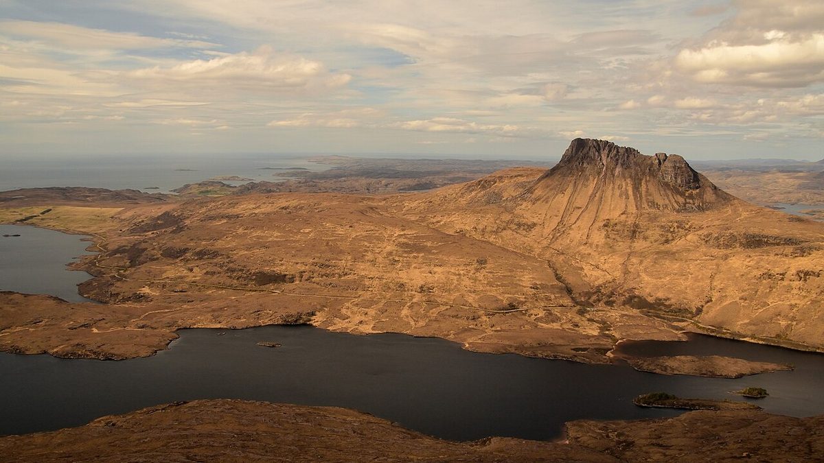
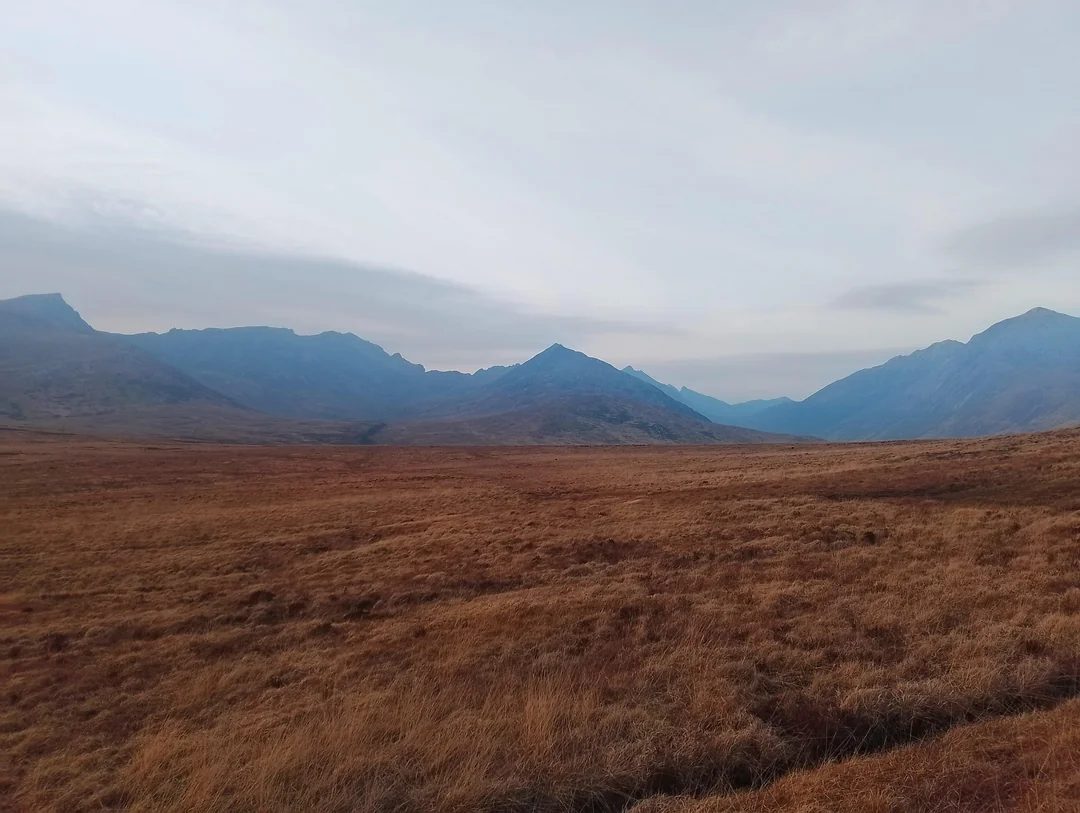
North of Ullapool the landscape goes primeval. Stac Pollaidh (612m) looks like a hill from a fantasy novel and delivers a 2–3 hour circuit with views over a wilderness of lochans; it may be the best non-Munro in Scotland. The Beinn Eighe Mountain Trail in Torridon is Britain’s only waymarked mountain trail, 3–4 hours through 750-million-year-old rock. An Teallach, for those with a scrambling head, is simply the finest mountain in Britain. Much of this country sits on the North Coast 500 route, so build hill days into the drive. Across the water, Goatfell (874m) crowns the Isle of Arran — a 4.5–6 hour return from Brodick that starts almost at the ferry; it is the easiest big island hill to reach without a car, and a fine taster for the rest of the Scottish islands.
Edinburgh and the Lowlands
Do not let anyone tell you the south has no walking. Arthur’s Seat (251m) puts a volcano summit 45 minutes from Princes Street. St Abbs Head on the Berwickshire coast is the best seabird cliff walk in mainland Scotland — puffins in early summer, included in my wildlife watching guide. And the Grey Mare’s Tail near Moffat (NTS car park £3) climbs past a 60m waterfall to hidden Loch Skeen in 2–2.5 hours.

Scotland’s Long-Distance Trails, Compared Honestly
Scotland has around 29 branded Great Trails totalling more than 1,700 miles, every one of them at least 25 miles long and waymarked — with one infamous exception I will come to. I have compared the full set in my guide to the best long-distance walks in Scotland; here is the executive summary.
| Trail | Distance | Days | Difficulty | Baggage transfer? |
|---|---|---|---|---|
| West Highland Way | 96 miles | 5–8 | Moderate | Yes (£65–85/bag) |
| Great Glen Way | 79 miles | 5–7 | Easy–moderate | Yes |
| Affric Kintail Way | 44 miles | 4 | Moderate, remote | Limited |
| Speyside Way | 65 miles | 5–6 | Easy | Yes |
| Rob Roy Way | 79 miles | 6–7 | Easy–moderate | Yes |
| Hebridean Way | 155 miles | 10–12 | Moderate | Limited |
| Southern Upland Way | 214 miles | 12–16 | Hard (remote) | Partial |
| Cape Wrath Trail | ~230 miles | 16–22 | Expert only | None |
West Highland Way: the famous one
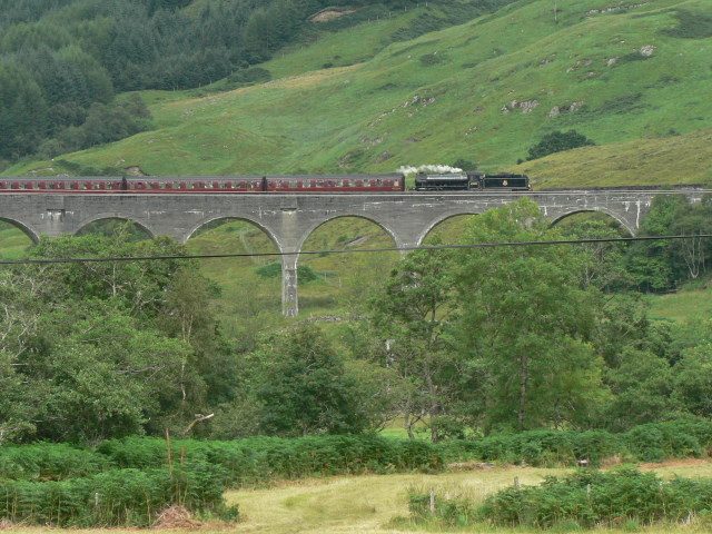
Scotland’s first official long-distance route (opened 1980) runs 96 miles from Milngavie, on the edge of Glasgow, to Fort William under Ben Nevis — over Conic Hill, along the roadless east shore of Loch Lomond, across Rannoch Moor and up the Devil’s Staircase, the route’s 550m high point above Glencoe. Most walkers take 6–7 days. It is sociable, superbly serviced and justifiably world-famous; book accommodation months ahead for May–September. Baggage transfer firms will cart your pack between stops for £65–85 for the whole route, which transforms the experience. My day-by-day West Highland Way itinerary guide has the full planning detail, and my where to stay in Scotland guide covers the accommodation styles you will meet along the way.


Great Glen Way: the gentle one
Fort William to Inverness, 79 miles along the Great Glen fault — canal towpaths, forest tracks and the entire length of Loch Ness. It is the long-distance walk I recommend to first-timers and anyone walking in spring or autumn, because it stays low and is walkable year-round. The high-route variants above Loch Ness are worth every extra metre of climb. Full details in my Great Glen Way guide, and you can tack on monster-hunting at the end with my Loch Ness and Inverness guide.
Affric Kintail Way: the wild long weekend
Forty-four miles in four days from Drumnadrochit through Glen Affric — widely called Scotland’s most beautiful glen, and I will not argue — to Morvich beneath the peaks of Kintail. The middle night is spent at Alltbeithe, a youth hostel so remote it has no road. This is the trail I recommend to people who want wildness without committing to the Cape Wrath Trail.
Cape Wrath Trail: Britain’s toughest trek
Around 230 miles from Fort William to the lighthouse at Cape Wrath, Scotland’s extreme northwestern tip. Unmarked, largely pathless, with river crossings that become impassable in spate and 16–22 days of self-sufficiency. There is no baggage transfer, no waymarking and frequently no path. It is the hardest long-distance walk in Britain and the best thing I have ever done with three weeks. Do the West Highland Way and a few wet Munros first, then decide if you are the type.
When to Go Hiking in Scotland: A Season-by-Season Strategy
The honest answer to “when should I hike in Scotland?” is May, early June or September. You get long daylight (up to 17–18 hours in midsummer in the north), the driest months statistically, and — crucially — you bracket the midge season. I break the whole calendar down in my guide to the Scottish seasons, but for walkers it goes like this.
April–May: my favourite. Snow lingers photogenically on the tops (carry an ice axe for high Munros into early May), waterfalls are full, midges absent. June: longest days; midges arrive late in the month on the west coast. July–August: peak season and peak midge; the hills are at their busiest and the air at its haziest. School holidays fill every campsite. September: the connoisseur’s month — heather still purple, midges fading, autumn light. October: golden larches and the first storms; days shorten fast. November–April: the Scottish mountains become genuine winter mountaineering — ice axe, crampons and the skills to use them, or stay on low-level routes like the Great Glen Way. Be aware too of deer stalking season (roughly 1 July–20 October on many estates): access rights still apply, but check the Heading for the Scottish Hills service and follow signed advice.
Surviving the midges
The Highland midge is a 1.5mm insect that has ruined more Scottish camping trips than the weather. Season: late May to early September, peaking July–August, worst on the west coast — Lochaber, Skye, Torridon — in still, humid, overcast conditions at dawn and dusk. The defence that actually works: Smidge repellent (picaridin-based, about £8 a bottle), a head net for camp, light-coloured long sleeves, and choosing breezy pitches — midges cannot fly in wind above about 6mph. The east coast is far less afflicted. Campfire smoke helps; citronella candles, in my experience, merely amuse them.
The Right to Roam, Wild Camping and Bothies
Scotland’s access law in one paragraph
Under the Land Reform (Scotland) Act 2003 and the Scottish Outdoor Access Code, you may walk, cycle, swim and camp on almost all land in Scotland, regardless of ownership — the famous “right to roam.” The deal is responsibility in return: keep dogs under close control (especially during lambing and ground-nesting season), leave gates as you find them, take every scrap of litter home, and stay clear of houses and growing crops. It is a privilege almost unique in the world. Do not be the person who gets it restricted.
Wild camping rules
Wild camping — lightweight, small numbers, two or three nights in one spot — is legal across nearly all of Scotland under the access code. The one big exception: the Loch Lomond & the Trossachs camping management zones, where from 1 March to 30 September you must use a campsite or buy a permit (£4.30 per tent per night, maximum three nights, fines up to £500). The zones cover under 4% of the national park, mostly the busy loch shores; walk twenty minutes uphill and you are usually outside them. Pitch late, leave early, carry out everything — including the things previous campers did not.

Bothies: Scotland’s free mountain shelters
Scattered through the Highlands are around 100 bothies — simple, unlocked stone shelters maintained by the volunteer Mountain Bothies Association since 1965, free for anyone to use. No booking, no fee, no electricity, usually no toilet (bring a trowel, walk far from water). The unwritten rules: small groups only, carry out all rubbish, leave dry kindling for the next soul who staggers in from the rain. A night in a remote bothy with strangers, a candle and a shared dram is about as Scottish as experiences get — pack accordingly with help from my Scottish food and drink guide and, for the dram itself, my tour of Scotch whisky distilleries.
Staying Safe in the Scottish Hills
Scottish mountain rescue teams — 26 of them, 850-plus volunteers, entirely free of charge — answer hundreds of callouts a year, and the same stories repeat: no map, no compass, cotton clothing, a phone with 4% battery. The hills here are lower than the Alps but the weather is faster, wetter and more disorienting, and in mist a featureless plateau like the Cairngorms or the Nevis summit can turn lethal. None of this should put you off; all of it should organise your rucksack.
Navigation. Carry an OS Explorer 1:25,000 paper map (£9–17) and a compass, and know how to take a bearing. Phone apps are brilliant until they are wet, cold and dead; the free OS Locate app at least gives a grid reference to read out to rescue. Weather. Check MWIS and the Met Office mountain forecast the night before and the morning of — they differ from valley forecasts in ways that matter, chiefly wind. Above 40mph forecast on the tops, I change plans. Grading. Walkhighlands grades routes 1–5 (most Munros are grade 4) and adds a wonderful “bog factor” out of 5; believe both numbers. Scottish miles take longer than map miles — budget 1 hour per 4km plus 1 minute per 10m of ascent, then add a fudge factor for bog, photos and wind. Emergency. Call 999, ask for Police then Mountain Rescue, give your grid reference, then stay put and stay warm. A £6 foil bivvy bag weighs nothing and has saved lives.

Kit, briefly. Waterproof jacket and trousers (not “water resistant” — waterproof), spare warm layer even in July, hat and gloves year-round, gaiters if you hate wet socks, and boots with ankle support for the pathless stuff. Ticks are common in bracken and long grass May–October: wear long trousers, check yourself at night, and remove any tick promptly with a tick tool — Lyme disease is present in Scotland. There are no bears, no wolves and only one mildly venomous snake (the shy adder). The dangerous animal in the Scottish hills is the weather.
What Hiking in Scotland Actually Costs
Walking is the cheapest way to see Scotland, but the incidentals add up. Real-world 2026 figures:
| Item | Typical cost |
|---|---|
| Trailhead parking | £2–9/day (NTS car parks ~£3; Skye honeypots £3–7) |
| Hostel dorm bed | £17–30/night (remote hostels like Loch Ossian are the bargains) |
| Bothy | Free |
| Loch Lomond camping permit | £4.30/tent/night (Mar–Sep zones only) |
| WHW baggage transfer | £65–85/bag for the full route |
| Guided Ben Nevis ascent | £40–100 per person |
| OS Explorer map | £9–17 |
| Smidge + head net | ~£15 (the best £15 you will spend in July) |
Budget walkers can comfortably do a week’s wild-camping trip for under £150 plus food. At the other end, guided walking holidays with luggage transfer and hotels run £800–1,500 a week — my Scotland tours guide compares the options. Either way, build your route with my Scotland itinerary planner.
Hiking in Scotland Without a Car
Scotland is unusually good for car-free hill days, mostly thanks to the West Highland Line — one of the world’s great railways, with three trains a day from Glasgow towards Fort William and Mallaig. Corrour, at 408m the highest station in Britain, has no road access at all: step off the train onto open moor with three Munros (Beinn na Lap is the easiest in the book from here) and the Loch Ossian hostel for the night. Arrochar & Tarbet station serves the Cobbler. Conic Hill is a bus to Balmaha from Glasgow; Goatfell is the Ardrossan–Brodick ferry; Arthur’s Seat is a walk from Edinburgh Waverley. The Caledonian Sleeper from London even drops you at Corrour for breakfast. Full connections in my getting around Scotland guide.
Beyond the Boots: Swimming, Paddling and Wildlife
The same access law that lets you roam lets you swim and paddle. Every loch you walk past is legally yours to swim in — my wild swimming guide picks the warmest and safest spots. Sea kayakers have arguably the best coastline in Europe; start with my kayaking and canoeing guide. And the walks double as safaris: golden eagles over the Cairngorms, otters on Skye shores, minke whales off Mull — timings and boat trips in my whale, dolphin and puffin watching guide. If you are still assembling the wider trip, my master list of things to do in Scotland is the place to start.
Frequently Asked Questions About Hiking in Scotland
What is the best hike in Scotland?
There is no single answer, so here are four. Best short walk: the Lost Valley in Glencoe. Best photogenic walk: the Quiraing on Skye. Best summit day: Ben Nevis via the CMD Arête if you can scramble, Ben A’an if you want maximum view for minimum effort. Best multi-day: the West Highland Way, still the king after four decades.
What does Munro bagging mean?
Munro bagging is the pursuit of climbing all 282 Scottish mountains over 3,000 feet (914.4m), listed by Sir Hugh Munro in 1891. Completing the list — “compleating,” in the Scottish Mountaineering Club’s spelling — has been achieved by fewer than 7,000 people. Some finish in months; most take decades of happy weekends.
How hard is it to climb Ben Nevis?
Harder than its crowds suggest. The Mountain Track is 17km return with 1,352m of ascent — 7–9 hours for most people. A fit beginner can manage it in summer with proper boots, waterproofs, food and an early start. In mist the summit plateau demands compass navigation, and from November to April it is a winter mountaineering route, not a walk.
What is the most famous walk in Scotland?
The West Highland Way, by a distance. Opened in 1980 as Scotland’s first official long-distance route, it carries tens of thousands of walkers a year along its 96 miles from Milngavie to Fort William, via Loch Lomond, Rannoch Moor and the Devil’s Staircase. Among day walks, the Old Man of Storr on Skye is probably the most photographed.
Is wild camping legal in Scotland?
Yes. Under the Land Reform (Scotland) Act 2003 and the Scottish Outdoor Access Code, lightweight wild camping is legal on most unenclosed land — small groups, two or three nights maximum, away from roads and buildings, leave no trace. The exception is the Loch Lomond camping management zones (1 March–30 September), where you need a £4.30 permit or a campsite.
How many Munros are there?
There are currently 282 Munros — Scottish mountains over 3,000 feet. The number occasionally changes when the Scottish Mountaineering Club resurveys marginal summits; Sir Hugh Munro’s original 1891 list had 283. There are also 222 Corbetts (2,500–3,000ft) and 224 Grahams (2,000–2,500ft) for when you finish.
When is the best time to hike in Scotland?
May, early June and September are the sweet spots: statistically drier, midge-light, with long daylight. July and August bring peak midges and peak crowds, though the high tops are at their safest. November to April turns the mountains into winter climbing territory — glorious with the skills, dangerous without. Low-level trails work year-round.
How bad are the midges in Scotland?
From late May to early September on the west coast: bad enough to have their own forecast (the Scottish Midge Forecast, genuinely). They swarm at dawn and dusk in still, humid weather but cannot fly in winds above about 6mph. Smidge repellent, a head net and a breezy pitch defeat them. The east coast barely notices them.
Do you need a guide to hike in Scotland?
For waymarked trails and popular Munros in summer: no — navigation skills and a good forecast are enough. A guide earns their fee for the Inaccessible Pinnacle (a genuine rock climb), the Aonach Eagach, the Cuillin ridge generally, and any winter Munro if you lack ice axe and crampon training. Guided days run roughly £40–100 per person.
Are there dangerous animals in Scotland?
Effectively no. Scotland has no bears or wolves; the adder is shy and bites are vanishingly rare. The real hazards are weather, navigation error and ticks — check for them after walking through bracken, as Lyme disease occurs in Scotland. Highland cattle look alarming but are placid; give all livestock with calves a wide berth.
Does Scotland have a right to roam?
Yes — one of the strongest in the world. The Land Reform (Scotland) Act 2003 gives everyone access rights over most land and inland water for walking, cycling, swimming and camping, balanced by the responsibilities in the Scottish Outdoor Access Code: respect privacy around homes, keep dogs controlled, leave no trace, and heed stalking-season advice.
What should I pack for hiking in Scotland?
Full waterproofs (jacket and trousers), spare insulating layer, hat and gloves in every month, map and compass, head torch, food and a litre of water, midge net and Smidge in summer, and a foil bivvy bag. Boots over trainers for anything pathless or boggy. The cliche is true: four seasons in one day is the standard forecast.
Final Thoughts: My Honest Take
I have hiked in the Alps, the Pyrenees and the Rockies, and I keep coming back to Scotland. Nowhere else combines this much freedom — legal, practical, spiritual — with this much drama in such a small space. Yes, it will rain on you. Yes, the midges in August are a plague of biblical ambition. But then you crest the Devil’s Staircase with the whole of Rannoch Moor burning gold behind you, or you watch cloud pour like dry ice off An Teallach’s pinnacles, and you understand why people spend thirty years finishing the Munros.
Start with one good day hike — Ben A’an or the Lost Valley. Then a first Munro. Then, when Scotland has its hooks in you properly, the West Highland Way. After that, I will see you somewhere on the Cape Wrath Trail, and you can tell me it was all my fault. For the bigger picture — seasons, regions, logistics — my guides to the Scottish Highlands and when to visit are the natural next reads.
If your Scottish walking starts before you have even left the city, Edinburgh has a proper hill sitting in the middle of it. Our guide to hiking Arthur’s Seat covers all five approaches, honest timings for each, and the sunrise and sunset figures that quietly decide whether an evening attempt works at all.
Spring is an underrated hill-walking season — firm ground underfoot, snow still lying on the high tops and not a midge in sight. Our guide to Scotland in spring compares March, April and May for exactly this kind of trip.
Two Highland bases give you more routes per hour of driving than anywhere else. Fort William has Ben Nevis, Glen Nevis and the Mamores at the door, with an honest briefing on the mountain track and why the descent is the dangerous half. Aviemore and the Cairngorms covers the arctic plateau, which is a different and less forgiving proposition than its ski-resort reputation suggests.
If you intend to sleep out rather than book ahead, our guide to camping and the wild camping rules on the NC500 sets out precisely what the Scottish Outdoor Access Code does and does not permit, and which northern sites have a drying room worth having in October.
Walkers have accommodation options nobody else uses. Bothies, bunkhouses, camping barns and the statutory right to wild camp are all covered in our guide to doing Scotland cheaply, along with the bothy code most first-timers break. Walking with a dog brings its own rules, which we set out in the dog-friendly Highlands guide.
Photo Credits
Images via Wikimedia Commons: Nilfanion / Wikimedia Commons (CC BY-SA 3.0) — source; Peter S / Wikimedia Commons (CC BY-SA 2.0) — source; Lauwz The Kiwistralian / Wikimedia Commons (CC0) — source; GeographUser / Wikimedia Commons (CC0) — source; Peter S / Wikimedia Commons (CC BY-SA 2.0) — source; dave souza / Wikimedia Commons (CC BY-SA 4.0) — source; Aais6 / Wikimedia Commons (CC BY-SA 4.0) — source; Tony Kinghorn / Wikimedia Commons (CC BY-SA 2.0) — source; Andrew Tryon / Wikimedia Commons (CC BY-SA 2.0) — source; Carol Walker / Wikimedia Commons (CC BY-SA 2.0) — source; Rowyn flowerdew / Wikimedia Commons (CC0) — source; Steve Cadman / Wikimedia Commons (CC BY-SA 2.0) — source; Colin / Wikimedia Commons (CC BY-SA 4.0) — source; Peter S / Wikimedia Commons (CC BY-SA 2.0) — source

3 notes from readers