The first time I drove up to the Quiraing I parked, walked for roughly twelve minutes, stood on a ledge of rock with my hood up against the wind, and assumed I had done something wrong. I hadn’t. Those twelve minutes gave me the view that sold Skye to me, and it took a second trip to work out that the thing everybody photographs is not the same thing as the walk everybody writes about.
Type “Quiraing Skye” into a search box and nearly every result folds two completely different visits into one page. There is the short walk from the car park to the famous viewpoint. There is the 6.8km circuit that swings round the back of the escarpment and climbs onto the ridge. Most people who drive up there want the first one, and hardly anyone tells them that’s a legitimate option. So let’s pull them apart before anything else.
The short version: there are two Quiraings
From the car park at the summit of the Staffin to Uig road, it is roughly a 15-minute walk on a broad, obvious path to the classic Quiraing viewpoint, and for most visitors that is the whole visit. The full circuit is 6.5 to 6.8km with about 375m of ascent, takes three to four hours, and includes one narrow, eroded traverse that wants dry, calm weather.
Everything below assumes you’re fitting this into a wider trip north, so if you’re still working out the shape of that, start with our guide to the Isle of Skye and pencil the Quiraing in as a half-day rather than a whole one.
| The viewpoint walk | The full circuit | |
|---|---|---|
| Distance | Around 600 to 800m each way | 6.5 to 6.8km, back to the same car park |
| Time on foot | 15 to 40 minutes there and back | 3 to 4 hours with stops; 2 if you march |
| Ascent | Barely 30m, all of it gentle | About 375m, most of it in one steep pull |
| Ground | Wide earth-and-gravel path, a couple of muddy dips | Rocky traverse, one scrambly step, an eroded climb, a boggy descent |
| Exposure | Negligible | One sloping, narrow section with a genuine drop below it |
| Footwear | Trainers cope in dry weather | Boots with proper grip, no argument |
| Best for | Families, short weather windows, anyone with an hour | Regular hillwalkers comfortable on rough ground |
| Cost | Parking only, around £3 for three hours | Parking only, around £5 for six hours |
Two Quiraings, and which one you actually want
Almost every disagreement about this place comes down to people describing different walks. One person tells you it’s easy and their seven-year-old loved it. The next tells you the path is eroded and they turned back. Both are being honest about the bit they did.
The 15-minute walk to the view
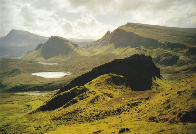
Leave the car park on the path signed for Flodigarry, on the north side of the road. It rises gently for a minute or two, swings round the shoulder of the hill, and then the whole landscape opens at once: a wall of cliffs above you on the left, a green chaos of slipped ground below, and small lochs sitting in hollows where the land tore itself apart.
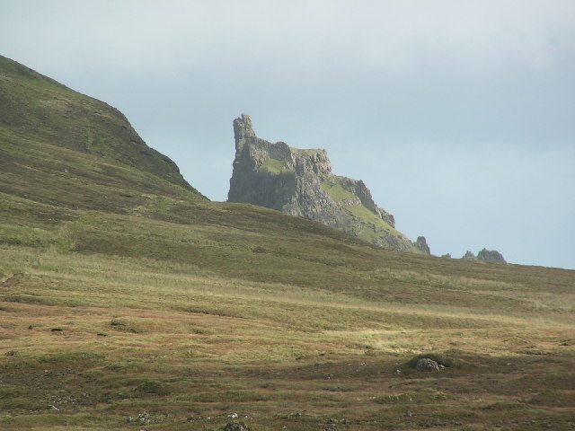
Carry on for ten minutes or so and you reach a broad rocky area where most of the crowd naturally stops. The Prison is dead ahead, the Needle and the main crags are up to your left, and the terraces run away to the sea on your right. That is the photograph. That is what you drove up here for.
It’s 600 to 800 metres each way with very little climbing, and in dry conditions a steady walker in trainers manages it comfortably. In the wet it goes greasy in two or three spots and boots earn their keep. It is not a mountain walk and never pretends to be.
Plenty of people go even shorter. There’s a gully near the start with a wind-bent rowan tree clinging to the side of it, and I’ve watched a good number of visitors walk five minutes, photograph the tree, and go back to the car perfectly satisfied. Nobody is marking your card up there.
The full circuit, the one the guidebooks describe
When people say the Quiraing hike, this loop is what they mean. The circuit keeps going north beneath the cliffs, past the Prison, under a leaning slab of overhanging rock, over a stile and into ground where the crowds vanish almost the moment the car park drops out of sight. At the far end it doubles back and climbs hard onto the top of the escarpment, then follows the cliff edge south, high above everything you have just walked through, before dropping back down to the start.
Walkhighlands measures it at 6.5km with 374m of ascent. GPS traces from people who detour to viewpoints tend to come out nearer 6.8km and 400m, which is why you’ll see both figures quoted. Either way, allow three to four hours if you’re the sort who stops and looks properly.
It is a genuine hillwalk, and the ridge section that finishes it is both the best part and the part that falls apart in bad weather. If you already walk hills and the forecast is kind, do it: looking down onto the Table from the escarpment rim is worth a wet foot or two. If you’re building a Skye trip around walking, it belongs on the same shortlist as the classics in our overview of hiking in Scotland.
The middle option almost nobody mentions
There’s a third visit sitting between the two, and it’s the one I’d push hardest for anyone unsure about the full loop. Walk the low path out as far as the Prison, spend twenty minutes poking about at its base, then turn round and come back the way you came.
That’s roughly an hour and a half, it includes every one of the famous rock features seen from below, and it commits you to nothing. You can extend it into a short loop around the base of the Prison itself, which adds about twenty minutes. Crucially, you can bail out at any moment, because you’re never more than half an hour from the car.
Out-and-back has a reputation as the consolation prize. On the Quiraing it isn’t. The scenery on the low path is the best scenery on the walk; the ridge gives you the overview, not the drama.
Why the Quiraing looks like nothing else in Scotland
Britain’s largest active landslip, in plain English
The Trotternish peninsula is built the wrong way up. Layer upon layer of hard volcanic basalt sits on top of much older, much weaker Jurassic mudstones and sandstones. Heavy rock on soft rock, tilted seawards. It is the geological equivalent of stacking bricks on a wet sponge and walking away.
What that produced is a roughly 30km escarpment running the length of the peninsula, formed where the basalt has repeatedly broken away and slumped downhill in vast blocks. Nearly all of it is now dormant. One stretch is not, and that stretch is the Quiraing: the largest active landslip in Britain.
“Active” is a slow word here. Nobody is going to be carried off. Ground surveys have measured movement in the order of a few centimetres a year in the most mobile parts, which is nothing at all by the standards of a dramatic headline and a great deal by the standards of a road surface.
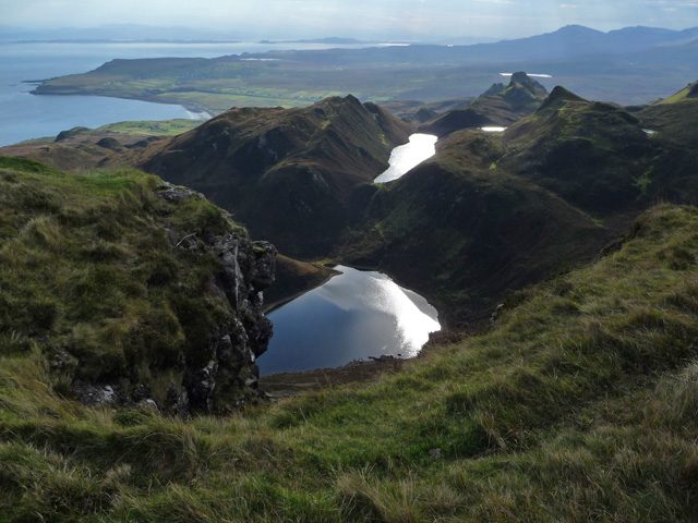
What it means underfoot is a landscape that hasn’t finished happening. Blocks have rotated backwards as they slid, which is why you keep meeting flat grassy shelves tilting the wrong way, with boggy hollows trapped behind them where no hollow has any business being. Loch Hasco and the smaller lochans sit in exactly those pockets. It is the reason the place reads as chaotic rather than merely steep, and the reason it doesn’t resemble anywhere else among Scotland’s best-known landscapes.
The Needle, the Prison and the Table
Three features have names, and all three are pieces of the old cliff that have gone travelling.
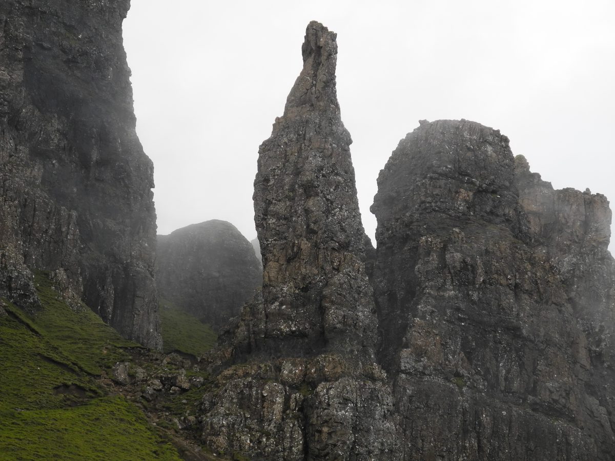
The Needle is a leaning spike of rock somewhere around 37m tall, standing above a fan of scree on the uphill side of the path. You get the classic view of it from below on the way out. Getting closer means a steep, loose scramble that is considerably harder coming down than going up, and I’d leave it unless you’re sure-footed and the rock is dry.
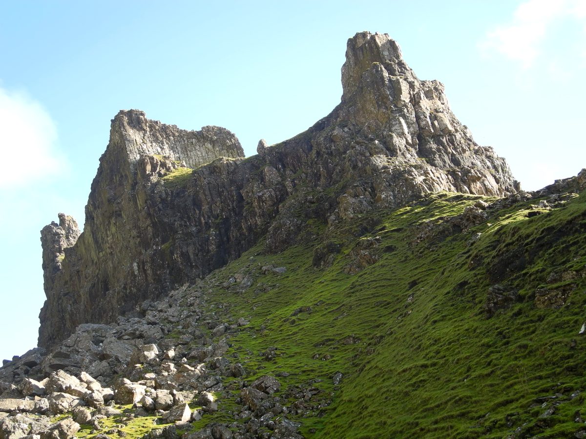
The Prison is the big flat-topped buttress the path squeezes past, and from certain angles it really does look like the ruin of a keep. Competent scramblers get on top of it. Everybody else walks round the bottom, which is the sensible call and gives you better photographs anyway.
The Table is a lawn of flat grass sitting high among the crags, a slab of hillside that slid down and happened to settle level. The story you’ll hear is that crofters once hid cattle up there from raiders, and that the Old Norse root behind the name Quiraing means something close to “round fold” for exactly that reason. It’s good folklore. Treat it as folklore rather than documented fact.
Here’s the practical point about the Table: the best view of it is from above. On the return half of the circuit you walk along the escarpment rim and look straight down onto that green rectangle, ringed by pinnacles, usually with two or three tiny figures wandering about on it. Climbing up to be one of those figures involves a steep loose gully and a fair amount of unhappiness. Look down on it instead.
Why the road keeps cracking
The single-track road over the pass runs across ground that is still moving, and moving ground does to tarmac exactly what you’d expect. Cracks open along the edges, the surface slumps and goes wavy in a way that isn’t potholing so much as the road quietly changing shape, and the repairs come round again and again. It is one of very few roads in Britain that needs regular attention because the hillside underneath it will not stay still.
That isn’t a reason to avoid the drive. It’s context for why the surface is patched, uneven and narrower than you expect. The road has an excuse.
Walking the Quiraing circuit: what actually happens, in order
Which direction to go, and why anticlockwise wins
Cross the road from the car park and the path forks almost immediately. Right and roughly level takes you north along the base of the cliffs. Left and up takes you straight onto the escarpment. Both complete the loop. They are not equally good ideas.
Walk it anticlockwise: low path first, climb at the far end, return along the top. Four reasons, in ascending order of how much they matter.
- The best scenery comes first. The Prison, the Needle and the pinnacle-choked hollows are all on the low traverse. Doing them at the start means you’ve banked the good bit before anything can go wrong with the weather.
- The morning light is on the cliffs. The escarpment faces roughly east. Early on, the crags are lit; by mid-afternoon that whole face has gone flat and grey while the sun works its way round behind the ridge.
- You climb the steep eroded pull rather than descend it. The path onto the ridge at the north end is loose, badly worn and steep. Going up it is a slog. Coming down it in the wet is the sort of thing that produces sprained ankles.
- You keep your options open. This is the big one. Anticlockwise, the exposed traverse comes early, while you’re fresh, close to the car and free to turn round the moment you don’t like it. Clockwise, you do all the climbing first and reach the narrow section two and a half hours in, tired, with a long re-ascent as the only alternative to crossing it.
Some guides argue for clockwise on the grounds that you come over the top with the sea and the Rubha Hunish headland laid out in front of you, and that view genuinely is superb. I still think it’s the wrong call for most walkers, purely because of the last point. Keep your escape route short.
Stage one: the car park to the Prison
Twenty to thirty minutes of easy walking on a good path, gaining height so gradually you barely notice. One awkward moment: a rocky step across a small burn where the path crosses a gully, which is a long stride rather than a scramble, but it defeats some people and it’s worth knowing it’s there. It arrives early enough that you can decide the walk isn’t for you and lose nothing.
Look back over your shoulder regularly on this stretch. The view south along the ridge towards Bioda Buidhe is the one most visitors miss because they’re staring ahead at the cliffs.
Stage two: the traverse, which is the section to take seriously
Past the Prison the path narrows and starts contouring across genuinely steep ground beneath the crags. This is the part of the Quiraing that every cheerful “moderate, family-friendly” description skates over, and it deserves a straight answer.
The path here is roughly a boot and a half wide in places. It slopes outwards and downhill, it’s worn into loose gravel and greasy earth where thousands of feet have cut into it, and below it the hillside falls away steeply for a long way. There is no fence, no chain, no cut steps. In dry weather with no wind it is completely manageable and most people cross it without a second thought.
In wind or wet it is a different proposition. Rain turns the surface slick, the outward camber stops being theoretical, and the wind comes over the escarpment in gusts that arrive sideways with no warning at all. I’ve crossed it in both conditions. Dry, it’s a pleasant path with a view. Wet and blowy, it’s the sort of place where you find yourself putting a hand on the slope and thinking hard.
Two practical notes. First, if you have a real problem with heights, the exposure here is the kind that bothers people, even though the path itself is perfectly walkable. Second, if you’re carrying a small child, this is not the place to discover that. Turn round at the Prison and don’t feel remotely bad about it.
Beyond the traverse the path passes under a dramatic overhanging slab, rounds a corner into a quieter world of smaller pinnacles, and crosses a stile. From here on the walk relaxes.
Stage three: the climb onto the ridge
Keep going and you reach a fork. The right branch drops away towards Loch Hasco and the coast; take the left, which climbs gently over a saddle and through a gap in an old drystone wall into a hidden glen of small towers. It’s an odd, enclosed little place and one of the highlights of the walk, though almost nobody photographs it.
Then the path turns uphill and gets on with it. The climb to the ridge is badly eroded, steep, and about as unglamorous as walking gets: heads down, roughly twenty to thirty minutes of steady effort, gaining a couple of hundred metres. It is the price of admission for the second half. Take it slowly and stop often; there’s no prize for speed and the views behind you improve with every step.
At the top there’s a stile onto the ridge. If you have energy and time, the prow of Sron Vourlinn is a short detour to the right and gives an enormous view north. Otherwise turn left and start the long, steady rise along the cliff edge.
Stage four: the escarpment rim and the way home
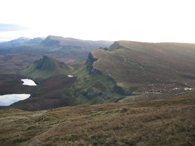
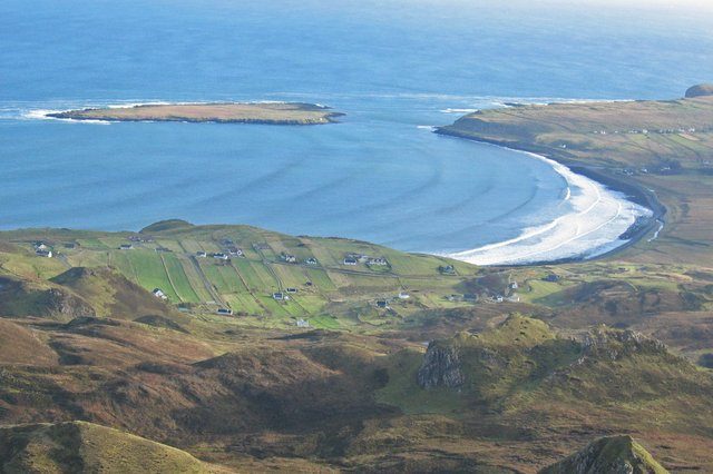
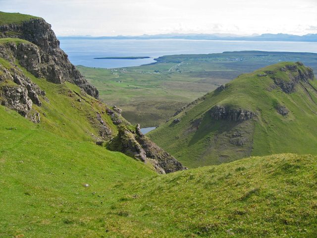
This is the reward. You’re now walking the top of everything, with the whole landslip spilling away below on your left and the sea beyond it. The Table appears first, a flat green shelf directly beneath you. Then the view opens across Staffin Bay to the mainland, and on a clear day the Torridon hills stand up on the horizon in a way that stops conversation.
Keep well back from the edge. It is undercut in places and the ground is, by definition, not entirely reliable. The path itself is a comfortable distance from the drop and there’s no reason to go closer.
The top of the walk is a shade over 500m. The true summit of Meall na Suiramach lies off to the right across a dull plateau, and unless you’re collecting summits there’s no reason to go and find it; the drama is all along the edge. From the highest point the path swings down across grassy slopes, through a gate, and drops back towards the road. That final descent is steeper and boggier than it looks and it’s where most people’s legs finally complain. Then you meet the outward path, turn right, and you’re at the car.
Getting there: the road, the car park, and the real bottleneck
The Staffin to Uig road, and why campervans hate it
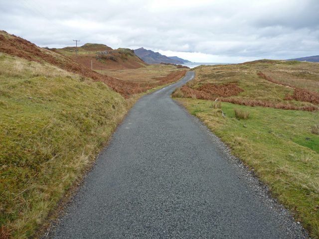
The car park sits at the top of a minor single-track road that crosses the Trotternish ridge, about 2.5 miles up from Staffin on the east coast and about 5.5 miles from Uig on the west. From Portree it’s roughly 21 miles and 30 to 40 minutes by either route.
The Staffin side is the hard one. It climbs sharply from sea level with gradients reaching around 14 per cent, two genuinely tight hairpin bends, no width to speak of, and passing places that require you to actually think about who reverses. Add a surface that’s been repeatedly patched because the ground beneath it keeps shifting and you have a road that arrives at people’s nerves before they’ve even parked.
I’ve seen more rattled drivers in that car park than at any other spot on Skye, and it’s nearly always the same story: a large hire campervan, a driver unused to single-track, and a queue behind them on a hairpin. If that’s you, three things help. Come up from Uig instead, which is longer but less severe. Go early, before the two-way traffic builds. And accept in advance that you will reverse, sometimes uphill, sometimes further than feels fair.
If reversing a big vehicle on a gradient is genuinely beyond your comfort zone, don’t do it. Park at Staffin and take a taxi, or leave the Quiraing for a day when you’re driving something smaller. The basics of Highland single-track etiquette are in our notes on getting around Scotland, and they matter more here than almost anywhere.
One more timing note: this road is at its worst between about 11am and 3pm in summer, when the tour minibuses, the day-trippers and the campervans all arrive at once and meet each other on the bends.
The car park, the charges and what time it fills
Quiraing parking comes down to one car park and one decision: how early you are willing to get up. There is a single proper car park, at the summit of the pass, run by The Highland Council. Pay and display, card accepted at the machine, and payable through the RingGo app if the machine is having a day. At the time of writing it’s around £3 for up to three hours and £5 for up to six, with charges applying roughly 8am to 6pm. Prices creep, so check the current signage rather than trusting this paragraph.
Three hours covers the viewpoint walk several times over and is tight for the full circuit if you dawdle. If you’re doing the loop, buy six hours and stop thinking about it.
How big is it? Bigger than it was, smaller than it needs to be. You’ll see wildly different capacity figures quoted online, which tells you something about how people park up there. What matters is the pattern: on a fine day between roughly June and August it fills by mid-morning and stays full, and cars then circle waiting for someone to leave. That, not the walk, is the thing most likely to ruin your visit.
There are no toilets, no cafe, no water and no shelter at the car park. Nearest facilities are down in Staffin. Plan accordingly, because the drive back down is not one you want to do in a hurry.
If the car park is full
Do not park on the hairpins, in passing places or on the verge on the bends. It’s dangerous on a road this narrow, it blocks the buses and delivery vans that need to get through, and it’s exactly the behaviour that gets access restricted.
There is some additional space along the road west towards Uig, and smaller parking areas and laybys down towards Staffin on the A855. From the lower layby near Flodigarry you can walk in on a path past Loch Hasco, which adds around 1.5 miles each way and 40 minutes or so, and joins the circuit near its northern end. It’s a decent option and it’s free, though the extra ground is honestly the least interesting walking of the day.
The simplest fix remains the boring one: arrive before 9am or after 4pm. Both windows also give you better light and fewer people on the path.
Getting there without a car
No bus runs over the Quiraing pass. The Stagecoach service that loops the Trotternish peninsula from Portree gets you to the Flodigarry area on the A855, which leaves a walk in from below rather than from the top; check the current timetable before you rely on it, because frequencies change with the season and it’s a long wait for the next one.
Otherwise, a guided minibus tour from Portree is a reasonable answer, and a taxi from Staffin is worth pricing if there are three or four of you. Trains don’t come to Skye at all, though the line to Kyle of Lochalsh is one of the great routes in our round-up of scenic train journeys in Scotland and gets you to the bridge. For the wider problem of doing this part of the country on public transport, our car-free Scotland itinerary sets out what’s realistic and what isn’t.
Timing it: light, cloud and season
Sunrise or sunset? Here the answer is clear
Most Skye viewpoints are a coin toss. This one isn’t. The Quiraing escarpment faces roughly east and north-east across Staffin Bay, which means the sun comes up more or less straight into the cliffs. At sunrise the pinnacles are side-lit, the terraces throw long shadows down the slipped ground, and the whole thing looks like the photographs that made you want to come.
Sunset does the opposite. The sun goes down behind the ridge, so the face you’re looking at falls into shadow well before the sky does anything interesting, and by then you’re standing in your own hill’s shade watching colour happen somewhere else. Late evening in high summer is a partial exception, because the sun sets so far to the north-west at this latitude that some light can still rake along the escarpment, but it’s a bonus rather than a plan.
The practical catch is the hour. In late September, sunrise up there is around 7am, which is a civilised alarm clock. In mid-June it’s before 4.30am, which is not. If the early start is out of the question, aim for the first two or three hours after sunrise instead: the light is still low and directional, and the car park is still half empty.
A genuine bonus of the pre-dawn drive is the sky itself. Trotternish is a long way from any real light pollution, and if you’re up there in the small hours in autumn or winter you may get more than you bargained for, as our guide to Scotland’s dark skies explains.
Low cloud, and the honest verdict on walking in it
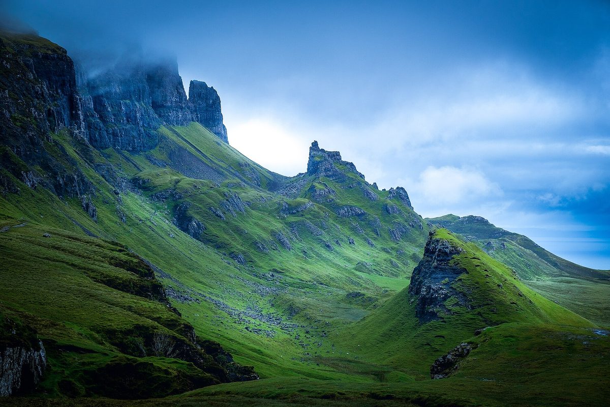
Low cloud on the Trotternish ridge is not an unlucky outcome. It’s a normal one. The escarpment is the first high ground that damp Atlantic air meets, and it manufactures cloud on its own account with impressive reliability.
So here’s the honest position. If the cloud base is sitting below the top of the escarpment, the second half of the circuit is a grey walk. You will climb 200-odd metres of eroded path to arrive at a ridge with roughly 30 metres of visibility, walk along it for an hour seeing nothing at all, and descend. There’s no view of the Table, no Staffin Bay, no Torridon. It’s not dangerous if you can navigate, but it isn’t a good day out either.
The low path, though, is a completely different story in cloud. Down beneath the crags you’re inside the landscape rather than looking at it, and cloud tearing through the pinnacles above you is genuinely atmospheric. Some of my favourite hours at the Quiraing have been in murk on the low traverse.
So my rule is simple: if the tops are in, do the out-and-back to the Prison and skip the ridge. Save the circuit for a day when you can see. Check the mountain forecast rather than the town one before you commit, and read our month-by-month breakdown of Scotland’s weather so the odds don’t surprise you.
Which months work best
May and early June are the sweet spot: the longest run of settled, clear days Skye gets, the hills freshly green, and the worst of the midges not yet arrived. Our notes on Scotland in May cover why that month punches above its weight.
September is my personal favourite up here. The light gets low and warm, the crowds thin noticeably after the school holidays, sunrise is achievable without a 4am alarm, and the hillside colours shift towards russet and gold. It does rain more than May. It’s still worth it, as our guide to Scotland in September argues at greater length.
July and August give you long days and the busiest car park of the year, plus midges wherever the wind drops. The Quiraing car park is usually breezy enough to keep them off, but the sheltered sections of the low path are not, and a still, damp evening will find you. Our midge season guide explains when and where they bite.
Winter is for the viewpoint only, unless you’re properly equipped. The days are short, the traverse can hold ice, and the road over the pass is one of the first on Skye to become unpleasant in snow or hard frost. For the broader trade-offs between seasons, our guide to the best time to visit Scotland is the place to start.
What to wear and take
For the viewpoint walk: whatever you’d wear for a walk in the rain at home, plus a warm layer. The car park is high and exposed, and it’s routinely five degrees colder and considerably windier up there than in Portree.
For the circuit: boots with real grip, waterproof jacket and trousers, hat and gloves outside high summer, more food than you think, and a means of navigating that isn’t solely your phone. There’s no shelter anywhere on the route and no water you’d want to drink.
Take a paper map or a downloaded offline map. The Ordnance Survey sheet is Explorer 408, Trotternish, and the car park sits at grid reference NG440679. Phone signal on the ridge is patchy at best, and the descent path in poor visibility is genuinely easy to lose.
Two small things people forget. There are stiles and fences on the route, so a rucksack that catches on wire is a nuisance. And walking poles are more useful here than on most Skye walks, both for the eroded climb and the boggy descent. A few more of these small Highland-specific habits are collected in our Scotland travel tips.
What underwhelms, what to skip, and the mistakes I see most
Reading the wrong forecast
People check whether it will rain. The number that decides your day here is the cloud base, and the two are only loosely related: some of the driest days on Skye come with the ridge socked in all morning, and some of the wettest are perfectly clear at 500m.
Mountain forecasts publish a cloud base height and a chance of cloud-free hills. Look those up rather than the town forecast for Portree, and make the loop-or-out-and-back decision at the car park with that number in your head. Sunk cost is what pushes people onto the ridge in cloud: they’ve driven two hours, so they climb anyway, and spend an hour walking inside a grey bag.
The scramble up to the Table
Popular, and I’d skip it. The ascent from below is steep, loose scree and eroded gully, the descent is worse, and the reward is standing on a flat piece of grass you can’t really see the shape of because you’re on it. The view from the escarpment rim, looking down, is better in every way and comes free with the circuit.
Trainers on the full circuit
Fine for the viewpoint. Not fine for the traverse or the eroded climb, especially wet. This isn’t gear snobbery; it’s the single most common reason people end up moving nervously across the narrow section.
Arriving at midday in July
You will queue on the road, circle the car park, and share the path with a steady procession. The Quiraing at 8am and the Quiraing at 1pm are different experiences, and only one of them is the one you saw in photographs.
Flying a drone because everyone else’s photos look like that
The aerial shots you’ve seen were mostly taken before the rules and local sensitivities tightened. This is protected ground with sensitive designations and a lot of people trying to enjoy quiet. Check the current restrictions properly before you even think about it, and expect a frosty reception regardless.
Treating it as an interchangeable substitute for the Old Man of Storr
They’re not the same experience. The Old Man is a there-and-back climb to stand among a handful of extraordinary pinnacles; the walking is a means to an end, and our Old Man of Storr guide sets out how steep and how busy it now is. The Quiraing is scenery all the way round, with no single hero object.
With one day on Trotternish you can do both comfortably, plus Kilt Rock and lunch in Staffin. If you can only do one and you want the photograph, take the Storr. If you want the walk, take the Quiraing. And if you’re travelling with people who tire quickly, the Quiraing viewpoint wins outright, because the Storr has no equivalent short option.
Trying to bolt it onto a day that’s already full
The Quiraing is at the far north of Skye. Fitting it, the Fairy Pools and Dunvegan into one day means three hours of single-track driving and not much looking. Base yourself somewhere sensible instead: Portree for the middle of the island, Staffin or Uig for early starts at the Quiraing, or a mainland base if you’re touring more widely, as covered in our comparison of the best base towns in the Scottish Highlands and our wider notes on where to stay in Scotland.
Frequently asked questions
How long does the Quiraing walk take?
The full circuit takes three to four hours at a normal pace with photo stops, and around two if you push. The short walk to the main viewpoint takes 15 to 20 minutes each way. Buy six hours of parking for the circuit and three for the viewpoint, and you won’t be watching the clock.
How hard is the Quiraing Skye walk?
The viewpoint walk is easy. The circuit is moderate in fitness terms, with about 375m of ascent, but harder than that in terrain terms: a narrow sloping traverse with a drop below it, a steep eroded climb and a boggy descent. Sure-footedness matters more than stamina here.
Do you have to pay to park at the Quiraing?
Yes. The car park at the top of the pass is pay and display, run by The Highland Council, at roughly £3 for three hours and £5 for six at the time of writing, payable by card or via the RingGo app during charging hours. Check the signs on arrival, as rates change.
Can you see the Quiraing without hiking?
Partly. You get glimpses from the road as it crosses the pass, and a reasonable view from the car park itself. But the classic outlook needs about 15 minutes of easy walking on a good path, and that short stretch is what turns a roadside stop into the view everyone photographs. It’s worth the boots.
Is the Quiraing suitable for children?
The viewpoint walk suits most children who can manage a gentle uphill mile. The full circuit isn’t a children’s walk: the exposed traverse and the eroded climb aren’t places for anyone unsteady or easily distracted. Do the out-and-back to the Prison instead, and everyone still sees the good bits.
Should I do the Quiraing or the Old Man of Storr?
Do both if you have a day on Trotternish; they’re only about 20 minutes apart by car. If you must choose, the Storr delivers the single iconic photograph on a shorter, steeper there-and-back, while the Quiraing gives better walking and more varied scenery over three to four hours.
Can you get to the Quiraing by public transport?
Not directly. No bus crosses the Quiraing pass. The Trotternish peninsula service from Portree drops you on the A855 near Flodigarry, leaving a walk in from below of roughly 1.5 miles each way. Check timetables carefully, allow generous margins, and consider a guided tour or taxi from Staffin instead.
Is the Quiraing walk safe in bad weather?
The viewpoint walk is fine in most weather. The circuit isn’t: the narrow traverse gets slippery and the wind arrives in sideways gusts over the escarpment, while the ridge section is fully exposed with no shelter and no easy escape. In wind, ice or heavy rain, walk out to the Prison and back instead.
Final thoughts
The Quiraing is the best 15 minutes of walking in Scotland and also a genuinely good three-hour hillwalk, and the trick is knowing which of those you came for. Most visitors want the first, have been sold the second, and end up somewhere in between feeling vaguely underprepared.
Go early, buy enough parking, and decide at the Prison. If the tops are clear and your boots are good, keep going anticlockwise and enjoy one of the finest ridge walks on the Scottish islands. If they’re not, turn round without a shred of guilt, drive down to Staffin for coffee, and come back another morning.
It’s a landscape that is still, very slowly, falling apart. That’s rather the point of it, and it’s why the Quiraing keeps its place near the top of everyone’s list of things to do on Skye, alongside the wider wanders in our guides to Scotland’s islands and the driving routes in our Highlands road trip routes. If it’s your first time this far north, our first-timer’s tips for Scotland will save you a few of the mistakes above.
Coming off the Quiraing, the road drops towards Uig and past the turning for the Fairy Glen — a half-hour of grassy cones and terraces that most people confuse with the Fairy Pools entirely.
About the author: This guide was written and is maintained by the ScotlandTourism.org editorial team — travel writers who’ve spent years exploring Scotland’s cities, Highlands and islands, from bagging Munros to chasing the perfect dram. We update our guides regularly to keep prices, opening details and advice current.
Last updated: September 2026. Prices and opening times change — always check the official site before you travel.
Photo credits
All images are used under their respective Creative Commons or public-domain licenses:
- Quiraing skye escarpment view — Carol Walker, CC BY-SA 2.0, via Wikimedia Commons
- Quiraing skye prison from path — Norrie Adamson, CC BY-SA 2.0, via Wikimedia Commons
- Quiraing skye the prison — Drianmcdonald, CC BY 4.0, via Wikimedia Commons
- Quiraing skye the needle — Drianmcdonald, CC BY 4.0, via Wikimedia Commons
- Quiraing skye meall na suiramach — John Allan, CC BY-SA 2.0, via Wikimedia Commons
- Quiraing skye trotternish ridge — John Allan, CC BY-SA 2.0, via Wikimedia Commons
- Quiraing skye loch hasco — John Allan, CC BY-SA 2.0, via Wikimedia Commons
- Quiraing skye low cloud — Chris Combe from York, UK, CC BY 2.0, via Wikimedia Commons
- Quiraing skye staffin bay from above — John Allan, CC BY-SA 2.0, via Wikimedia Commons
- Quiraing skye passing place — John Allan, CC BY-SA 2.0, via Wikimedia Commons