The first time I drove up the west side of Loch Lomond I did what almost everyone does. I joined the A82 at Balloch, crawled through Luss behind a coach, took the same photograph from the same pier that four hundred other people took that afternoon, and drove home slightly puzzled about what the fuss was. It took me three more visits to work out that I had been looking at roughly one fifth of the place.
Every list of Loch Lomond things to do treats the loch as one place. It isn’t. It is 24 miles long, the two shores are entirely different trips, and the Trossachs — the wooded valley system east of the loch that shares the national park’s name — is a third trip again, with its own lochs, its own hills and a Victorian steamship that has been in service since 1900. Most visitors pick one of those three by accident, based on which road their satnav offered, and never find out the other two existed. This guide is my attempt to fix that, because it’s the single most useful thing I can tell you about the southern edge of the Scottish Highlands.
Loch Lomond things to do: the short answer
Cruise the loch from Balloch or Tarbet, walk Conic Hill from Balmaha for the classic island view, sail Loch Katrine on the steamship Sir Walter Scott, and climb Ben A’an for the best view-per-effort hill in central Scotland. Balloch is 45 minutes by train from Glasgow, so you don’t need a car.
The geography that makes everything else make sense
Loch Lomond and the Trossachs National Park covers about 720 square miles, and the loch itself is only part of it. Think of the area as three distinct trips that happen to share a name.
The west shore is the A82 corridor: Balloch at the southern tip, then Luss, Tarbet, Inveruglas and Ardlui strung out along the water. It is easy, it is fast, it is where the coaches go, and it is where you’ll find the cruises, the tea rooms and the famous village. It is also, on a warm Sunday in July, a queue.
The east shore is a dead end, and that is exactly why it’s better. A single-track-ish road runs from Drymen through Balmaha to Rowardennan and then simply stops. Beyond that there is only the West Highland Way on foot. This is where Conic Hill sits, where Ben Lomond starts, where the ferry to Inchcailloch leaves from, and where you can stand on a summit and physically see the geological line that divides Lowland Scotland from the Highlands.
The Trossachs are east again, up the A81 and A821 from Aberfoyle, or west from Callander. Loch Katrine, Loch Achray, Loch Venachar, Ben A’an, Ben Venue, the Duke’s Pass. Half the articles about “Loch Lomond” skip this entirely, which is a shame, because for a first-time visitor with one day and a car, the Trossachs are arguably the better half.
| Area | Best for | From Glasgow | Time needed | The catch |
|---|---|---|---|---|
| West shore (Balloch, Luss, Tarbet) | Cruises, easy scenery, car-free access | 45 min train to Balloch; 50 min drive to Luss | Half a day to a full day | Busiest part of the park by a distance |
| East shore (Balmaha, Rowardennan) | Conic Hill, Ben Lomond, island ferry, West Highland Way | About 1 hour by car; bus 309 from Balloch | Full day | Road ends at Rowardennan; car parks fill by 10am |
| The Trossachs (Aberfoyle, Loch Katrine) | Steamship, Ben A’an, Duke’s Pass, forest walks | About 1 hour 15 min by car | Full day, or two if you walk | Genuinely awkward without a car |
| Callander and the eastern edge | Waterfalls, cafes, a proper town with shops | 1 hour 15 min by car; bus via Stirling | Half a day | Not on the loch at all |
| The north end (Ardlui, Falls of Falloch) | Road-trip stops on the way to Glencoe | 1 hour 15 min by car | An hour, en route | Little reason to stay |
| The Arrochar Alps (The Cobbler) | Serious hillwalking, scrambling | 1 hour by car; train to Arrochar & Tarbet | Full day | Steep, and the weather comes in fast |
The west shore: Balloch, Luss and the A82
This is the Loch Lomond of postcards and coach itineraries. I’m not sniffy about it — the views from the A82 north of Tarbet are properly good, and for anyone travelling without a car it is the only realistic way in. But it repays a bit of strategy.
Balloch: the gateway that actually works without a car
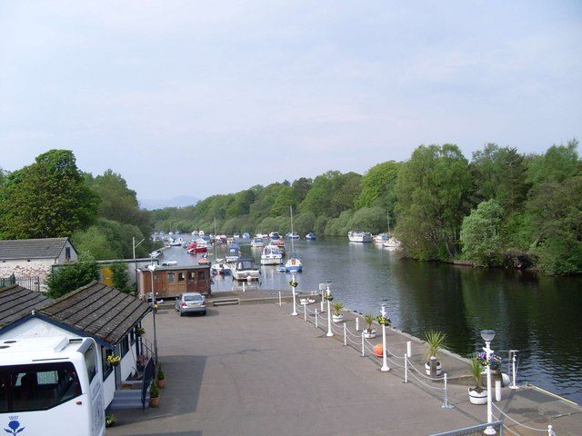
Balloch sits at the southern tip of the loch where the River Leven flows out towards the Clyde. It is not the prettiest place in the park. What it is, is astonishingly convenient: ScotRail runs direct trains from Glasgow Queen Street, roughly every half hour, taking about 45 to 50 minutes, with an off-peak return usually somewhere around £8 to £11 at the time of writing. That is one of very few trips to the Highland edge that genuinely works with no car at all, and it’s a big part of why I recommend Loch Lomond to people doing a whole Scottish trip by public transport.
From Balloch station you walk five minutes to the loch. Cruise boats leave from the pier by the bridge. Buses to Luss and Balmaha leave from outside the station. Balloch Castle Country Park — 200 acres of woodland, walled garden and lochside lawn, free to walk into — is a ten-minute stroll the other way, and it is a much nicer picnic than anywhere you’ll find in Luss on a busy weekend.
Loch Lomond Shores, and why I’d manage your expectations
Loch Lomond Shores is the development next to Balloch pier, and it turns up on a lot of lists as an attraction. It is, in plain terms, a retail outlet with a car park, a chain of shops, a viewing tower and an aquarium. The SEA LIFE centre inside is a perfectly decent hour if you’re travelling with small children on a wet afternoon, and I’d put it in the same bracket as other rainy-day options for families in Scotland. But if you have come to Loch Lomond for Loch Lomond, walk past it and get on a boat instead.
Luss: lovely, and also a car park with a tea room attached
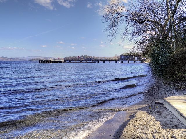
Luss is a conservation village of low slate-roofed cottages built in the 18th and 19th centuries for workers at the local slate quarries. The main street is a single row of them, with roses in summer, and it opens onto a beach and a long wooden pier looking straight across the water at Ben Lomond. On a still morning in April it is one of the loveliest half hours in Scotland.
On a Sunday in July, it is a pay-and-display car park with a queue for ice cream. The village has a few hundred residents and receives visitors by the coachload, and it shows. My honest advice: come before 10am or after 5pm, or come on a weekday, or come out of season entirely. If you arrive at 2pm in August and find yourself circling for a space, drive on to Tarbet and don’t feel you’ve missed much.
Getting on the water: cruises and the waterbus
The loch is much better from the middle than from the edge, and this is the one thing I’d tell every first-time visitor to spend money on. There are two broad options.
Round-trip sightseeing cruises leave from Balloch pier and from Luss, typically running an hour to two hours, looping around the island group in the southern basin — Inchmurrin, Inchcailloch, Inchfad and the rest, roughly 30 islands and islets depending on how you count them. These are the easy option if you have a train ticket and a few hours.
The waterbus is the more interesting one. Cruise Loch Lomond, based at Tarbet, runs scheduled crossings that link Tarbet, Inversnaid, Rowardennan, Balmaha and Luss, with the main season running from around mid-March to early November. The crossings are about 30 minutes. That matters, because it means you can start on the busy west shore and end up on the quiet east one without a car, or walk a section of the West Highland Way in one direction and sail back. Check current times and fares directly with the operator before you plan around it — sailings are weather-dependent and the timetable changes with the season.
Tarbet, Inveruglas and the road north
Tarbet is where the A83 peels off west towards Arrochar, Rest and Be Thankful and Inveraray. The name is the giveaway: tairbeart, an isthmus, the narrow neck of land over which Viking raiders are said to have dragged their boats between Loch Long and Loch Lomond. There is a station here too — Arrochar & Tarbet, on the West Highland Line, which is one of the finest railway journeys in Britain and worth riding even if you never get off.
North of Tarbet the A82 narrows and starts to behave like a Highland road: tight bends, oak woods dropping into the water, laybys with views. At Inveruglas there’s a viewpoint called An Ceann Mor, a timber pyramid that looks odd in photographs and works very well in person, looking straight across at Ben Lomond. It takes about three minutes to walk to. Stop.
Falls of Falloch
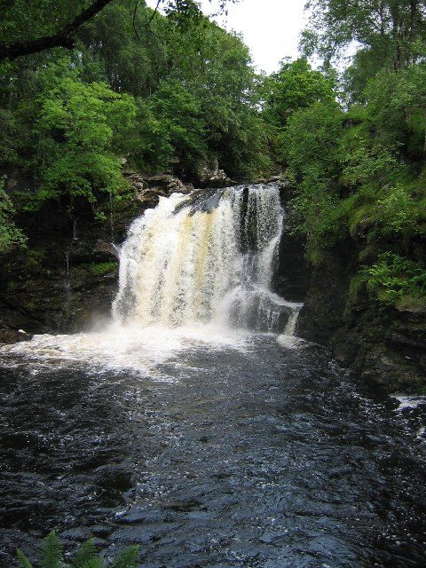
Ten minutes north of Ardlui, past the top of the loch, there’s a car park on the A82 for the Falls of Falloch. A flat five-minute walk through birch and oak brings you to a wide, powerful waterfall dropping into a deep black pool, with a sculptural viewing platform above it — part of the national park’s scenic routes programme — that carries lines from Dorothy Wordsworth’s Highland journals.
It is the best-value stop on the whole A82 between Glasgow and Crianlarich: two minutes off the road, no ticket, no queue. If you’re driving on towards Glencoe or Fort William, it breaks the journey perfectly. People swim in the pool in summer. It is extremely cold, and the rock around it is slick.
The east shore: Balmaha, Conic Hill and the road that stops
Cross to the other side and the tone changes completely. There is no A-road here. You come in from Drymen on the B837, reach Balmaha, carry on for seven miles of twisting single carriageway through oak woods to Rowardennan, and then the tarmac ends. Everything beyond is walking.
That dead end is the east shore’s whole appeal. Coaches can’t turn round easily, so they mostly don’t come. Walkers do, in numbers, because the West Highland Way runs along this bank. If your idea of a good day out involves boots rather than a gift shop, this is your side.
Conic Hill: the geology lesson you can see with your own eyes
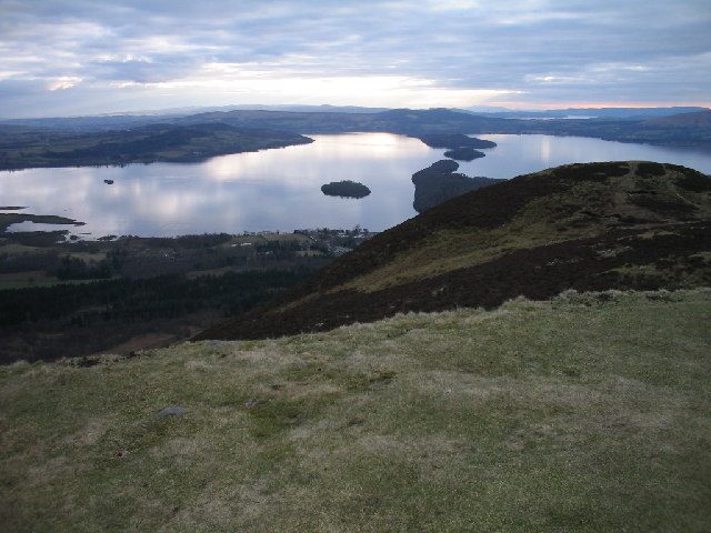
Conic Hill is 361 metres of grass and heather rising straight out of the car park at Balmaha, and it is the single best short walk in the national park. Allow about two hours return, maybe two and a half with a long stop at the top. The path is well made almost the whole way, and it climbs steadily through forestry before breaking out onto open hillside.
What makes it remarkable is not the height. It’s the Highland Boundary Fault. The fault line is the geological join between the old, hard rocks of the Highlands and the younger Lowland sandstones to the south, and it runs diagonally across Scotland from Arran to Stonehaven. It passes directly under Conic Hill — and then continues out into the loch as a chain of islands.
From the ridge you look down on Inchcailloch, Torrinch, Creinch and Inchmurrin lined up in a dead-straight row across the water. That row is the fault. To the south of it: flat, green, farmed. To the north: mountains. I have taken people up Conic Hill who had no interest whatsoever in geology and watched them stand there working it out. It costs you two hours and it explains the whole country.
A word of warning. The Balmaha car park is not large, it fills by mid-morning at weekends from about April onwards, and the overflow parking is a walk away. Get there before 9.30am or come on a weekday. Parts of the hill are also closed to dogs during the spring lambing season, so check the signs at the bottom.
Balmaha itself
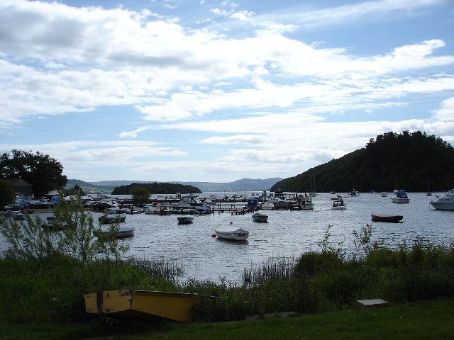
Balmaha is a bay, a boatyard, a pub, a visitor centre and not much else, which is precisely right. On the shore stands a bronze statue of Tom Weir — climber, writer and presenter of Weir’s Way, the television series that taught a generation of Scots to go outside. He’s in his woolly hat, looking out at the water. Scottish walkers touch it on the way past.
The Oak Tree Inn opposite serves the sort of food you want after a hill, and there’s an ice cream counter that does a roaring trade in summer. It is a far better lunch stop than anything on the west shore, mostly because the people around you have also just been up something.
Inchcailloch: the island you can actually get to
From the boatyard at Balmaha, a small open ferry runs across to Inchcailloch, five minutes offshore. Expect to pay somewhere around £7 to £8 return for an adult and roughly half that for a child, and it is worth checking sailings with the boatyard in advance, particularly outside high summer.
The name means something like “island of the old woman”, a reference to Saint Kentigerna, an Irish holy woman who is said to have lived here in the 8th century. There’s a ruined church and a burial ground in the trees, including graves of the MacGregors — Rob Roy’s people. A waymarked path loops over the island’s wooded summit in about an hour and a half, and there’s a sandy bay at Port Bawn at the far end with a basic campsite you have to book.
In late April and early May the whole island turns blue with bluebells under bare oak. It is my favourite hour anywhere on Loch Lomond and it costs less than a round of drinks.
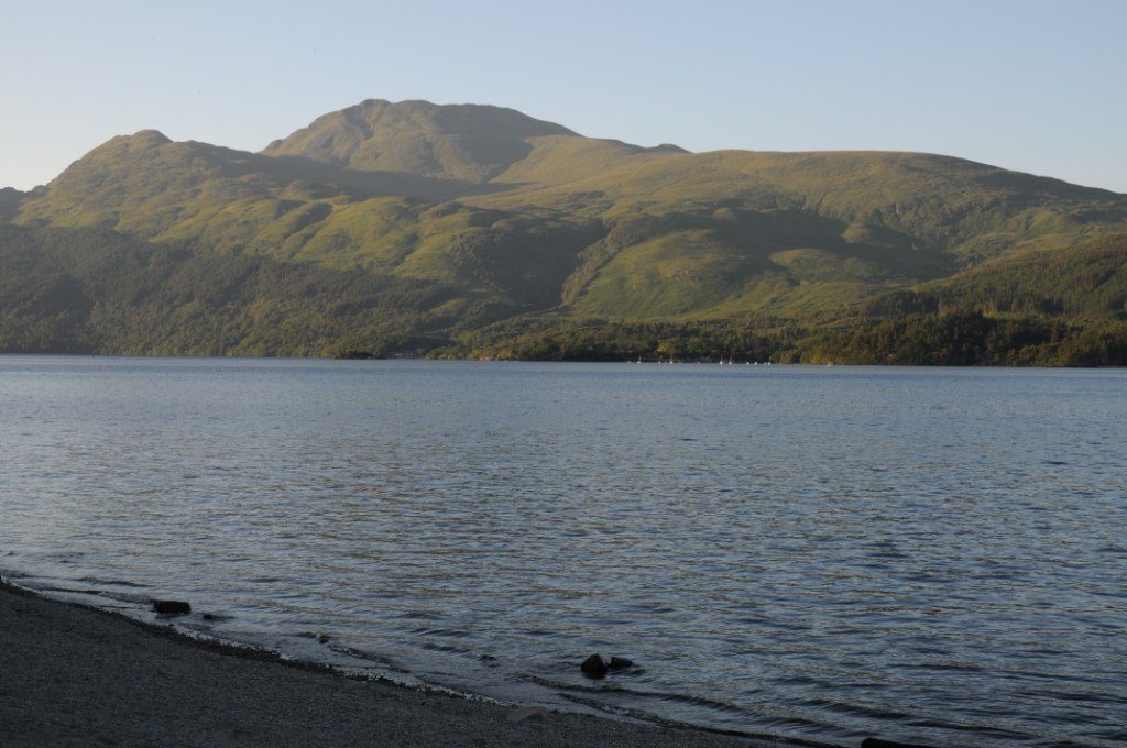
Rowardennan and Ben Lomond
Ben Lomond, 974 metres, is Scotland’s most southerly Munro and the one most Glaswegians climb first. The path starts at Rowardennan, where the road ends, and the standard round trip is roughly 12 kilometres with about 950 metres of ascent — realistically four and a half to six hours, depending on how much you stop.
The tourist path is a motorway by Highland standards: broad, engineered, unmistakable. The Ptarmigan ridge is the better route, narrower and rockier, and doing Ptarmigan up and the tourist path down makes a properly satisfying circuit. On a clear day you can see Loch Katrine, the Arrochar Alps, Ben Lui and, if you’re lucky, Arran and the sea.
Here’s my honest steer, and it’s the one bit of advice in this guide people argue with me about. If you have one day and you want a view of Loch Lomond, do Conic Hill, not Ben Lomond. Conic gives you the loch laid out beneath you with the islands and the fault line, and it takes two hours. Ben Lomond gives you a bigger, more distant panorama for five or six hours of work, and it is in cloud a great deal of the time. Climb Ben Lomond because you want to climb a Munro, which is a fine reason. Don’t climb it because you think it’s the only way to see the loch. If you’re building a wider trip around hillwalking across Scotland, Ben Lomond is a sensible first Munro precisely because the path is so hard to lose.
Parking at Rowardennan is run by Forestry and Land Scotland and costs around £2 an hour or roughly £5 for the day at the time of writing, payable by card, coin or the RingGo app. Blue Badge holders park free. Bring coins as backup, because the mobile signal is patchy.
Where the road ends: Inversnaid and the West Highland Way
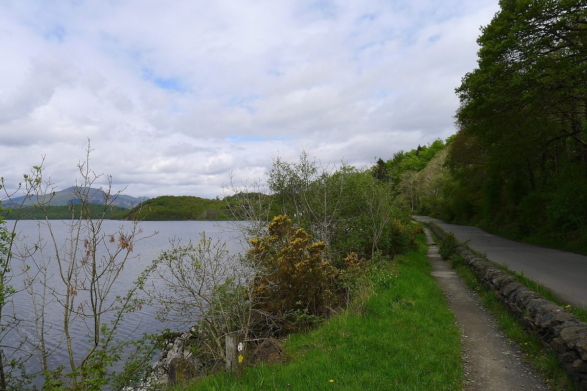
North of Rowardennan the shore belongs to walkers. The West Highland Way — 96 miles from Milngavie on the edge of Glasgow to Fort William — runs along the water here, and the stretch between Rowardennan and Inversnaid is famously rough: tree roots, boulders, scrambling over slabs above the loch. Long-distance walkers grumble about it for the rest of the trail.
You can sample it without committing to the whole thing. Take the waterbus from Tarbet to Inversnaid, walk south along the Way to Rowardennan, and sail back. Or walk north from Balmaha to Rowardennan, which is far gentler and takes about three hours. Inversnaid itself has a hotel, a waterfall that comes crashing down beside it, and a cave a mile north that is signposted as Rob Roy’s. Whether he ever hid in it is anybody’s guess. It is a hole in some rocks, and getting there is the good part.
The Trossachs: the half of the park most people never see
Now for the section that most “Loch Lomond” articles leave out. Drive east from Drymen to Aberfoyle, or west from Callander, and you enter a completely different landscape: smaller lochs, thicker forest, steeper little hills, and roads that were built for Victorian tourists in horse-drawn carriages.
This is where Scottish tourism arguably began. Walter Scott set The Lady of the Lake on Loch Katrine in 1810, and within a few years the well-off of Britain were coming to look at the scenery he described. The infrastructure that grew up to serve them — the piers, the pass, the hotels — is still largely what you drive on today.
Loch Katrine and the steamship Sir Walter Scott
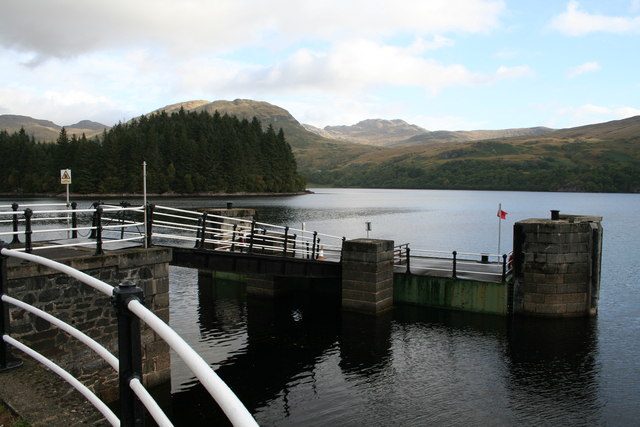
Loch Katrine is eight miles of dark water with no public road along its northern shore and, on a still morning, some of the best reflections in Scotland. It has supplied Glasgow’s drinking water since 1859, which is why there are no houses on the banks and no private motorboats on the water.
And it has the steamship. The Sir Walter Scott was launched in 1899 and has been carrying passengers on this loch since 1900. She is a genuine survivor — a working Victorian passenger steamer, still in service, on the water she was built for, after a long and expensive restoration. There is nothing else quite like her in Britain.
The summer timetable in 2026 runs from late March to 25 October. Broadly: a two-hour sailing from Trossachs Pier to Stronachlachar at 10.30am and 2.30pm, returning at 11.30am and 3.30pm; a one-hour circular at 1pm; and 45-minute circular trips through the day from 10am. In winter the shorter sailings continue on the smaller boats, Lady of the Lake and Rob Roy III, with the steamship out on selected dates only. Check the operator’s current timetable and fares before you travel, and book ahead in July and August — the sailings do sell out.
The clever move: take the steamship one way to Stronachlachar and cycle the 14 miles back along the lochside road. The road is tarmac, closed to general traffic, almost flat and reliably empty. Bikes go on board for a small surcharge if you pre-book, and there’s hire on site at Trossachs Pier. It is one of the most enjoyable half-days in the whole national park and it does not require you to be remotely fit.
Ben A’an: the best effort-to-view ratio in central Scotland
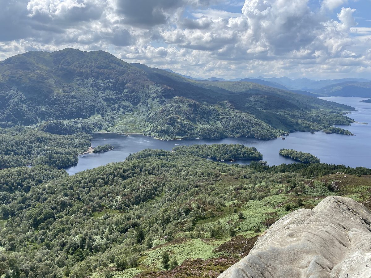
If you take one thing from this guide, take this one. Ben A’an is 454 metres, the round trip is under four kilometres, and most people are up and down in two to two and a half hours. The car park is on the A821 by Loch Achray, and the path starts across the road.
It goes up through conifer plantation, crosses a burn, and then breaks out onto a rocky little cone that behaves exactly like a proper mountain despite being nothing of the sort. Victorian writers called it a mountain in miniature and they were right. The summit is a bare rock nose, and from it you look straight down the length of Loch Katrine, across to the bulk of Ben Venue, and on a clear day out to the Arrochar Alps.
Compare the maths. Ben Lomond: five to six hours, 950 metres of ascent, one Munro. Ben A’an: two hours, and a view that I would honestly put ahead of it. If you have half a day and reasonable legs, this is the walk. Parking is pay-and-display, around £2 an hour or £5 all day, and the car park is not big, so early is better.
The Duke’s Pass
The A821 between Aberfoyle and Loch Achray is called the Duke’s Pass, after the Duke of Montrose, on whose land it was built. It climbs out of Aberfoyle in a series of hairpins, tops out on open moor with the whole Forth valley behind you, and drops into the Trossachs proper.
It takes about fifteen minutes to drive and it’s one of the most enjoyable roads in southern Scotland — a genuine highlight of any drive from the central belt up into the Highlands. There are viewpoints and a forest visitor centre near the top with a cafe, and a lot of red squirrels if you sit still. Drive it slowly. It is not a road for overtaking.
Doon Hill and the fairy tree, Aberfoyle
Just outside Aberfoyle there’s a small wooded knoll called Doon Hill, and on top of it a single old Scots pine hung with ribbons, scraps of cloth and handwritten notes.
The story attached to it is one of the strangest in Scottish folklore. Robert Kirk was the minister of Aberfoyle in the 17th century, and in 1691 he wrote The Secret Commonwealth of Elves, Fauns and Fairies, a straight-faced study of local fairy belief. In 1692 he collapsed and died on this hill. Local tradition held that he hadn’t died at all — that he had been taken, and that his spirit remained in the tree.
The walk up takes about twenty minutes from the car park at the bottom of the lane. It is free, it is quiet, and it is a genuinely odd thing to stand next to. Please don’t tie anything plastic to the tree; the notes and ribbons already do the branches no favours.
Callander, and the eastern edge
Callander is the biggest town on this side of the park and functions as its practical centre: banks, chemists, outdoor shops, a proper choice of places to eat. It sits on the River Teith outside the loch entirely, which is why guides that treat “Loch Lomond” as a single destination ignore it.
Two short walks make it worth an afternoon. Bracklinn Falls is fifteen minutes from town on a made path to a bridge over a gorge where the Keltie Water drops through a series of chutes. Callander Crags is steeper, about an hour and a half return, and gives you the town, Ben Ledi and the Highland Boundary Fault again from a different angle. The Falls of Leny, a couple of miles north on the old railway path towards Strathyre, are the most photogenic water in the area when the river is up after rain.
Just west of the town, the Trossachs Woollen Mill keeps Highland cattle in the field beside the car park, and they are used to people. If you’ve been hunting for a decent photograph of one, it’s an easier bet than most places on the Highland cow trail.
The Loch Lomond day trip from Glasgow, done properly
Loch Lomond is the classic day out from Glasgow, and it deserves the reputation. The southern tip of the loch is 20 miles from the city centre. What people get wrong is trying to do all three areas in one day, which turns a good trip into six hours of driving.
Without a car: the Balloch train
Take the train from Glasgow Queen Street to Balloch. Direct, roughly every half hour, 45 to 50 minutes, no changes. From the station: walk to the pier, take a loch cruise, walk back through Balloch Castle Country Park, eat somewhere in the village, train home. That is a genuinely good day and it needs no planning beyond turning up.
If you want a hill, catch the 309 bus from outside Balloch station to Balmaha, climb Conic Hill, eat at the Oak Tree Inn and bus back. Check the timetable carefully in both directions, because the last useful bus back is earlier than you’d like. The 305 does the same job for Luss on the west shore. This combination — train, bus, hill, pub — is one of the best car-free days in the country, and it slots neatly into any Glasgow stay if you’re working through what the city itself has to offer.
Citylink coaches from Buchanan Bus Station also run up the west shore to Luss, Tarbet and Ardlui on the way to Fort William, which is useful if you want to go further north than the train line reaches. More detail on stitching these together sits in our guide to getting around Scotland by train, bus and ferry.
With a car: pick one side
Two routes I’d actually recommend, each a full and unhurried day.
The east shore day. Glasgow to Drymen and Balmaha, about an hour. Conic Hill in the morning, lunch at Balmaha, ferry to Inchcailloch in the afternoon or drive on to Rowardennan for the lochside walk. Home the same way.
The Trossachs loop. Glasgow to Aberfoyle via the A81, over the Duke’s Pass, park at Loch Achray for Ben A’an, then Trossachs Pier for an afternoon sailing on Loch Katrine, then out east through Callander and back down the A84 and M80. Around three hours of driving in total, spread across a full day, and you see three completely different landscapes.
What I would not do is try to do Luss, Balmaha and Loch Katrine on the same day. Balmaha and Luss are four miles apart across the water and about 30 miles apart by road, because you have to drive all the way round the bottom of the loch. That single fact catches out more visitors than anything else here.
Planning: how long, when, and what to book
How many days do you need?
One day gets you one of the three areas properly. Two days gets you two, comfortably, with a night in Balmaha, Aberfoyle or Callander. Three days is plenty for the whole park including a Munro, and by then you’re into the territory covered in our broader advice on how long to spend in Scotland.
Most people fold Loch Lomond into a longer route north, which is sensible — it sits directly on the road to the Cairngorms and the west Highlands. If that’s you, give it a full day rather than an hour at Luss on the way past, and choose the east shore or the Trossachs over the A82 corridor.
When to come
May and September are the two best months here, and I’d nudge you towards May if you like long evenings and bluebells towards a September visit if you prefer fewer people and the first of the autumn colour on the oak woods. June to August brings the crowds, the full boat timetables and the midges, all at once.
Midges matter here more than most people expect, because this is exactly the damp, sheltered, wooded terrain they like. They’re at their worst from late June to early September, in still conditions, at dawn and dusk, and they are noticeably worse on the east shore under the trees than out on the open west side. Read up on when midge season peaks and what actually works against them before you plan a camping trip. Wind is your friend. So is a boat.
Winter is underrated. The Trossachs under frost, with the steamship still sailing shorter trips and nobody in the car parks, is a genuine pleasure. Days are short and the hills need proper gear, but the lower walks are all doable, and the park’s dark, unlit lochsides make it decent country for stargazing.
What to book, and how far ahead
Loch Katrine sailings in July and August: book online a week or two ahead, especially the two-hour steamship trips, which are the ones that fill. Waterbus crossings on Loch Lomond: worth booking a few days ahead in summer, and always check whether they’re running at all outside the March-to-November season. The Inchcailloch ferry: ring the boatyard, particularly midweek and out of season.
Accommodation in Balmaha, Luss and Aberfoyle is limited and books out for summer weekends months in advance. Callander has more beds and is a better bet at short notice. Nothing else here needs booking — the hills, the waterfalls and the fairy tree are all free and always open, which makes this an easy area to enjoy on a tight budget.
Parking, and the money it quietly costs
Almost every car park you want is now pay-and-display. Forestry and Land Scotland sites such as Rowardennan and Ben A’an charge around £2 an hour or about £5 for the day at the time of writing; national park and council car parks at Balmaha, Luss and Loch Lubnaig are similar. Most take cards or RingGo, but signal is unreliable in the glens, so keep coins.
Budget maybe £10 to £15 a day in parking if you’re moving around, and factor in that arriving after 10am on a summer weekend at Balmaha, Ben A’an or Loch Lubnaig may mean no space at all. Verges are heavily signed against parking and the rangers do enforce it.
The camping byelaws that catch people out
This is the rule that trips up more visitors than any other, and it is worth understanding properly.
Scotland’s access legislation gives you a right of responsible access to most land, including the right to camp lightweight and out of sight. People arrive assuming that means they can pitch anywhere. In this national park, between 1 March and 30 September, that is not quite true.
The park has four Camping Management Zones covering the most-used lochshores — strips of west Loch Lomond, east Loch Lomond, the Trossachs around Loch Chon and Loch Achray, and north Loch Earn. Together they are less than 4% of the park’s area. Inside those zones, in those months, you may only camp on a formal campsite or with a permit. Permits cost a few pounds per tent or motorhome per night — the Park Authority has listed £4.30 and the 2026 rate is around £4.50 — and are booked online, typically up to four weeks ahead. The Your Park campsites at Loch Chon and Loch Achray charge roughly £10.80 per adult per night with a lower rate for children.
Outside the zones, and everywhere in the park from October to February, ordinary responsible wild camping rules apply and no permit is needed. The byelaws also restrict open fires and prohibit collecting firewood, so bring your own or use a fire bowl. Ignoring the byelaws can be reported to the Procurator Fiscal, with a fine of up to £500.
The zones are mapped on the national park website, and the byelaws are currently under a ten-year review, so check before you travel rather than relying on anything you read last year — including this. General ground rules for the outdoors in Scotland are covered in our practical Scotland travel tips, and if this is your first trip to the country, the first-timer’s guide covers the access code in more depth.
What underwhelms, and the mistakes I see most
Treating Luss as the destination. It is a twenty-minute village. Lovely, and twenty minutes. People drive an hour, queue for a space, walk the one street, and leave thinking they’ve done Loch Lomond.
Loch Lomond Shores. Fine for a wet hour with children, a shopping centre otherwise. It should not be on any list of the most beautiful places in Scotland, and I’m always mildly irritated when it appears on one.
Underestimating Ben Lomond. It is a Munro. It takes five hours, the top is often in cloud, and the weather can turn from pleasant to unpleasant in twenty minutes. Every summer the mountain rescue team is called to people who set off at 2pm in trainers with a bottle of water.
Driving between the shores without checking the map. Four miles across the water; about 30 miles by road. I’ve said it twice deliberately.
Expecting Highland drama. This is the southern edge of the Highlands, and the transition is gradual rather than sudden. If you have already seen Glencoe or Skye, Loch Lomond will read as gentle. That’s not a fault. It is a different, softer, wooded kind of landscape, and it is best appreciated on its own terms or, ideally, before you go further north rather than after.
Arriving late in summer. Car parks full, boats sold out, one street’s worth of parking for a coachload of people. Early mornings here are transformative.
Assuming there’s a distillery on the loch. The distillery visitor experiences most people mean — Glengoyne, Deanston, Auchentoshan — sit just outside the park boundary rather than on the water. They’re all worth a stop if you’re already touring Scotland’s whisky distilleries, but don’t plan your day around finding one lochside.
Frequently asked questions
What are the best things to do in Loch Lomond?
A cruise on the loch from Balloch, Luss or Tarbet; Conic Hill from Balmaha for the classic island view; the steamship on Loch Katrine; Ben A’an for the finest short hill walk in the area; and the ferry to Inchcailloch island. If you have one day and can drive, do the Trossachs loop rather than the A82.
Can you do Loch Lomond as a day trip from Glasgow?
Easily. Balloch is 45 to 50 minutes by direct train from Glasgow Queen Street, roughly every half hour, and the loch is a five-minute walk from the station. By car, Balloch is about 40 minutes and Balmaha about an hour. The mistake is trying to cover both shores and the Trossachs in a single day.
Which side of Loch Lomond is better, east or west?
West if you want easy access, cruises, cafes and no walking — it’s the A82 side, served by train and bus. East if you want hills, woods, the West Highland Way and far fewer people; the road ends at Rowardennan, which keeps the coaches out. For a first visit with a car, I’d choose east.
Do you need a permit to camp at Loch Lomond?
Inside the national park’s four Camping Management Zones you do, between 1 March and 30 September. You need either a permit, which costs a few pounds per tent per night and is booked online, or a pitch on a campsite. Outside the zones, and from October to February, normal Scottish access rules apply. Check the zone maps before you go.
How long does Conic Hill take?
About two hours return from the Balmaha car park, or two and a half with stops, climbing to a 361-metre summit on a well-made path. It’s manageable for most reasonably fit people and for older children. Arrive before 9.30am at weekends between April and September or you may not find a parking space.
Is the Loch Katrine steamship worth it?
Yes, and it is the most unusual thing in the park. The Sir Walter Scott was launched in 1899 and has sailed this loch since 1900 — a working Victorian steamer on a loch with no road along its far shore. Take the two-hour sailing to Stronachlachar and cycle the flat, traffic-free 14 miles back if you can.
Can you swim in Loch Lomond?
You can, and plenty of people do at Milarrochy Bay, Firkin Point and the shallow bays near Luss. It is cold year-round, deep very quickly in places, and there is boat traffic in the southern basin, so stay close in and be visible. The pools below the Falls of Falloch and Bracklinn Falls are popular too, and colder still.
Is Loch Lomond worth visiting if I’m going to Skye or Glencoe anyway?
Yes, but see it first rather than last. It is the gentle, wooded, southern doorway to the Highlands, and it reads better before the bigger mountains than after them. It also sits directly on the A82 north, so it costs you a day rather than a detour. It earns its place on any Scotland bucket list on its own merits.
Final thoughts
I’ve come back to this park more often than anywhere else in Scotland, mostly because it is close enough to Glasgow to visit on a whim and varied enough that I still haven’t finished with it. The thing that changed it for me was giving up on “doing Loch Lomond” as one item on a list and treating it instead as three small regions that happen to be neighbours.
So pick one. Take the train to Balloch and get on a boat. Or drive to Balmaha, walk up Conic Hill before the car park fills, and stand there working out where the Highlands begin. Or go over the Duke’s Pass, climb Ben A’an in the morning and sail a 19th-century steamship in the afternoon. Any one of those is a better day than trying to squeeze all three into a hurried loop — and it leaves you a reason to come back, which around here you will.
About the author: This guide was written and is maintained by the ScotlandTourism.org editorial team — travel writers who’ve spent years exploring Scotland’s cities, Highlands and islands, from bagging Munros to chasing the perfect dram. We update our guides regularly to keep prices, opening details and advice current.
Last updated: September 2026. Prices and opening times change — always check the official site before you travel.
Photo credits
All images are used under their respective Creative Commons or public-domain licenses:
- View over Loch Lomond and its islands from the summit ridge of Conic Hill above Balmaha — Ian Mitchell, CC BY-SA 2.0, via Wikimedia Commons
- Ben Lomond, Scotland’s most southerly Munro, rising above the east shore of Loch Lomond — Philip Halling, CC BY-SA 2.0, via Wikimedia Commons
- The wooden pier at Luss looking out across Loch Lomond towards Ben Lomond — David Dixon, CC BY-SA 2.0, via Wikimedia Commons
- Small boats moored at Balmaha bay on the quieter east shore of Loch Lomond — paul birrell, CC BY-SA 2.0, via Wikimedia Commons
- The Falls of Falloch tumbling into its plunge pool in Glen Falloch north of Loch Lomond — Brian D Osborne, CC BY-SA 2.0, via Wikimedia Commons
- The stone landing stage at Stronachlachar pier on Loch Katrine in the Trossachs — John Gibson, CC BY-SA 2.0, via Wikimedia Commons
- The view down to Loch Katrine and Ben Venue from the rocky summit of Ben A’an — Aais6, CC BY-SA 4.0, via Wikimedia Commons
- The West Highland Way path beside the lochside road on the east shore of Loch Lomond — Tim Heaton, CC BY-SA 2.0, via Wikimedia Commons
- The River Leven at Balloch, the southern gateway to Loch Lomond and the end of the… — Stephen Sweeney, CC BY-SA 2.0, via Wikimedia Commons