The first time I drove into Fort William I thought somebody had made a mistake. Here was the self-styled Outdoor Capital of the UK, under Britain’s highest mountain, on a sea loch that runs to the Atlantic — and the approach was a dual carriageway past a supermarket, a retail park and a row of grey pebbledash. I got a working town with a roundabout.
Here’s what I’ve learned across a dozen visits since. The best things to do in Fort William have almost nothing to do with the town itself and everything to do with where it sits. It is not a pretty place, and anyone who tells you otherwise is selling something. But it is the most usefully positioned settlement in the western Highlands, and once you stop asking it to be beautiful and start asking it to be convenient, it becomes very hard to beat.
What are the best things to do in Fort William?
Climb Ben Nevis by the Mountain Track if you’re fit and the forecast is clear. If not, walk to Steall Falls in Glen Nevis, ride the Nevis Range gondola to 650 metres, watch boats descend Neptune’s Staircase at Banavie, and use the town as a base for Glencoe, Glenfinnan and the Road to the Isles.
| Where | Best for | Time needed | Cost |
|---|---|---|---|
| Ben Nevis Mountain Track | Fit walkers with a clear forecast | 7–9 hours round trip | Free (car park charge applies) |
| Steall Falls, Glen Nevis | The best short walk in Lochaber | 2–2.5 hours return | Free (car park charge applies) |
| Nevis Range gondola | Height without the effort | 2–4 hours | Around £28.95 adult day pass |
| Neptune’s Staircase, Banavie | Engineering, and boats in slow motion | 45–90 minutes | Free, free parking |
| Corpach shipwreck | The classic Ben Nevis photograph | 30 minutes | Free |
| West Highland Museum | A genuinely good rainy hour | 1–1.5 hours | Donation or small charge |
| Jacobite Steam Train | The Glenfinnan Viaduct crossing | Most of a day | Around £76 adult day return |
| Glen Roy Parallel Roads | Ice-age geology, almost no crowds | Half a day with the drive | Free |
Fort William is a base, not a destination — and that’s the point
Let’s deal with the town honestly, because most guides skate over it and then leave you disappointed on arrival.
Fort William has a population of around ten thousand, which makes it the largest settlement in the western Highlands and the place everyone within about sixty miles comes to for a supermarket shop, a dentist and a pair of walking boots. The High Street is a pedestrianised strip a few hundred metres long. It is pleasant enough, and it contains an excellent independent bookshop, a well-regarded vegan cafe, several bakeries and an unusually high concentration of shops selling waterproof trousers. It is not a historic old town. The actual fort that gave the place its name — built for Cromwell’s General Monck in 1654 and rebuilt and renamed under William of Orange in 1690 — was bought by the railway company and demolished around 1890 to make room for a goods yard. Its entrance archway was taken down stone by stone and re-erected at the Craigs burial ground on Belford Road, where it still stands. That tells you something about local priorities.
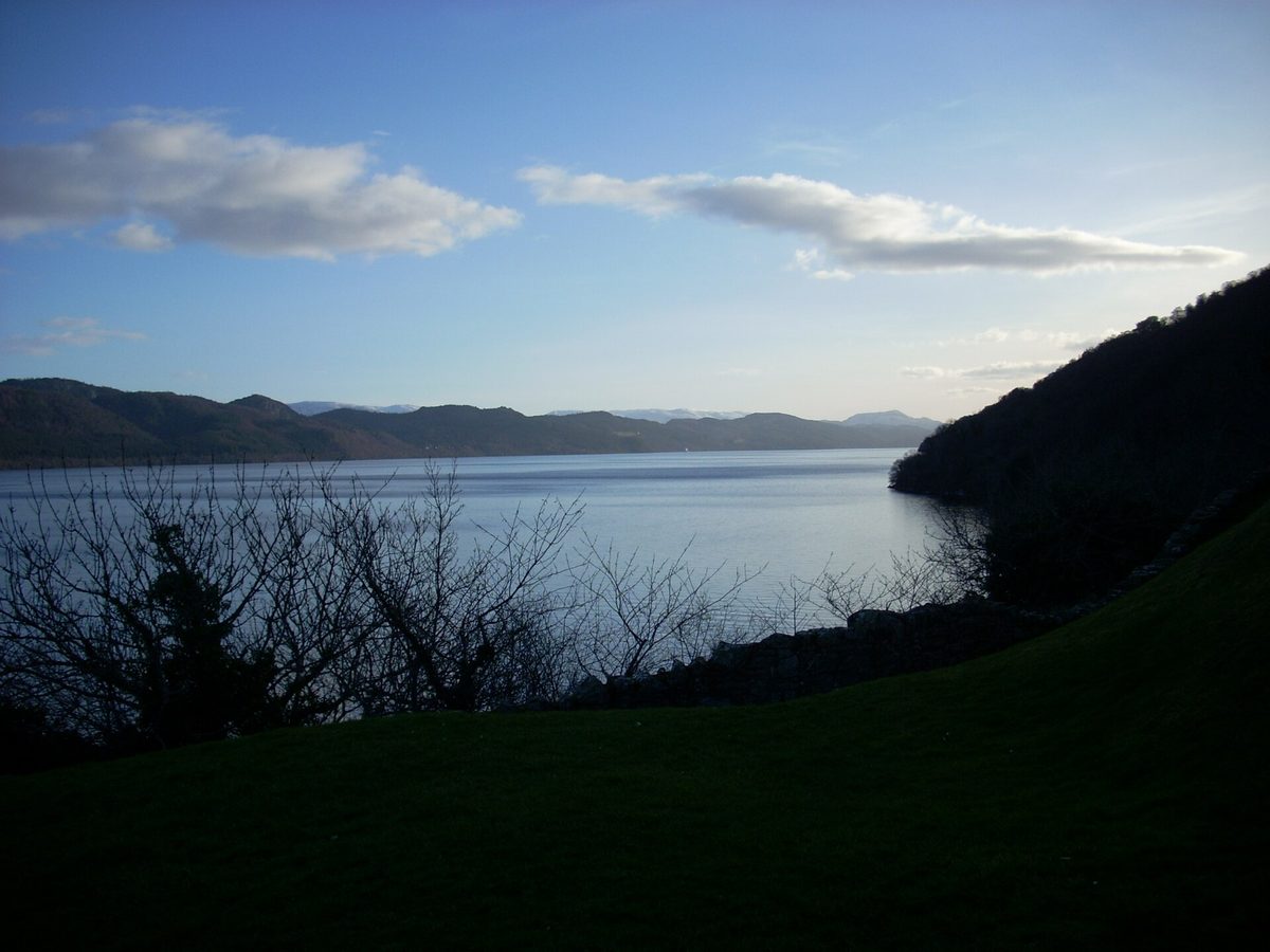
Then there’s the loch. Fort William sits on Loch Linnhe, a sea loch running south-west towards Oban and eventually the Atlantic, and on a still evening the view down it is one of the best in the western Highlands. Unfortunately the A82 runs between the town and the water, and along part of the frontage it is a dual carriageway with crash barriers. You can reach the shore, but you cross a trunk road to do it. It is a long-standing local grievance.
So why come? Geography. Fort William sits at the junction of the Great Glen — the geological fault that slices Scotland in half from Inverness to the west coast — and the road west to the Atlantic at Mallaig. Glencoe is half an hour south, Glenfinnan half an hour west, Ardnamurchan a short ferry hop across the loch, Skye under three hours. Nowhere else in the region puts that much within a comfortable day’s drive of a bed, a chemist and a chip shop.
Spectacular surroundings, ordinary town: that is exactly what you want in a base. Prettier villages nearby have four hotels between them and nowhere to buy a plaster. Our complete guide to the Scottish Highlands sets out how Lochaber fits alongside the Cairngorms, Wester Ross and the far north, and this town is the obvious anchor for the western half.
Ben Nevis: the honest briefing nobody gives you
Around 125,000 people set off up Ben Nevis every year. A large number of them are underprepared, and a small number of them do not come back. I want to be straightforward about this mountain, because the cheerful listicle treatment does genuine harm.
What the Mountain Track actually involves
The standard route is the Mountain Track, still widely called the Pony Track or the Tourist Path after the bridle path built in 1883 to service the old summit observatory. That last nickname is dangerous. There is nothing touristy about it.
You start at roughly sea level and finish at 1,345 metres. The round trip is about 17 kilometres with something close to 1,350 metres of ascent, and most people take seven to nine hours car park to car park. It is a relentless, rough, rocky staircase. There is no scrambling and no exposure on the standard line, so it doesn’t require technical skill — it requires several hours of continuous uphill effort on ankle-turning ground, and then several more hours of downhill pounding.
The route climbs steeply to the halfway lochan, Lochan Meall an t-Suidhe, then swings back right and grinds up a long series of zigzags across the upper mountain. The zigzags are where most people’s spirits break. They go on much longer than you expect and the ground gets progressively looser and more broken.
Where to start and where to park
Most people start from the Glen Nevis Visitor Centre car park, about two miles from the town centre. It has toilets, a shop and a big car park, and there’s a footbridge across the Water of Nevis onto the track. Parking here is pay and display — expect somewhere in the region of £6 for a full day at the time of writing, and check the machine, because Highland Council approved a fresh round of mandatory parking charges across Lochaber sites in May 2026 and the tariffs have been moving.
The alternatives are Achintee on the other side of the river, where a small amount of parking by the farm fills by about seven on a summer morning, and a path from behind the Glen Nevis Youth Hostel. All three merge within twenty minutes. Get there early either way: by ten on a fine August Saturday the visitor centre car park is full and cars are lining the verges of a single-track glen road, which the council is steadily clamping down on.
Why the summit plateau is the dangerous part
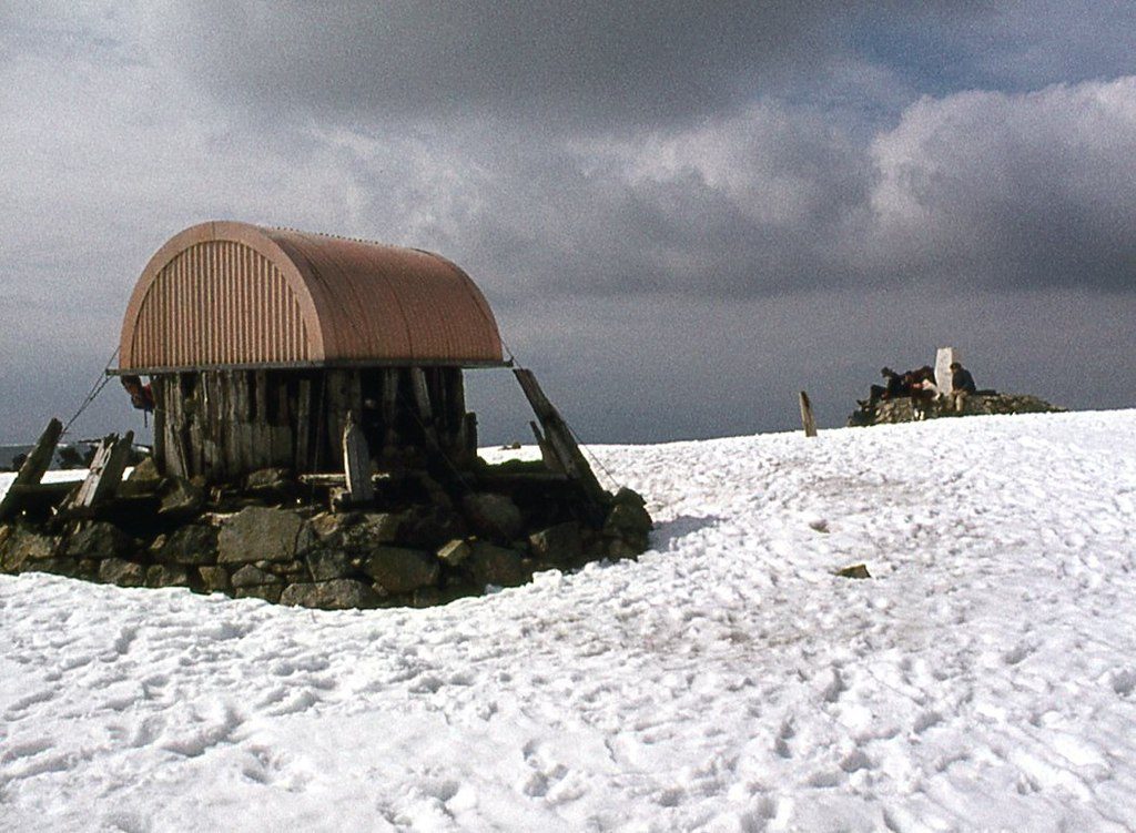
Here is the thing that guides skip. The summit of Ben Nevis is not a peak. It is a wide, flat, stony plateau, roughly the size of a large field, ringed on its northern and western sides by cliffs and gullies with hundred-metre drops. In clear weather this is obvious and harmless. In cloud — which is most days, since the summit is in cloud roughly two days out of three — the plateau becomes a featureless white or grey space with no visual reference at all.
People die there. Not from falling off a path, but from walking confidently in the wrong direction across a flat surface and off the edge of it.
The mountain safety advice, which comes from Mountaineering Scotland and the local rescue teams, is unambiguous. Leaving the summit in poor visibility you follow a grid bearing of 231 degrees for 150 metres, which takes you safely clear of Gardyloo Gully. Only then do you turn onto a grid bearing of 282 degrees, which takes you back to the top of the zigzags and keeps you out of Five Finger Gully. Five Finger Gully is the killer. Its upper slopes are gentle and inviting and appear to lead downhill in exactly the direction you want to go. They lead over a cliff.
If you cannot take and follow a grid bearing on a compass, in wind, without hesitating, do not go to the summit in cloud. A phone map is a supplement, not a substitute — batteries die in the cold and screens are useless in driving rain. Carry a map and compass, and know how to use them. This is the single most important sentence in this guide.
The descent is the hard part
Ask any mountain rescue volunteer where the accidents happen and they’ll say the way down. You’re tired, your legs are shot, the ground is loose rock and worn stone, and the temptation is to hurry because you can see the car park.
Budget at least three hours for the descent, take poles if your knees are anything other than perfect, and eat something before you start down. The number of people I’ve passed sitting on a boulder at 900 metres looking grey and saying they’re fine is remarkable. They are usually not fine. They are usually out of food.
The CMD Arete is not a beginner alternative
You’ll see the Càrn Mòr Dearg Arete recommended as the “better” way up Ben Nevis, and it is — a magnificent curving ridge of granite blocks with the north face of the Ben on one side and a long drop on the other. It is also a serious mountaineering day, not a walk with a view.
It adds a second Munro, well over 1,600 metres of total ascent, and a long section of narrow rocky ridge where you will use your hands and where a slip has consequences. It takes ten to twelve hours for competent hillwalkers. There is no easy escape once you commit. In winter it is a full alpine-style outing requiring axe, crampons and the skills to use them.
If you are asking whether you’re experienced enough for the CMD Arete, you have your answer. Do the Mountain Track, or hire a guide — several Fort William outfits run guided ascents of both routes, and a guided day is money well spent if you want the ridge without the risk.
What to carry, and when not to go
Boots with ankle support and grip, waterproof jacket and trousers, warm layers including hat and gloves even in July, two litres of water, more food than you think, a head torch, map, compass and a charged phone. The summit is routinely ten to fifteen degrees colder than the car park, and there is often snow on the plateau into June.
Don’t go if summit winds are forecast above about 40mph, if the freezing level is below the summit and you’re not equipped for winter conditions, or if the tops will be in cloud and you’re not confident navigating. From roughly November to April this is a winter mountain and the Mountain Track is a mountaineering route, not a walk. Our guide to hiking in Scotland goes further into gear, grading and the access code, and if this is your first Scottish trip the things to know before your first visit are worth twenty minutes.
Glen Nevis: the best half day in Lochaber
If you take one piece of advice from this guide, take this one. Glen Nevis is better than the mountain that overlooks it, and almost everyone who climbs the Ben drives straight past it.
The single-track road runs seven miles up the glen from the visitor centre, past the youth hostel and the campsite, past the Lower Falls, and finishes at a small car park at the head of the road. The glen narrows steadily as you drive, from open pasture into a steep wooded gorge. You’ll recognise chunks of it from the opening scenes of a certain 1995 Mel Gibson film and from parts of the Harry Potter series — there’s more on that in our roundup of Harry Potter filming locations across Scotland.
Steall Falls and the wire bridge
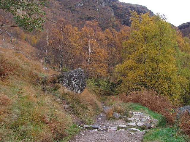
From the upper car park, a path climbs into the Nevis Gorge. It is roughly 2.5 miles there and back and takes about two hours at a gentle pace, which makes it sound easier than it is. The path is rocky, frequently wet, and traverses a steep hillside with a serious drop into the gorge on your right. There are no railings. It is absolutely fine in decent footwear and full attention, and absolutely not fine in trainers with a toddler running ahead.
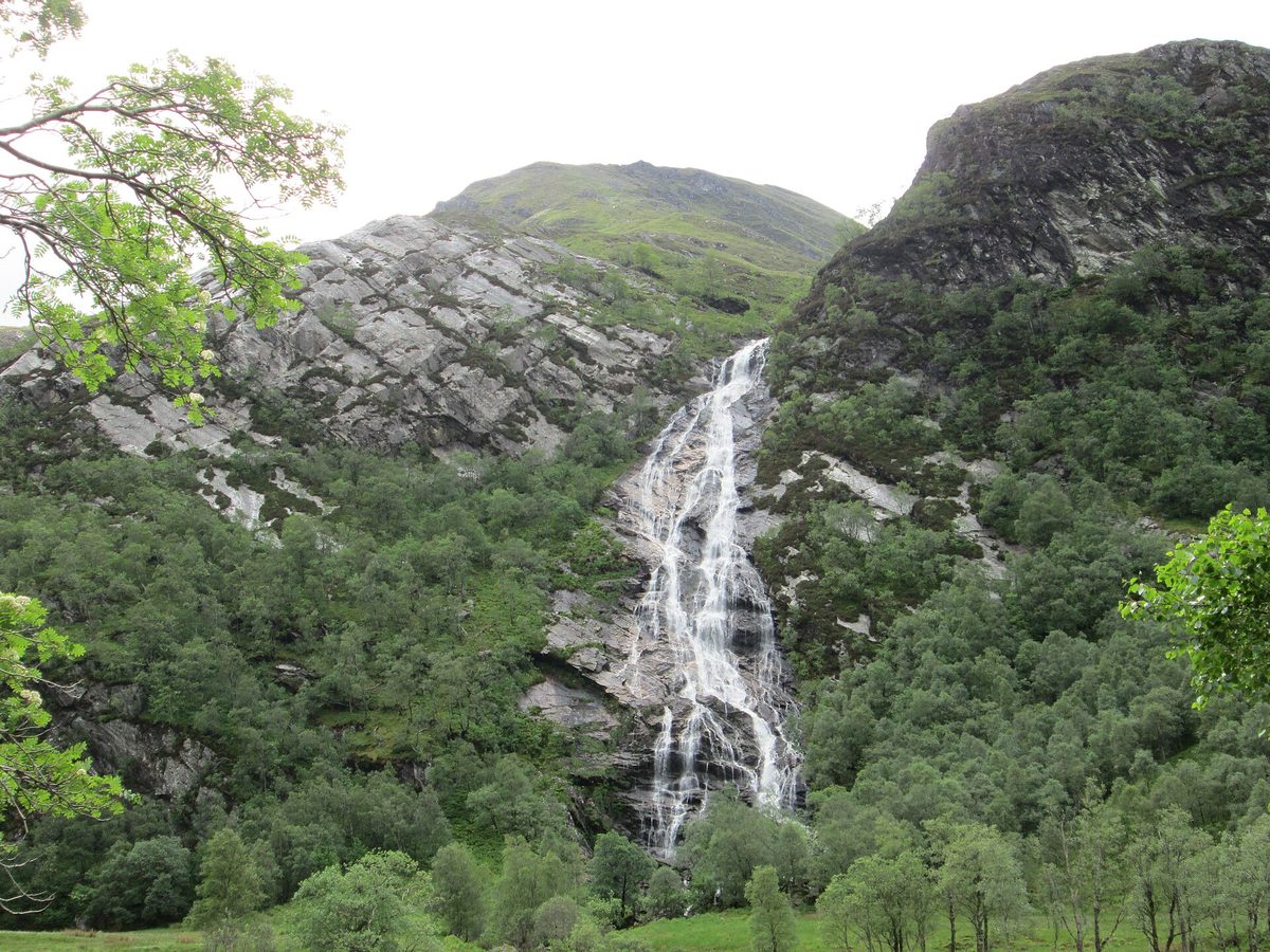
Then the gorge opens abruptly into a wide flat meadow with mountains on three sides, and Steall Falls comes into view on the far side — a single ribbon dropping 120 metres down a slab. It is the second-highest waterfall in Scotland and the reveal is genuinely theatrical, because you don’t see it coming until the last moment.
The land here is owned by the John Muir Trust, which manages it for its wild qualities, which is why there’s no cafe and no interpretation boards. Good.
And then there’s the wire bridge. Three steel cables span the Water of Nevis — one to walk on, two to hold. It is the only way to reach the base of the falls dry-shod, and crossing it is the sort of thing you either do immediately or watch other people do while pretending you weren’t going to. It is safe if you take it slowly and cross one at a time. It is not safe if the river is in spate and the cables are dripping, and it is genuinely unnerving in wind. There’s no shame in staying on the near bank; the view of the falls is just as good from the meadow.
The lower glen and the easy options
If the gorge path sounds like too much, the Lower Falls car park halfway up the glen gives you a set of white-water cascades and a stone bridge about ninety seconds from the car. There are riverside meadows near the campsite where you can sit with a flask and look straight up at the flank of the Ben. There’s also a short forest trail network signposted from the visitor centre, which is flat, buggy-friendly and gets you into birch woodland within minutes.
One practical warning. The glen road is single track with passing places for its upper stretch, it is busy, and the upper car park fills completely by mid-morning in summer. Go before nine or after four.
Getting high without climbing: the Nevis Range
Seven miles north of town on the A82, the Nevis Range runs Britain’s only mountain gondola. It doesn’t go up Ben Nevis — it climbs the north face of Aonach Mòr, the eighth-highest mountain in the UK, which sits directly behind the Ben.
The gondola
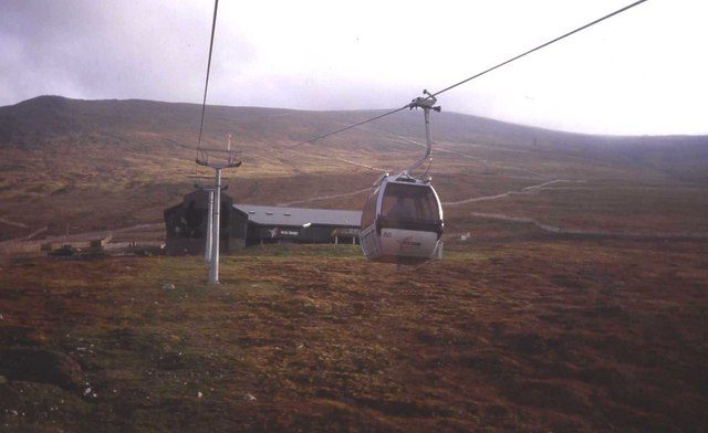
The ride takes about fifteen minutes each way and lifts you from 100 metres to a top station at 650 metres. That’s roughly half of Ben Nevis, achieved sitting down in a six-person cabin with your coffee. For anyone with young children, dodgy knees, limited time or a sensible aversion to nine-hour uphill slogs, this is the best value activity in Lochaber.
Prices for the 2026 season are around £28.95 for an adult day pass, £14.95 for juniors aged 5 to 17, £22.95 for under-26s and over-65s, and about £62.95 for a family of two adults and two children, with parking at roughly £5 a day. Online booking is cheaper. Check the mountain status page before you set out, because the gondola shuts without notice in high wind and on a gusty day you can drive out there for nothing. It generally runs from 09:30, with the last car up around 16:45 and the last down at 17:00, and hours shorten in midwinter. Dogs are welcome in the cabins.
At the top there’s the Snowgoose cafe and two waymarked walks: Sgurr Finnisg-aig takes about 45 minutes return and Meall Beag about an hour. Both are on rough mountain paths, so you still want proper shoes and a jacket. From the higher viewpoint you look across to the summit plateau of Ben Nevis, down the Great Glen, and on a clear day out to the Inner Hebrides. On a bad day you look at cloud from inside it, which is its own kind of experience.
The World Cup downhill track
Aonach Mòr is one of the most famous names in mountain biking. The Fort William downhill course drops 555 metres over 2.8 kilometres of rock slab, root and boulder, and it hosted a round of the UCI Mountain Bike World Cup for the better part of two decades. It remains the only gondola-served downhill track in the UK.
To be clear about what it is: this is a race-grade black run for experienced riders on full-suspension downhill bikes with full-face helmets and body armour. It is not somewhere to take a hardtail and optimism. Gondola bike uplift costs around £28.95 for an adult single trip booked online, with multi-trip and multi-day tickets available.
There is a proper spread of easier trails lower down, plus red-graded cross-country loops in the Leanachan Forest at the base, so less confident riders aren’t shut out. Bike hire is available on site and from two shops in Fort William. The World Cup itself has been off the calendar in recent seasons while the venue negotiates its return, but the site hosts European Cup rounds and endurance events through the summer — check what’s on before you book, because event weekends make the whole area extremely busy.
The canal, the coast and the water
Neptune’s Staircase at Banavie
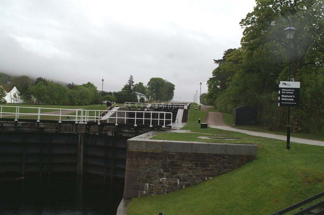
Three miles north-west of town at Banavie, the Caledonian Canal drops down to sea level through eight linked locks in a row. This is Neptune’s Staircase, designed by Thomas Telford, built between 1803 and 1822, and still the longest staircase lock in Britain: 447 metres of masonry lowering boats 19.5 metres from the canal to the sea.
It is free, there’s a free car park, and it is one of my favourite hours in the whole area. A boat takes around ninety minutes to work its way down the flight, which means the entire experience runs at the speed of a kettle boiling. You lean on a lock gate. Water thunders. A yacht sinks slowly out of view. Somebody’s dog gets overexcited. Then it all happens again in the next chamber.
Two things make it better than it sounds. First, the view: stand at the top of the flight looking back east and Ben Nevis fills the horizon behind the canal, which is the composition every photographer in the area is chasing. Second, the railway. The West Highland Line to Mallaig crosses the canal here on a swing bridge, so if you time it right you can watch the Jacobite steam train roll past the locks — and you can watch the bridge swing open for a boat, which is a rarer treat.
Walk the towpath a few hundred metres in either direction and you’ll have it largely to yourself.
Corpach, and the boat everyone photographs
Two miles further on, on the shingle between Corpach and Caol, sits a rusting wooden fishing boat. It is the Dayspring, built at Sandhaven in 1975, 26 metres long, and it has been beached here since a storm tore it from its moorings in December 2011. Everyone calls it the Corpach wreck or the Old Boat of Caol.
It has become one of the most photographed objects in the Highlands, and for once the hype is earned. The boat sits low and dark against the water with Ben Nevis directly behind it. At high tide with still water you get a mirror reflection of the mountain and the hull together; at low tide you can walk right up to it across the shingle. It is free, it takes fifteen minutes, and it is signposted from the shore road.
Go at sunrise if you possibly can — in summer that means being there before six, but you’ll have it to yourself and the light comes from behind you onto the mountain. The wreck also sits on the Great Glen Way, so you can walk out from town along the canal and shore in about an hour and a quarter, which is a very decent flat evening stroll.

On the water
Loch Linnhe is a proper sea loch with seals, porpoises and regular sightings of sea eagles. Operators run wildlife cruises from the town pier and faster RIB trips out of Corpach, and guided sea kayaking on Loch Linnhe and Loch Eil is well established — the sheltered bays make this a sensible place to try it for the first time. Book direct, as schedules shift season to season.
History, whisky and indoor Fort William
The West Highland Museum and its secret portrait
Small, volunteer-run, slightly cluttered and much better than it looks from the door. The West Highland Museum sits on Cameron Square just off the High Street, and it covers Jacobite history, the Commandos who trained in Lochaber during the Second World War, and a magpie collection of local artefacts, weapons, clothing and archaeology.
The thing to see is the Secret Portrait. At first glance it’s a flat panel covered in meaningless smears of paint. Place a polished cylindrical mirror in the centre and the smears resolve into a recognisable portrait of Bonnie Prince Charlie. After Culloden it was treasonous to own an image of the Prince, so his supporters commissioned anamorphic paintings that were only legible when you knew the trick — a loyalty test disguised as a party piece. The museum’s founder bought this one for £8 in a London junk shop in 1924.
Entry has traditionally been by donation, though small museums have been reviewing their charges, so check before you go. Allow an hour, more if you like the military gallery.
Old Inverlochy Castle
Two miles north-east of the centre, just off the A82 near the distillery, stand the remains of a 13th-century castle built by the Comyns: a square curtain wall with round towers at each corner and a water gate onto the River Lochy. Two significant battles were fought here, in 1431 and 1645, the second of them one of Montrose’s most famous victories.
It is free, it is cared for by Historic Environment Scotland, and it is one of the least-visited castles in the Highlands, which is largely a function of it being next to an industrial estate. Be aware that visitor access to the castle interior has been restricted while high-level masonry inspections are carried out — at the time of writing you view it through protective fencing from the surrounding grounds. Check the Historic Environment Scotland site for the current position before you make the trip.
Ben Nevis Distillery
At Lochy Bridge on the northern edge of town, this is one of Scotland’s older licensed distilleries, founded in 1825 by “Long John” MacDonald, and it sits a few hundred metres from Inverlochy Castle so the two pair naturally. It runs tours and tastings from a visitor centre. It’s a working industrial distillery rather than a manicured showpiece, which some people love and some find flat — book ahead in summer. If whisky is the point of your trip rather than a sideline, our guide to Scotch whisky distilleries lays out which regions reward a detour.
Glen Roy: the strangest thing in Lochaber
This one is worth the detour, and hardly anyone makes it.
Drive north-east on the A82 to Spean Bridge, take the A86 to Roybridge, then turn up the minor road into Glen Roy for about five kilometres to the viewpoint car park. Look at the hillsides. Running along both flanks of the glen, dead level and perfectly parallel, are three horizontal terraces that look exactly like man-made roads contouring around the hills.
They are shorelines. During the last cold snap of the ice age, around 12,900 years ago, glaciers advancing from the south-west dammed the mouth of the glen and filled it with a lake. The water sat at one level long enough to cut a beach into the hillside, then the dam failed or the outflow changed, the lake dropped, and the process repeated. The three lines sit at 260, 325 and 350 metres above sea level. Charles Darwin came here in 1838, decided they were raised sea beaches, published the argument, and was later shown to be wrong — an error he was candid about. The glen is now a National Nature Reserve managed by NatureScot and is internationally recognised as a geological landmark.
You can see the whole thing from the roadside viewpoint, so it’s accessible to anyone who can get out of a car, and there are longer walks up the glen if you want them. The drive from Fort William takes about 40 minutes each way, and the last stretch is single track with blind summits. It belongs on any list of the most beautiful places in Scotland, and almost never makes one.
Fort William as a hub: day trips by drive time
This is the real reason to stay here. Everything below is a comfortable out-and-back in a day, and several of them can be combined.
Glencoe — 25 minutes
Sixteen miles south on the A82 and you’re in the most dramatic glen in Scotland. The Three Sisters viewpoint, the Study, the Lost Valley walk, the Glencoe Visitor Centre and the side road down Glen Etive are all within a compact area. You can do the headline viewpoints in three hours or spend two full days walking there. It is close enough that if the forecast turns good at eleven in the morning you can simply go.
Glenfinnan — 35 minutes
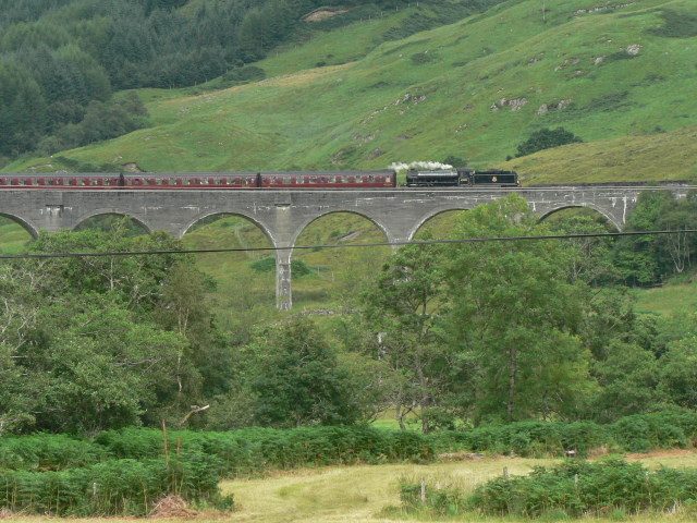
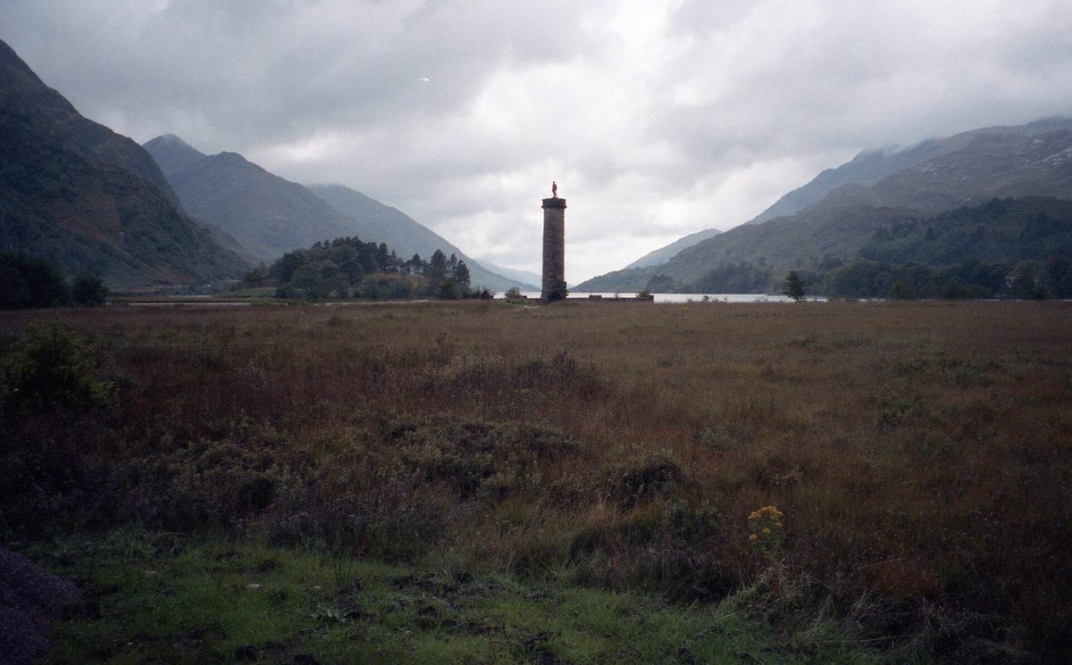
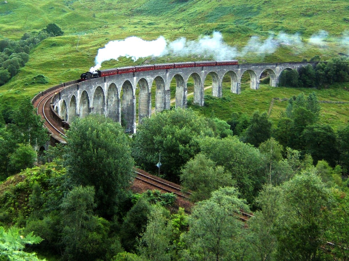
West on the A830 to the head of Loch Shiel, where Bonnie Prince Charlie raised his standard in 1745 and where a 21-arch concrete viaduct carries the railway across the glen. There’s a monument, a National Trust for Scotland visitor centre, a viewpoint trail up the hillside, and on a good day one of the best compositions in Scotland.
Parking is the problem. The car parks fill early on steam-train days and roadside parking on the A830 is heavily enforced. Arrive at least ninety minutes before the train is due, or come outside train times and enjoy the place empty.
Mallaig and the Road to the Isles — 1 hour 15
The A830 west from Fort William to the fishing port of Mallaig is 42 miles of upgraded road through some of the best coastal scenery in Britain. Along the way you pass Loch Eilt, the Silver Sands of Morar, and the string of white shell beaches around Arisaig and Camusdarach with the Small Isles and the Cuillin of Skye on the horizon.
Mallaig itself is a working port with excellent seafood and a ferry terminal. It’s the jumping-off point for Skye, the Small Isles and the passenger ferry to Knoydart — a peninsula with no road connection at all, where the walk in from the nearest tarmac takes two days. Those beaches, incidentally, hold their own against anything in our roundup of the best beaches in Scotland, which surprises people who assume Highland beaches means grey pebbles.
Ardnamurchan via the Corran Ferry — a proper day out
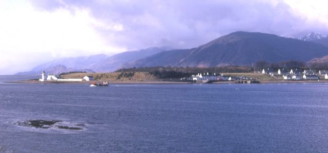
Eight miles south of Fort William on the A82, the Corran Ferry crosses the narrowest point of Loch Linnhe to Ardgour. The crossing takes about five minutes and it opens up a genuinely remote quarter of the mainland: Ardgour, Sunart, Moidart and the long single-track road out to Ardnamurchan Point, the most westerly point on the British mainland, with its Stevenson lighthouse.
The ferry is run by Highland Council. Fares rose on 1 May 2026 to around £13 for a car and £6 for a motorbike, with a book of 30 tickets at £96 for repeat crossings. Sailings run frequently from around a quarter to nine in the morning until half nine at night. One important caveat: this is a single vessel on an ageing service and it has suffered repeated breakdowns and periods of passenger-only running in recent years. Check the Highland Council status page on the morning you travel, because the alternative — driving round the head of the loch via Kinlochleven — adds well over an hour each way.
Allow a full day for Ardnamurchan Point. It’s only about 50 miles from the ferry slip, but the road is single track with passing places for most of the way and you will not average 30mph.
Skye — 2 hours 45
North on the A82 to Invergarry, west on the A87 past Loch Cluanie and through Glen Shiel to the Skye Bridge, and you’re at Portree in under three hours. That’s doable as a day trip if you must, but it is a long day for a short look, and it means five and a half hours of driving. Better to treat Fort William as the staging post the night before and then move onto the island properly — our Isle of Skye guide makes the case for at least three nights there.
Loch Ness, Inverness and Oban
The A82 runs north-east up the Great Glen past Loch Lochy and Loch Oich to Fort Augustus at the foot of Loch Ness, which is about 50 minutes, and on to Inverness in around two hours. Urquhart Castle and the Loch Ness attractions are all on that road — see our Loch Ness and Inverness guide for what’s worth stopping for and what isn’t. Oban is about an hour and a half south-west and gives you seafood, a distillery and the ferries to Mull and Iona.
Fort William also sits naturally on the classic Edinburgh to Highlands road trip route, and it makes a sensible warm-up stop if you’re heading further north afterwards.
The Jacobite Steam Train
One correction that matters for planning: the Jacobite departs from Fort William, not from Glenfinnan. People book flights and hotels around Glenfinnan assuming the train starts there. It doesn’t. It leaves Fort William station, crosses the Banavie swing bridge, runs west along Loch Eil, crosses the Glenfinnan Viaduct, and continues along the coast to Mallaig, where it pauses for a couple of hours before returning.
It’s operated by West Coast Railways, not by ScotRail. For the 2026 season the morning service runs daily from 1 June to 23 October, with a second afternoon service from 10 June to 25 September. Standard class is around £76 for an adult day return and £43 for a child aged 16 or under; first class is around £116 and £76, with a private table for two at £252. There’s a minimum booking fee of £3.75 and a £15 fee to amend a booking, and only day returns are sold on the main product. Book the moment the season opens if you want July or August — peak dates disappear months ahead. The guard sometimes has a handful of cash-only seats on the day, but treat that as a lottery ticket rather than a plan.
Here’s the money-saving version. The scheduled ScotRail service to Mallaig uses exactly the same track and crosses exactly the same viaduct, several times a day, for a fraction of the price. You don’t get the steam locomotive, the carriages or the occasion — but you do get the scenery, and you can get off at Glenfinnan or Arisaig and walk. That trick, and several like it, are in our guide to Scotland’s best scenic train journeys. And if the point is the photograph rather than the ride, you want to be on the viewpoint trail at Glenfinnan when the train crosses, not sitting inside it.
Walking and cycling straight from the town
The end of the West Highland Way
Fort William is the finish line of the 96-mile West Highland Way from Milngavie on the edge of Glasgow. Walkers come down off the Lairig Mòr from Kinlochleven, along the glen and into town, ending at Gordon Square where there’s a bronze statue of a seated walker rubbing his sore feet.
It is, by common consent, an anticlimactic finish — a pedestrian precinct after seven days of mountains — and there’s a long-running local conversation about giving it a better ending. Even so, the pubs on the High Street on a summer evening are full of people with sunburnt forearms and enormous appetites, and the atmosphere is excellent. If you’re walking it, book your Fort William bed months ahead.
Cow Hill
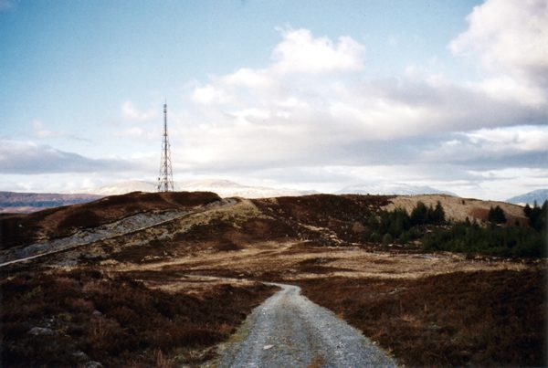
The obvious short walk from the town centre. A track climbs from behind the High Street up onto Cow Hill, a 287-metre lump topped with a radio mast, and gives you the classic aerial view of Fort William, the length of Loch Linnhe and the Ardgour hills opposite. It takes about ninety minutes return and it is the cheapest good view in the area. Circular options link it to Glen Nevis if you want to extend.
The Great Glen Way and cycling
The 79-mile Great Glen Way starts in Fort William and runs to Inverness along canal towpaths, forest tracks and lochside. You don’t need to do the whole thing. The first few miles out to Neptune’s Staircase and the Corpach wreck are flat, traffic-free and lovely on a bike, and there’s a separate off-road cycling route sharing much of the corridor.
Two bike shops in town rent standard and electric bikes by the day. An e-bike makes Glen Nevis an easy morning rather than a hilly slog, and it lets you leave the car parked, which given the state of the glen car parks in August is a genuine advantage.
Rain: the thing nobody plans for
Fort William gets roughly 2,000mm of rain a year. London gets a little over 600mm. That is not a rounding difference — it is more than three times as much water, spread across roughly 220 wet days.
Two consequences follow. First, rain during your stay is not bad luck, it is the baseline expectation, and an itinerary that needs four consecutive dry days is planning to be disappointed. Second, and more usefully: the weather here changes fast, and a morning of horizontal drizzle very often becomes a bright, washed, spectacular afternoon. The mistake is writing the day off at nine in the morning. Keep the plan loose. Check the mountain forecast the night before and again at breakfast, hold a wet list and a fine list, and swap them at an hour’s notice.
A genuine wet-day plan
This is what I actually do when it’s raining sideways.
Start with the West Highland Museum — an hour, indoors, and the Secret Portrait is better in bad weather because you’ll have the room to yourself. Follow it with a coffee and something baked on the High Street, then the Lochaber Geopark centre for twenty minutes of context on the landscape you can’t currently see.
Drive out to Neptune’s Staircase and watch the locks in the rain from the car if you must; wet weather actually suits the canal, and there’s a pub at the top of the flight. Take the road out to Corpach and photograph the wreck — low cloud and rain make it dramatically better, and everyone else has stayed in bed. Then the distillery tour, which is indoors by definition and finishes with whisky.
Finish at the Highland Cinema. A film, a bar, and no more decisions to make.
If the rain has set in for days rather than hours, drive. The A830 to Mallaig is spectacular through a windscreen, the Corran Ferry is a fine twenty minutes out of the weather, and the gondola runs in rain provided the wind stays down — though there’s little point going up into cloud. Our guides to Scotland’s weather month by month and the best time to visit Scotland will help you set expectations before you book.
Where to stay in Fort William
Accommodation here is in genuinely short supply between May and September, and the town takes overflow from Glencoe, Skye traffic and the West Highland Way all at once. Book early. Prices in August are frankly high for what you get.
Achintore Road, the B&B strip
The A82 south out of town is lined with Victorian villas turned guesthouses, one after another, most with loch views from the front rooms. This is where the majority of visitors end up and it’s a perfectly good option: good value, generous breakfasts, hosts who know the area. The trade-off is the road. The A82 is the main trunk route through the western Highlands and it carries lorries at six in the morning. Ask for a room at the back, or accept the view and bring earplugs.
Town centre
Best if you’re without a car or finishing the West Highland Way. You can walk to the station, the bus stop, the supermarket and every restaurant in town. There are a couple of larger hotels and a scattering of guesthouses. Parking is the constraint — confirm what your accommodation offers before you book.
Corpach, Banavie and Glen Nevis
Corpach and Banavie sit two to three miles north-west on the canal and the shore: quieter, cheaper, and with the good view of Ben Nevis rather than being underneath it. Self-catering and a hostel out here, plus a station at Banavie on the Mallaig line. Up Glen Nevis there’s a large campsite, a youth hostel and some lodges — unbeatable if you’re climbing the Ben, since you can walk to the start of the track, but patchy phone signal and a drive in and out for every meal.
Spean Bridge, Onich and Glencoe
If Fort William is full or overpriced, look ten miles out. Spean Bridge to the north-east has hotels, a couple of good places to eat and the Commando Memorial — a bronze of three Commandos on a rise with Ben Nevis behind, worth a stop in its own right. Onich and North Ballachulish sit south on the loch shore, fifteen minutes away, with better views and lower prices. Glencoe village is half an hour and is the obvious alternative base if mountains matter more to you than a supermarket.
For the broader picture on regions, seasons and budget, our guide to where to stay in Scotland covers how to structure a multi-base trip without spending your holiday packing.
Getting there and getting around
By car
From Glasgow it’s about 100 miles up the A82 via Loch Lomond, Crianlarich and Glencoe — allow two and a half to three hours, and considerably more if you stop, which you will. From Edinburgh, allow three and a half to four hours via Stirling and Crianlarich. From Inverness it’s about two hours down the Great Glen. From Skye, two and a half.
The A82 along Loch Lomond is narrow, twisting and slow, with overhanging trees and no overtaking, so don’t plan on averaging anything like the speed limit. In town, use the pay-and-display car parks rather than hunting for free spaces; enforcement is active.
By train
The West Highland Line from Glasgow Queen Street to Fort William takes around three hours and forty-five minutes and is one of the great railway journeys in Europe, crossing Rannoch Moor on a floating bed of brushwood and ash. There are typically three direct services a day Monday to Saturday and two on Sundays, and Fort William station is right in the centre of town. From here the line continues to Mallaig over the Glenfinnan Viaduct, so you can do the famous crossing on a standard ticket.
The Caledonian Sleeper
This is the one that surprises people. You can board a train at London Euston in the evening, sleep in a berth, and step onto the platform at Fort William mid-morning with the mountain in front of you. The Highlander service runs six nights a week — every night except Saturday — and splits en route into separate portions for Aberdeen, Inverness and Fort William. The Fort William portion is known as the Deerstalker, and it calls at Rannoch and Corrour, the latter the highest and most isolated station in Britain with no public road to it at all. It isn’t cheap, particularly for an en-suite berth, and the seated option is a long night — but it removes a driving day in each direction. Book well ahead for summer.
Buses and going car-free
Scottish Citylink coaches run down the A82 between Glasgow, Fort William and Skye, and there are local services up the Great Glen to Inverness and west to Mallaig. Fort William is one of the few Highland bases where you can have a decent trip without a car: the train and coach network reaches the town, the Jacobite and ScotRail run west, buses go up Glen Nevis in summer, and the gondola is reachable by bus in season. It’s one of the anchor towns in our car-free Scotland itinerary, and the practicalities of Highland public transport are covered in getting around Scotland.
How long you need, and what to book ahead
One night is a stopover, not a visit. You’ll see the High Street and leave.
Two nights gives you one full day — enough for either the Ben or a Glen Nevis and Neptune’s Staircase combination, but not both.
Three nights is the sweet spot. Day one for Glen Nevis and the canal, day two for Ben Nevis or the gondola depending on the forecast, day three for Glencoe or Glenfinnan. That’s a satisfying, unhurried block.
Four or five nights lets you add Ardnamurchan, the Road to the Isles and Glen Roy, and gives you a buffer for weather — which, given the rainfall figures above, is the single most valuable thing you can build into a Lochaber itinerary. Our guide to how many days you need in Scotland puts that in the context of a whole trip.
Book these in advance: accommodation for any date between mid-May and mid-September, ideally three to six months out; Jacobite tickets as soon as the season opens in January if you want July or August; a mountain guide if you want the CMD Arete or a winter ascent; and any Skye accommodation if you’re moving on.
Don’t bother booking: the gondola beyond buying online the night before for a small discount; restaurant tables outside July and August, mostly; and anything weather-dependent more than a few days out.
What underwhelms, and what to skip
Some candour, since the rest of the internet won’t give you any.
The town itself as a sightseeing destination. Allow ninety minutes for the High Street and the museum, and don’t plan a day around it. There’s no old town, no castle in the centre, no waterfront promenade. Treat it as a place to eat and sleep between excellent days out.
The loch view from the town. It’s good, but the dual carriageway between you and the water spoils it. For the real thing, drive five minutes north to Corpach or ten minutes south to Onich.
Climbing Ben Nevis to tick a box. If the summit is in cloud — which is likely — you will spend nine hours going up and down a rocky staircase to stand in a fog bank next to a cairn and a ruined observatory, surrounded by 200 other people doing the same. There is no view, no cafe and no reward beyond the fact of having done it. On a clear day it is one of the great walks in Britain. On a cloudy day, honestly, do Glen Nevis and the gondola and come back another year.
Doing Ben Nevis as part of a National Three Peaks attempt. Teams arrive in the middle of the night, walk up in the dark under time pressure, and generate a disproportionate share of the rescue callouts. If you must, use a guide who knows the mountain.
Glenfinnan on a steam-train day without a plan. The car park fills, the verges are enforced, and hundreds of people converge on one hillside. Either arrive very early or come at a time when the train isn’t running and enjoy the loch, the monument and the viaduct in peace.
Assuming midges aren’t a problem here. They are, badly, from roughly June to early September, particularly in Glen Nevis at dusk and on still humid evenings by water. Repellent with a high DEET content or a head net will save your holiday — read our guide to Scotland’s midge season before you camp.
Turning up in late October expecting everything open. Seasonal attractions wind down from mid-October: the Jacobite finishes, some boat operators stop, and hours shorten. The gondola runs year-round, weather permitting, and the town itself never closes. See Scotland in October for what does and doesn’t survive the end of the season.
Frequently asked questions
Is Fort William worth visiting?
As a base, absolutely — nowhere else in the western Highlands puts Ben Nevis, Glen Nevis, Glencoe, Glenfinnan and the Road to the Isles within half an hour to an hour. As a town in its own right, it is functional rather than attractive. Come for the location and the day trips, not for the High Street.
How many days should I spend in Fort William?
Three nights is the sweet spot: one day for Glen Nevis and the canal, one for Ben Nevis or the gondola depending on the weather, and one for Glencoe or Glenfinnan. Two nights works if you’re selective. Add a fourth or fifth night if you want Ardnamurchan, Mallaig or a weather buffer.
Can a beginner climb Ben Nevis?
A fit beginner can manage the Mountain Track on a clear, settled summer day. It needs no technical skill, but it does need seven to nine hours of sustained effort, proper boots, warm and waterproof layers, food and water. In cloud you also need to navigate by map and compass across the summit plateau, which is where people get into serious trouble.
Does the Jacobite Steam Train leave from Glenfinnan?
No. It departs from Fort William station and runs west to Mallaig, crossing Glenfinnan Viaduct on the way. It’s operated by West Coast Railways, tickets are day returns costing around £76 for an adult in standard class, and peak summer dates sell out months ahead. Glenfinnan is where you watch it from, not where you board it.
How much is the Nevis Range gondola?
Around £28.95 for an adult day pass in the 2026 season, £14.95 for juniors aged 5 to 17 and about £62.95 for a family of four, with parking at roughly £5. Booking online is cheaper than paying at the ticket office. It closes in high wind at short notice, so check the mountain status page before you drive out.
What can you do in Fort William when it rains?
The West Highland Museum and its anamorphic Secret Portrait, the Lochaber Geopark centre, a distillery tour at Lochy Bridge, the Highland Cinema, and Neptune’s Staircase — which is arguably better in wet weather. Photographing the Corpach wreck under low cloud produces better pictures than a blue-sky day, and you’ll be alone.
Do I need a car in Fort William?
Not necessarily. Trains reach the town from Glasgow and London, coaches run from Glasgow and Skye, buses serve Glen Nevis and the Nevis Range in season, and the Mallaig line covers the Road to the Isles. A car makes Glen Roy, Ardnamurchan and Glencoe far easier, but a car-free trip here is more realistic than in most Highland bases.
When is the best time to visit Fort William?
May and September are the sweet spots: long daylight, most attractions open, fewer people than July, and — in May especially — noticeably fewer midges. June has the longest days but the midges arrive. Winter is quiet and dramatic, with the gondola running for skiing, but the Ben becomes a serious mountaineering objective. See Scotland in September for what that month looks like on the ground.
Final thoughts
I’ve stopped apologising for liking Fort William. It isn’t handsome, the main road is in the wrong place, and the High Street sells more Gore-Tex per square metre than anywhere in Britain. None of that matters, because you don’t come here to look at the town.
You come because you can eat breakfast, drive twenty-five minutes and be in Glencoe. Because a walk into a gorge that ends at a 120-metre waterfall is a two-hour round trip from a car park. Because there’s a rusting boat on a beach with the highest mountain in Britain behind it, and at six in the morning you’ll have it entirely to yourself.
Give it three nights, keep your plans loose enough to chase the weather, take the mountain seriously if you take it on at all, and don’t leave without walking up Glen Nevis. The town will never be the reason you came. It’s just the reason everything else was possible.
About the author: This guide was written and is maintained by the ScotlandTourism.org editorial team — travel writers who’ve spent years exploring Scotland’s cities, Highlands and islands, from bagging Munros to chasing the perfect dram. We update our guides regularly to keep prices, opening details and advice current.
Last updated: September 2026. Prices and opening times change — always check the official site before you travel.
Photo credits
All images are used under their respective Creative Commons or public-domain licenses:
- Loch Linnhe stretching south-west from Fort William towards the Corran Narrows — Mentifisto, CC BY-SA 3.0, via Wikimedia Commons
- The Cow Hill track above Fort William, with the Ardgour hills across Loch Linnhe — David Neale, CC BY-SA 2.0, via Wikimedia Commons
- The emergency shelter and summit cairn on the Ben Nevis plateau under late-spring snow — Alan Reid, CC BY-SA 2.0, via Wikimedia Commons
- The rocky path through the Nevis Gorge on the walk to Steall Falls near Fort William — Richard Webb, CC BY-SA 2.0, via Wikimedia Commons
- Steall Falls dropping 120 metres into upper Glen Nevis, one of the best things to do… — Peter S, CC BY-SA 2.0, via Wikimedia Commons
- A Nevis Range gondola cabin approaching the top station at 650 metres on Aonach Mor — Trevor Rickard, CC BY-SA 2.0, via Wikimedia Commons
- Neptune’s Staircase at Banavie, the eight-lock flight on the Caledonian Canal — David Long, CC BY-SA 2.0, via Wikimedia Commons
- The wrecked fishing boat on the shore at Corpach, with the Ardgour hills beyond — SimonXIX, CC BY 2.0, via Wikimedia Commons
- The Jacobite steam train crossing Glenfinnan Viaduct, 35 minutes west of Fort William — de:Benutzer:Nicolas17, CC BY-SA 2.5, via Wikimedia Commons
- The Glenfinnan Monument at the head of Loch Shiel on the Road to the Isles — Robert Linsdell from St. Andrews, Canada, CC BY 2.0, via Wikimedia Commons
- Ardgour across the Corran Narrows, reached by the short Corran Ferry crossing south of… — Anne Burgess, CC BY-SA 2.0, via Wikimedia Commons