The first time I drove an Edinburgh to Highlands road trip I did what most people do: I picked the stops off a list, plugged the last one into the satnav, and assumed the road in between would look after itself. It did not. I spent an hour and a half behind a timber lorry on a single-carriageway stretch of the A9 with nowhere to pass, arrived at Aviemore in the dark, and never saw the bit of the drive I had actually come for.
Since then I have driven every sensible way out of this city towards the mountains, in every month of the year, and I have come to a slightly unfashionable conclusion. The stops are the easy part. What decides whether the day is a pleasure or a slog is the road itself — which one you choose, how it behaves, where the enforcement is, where the fuel runs out, and what happens to it in February. That is what this guide is about.
The short answer
Three roads leave Edinburgh for the Highlands. The A9 north via Perth, Pitlochry and Aviemore is fastest to Inverness (around 157 miles, 3½ to 4 hours realistically). The A82 west via Loch Lomond, Rannoch Moor and Glencoe is slower and far more scenic. The A90 east coast route suits Aberdeenshire castles and Speyside whisky.
Edinburgh to Highlands road trip routes at a glance
| Route | Typical end point | Distance from Edinburgh | Realistic driving time | What the road is like |
|---|---|---|---|---|
| A9 north (Perth, Pitlochry, Aviemore) | Inverness | 157 miles | 3h 45m without stops | Fast trunk road, mixed dual and single carriageway, average-speed cameras end to end |
| A82 west via Glasgow and Loch Lomond | Fort William | 146 miles | 3h 30m — longer behind a coach | Motorway, then a genuinely narrow, twisting lochside road, then open moor |
| A84/A82 west via Stirling and Callander | Fort William | 150 miles | 3h 20m | Same finish, but skips the worst of the Loch Lomond narrows |
| A90 east coast (Dundee, Stonehaven, Aberdeen) | Aberdeen | 125 miles | 2h 30m | Dual carriageway almost throughout, dull but quick |
| A9 then A86/A87 | Portree, Isle of Skye | 235 miles | 5h 30m | Trunk road, then a long fast glen road, then single carriageway with passing places |
| A9 then A835 | Ullapool (NC500 start) | 215 miles | 4h 45m | Straightforward as far as Inverness, then empty and fast |
| A93 SnowRoads via Glenshee and Tomintoul | Grantown-on-Spey | 145 miles | 4h 15m in good weather | High, exposed, brilliant in June, unwise in a January dusk |
Times assume no meaningful stops and no roadworks. Add a third on a summer Friday afternoon, and add more if you are towing or driving something unfamiliar.
The three routes out of Edinburgh, compared properly
The A9 north: Perth, Pitlochry, Drumochter, Aviemore, Inverness
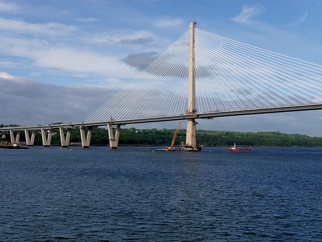
This is the default, and for most people it is the right call. You leave Edinburgh on the M90 over the Queensferry Crossing, skirt Perth, and join the A9 proper somewhere around Luncarty. From there it is one road all the way to Inverness.
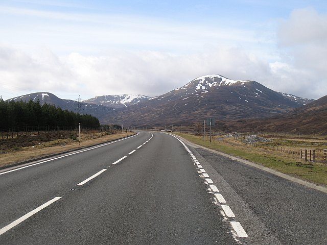
The landscape changes in stages, which is what makes it satisfying rather than merely efficient. Perthshire first: broadleaf woods, the Tay, Dunkeld and Birnam looking like a Victorian watercolour. Then Pitlochry and Blair Atholl, where the hills start to close in. Then the Pass of Drumochter, which is the moment the drive turns properly Highland — a broad, treeless corridor between rounded mountains, and the highest point on any trunk road in Great Britain at somewhere around 460 metres. After Dalwhinnie the road runs along the western edge of the Cairngorms to Aviemore, climbs once more at Slochd, and drops towards the Moray Firth.
The catch is that the A9 is not one consistent road. It alternates between dual carriageway and single carriageway in a pattern that no visitor can predict, which is exactly why it has the reputation it has. The dualling programme is slowly fixing this — Transport Scotland’s 2026 delivery plan targets roughly half the Perth–Inverness route dualled by the end of 2030 and the whole thing by 2035 — but for now you should expect long stretches where you are simply going at the speed of whatever is in front of you.
The A82 west: Loch Lomond, Rannoch Moor, Glencoe
If the A9 is the practical road, the A82 is the beautiful one. It is also the one people most often underestimate.
You have two ways of picking it up from Edinburgh, and the choice matters more than any stop on the route. The obvious version is the M8 to Glasgow, then the A82 up the west shore of Loch Lomond through Balloch, Luss and Tarbet. The less obvious version is the M9 to Stirling, then the A84 through Callander, Lochearnhead and Glen Ogle to Crianlarich, joining the A82 north of the loch entirely.
They are within ten minutes of each other on paper. In practice the second one is often quicker and always calmer, because it skips the ten-mile stretch between Tarbet and Ardlui where the A82 is pinned between the water and a steep wooded hillside. Transport Scotland’s own project documents describe that section as generally below modern standard width, narrowing to under six metres in places. Behind a coach you will do 30mph for twenty minutes and there is nothing to be done about it.
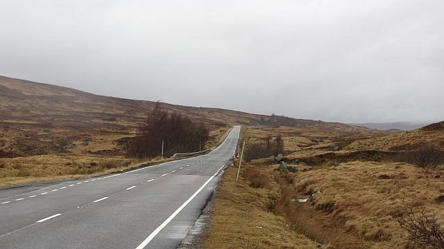
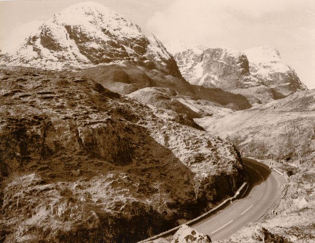
North of Crianlarich the road opens out and becomes one of the great drives in Britain. Tyndrum, then Bridge of Orchy, then the long climb onto Rannoch Moor, where for a good ten miles there is nothing but peat, water and sky. Then the descent past Buachaille Etive Mor into Glen Coe, which is the single most dramatic piece of road on any of these routes. Fort William is 16 miles further on.
The A90 east coast: the Forth crossings, Dundee, Aberdeenshire castle country
This one gets written off, and I think unfairly — it just serves a different trip. As a drive it is the least interesting of the three: dual carriageway most of the way, sea glimpses rather than sea views, and a long uneventful run through Angus.
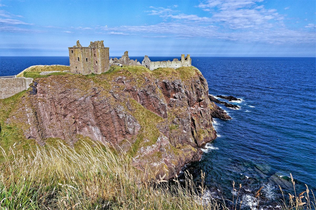
What it gives you is Aberdeenshire, which has the highest concentration of castles worth stopping for anywhere in Scotland, plus Speyside beyond it. Dunnottar Castle on its sea stack just south of Stonehaven is worth the whole detour on its own. Then Crathes, Fyvie, Craigievar, Dunnottar’s quieter neighbours, and eventually the densest cluster of working distilleries in the country around Dufftown and Aberlour.
From Aberdeen you can carry on north-west on the A96 to Elgin, Forres and Inverness, which turns the whole thing into a loop rather than an out-and-back. Edinburgh to Inverness the east-coast way is around 190 miles and a shade over four hours — roughly 35 miles and 30 minutes more than the A9, in exchange for a completely different set of days.
Which route for which destination
This is the table I wish someone had given me. Pick the row that matches where you are actually going, not the one that sounds nicest.
| You are heading for | Take | Why | Sensible overnight stop |
|---|---|---|---|
| Inverness and Loch Ness | A9 | Fastest, best-serviced, and the Drumochter section gives you real Highland scenery anyway | Pitlochry or Aviemore |
| Isle of Skye | A9 to Dalwhinnie, A889/A86 to Spean Bridge, A82/A87 west | Counter-intuitive but genuinely faster than going via Glasgow, and the Glen Spean run is lovely | Fort William or Fort Augustus |
| Glencoe, Ben Nevis, Fort William | A84 via Callander, then A82 | Same distance as the Glasgow route, less traffic, no Loch Lomond narrows | Killin, Crianlarich or Glencoe village |
| The start of the NC500 | A9 to Inverness | You want to arrive with energy, not scenery fatigue — save it for the loop itself | Aviemore, or push through and sleep in Inverness |
| Aberdeenshire and Speyside | A90 east coast | Dull road, excellent destinations, and it sets up an A96 return | Stonehaven or Ballater |
| Oban, Mull and the west coast ferries | A84/A85 via Callander and Crianlarich | Direct, and avoids both the A82 narrows and the A83 | Oban itself — the morning ferries go early |
| Inveraray, Kintyre, Islay ferries | A82 then A83 over the Rest and Be Thankful | The only practical route, but check it is open before you commit | Inveraray or Tarbert |
| Cairngorms hillwalking | A9 to Aviemore, or A93 SnowRoads in summer | The SnowRoads put you on the Deeside side, which is quieter | Braemar or Aviemore |
If you are still deciding how the driving fits around everything else, our full Scotland itinerary planner lays out how these legs slot into trips of different lengths, and the seven-day version uses the A9 and A82 as a loop rather than a there-and-back.
The road mechanics nobody puts in the stop lists
The A9 average-speed cameras, and what they do to your timing
This is the single most useful thing to know before you set off. The A9 between Dunblane and Inverness is covered end to end by average-speed cameras — something like 136 miles of road, with dozens of camera sites along it. They went live in late 2014 and were upgraded a few years ago.
Average-speed enforcement works differently from a single camera. It measures how long you took between two points, so there is no braking-then-accelerating game to play. The practical effect is that the whole road now moves at, or fractionally below, the limit: 60mph on the single-carriageway sections, 70mph on the dual. Nobody is going to overtake you at 85 and nobody is going to sit at 45 either.
Two consequences for your planning. First, your journey time is far more predictable than it used to be — if the satnav says 3h 15m, you will do it in about 3h 15m plus whatever you spend on breaks. Second, do not budget on “making up time” later in the day, because you cannot. Build the stops in from the start.
The same package that brought in the cameras also raised the lorry limit on single-carriageway sections from 40mph to 50mph, which was meant to reduce the frustration behind HGVs. It helped. The A9 Safety Group has reported large falls in fatal and serious casualties since the cameras went in, and speeding dropping from around one driver in three to roughly one in twenty. Whatever you think of cameras in general, on this road they have made the drive calmer.
Overtaking, and where you will not get the chance
Here is the thing about mixed dual and single carriageway: it trains you badly. You get used to a 70mph flow, the dualling ends, and suddenly you are third in a queue behind a caravan doing 48.
The stretches to be mentally prepared for are the run between Dunkeld and Pitlochry, the climb north of Blair Atholl, most of Drumochter, the section between Kingussie and Aviemore, and the last pull over Slochd. On some of these you will get a short dualled overtaking section every few miles; on others you will not. My rule is simple: if you have been stuck for more than about ten minutes, accept it, drop back to a sensible gap, and put the radio on. The overtakes people attempt out of impatience on this road are the ones that go wrong.
On the A82 north of Crianlarich the picture is different. It is single carriageway throughout, but it is fast, wide-ish and has long sight lines across Rannoch Moor, so overtaking is genuinely possible — and genuinely tempting, which is its own hazard on a road full of people looking at mountains instead of mirrors.
The Rest and Be Thankful: the closure that catches people out
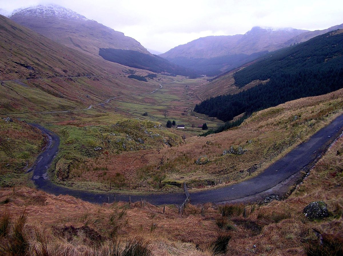
If your route involves Inveraray, Kintyre, the Islay ferry at Kennacraig or anywhere in southern Argyll, you will use the A83 over the Rest and Be Thankful, the hairpin climb out of Glen Croe. And you need to check it before you go.
The hillside above the road is unstable and has produced repeated landslides over the past fifteen-odd years, closing the A83 for days or weeks at a time. When it closes, traffic goes onto the Old Military Road on the valley floor below, usually under convoy or single-file working, which turns a five-minute climb into a long wait.
Transport Scotland has been working through a fix: a medium-term programme to make the Old Military Road diversion more resilient, and a long-term scheme centred on a debris-flow shelter about 1.4km long, with draft orders and public exhibitions having gone out in recent years. It is not built yet. Until it is, treat the A83 as conditional — check Traffic Scotland the morning you travel, and know that the alternative is a very long detour round Loch Fyne via Dalmally.
Loch Lomond’s west shore, and why it is slower than it looks
I have mentioned this already but it deserves its own note, because the map lies here. Tarbet to Ardlui is about ten miles. It looks like ten minutes. It is rarely less than twenty and often much more.
The road is narrow, there is no verge to speak of, the bends are tight and blind, and it carries everything — tour coaches, timber lorries, motorhomes, cyclists. Two HGVs meeting on one of those bends slows everybody down. There is no overtaking worth attempting for the whole stretch.
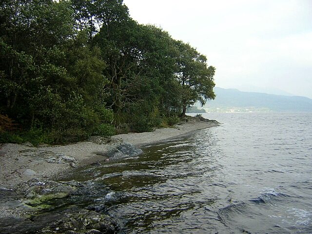
It is also, in fairness, lovely: oak woods coming down to the water, the loch flickering through the trees. Just do not schedule it as if it were an A-road elsewhere in the country. Either accept the pace, or use the Callander approach and come back to the loch on a day when you are not trying to be somewhere.
Where the petrol stations thin out, and what fuel costs up there
On the A9 itself you are fine. Between Perth and Inverness there are pumps at Pitlochry, Blair Atholl, Dalwhinnie, Newtonmore, Kingussie, Aviemore and Carrbridge, and you are rarely more than 25 miles from one. People who run dry on the A9 do it through inattention, not scarcity.
West and north-west is a different country. Once you are past Crianlarich on the A82, the useful fills are Tyndrum, Glencoe or Ballachulish, and Fort William — and then almost nothing until Invergarry or Kyle of Lochalsh if you are heading for Skye. Village pumps close early, and some do not open on Sundays at all. My habit is to fill at Fort William regardless of what the gauge says, because the next reliable full-service station is a long way off.
On price: expect to pay noticeably more the further north-west you go — commonly something like 10 to 20 pence a litre above a central-belt supermarket at the time of writing, and more again at remote single-pump stations. There is a rural fuel duty relief scheme that knocks 5p a litre off in a specified list of remote areas, mostly islands, but it has been unchanged since 2012 and does not cover most of the mainland Highlands, so do not plan your budget around it. On a 500-mile round trip the differential is worth maybe £10 to £15 — annoying rather than ruinous, but worth a supermarket fill before you leave Edinburgh.
Electric drivers: the A9 corridor is well covered by rapid chargers at Pitlochry, House of Bruar, Aviemore and Inverness, but the west and north-west are patchier and units do go out of service. Plan a charge you can reach with 20% in reserve, and have a second option. Our guide to getting around Scotland goes into the alternatives if driving is starting to sound like more effort than it is worth.
Winter: Drumochter, Slochd, Glenshee and the Lecht
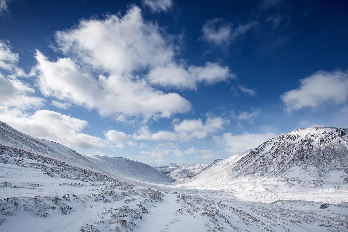
Between roughly November and March, altitude is the thing that matters. Drumochter is the highest point on any trunk road in Britain and it behaves accordingly — it gets snow, drifting and crosswinds when Perth is merely wet. There are snow gates near Dalwhinnie and Dalnacardoch precisely so the pass can be shut when it is impassable, and they do get used, occasionally for most of a day.
The A9 is a priority gritting route and is treated hard and early, so in practice it reopens quickly. The high Cairngorms roads are a different matter. The A93 over Glenshee and the A939 over the Lecht cross some of the highest public roads in Britain, and they close more often, reopen later, and are genuinely unpleasant in poor visibility. They are magnificent in June and a bad idea in a January dusk.
You do not need a 4×4 or winter tyres for the A9 in a normal winter. You do need to check Traffic Scotland before you leave, keep the tank above half, carry a blanket and a torch, and accept that on a bad day the answer is to stop in Pitlochry rather than push on. Our notes on driving and travelling in Scotland in winter are worth reading before a December trip.
The stops that earn their detour
I have deliberately kept this short. The mistake almost everyone makes is stopping too often, which turns a fine drive into a series of car parks. Two or three proper stops beat eight rushed ones.
On the A9
Dunkeld and Birnam (45 minutes off the road, or two hours if you walk). Two villages either side of the Tay, a ruined cathedral, and the Hermitage woodland walk just west with its folly above a waterfall. Best in October when the beeches turn.
Pitlochry (an hour). The obvious first stop and rightly so — it has the services, the cafes and the toilets, and it is far enough north that you feel you have started. The fish ladder and the dam are a decent leg-stretch.
Blair Castle (two to three hours). White-harled, absurdly grand, seat of the Dukes of Atholl. If you want one castle on the A9, this is it. Generally open April to October — check before you rely on it.
Aviemore and the Cairngorms (half a day, if you have it). Loch an Eilein with its island castle, Loch Morlich’s beach, the Rothiemurchus pinewoods. This is where the A9 stops being a transfer. Good walking of every grade, and the reindeer herd at Glenmore if you have children in the car.
Culloden and Clava Cairns (90 minutes for both). Five miles apart, just short of Inverness. The battlefield is quietly devastating and the visitor centre handles it well. Clava’s Bronze Age cairns are free and usually empty in the early evening.
On the A82
Doune Castle if you go via Callander — ten minutes off the A84, and familiar from more films and series than any other building on this list.
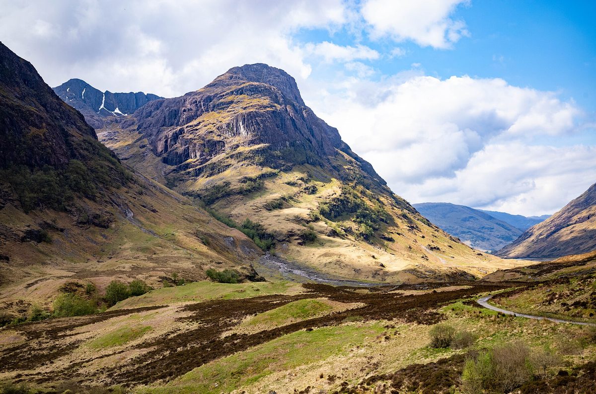
Glen Coe (as long as you like). Pull in at the Three Sisters viewpoint, then again at the Study, then walk into the Lost Valley if you have three hours and decent boots. It is the most affecting landscape in a country full of them, and it carries its history heavily.
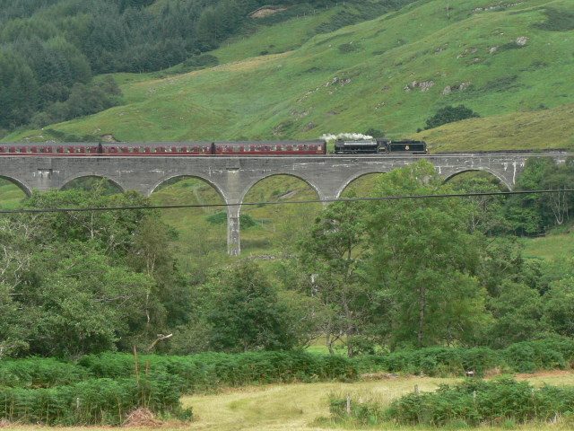
Glenfinnan, 40 minutes past Fort William on the A830, if you want the viaduct. Check the steam train times before you go or you will be looking at an empty bridge with two hundred other people. There is more on the film locations in our Harry Potter guide to Scotland.
On the A90
Dunnottar Castle (90 minutes including the walk down and back up). A ruined fortress on a sea stack outside Stonehaven, reached by a steep flight of steps. Photographs undersell it.
Stonehaven harbour for lunch, and the Ship Inn if it is not full. The open-air Art Deco lido is the other reason to stop, if it is a warm day and you own the nerve.
How long it actually takes: the one-day blast and the two-day version
One day, Edinburgh to Inverness
Entirely doable and, if Inverness is your base for the North Coast 500, the right way to do it. Leave Edinburgh at 08:00 to clear the city before the traffic settles in. Coffee in Dunkeld at 09:30. Pitlochry or Blair Castle from about 11:00. Lunch at House of Bruar or in Kingussie. Aviemore mid-afternoon for a walk at Loch an Eilein. Into Inverness by 18:00 with the light still on the firth in summer.
That is roughly four hours of driving spread across ten hours of day. It works. What does not work is trying to add Loch Ness and Culloden to the same day — you will do both badly.
One day, Edinburgh to Skye
Honestly? Don’t. It is 235 miles and around five and a half hours of genuine driving before you have stopped for anything, and the last hour on the A87 is single carriageway with passing places where you cannot rush. People do it, arrive at nine at night, and spend the next morning recovering.
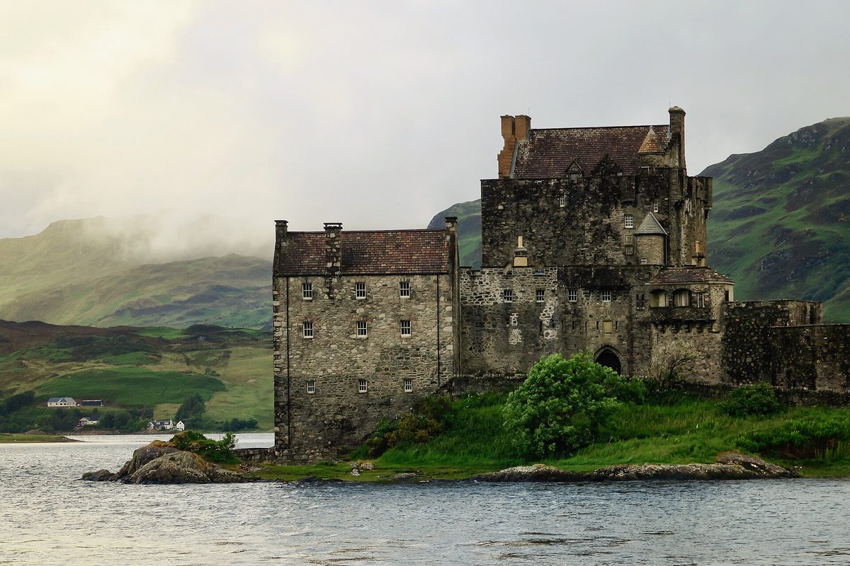
If you must, take the A9 to Dalwhinnie, cut west on the A889 and A86 through Glen Spean to Spean Bridge, then the A82 to Invergarry and the A87 to the bridge. Leave at seven, eat properly at Fort Augustus, stop at Eilean Donan for twenty minutes and no more. Better still, break it at Fort William and arrive on Skye fresh the following morning.
Two days, the A9 version
Day one: Edinburgh to Pitlochry the slow way — Queensferry for the bridges, Dunkeld and the Hermitage, then Blair Castle in the afternoon. Sleep in Pitlochry. That is only 75 miles and you will have had a full day.
Day two: Drumochter in the morning light, Ruthven Barracks for twenty minutes, then the Cairngorms around Aviemore for as long as you can spare. Culloden and Clava late afternoon, Inverness for dinner. Around 90 miles.
Two days, the A82 version
Day one: Edinburgh to Glencoe via Stirling and Callander — Doune Castle, lunch in Killin, Glen Ogle and Crianlarich, then Rannoch Moor in the afternoon when the light is low across the peat. Sleep in Glencoe village or Ballachulish. About 120 miles.
Day two: the Lost Valley walk in the morning, Fort William for supplies, then either north on the A82 along Loch Ness to Inverness or west on the A87 to Skye. Either is roughly 70 to 110 miles.
Two days is the sweet spot for this drive. Three is better. If you are working out how the rest of the trip hangs together, our piece on how many days you really need in Scotland is a more honest answer than most.
Practical planning
Hiring a car. Book six to eight weeks ahead for July and August; Scottish hire fleets are small and prices spike hard in summer. Take the smallest car you can live with — on the A82 narrows and any single-track road, width is worth more than boot space. Automatics cost more and sell out first, so book early if you cannot drive a manual.
Insurance and excess. Standard hire excesses in the UK are often £1,000 to £1,500. A third-party annual excess policy typically costs a fraction of the counter product. Photograph the car all round before you leave the depot, including the roof and the wheel rims — Highland car parks are gravelly.
When to go. May and September are the best compromises: long days, thinner traffic than midsummer, and the midges either not started or fading. June has the longest light. October gives you the best colour on the A9 through Perthshire. February gives you empty roads and about seven hours of usable daylight, which is a real constraint. There is more detail in our guide to the best time to visit Scotland.
What to book ahead. Accommodation in Pitlochry, Glencoe, Fort William and Aviemore between June and August — two to three months out is not excessive. Blair Castle and Culloden are fine on the day outside peak weeks. Skye accommodation is the one that genuinely sells out; four to six months for July is normal now. Our where to stay guide breaks the regions down.
If you would rather not drive at all. The Edinburgh–Inverness railway shadows the A9 for most of its length and is one of the more pleasant journeys in the country; the West Highland Line to Fort William and Mallaig is better still. See our round-up of Scotland’s scenic rail journeys if you would rather let someone else do the driving.
What underwhelms, and the mistakes I see most
Trying to combine two routes in one day. The classic version is A9 north, SnowRoads across, coast home. On a map it looks clever. In reality it is nine hours of driving and you will resent all of it. Pick one road per day.
Loch Ness. I will take the criticism for this: the loch itself is long, dark and rather monotonous from the road, and the monster industry at Drumnadrochit is thin stuff. Urquhart Castle is genuinely good and the boat trips are pleasant. But if you are choosing between Loch Ness and an extra afternoon in Glen Coe or the Cairngorms, take the mountains.
The House of Bruar. Useful for a toilet and a coffee. Presented by half the internet as an attraction. It is a shop, and an expensive one.
Underestimating daylight in winter. In mid-December it is properly dark by about half three in the Highlands. A four-hour drive that starts at noon finishes in the dark on unlit single carriageway with deer about. Start early or don’t start.
Booking the far end and nothing in between. People reserve four nights on Skye and then discover the drive there is a day in itself. Build the transit day into the itinerary as a day, not as a gap.
Assuming Glasgow is a detour. If you are heading west, leaving Edinburgh via Glasgow is often the sensible line, and Glasgow is a far better stop than people expect. Equally, if you want Edinburgh itself, do it before you collect the car — parking in the city is expensive and largely pointless.
Chasing highland cows from the car. They are not evenly distributed along the A9, whatever social media suggests, and an hour of hopeful peering into fields at 60mph is an hour you could have spent walking somewhere.
Frequently asked questions
How long does it take to drive from Edinburgh to the Highlands?
You are in Highland scenery within two hours whichever way you go. Callander is 55 miles and about an hour and a quarter; Pitlochry is 75 miles and about an hour and a half; Glencoe is 115 miles and just under three hours; Inverness is 157 miles and around three and three quarter hours in practice. Add a third in summer traffic.
Is the A9 a dangerous road?
It has a poor historic reputation, largely because of the abrupt switching between dual and single carriageway and the overtakes that provoked. Since average-speed cameras went in along the Dunblane to Inverness stretch in 2014, fatal and serious casualties have fallen substantially. Drive it at the limit, do not fight the queues, and it is unremarkable.
Can you drive from Edinburgh to Skye in one day?
Yes, but it is a long day and a poor one. It is about 235 miles and five and a half hours of driving without stops, finishing on single-carriageway roads where you cannot make up time. Leaving by 07:00 and stopping only twice makes it manageable. Splitting it at Fort William or Fort Augustus makes it enjoyable.
Do I need a four-wheel drive or winter tyres?
Not for the main routes. The A9, A82 and A90 are priority gritting routes and are treated early. What you need in winter is a full tank, a charged phone, warm layers, and the willingness to check Traffic Scotland and change plan. High minor roads like the A93 over Glenshee and the A939 over the Lecht are a different matter and close regularly.
Is it better to start from Edinburgh or Glasgow?
For Inverness, the Cairngorms and the east, Edinburgh is closer and the A9 is the natural line. For Glencoe, Fort William, Oban and Argyll, Glasgow has a head start of roughly 45 minutes. If you are flying in and heading straight west, Glasgow Airport is worth considering as a pickup point.
Where should I stop overnight between Edinburgh and Inverness?
Pitlochry if you want shops, restaurants and an easy first day. Aviemore if you want to be on the doorstep of the Cairngorms the next morning. Dunkeld or Aberfeldy if you want somewhere quieter with good food. All three have plenty of beds, though July and August still need booking well ahead.
Are there any tolls or charges on the way north?
No tolls. The Queensferry Crossing has been free since it opened and the older Forth Road Bridge now carries buses, taxis, bikes and pedestrians only. Edinburgh has a low emission zone covering the city centre, so check your hire car complies if you are collecting from a central depot. Most Highland car parks charge, usually a few pounds.
What time should I leave Edinburgh?
Before 08:00 on a weekday, or you will spend forty minutes getting to the Forth. On summer Fridays leave before 14:00 or after 19:00, because the A9 north of Perth fills with weekend traffic. On a winter day, leave at first light — whatever else you do, do not plan to be on the passes after dark. A few more habits like this are collected in our Scotland travel tips.
Final thoughts
The Edinburgh to Highlands drive is one of the best short road trips in Europe, and it is repeatedly ruined by people treating it as dead time between attractions. It isn’t. Drumochter in low cloud, Rannoch Moor in flat winter light, the drop into Glen Coe on a clear evening — those are the memories, not the gift shops.
So pick the road that matches your destination rather than the one with the most listicle stops. Give it a day and a half rather than four hours. Fill up before you need to, check the passes before you commit, and let the lorry in front of you get on with its day. Do that and the Highlands will meet you halfway.
Once you are past Glencoe, Fort William is where most people should stop for the night rather than pushing on. It is not a pretty town, but nowhere in the western Highlands is better placed — Glenfinnan is 35 minutes away, Mallaig an hour and a quarter, and Ben Nevis starts at the edge of it.
If the Highlands leg is turning into a full road trip, the north loop is the obvious extension. Our three- and four-day NC500 itinerary is honest about what a long weekend up there really costs you in driving hours.
Five miles east of Inverness, Culloden battlefield is worth building into the drive, and it repays going in poor weather rather than waiting for a clear day.
About the author: This guide was written and is maintained by the ScotlandTourism.org editorial team — travel writers who’ve spent years exploring Scotland’s cities, Highlands and islands, from bagging Munros to chasing the perfect dram. We update our guides regularly to keep prices, opening details and advice current.
Last updated: August 2026. Prices and opening times change — always check the official site before you travel.
Photo credits
All images are used under their respective Creative Commons or public-domain licenses:
- The A82 curving beneath the Three Sisters in Glen Coe on the western route from Edinburgh — Peter Bond, CC BY-SA 2.0, via Geograph
- The A9 climbing through the Pass of Drumochter, the highest point on the Edinburgh to Inverness drive — Richard Webb, CC BY-SA 2.0, via Geograph
- The Queensferry Crossing over the Firth of Forth, where the drive north out of Edinburgh begins — David Dixon, CC BY-SA 2.0, via Geograph
- The wooded shore of Loch Lomond, which the A82 hugs on the narrow west-side stretch — Iain Thompson, CC BY-SA 2.0, via Geograph
- Snow-covered Cairngorms above Aviemore, the scenic anchor of the A9 route — Daniël Hartog danielhartog, CC0, via Wikimedia Commons
- Dunnottar Castle near Stonehaven on the A90 east coast route from Edinburgh — Holger Uwe Schmitt, CC BY-SA 4.0, via Wikimedia Commons
- Eilean Donan Castle on the A87, the last landmark before the Skye Bridge — George Hiles hilesy, CC0, via Wikimedia Commons
- Inverness and its castle lit up above the River Ness at the end of the A9 drive — Mike Pennington, CC BY-SA 2.0, via Geograph
- The A82 crossing Rannoch Moor, the emptiest stretch of the Edinburgh to Highlands road trip — Richard Webb, CC BY-SA 2.0, via Geograph
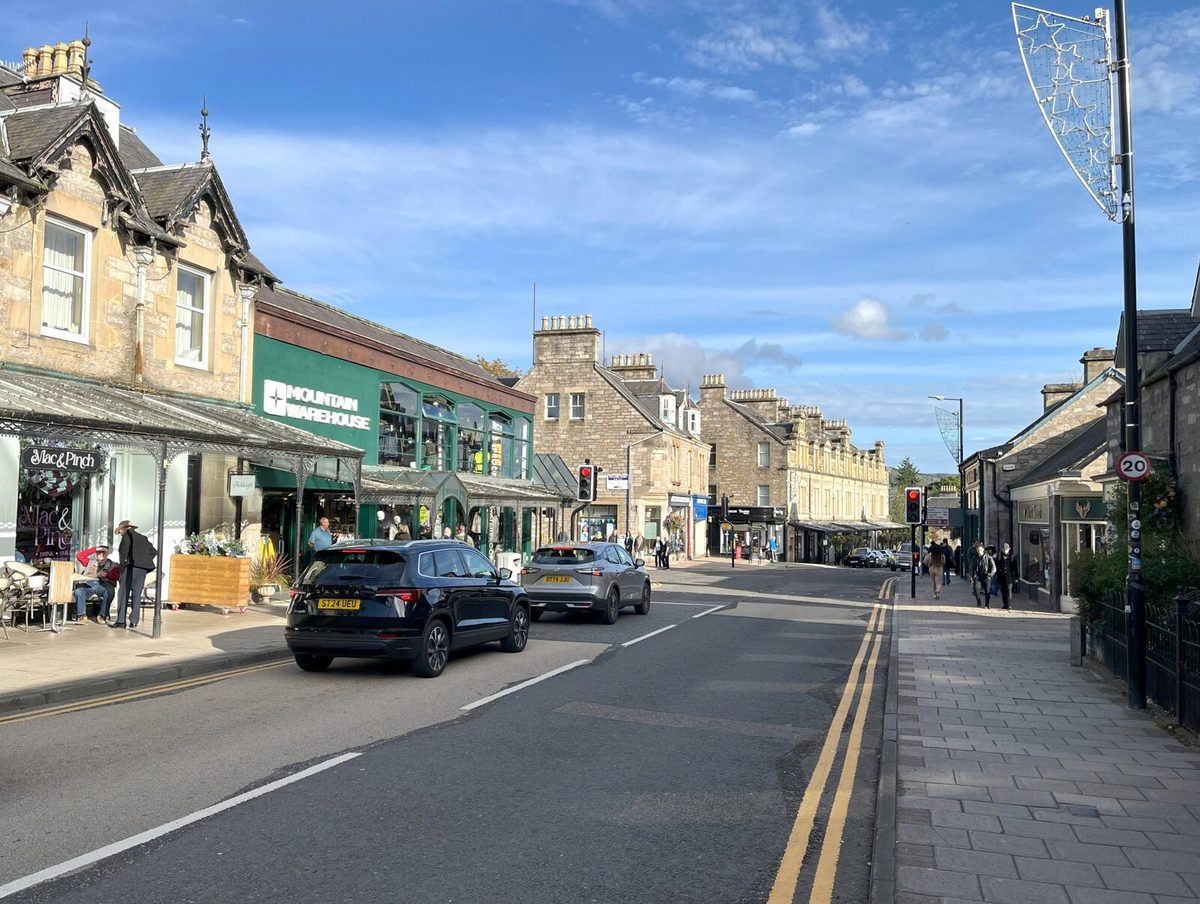
- Atholl Road in Pitlochry, the standard first proper stop on the A9 north from Edinburgh — Adrian Taylor, CC BY-SA 2.0, via Geograph
- The hairpin of the Rest and Be Thankful above Glen Croe, where the A83 is prone to landslides — Richard Harvey, CC BY-SA 3.0, via Wikimedia Commons