The obvious way to drive north out of Glasgow is to point the car at Inverness and start the clock. It gets you a long day of tarmac and very little you’ll remember. The mistake is thinking of a Scottish Highlands road trip as a distance problem. It isn’t. It’s a sequence of about seven or eight specific roads, each with its own character, its own bottleneck and its own reason to stop, and the trick is knowing which ones to drive and how slowly.
This guide takes them road by road: what each one is like to drive, how much time to allow, where the queues form, where the fuel runs out, and what happens when you get the etiquette wrong.
The short answer
The best Highlands driving is on the west and east flanks, not the north coast. Build a trip around the A82 through Glen Coe, the A830 to Mallaig, the A87 to Skye, the Applecross loop, the Argyll run to Oban and the A939 Snow Roads. Budget 60 to 80 miles a day, not 150.
Everything below sits inside the wider Scottish Highlands region guide, which is worth reading first if you’re still deciding where in this very large area you actually want to be. Here’s how the main corridors compare.
| Route | Distance | Realistic driving time | Road type | Best for |
|---|---|---|---|---|
| A82 Glasgow to Fort William | About 104 miles | Allow 2.5 to 3 hours with stops | Two-lane, narrow near Tarbet | First-timers, big mountain scenery |
| A830 Road to the Isles (Fort William to Mallaig) | Under 50 miles | Short, but allow for stops | Two-lane, mostly modern | Beaches, the Jacobite, island ferries |
| A87 Invergarry to Kyle of Lochalsh | Shorter than the A82 run | Moves quickly; stops add time | Two-lane, fast and open | Getting to Skye, Glen Shiel |
| Bealach na Bà (Tornapress to Applecross) | About 11 miles | Allow plenty of time | Single track, 20% gradients | Confident drivers, small cars |
| Applecross to Shieldaig coast road | Short | Slow going; give it plenty of time | Single track, constant bends | Sea views, quiet mornings |
| Glasgow to Oban via A82/A85 | About 93 miles | About 2 hours before stops and delays | Two-lane, A83 alternative | Ferries, seafood, Argyll castles |
| A93/A939 Snow Roads (Blairgowrie to Grantown-on-Spey) | About 90 miles | Best spread over a few days | Two-lane, high and exposed | Cairngorms, quieter driving |
| A835 Inverness to Ullapool | About 57 miles | 1.5 hours | Two-lane, fast | Wester Ross, Outer Hebrides ferry |
Why I’d steer you away from the North Coast 500
Let me get this out of the way, because it’s the elephant in every Scottish road trip article. The North Coast 500 is a genuinely fine drive that has been loved into a state of considerable strain. It was launched in 2015 as a marketing route stitched together from existing roads, and it worked far better than anyone expected.
What that means on the ground: single-track roads that get very busy in summer, campervans on the Bealach na Bà and around Assynt, and accommodation you need to book well ahead. Fodor’s put the route on its “No List” of destinations to reconsider, and Highland communities have pushed for a formal review of its impact. That isn’t snobbery about crowds. It’s a road network reaching its limits.
Here’s the practical case against it for most visitors. The NC500 is a 516-mile loop, so a five-day trip averages just over 100 miles a day, much of it on narrow single-track roads that take longer than you’d expect. You spend the trip driving. The scenery on the north coast between Thurso and Durness is superb, but you have to earn it with a long, featureless run up the A9 first.
The corridors below give you the same landscape quality with a fraction of the mileage, better food, more shelter when the weather turns and roads that can absorb you. If you have ten days and a real appetite for remoteness, do the NC500 in May or late September and take eight days over it. Otherwise, drive these instead.
The western corridors: Glasgow to the sea lochs
This is the classic run and, honestly, still the best single day’s driving in Scotland. It starts in a city and ends among 1,000-metre mountains.
The A82 from Glasgow to Glen Coe
The A82 leaves Glasgow, skirts Dumbarton and arrives at Loch Lomond within forty minutes. From Balloch to Tarbet the road is wide and pleasant. Then it changes. The stretch between Tarbet and Ardlui is squeezed between the loch and a rock face, with overhanging trees, blind bends and a 40mph limit that is not a suggestion. Lorries take up most of their lane and some of yours.
Don’t fight it. This is the first real test of patience on the drive north. There are laybys, and the Loch Lomond and Trossachs national park has plenty of reasons to stop before you get there anyway. Tarbet and Luss both have parking and a view.
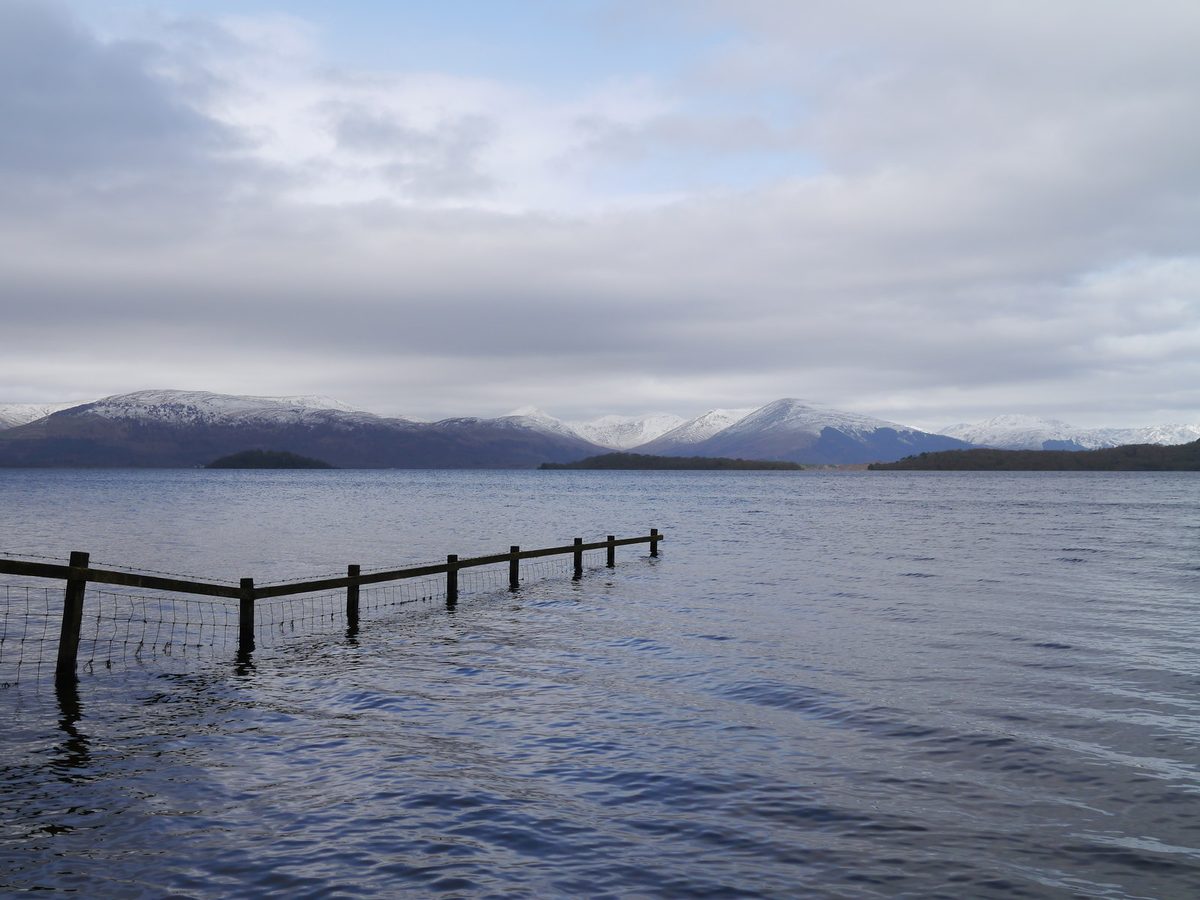
North of Ardlui the road opens up through Crianlarich and Tyndrum. Tyndrum is your last reliable fuel and food stop before Glen Coe, and both filling stations there are busy in summer. Fill up. The next dependable pumps heading north are at Glencoe village or Ballachulish, and on a Sunday evening in winter you don’t want to be gambling.
From Bridge of Orchy the A82 climbs past Loch Tulla and onto Rannoch Moor, which is the moment the trip changes gear. The moor is a peat basin roughly eleven miles across, scattered with lochans and dead-flat to the horizon in every direction, ringed by mountains. There is nothing on it: no houses, no phone signal to speak of, no shelter. In low cloud it feels genuinely serious. In evening light it’s the best thing on the road.
There’s a large layby on the west side about halfway across with room to pull off safely. Use that rather than stopping on the carriageway, which people do constantly and which causes most of the near-misses I’ve seen on this road.
Glen Coe itself
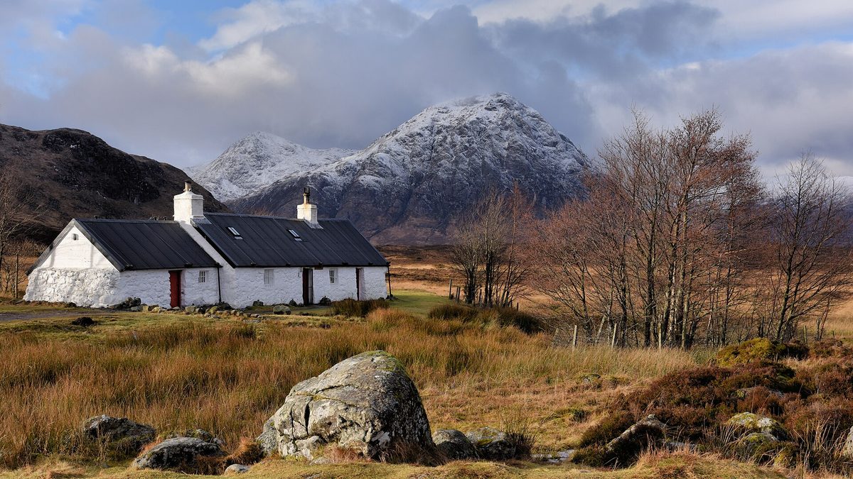
The moor ends at Buachaille Etive Mòr, the pyramid of rock standing at the junction where the Glen Etive road turns off. From there the A82 drops into Glen Coe proper: seven miles of glacial valley with the Three Sisters ridge on your left and the Aonach Eagach on your right.
The stops that matter, in order coming from the south: the Glencoe Mountain Resort turning, which has a café and a chairlift that runs in summer; the Kingshouse; the Study viewpoint layby; the Three Sisters car park; and the National Trust for Scotland visitor centre near Glencoe village. There is a lot more to do here than drive through, and the Glen Coe activities guide covers the walks properly, including the Lost Valley scramble, which is the one worth the effort.
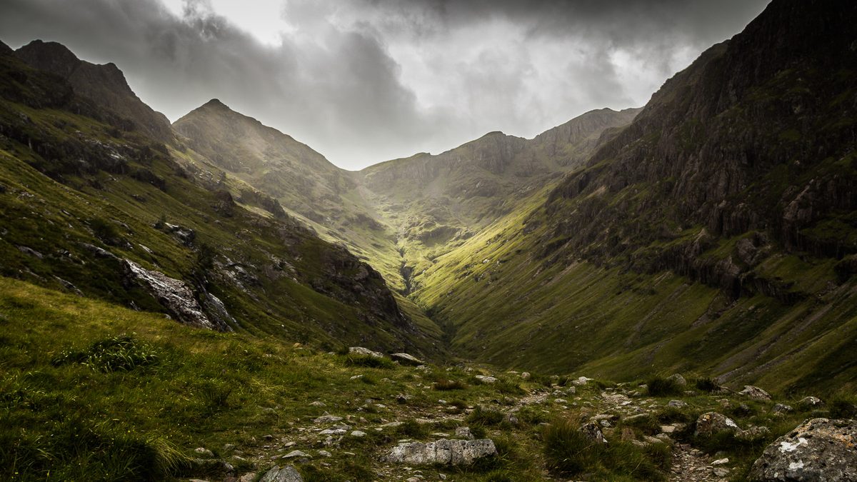
The bottleneck here is parking, not traffic. The Three Sisters car park charges and fills from mid-morning through to late afternoon in July and August, and the overflow spills onto the verge, which is both illegal and dangerous on a 60mph road. Allow for it: if the car park is full, drive on to the next stop rather than add another car to the verge.
The Glen Etive spur
The single-track road down Glen Etive is a dozen miles of dead end. It’s beautiful, it has a river with pools people swim in, and it appeared in a Bond film, which is why it now carries far more cars than it was built for.
My honest advice: only drive it if you’re comfortable reversing on single track and you’re going early. There are passing places but there’s very little formal parking, the verges have been badly chewed up, and the informal camping problem here has been severe enough for rangers to get involved. If you go, take everything out with you and don’t park anywhere that blocks a passing place. If that sounds like too much bother, it probably is, and Glen Coe itself gives you 90% of the same landscape.
The A830 Road to the Isles
From Fort William, the A830 runs under 50 miles west to Mallaig. Its 7.5km stretch between Arisaig and Loch nan Uamh was single track until April 2009, when the upgraded two-way road opened. Your satnav will undersell the drive, so allow extra time, and more again if you’re stopping.
Fort William itself is the practical base for this whole western section, and it’s the place to stock up before you head west, with a supermarket, a proper choice of restaurants and a garage. It’s not a beautiful town. It is a very useful one.
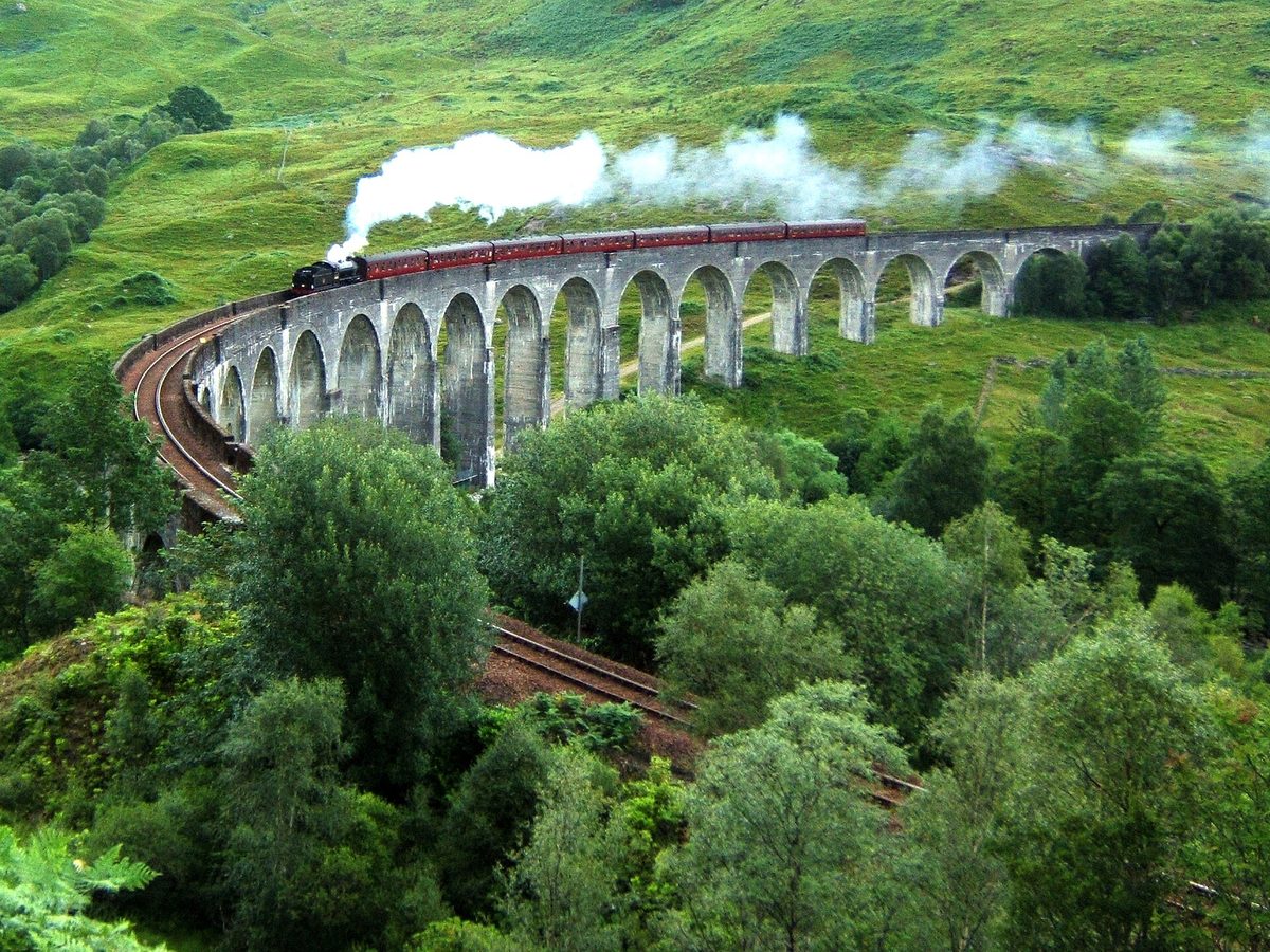
Fourteen miles out you reach Glenfinnan. The viaduct is the reason most people come, and the timing is everything: the Jacobite steam train crosses at broadly predictable times through the summer season, and the car parks fill an hour before. The full Glenfinnan and Jacobite guide goes into schedules and the two viewpoint walks in detail. Parking on the A830 verge here is prohibited and enforced, and for good reason, because the road is fast and the sightlines are poor.
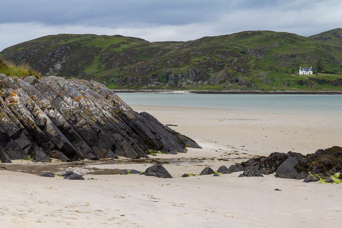
Past Glenfinnan the road runs along Loch Eilt, then Loch Ailort, then hits the coast at Arisaig, and this is where it becomes exceptional. The old single-track road still runs parallel in places if you want to slow right down. Camusdarach and the Silver Sands of Morar are white shell-sand beaches looking straight across to Eigg and Rum, and on a clear day they don’t look like Scotland at all.
Mallaig at the end is a working fishing port with a ferry terminal, a chip shop queue and a smokehouse. From here CalMac sails to Armadale on Skye and to the Small Isles, and a separate small operator runs to Inverie in Knoydart, which has no road connection at all. If you’re building islands into the trip, the Scottish islands overview is the place to work out which ones justify the ferry cost.
The Corran Ferry and Ardnamurchan
Eight miles south of Fort William, a small vehicle ferry crosses the narrows at Corran to Ardgour in about five minutes. It’s run by The Highland Council, there’s a modest per-car charge, and it opens up a peninsula that most road trips skip entirely.
Beyond Strontian and Salen, the B8007 to Ardnamurchan Point is proper single track with a lot of blind summits. Give it plenty of time each way. The reward is the most westerly point of the British mainland, a lighthouse you can climb, and the near-certainty of having the road to yourself. The catch is fuel: plan to arrive with a full tank from Fort William, because pump options out here are limited and often have restricted hours. Check the sailing times before you commit, and be aware the crossing can stop in high winds.
The roads to Skye and Wester Ross
This is where Highland driving gets serious, in the good sense and occasionally the bad one.
The A87 through Glen Shiel
The A87 leaves the A82 at Invergarry in the Great Glen and runs west through Glen Shiel to Kyle of Lochalsh. Here the satnav time is roughly right, because this is a genuinely fast road, but you will want to stop.
Three or four miles up, a signed viewpoint looks down Loch Garry, which from that angle has a shape people claim resembles a map of Scotland. It’s a five-minute detour and it’s a good one. After that the road climbs to Loch Cluanie, crosses the watershed and drops into Glen Shiel, running for miles directly beneath the Five Sisters of Kintail. There are laybys throughout. The two-lane road runs right beneath the ridge, which tops 1,000 metres.
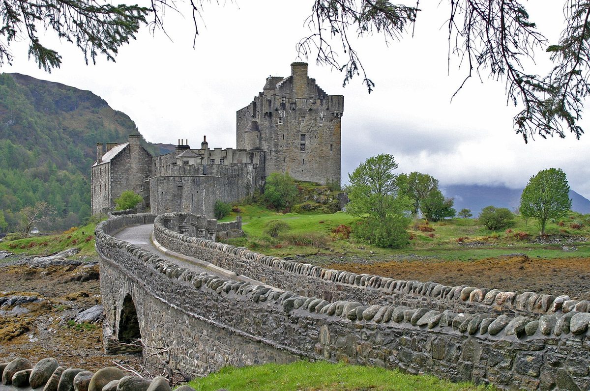
At Shiel Bridge you meet the sea. A few miles on is Eilean Donan, which is the most photographed castle in the country and, yes, it looks exactly like the pictures. There’s an admission charge to go inside and a large car park that fills mid-afternoon; the exterior view from the road side costs nothing, and honestly it’s the better angle.
The Skye Bridge at Kyle of Lochalsh has been toll-free since 2004. If you’d rather arrive with more ceremony, the Glenelg to Kylerhea turntable ferry runs roughly April to October, takes six cars at a time, and gets there via the Mam Ratagan pass, which is a steep hairpinned climb with a superb view back down Loch Duich. It’s slower and it costs money. It’s also far more fun. For what to do once you’re across, the Isle of Skye guide covers the island’s own driving problems, which are considerable in summer.
Bealach na Bà
The road over the Bealach na Bà, the Pass of the Cattle, climbs from sea level at Tornapress on Loch Kishorn to 626 metres (2,053 feet) in about six miles, then drops to Applecross on the far side. Total distance from the junction to the village is around eleven miles.
The roadside information at the bottom is unusually honest. The road rises to 2,053 feet with gradients of 1 in 5 and hairpin bends, and it is not advised for learner drivers, very large vehicles or caravans. Take that literally. This is the greatest continuous road climb in the UK, the gradients touch about 20%, and the hairpins near the top are tight.
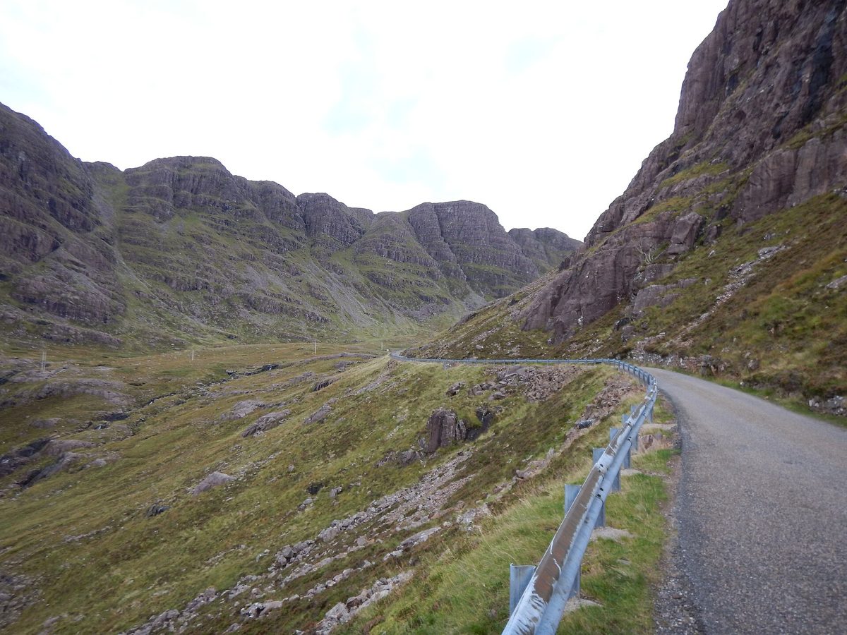
In a normal car it’s fine. Second gear on the way up, second gear on the way down, and don’t ride the brakes. Allow plenty of time at a sensible pace: traffic, weather and passing manoeuvres all slow you down, and snow can close the pass in winter. The summit car park is the obvious place to stop for photos. Passing places on this road are not viewpoints and blocking one on a 20% gradient is genuinely dangerous.
The other thing nobody mentions: the view is often nonexistent. When the cloud is down you can drive all the way to the top and see nothing at all. Check the forecast, and if the tops are in, consider going round by the coast road instead and saving the pass for a better day.
The Applecross coast road and Torridon
Applecross village is small, remote and has an inn that people drive a long way for. Book a table well ahead in summer, and book a room months ahead. There’s a community-run filling station near the shore which is unmanned and card-only, and it has rescued more than one visitor who arrived on fumes.
From Applecross the coast road runs north and east to Shieldaig on single track that hugs the sea, climbs over headlands and gives you views across to Raasay, Skye and, on a clear day, the Outer Hebrides. It’s slow, so give it plenty of time. It’s also, for my money, better than the pass.
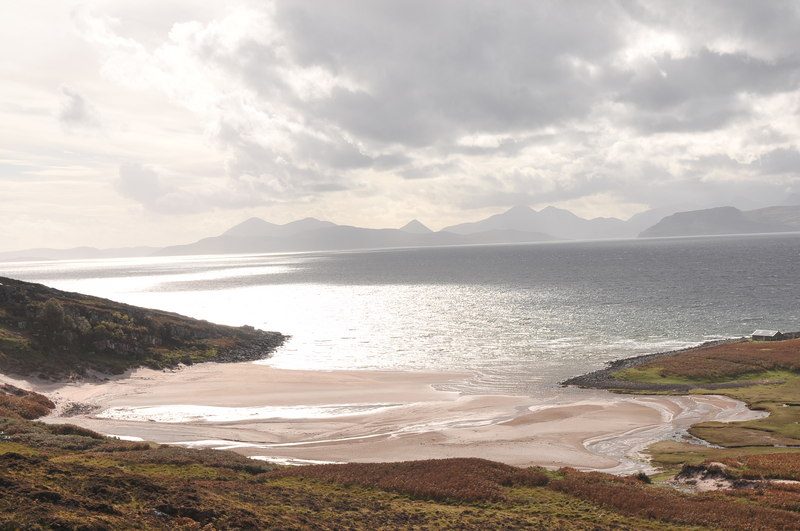
Continue on the A896 and you’re into Torridon, which is the most impressive mountain scenery in Scotland that most visitors never see: Liathach and Beinn Eighe rising straight off the roadside in banded sandstone and quartzite. From there the A832 runs past Loch Maree to Gairloch and Poolewe. Allow a full day from Applecross to Ullapool and don’t try to add anything else to it.
Argyll: the quiet coastal run to Oban
Argyll gets overlooked because it isn’t technically “the Highlands” in most people’s mental map, and that’s exactly why it’s worth driving. It has sea lochs, castles and ferries, and in August it’s noticeably calmer than Skye.
The A83 and the Rest and Be Thankful
The A83 leaves the A82 at Tarbet and climbs Glen Croe to a pass called the Rest and Be Thankful. This is the single most unreliable piece of road in the Highlands. The hillside above it is prone to landslides, and the route has been closed repeatedly over the past decade, with traffic diverted onto the Old Military Road below under convoy control.
Transport Scotland has been working through options for a permanent fix, including a proposed debris flow shelter, and has been improving the diversion route in the meantime. What that means for you: check Traffic Scotland the morning you plan to drive it. If it’s shut and the diversion is running, expect delays. If it’s fully closed, the alternative is a long way round via Crianlarich and Dalmally, which can add an hour and a half.
Inveraray, Loch Awe and the Pass of Brander
Past the pass, the A83 drops to Loch Fyne and Inveraray, a planned town with a castle, a preserved Georgian jail and an oyster bar on the loch shore a few miles back up the road. From there the A819 cuts north to Loch Awe, where Kilchurn Castle sits on a promontory at the loch’s head and is free to walk out to.
The A85 then threads the Pass of Brander, a narrow defile between Ben Cruachan and the loch where the road and railway share a shelf above the water. It’s short, it’s dramatic, and Cruachan’s hydroelectric power station is built inside the mountain. Its tours into the mountain are closed while two of the station’s four units are upgraded, though the visitor centre stays open; check the Visit Cruachan site for when tours resume.
Oban and the ferry connections
Oban is the best small town on the west coast: a curved seafront, a folly on the hill above it, a distillery in the middle of town and the busiest ferry terminal in the region. Glasgow to Oban via the A82 and A85 is about 93 miles, roughly two hours of driving before stops and delays. If you go the other way, over the Rest and Be Thankful on the A83, check for closures first.
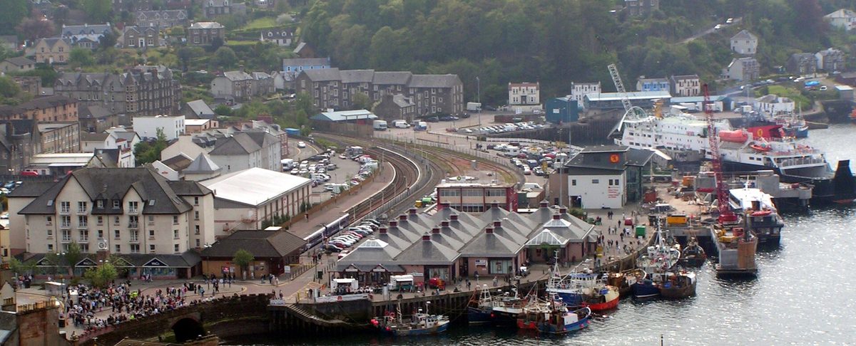
From here you can put the car on a boat to Mull, Colonsay, Coll, Tiree, Barra and South Uist. The Oban travel guide covers the town properly. If seafood is any part of your motivation for coming to Scotland, this is where the trip peaks: the seafood shack by the ferry pier does langoustines that need nothing doing to them.
The eastern Highlands: Deeside and the Snow Roads
Everyone drives the west. The east is emptier, drier, and has the two highest main roads in Britain. If you’re coming from Edinburgh or flying into Aberdeen, start here.
The A93 over Glenshee
From Blairgowrie the A93 climbs to the Cairnwell Pass at 670 metres (2,199 feet), the highest public road in the UK. It’s a proper mountain road, wide and well engineered, past the Glenshee ski centre and down into Braemar. The old Devil’s Elbow hairpins were bypassed decades ago but you can still see the line of the original road on the hillside.
Braemar is a good lunch stop with a castle and, in early September, the Highland Games that the royal family attends. Down the valley, Balmoral opens parts of the estate to visitors for a limited season, usually in spring and early summer, so check dates before building a day around it. Royal Lochnagar distillery sits just off the road nearby, and it’s a calmer visit than the big Speyside names an hour to the north.
The A939 Snow Roads
At Ballater the signed Snow Roads Scenic Route turns north onto the A939 and climbs again, over the Lecht to Tomintoul and on to Grantown-on-Spey. The full marketed route runs about 90 miles from Blairgowrie to Grantown and there are a few contemporary viewpoint installations along it, which are better than that description makes them sound.
The Lecht climb is steep and exposed, with a ski centre at the top and Corgarff Castle, a white tower inside a star-shaped defensive wall, a few miles below. The section between Cockbridge and Tomintoul is often one of the first roads in Britain to close when snow arrives, which tells you everything about how exposed it is.
Tomintoul is one of the highest villages in the Highlands and a sensible overnight if you want dark skies, because there is almost no light pollution up here and the road is quiet enough to stop on after dark. From Grantown you’re into Speyside and the northern Cairngorms, and Aviemore and the Cairngorms makes an easy base with far more accommodation than anywhere on the route itself.
North-west without the NC500
You can have the far north-west without doing the full loop. Treat Ullapool as a destination rather than a waypoint and the whole thing becomes manageable in three days.
The A835 from Inverness
Inverness to Ullapool is about 57 miles on a fast, well-surfaced road that takes under an hour and a half. It climbs through Garve, past the Rogie Falls forest walk, and drops to Braemore Junction where Corrieshalloch Gorge cuts a slot in the rock with a Victorian suspension bridge across it. The visitor facilities there have been rebuilt in recent years and it’s a proper stop, not a photo pull-in.
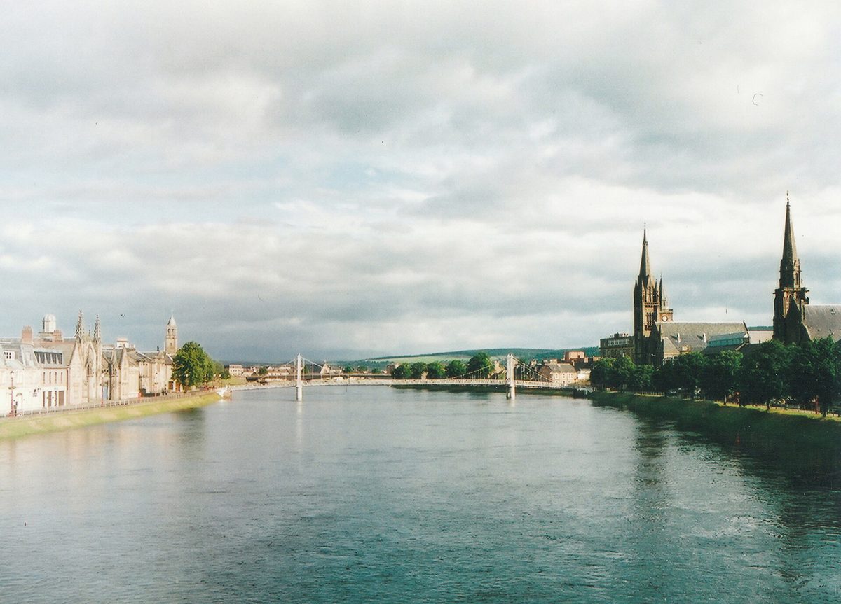
Inverness itself is the obvious start and end point for anything in the north, and it’s covered along with the loch to its south in the Inverness and Loch Ness guide.
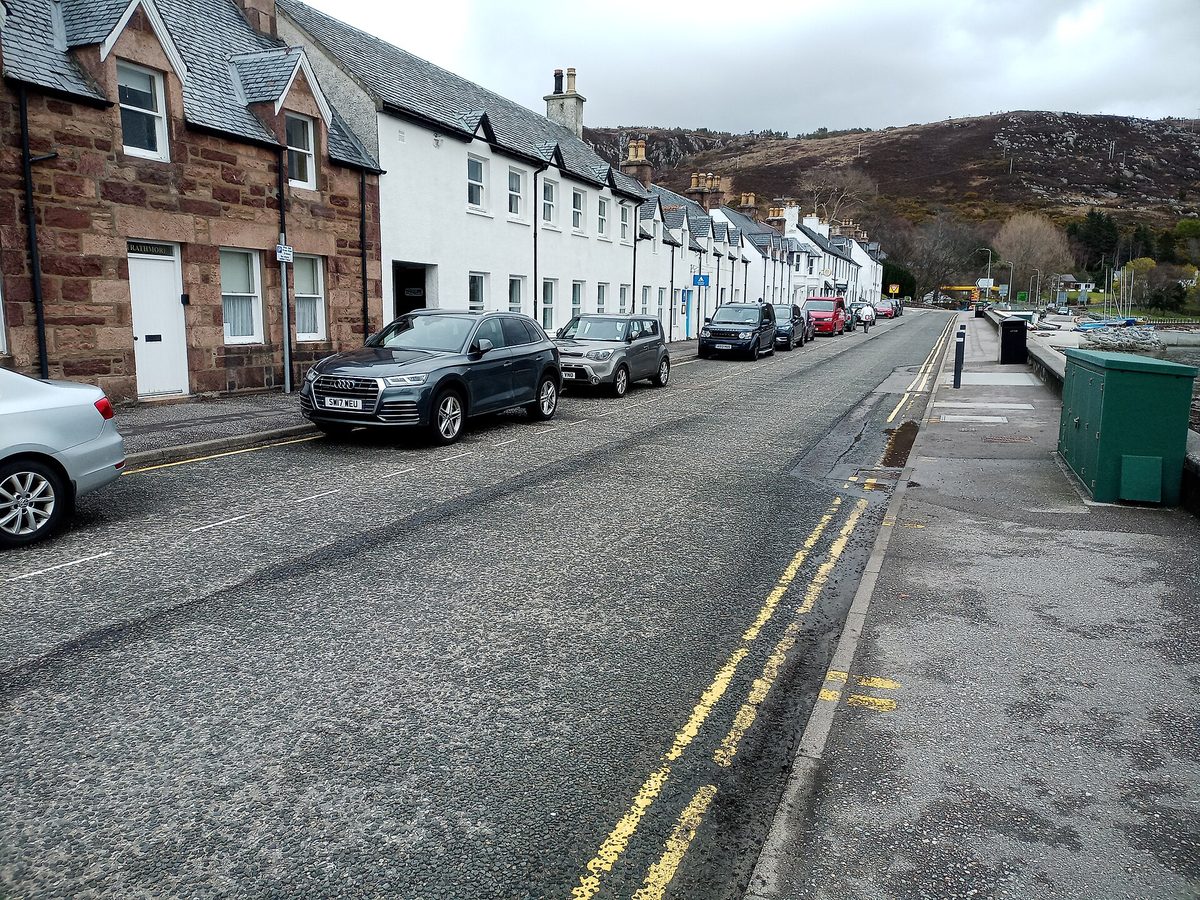
Ullapool is a planned fishing village on Loch Broom with a bookshop, a good music venue and the CalMac ferry to Stornoway on Lewis. It’s a useful stop for supplies before you head further north, and in summer it pays to book a bed before you arrive.
Assynt and the wee road to Drumbeg
North of Ullapool the A835 and A837 run into Assynt, which has the strangest skyline in Britain: Stac Pollaidh, Cul Mor and Suilven standing as isolated sandstone lumps on a floor of ancient gneiss. Ardvreck Castle sits ruined on a spit into Loch Assynt and costs nothing to visit.
The B869 from Lochinver to Kylesku, known locally as the wee road, is single track with steep gradients, blind summits and hairpins, past a string of beaches at Achmelvich and Clachtoll. It is one of the best drives in the country and it is emphatically not for motorhomes, however confident you feel. Allow at least an hour and a half. Then cross Kylesku Bridge, which is a genuinely elegant piece of engineering, and turn round.
Single-track roads: the etiquette that actually matters
This is the section I’d most like people to read. Nothing else you do on a Highlands trip affects local people as directly as how you handle single track, and the vast majority of visitor mistakes come down to three or four specific things.
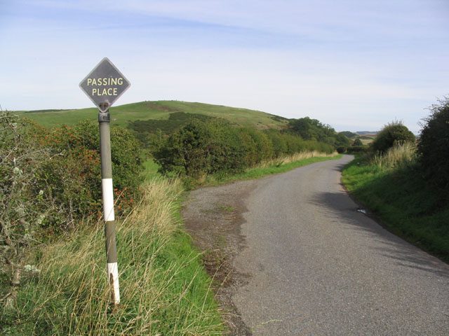
A single-track road carries traffic in both directions on one lane, with passing places marked by a black-and-white diamond sign or a striped pole. The rules are simple and there is no ambiguity about them.
Give way properly
If a vehicle is coming towards you and the nearest passing place is on your left, pull into it and stop. If the nearest passing place is on your right, stop opposite it and let the other driver use it. Do not drive into a passing place on the right-hand side of the road. Once you’re stopped, the other driver comes past, everybody waves, and it takes four seconds.
If you meet head-on with no passing place between you, whoever is closer to one reverses. If you can’t reverse confidently in a straight line for 50 metres, practise before you come. It’s the single most useful skill for this trip.
Passing places are for letting people through, not just for passing
Here’s the one that visitors miss. If a car appears behind you and it’s obviously moving faster, pull into the next passing place on your left and wave it past. You do not need to wait for oncoming traffic. You are not being overtaken aggressively; you are holding up someone who lives here.
The van behind you might be the postie on a delivery round, a district nurse, a fish lorry on a timed run to the market or a joiner who has forty miles to cover before dark. They drive this road every day and they will do it faster than you. Let them go. It costs you ten seconds and it’s the difference between visitors being tolerated and visitors being resented.
Never park in a passing place
Not for a photograph. Not for a quick look at the map. Not “just for a minute” while someone gets out to see the view. A blocked passing place turns a functioning road into a standoff, and on gradients like the Bealach it can force reversing in exactly the place you least want to be reversing.
If there’s nowhere legitimate to stop, drive on until there is. Verges look solid and often aren’t, particularly after rain; peat gives way and a recovery from a remote Highland verge is expensive and slow.
Speed, sightlines and everything else on the road
The national speed limit on most single-track roads is 60mph, which is close to meaningless. Drive at a speed you can stop within the distance you can see to be clear, and treat every blind summit as if there’s a tractor on the far side, because sooner or later there is.
Sheep have right of way and no sense. Deer come out at dawn and dusk, particularly in autumn, and a red deer through a windscreen is a serious accident. Cyclists on these roads have nowhere to go, so wait until there’s genuine room. Don’t tailgate a car that’s already going slowly, because all that does is stop the driver seeing a passing place in time to use it.
And use your indicators when you pull in. It reads as “I’ve seen you, I’m stopping” and it takes the guesswork out of the next thirty metres. More general road rules are in the getting around Scotland guide, which is worth skimming if you’ve never driven on the left.
Campervans and motorhomes: what’s different
A campervan changes this trip more than people expect, and not always for the worse. But there are hard constraints.
Some roads are effectively closed to you. The Bealach na Bà warns against very large vehicles and caravans, and the Applecross community has repeatedly asked motorhome drivers to use the coast road via Shieldaig instead. The B869 Drumbeg road, the Glen Etive spur and the Mam Ratagan pass to Glenelg are all in the same category. Your satnav will happily route you over all of them. It doesn’t know how long your vehicle is.
Overnight parking is not the same as wild camping. The right of responsible access under the Land Reform (Scotland) Act 2003 applies to non-motorised access, so it doesn’t give you a right to park a van overnight wherever you like. The Highland Council has been running a paid permit scheme for overnight stays in designated council car parks, typically with a fee in the region of £40 for a week’s pass at the time of writing, restricted hours of roughly 10pm to 8am, no return to the same car park within a set period, and waste disposal included. Check the council’s current terms before you rely on it.
Waste disposal is the thing locals notice. Empty chemical toilets only at proper disposal points. Rural septic systems are not designed for tank chemicals and emptying into a public toilet or a burn causes real damage. This, more than traffic, is what has soured community feeling along the popular routes.
Practical bits. Ferries charge by vehicle length, so a 7-metre van costs considerably more than a car and needs booking further ahead. LPG is scarce in the north-west. Fuel range matters more when you’re doing 20mpg. And on any single-track road, leave a decent gap to the van in front so cars can leapfrog the convoy rather than being stuck behind six of you.
If the constraints put you off, the good news is that the Highlands work well without a vehicle at all. There’s a car-free Scotland itinerary built around trains and buses, and the West Highland Line runs through much of the same country as the A82 and A830 on its way to Mallaig, crossing the Glenfinnan viaduct on the way. As a piece of scenery per hour it arguably beats the drive, and someone else is doing the reversing.
Winter, closures and the seasons
Highland roads close. Not often, but predictably, and the ones that close are the ones on this list.
The A939 between Cockbridge and Tomintoul is regularly among the first roads in Britain to shut with snow. The Cairnwell Pass on the A93 over Glenshee goes the same way. The Bealach na Bà is technically open year-round but is closed at short notice whenever snow or ice make it unsafe, sometimes for days. The A82 through Glen Coe stays open in most conditions but a closure there, whether for weather or an accident, means a diversion measured in hours because there is no parallel road.
Check Traffic Scotland before you set off on any winter morning, and take Met Office warnings seriously; an amber wind warning on the west coast means ferry cancellations as a near-certainty.
Daylight is the bigger constraint. In late December you get somewhere around seven hours of usable light in the western Highlands, so a “three-hour drive” eats half your day and you’ll be doing the second half in the dark on unlit roads with deer about. Plan two-thirds of the mileage you would in June. The winter in Scotland guide goes into what’s open and what isn’t.
For the rest of the year, my order of preference for driving is late May, late September, early October, then June. May gives you long light, low midge numbers and roads that haven’t filled up yet. September has the light and the colour without the school holidays. July and August are the school-holiday months and fall in the midsummer peak of midge season on the west coast, which the midge season guide explains in more detail than you probably want. If you’re weighing months against each other, the best time to visit Scotland breakdown compares them side by side.
Planning the trip properly
How long you need and how far to drive
Five days gets you a decent western loop: Glasgow, the A82, Glen Coe, the Road to the Isles, Skye and back down. Seven to ten days lets you add Applecross, Torridon and either Argyll or the Cairngorms without rushing.
The mileage rule I use is 60 to 80 miles a day of actual route, with anything over 120 counting as a transit day where you shouldn’t expect to do much else. That sounds absurdly low if you’re used to driving in flatter countries. It isn’t. Between the road type, the weather, the stops and the sheer amount of stopping other people do, a Highland mile takes roughly twice as long as you think. The how many days in the Highlands guide works through a few different trip lengths.
Where to sleep
Base yourself in fewer places and drive out and back. Three bases over a week beats seven one-night stops, which is mostly packing and unpacking. Fort William, Oban, Aviemore, Ullapool and Portree are the practical hubs, and the Highland base towns comparison weighs them against each other on price, food and how far you have to drive each morning.
Book July and August accommodation in January if you can. Applecross, Glenfinnan, Torridon and Kylesku have tiny bed stocks and go first.
Hire cars, ferries and fuel
Get the smallest car you’re comfortable in. On single track, a compact hatchback is genuinely a better tool than a large SUV, and you’ll spend less time reversing. Automatics are in shorter supply in the UK and cost more, so book early if you need one.
Read the hire agreement for clauses about unsurfaced roads, tyre damage and underbody damage, which are commonly excluded from standard cover and are exactly the damage single track causes. Excess reduction is usually worth buying for this trip.
Book vehicle ferry crossings in advance, especially Mallaig to Armadale and anything out of Oban in summer. Foot passengers can usually turn up; cars often can’t.
On fuel: treat a quarter tank as empty once you’re west of the A9. Rural stations close early, some are unmanned and card-only, and Sunday hours are unpredictable. Prices in the north-west run noticeably above the central belt, which is a fact of rural distribution rather than opportunism.
Download offline maps before you leave a signal area, because mobile coverage on Rannoch Moor, in Ardnamurchan and across much of Wester Ross ranges from patchy to absent. A paper road atlas in the door pocket is not a joke. There’s more general preparation advice in the Scotland travel tips guide.
Stitching the corridors into an actual route
Named roads are only useful if they join up. Here are three routes I’ve driven that use the corridors above without doubling back more than necessary. All three assume you’re picking the car up in Glasgow or Edinburgh unless stated.
Five days: the western essentials
Day one, Glasgow to Glencoe village on the A82. Stop at Luss or Tarbet, then Tyndrum for fuel, then give Rannoch Moor and the glen the whole afternoon. Sleep in Glencoe or Ballachulish.
Day two, Glencoe to Mallaig and back to Fort William on the A830. Glenfinnan first thing before the car parks fill, then the beaches at Arisaig and Morar, then Mallaig for lunch. That’s a short driving day and it should be.
Day three, Fort William to Skye via the A82 and A87, with the Loch Garry viewpoint, Glen Shiel and Eilean Donan on the way. Two nights on Skye.
Day four on Skye. Day five back south, either the A87 and A82 the way you came or, if you want variety, the Mallaig ferry from Armadale and the A830 back to Fort William. Then the A82 to Glasgow.
Five days like this hit the best of the western scenery without a rushed morning anywhere.
Seven days: adding Wester Ross
Run days one to three as above, but instead of two nights on Skye take one, then cross back to the mainland on day four and head north on the A87 and A890 to Lochcarron. Do the Bealach na Bà that afternoon and stay in Applecross.
Day five is the coast road to Shieldaig, Torridon and on to Gairloch or Poolewe, a run that will eat the whole day and be worth it. Day six, the A832 and A835 to Ullapool with Corrieshalloch Gorge on the way, then a night there. Day seven, the A835 to Inverness and either drop the car or run south on the A9.
This is my favourite of the three. It takes in some of the finest two-lane driving and single track in the country, and it ends somewhere with an airport.
Ten days: adding the east
Do the seven-day route, then from Inverness take the A9 south to Aviemore, cross to Deeside, and pick up the A939 Snow Roads and the A93 over Glenshee in reverse: Grantown to Tomintoul to Ballater to Braemar to Blairgowrie, then Perth and back to Edinburgh or Glasgow.
The east gives you a completely different landscape: rounded granite hills, pine forest, ski centres, whisky country. It’s also the part most likely to still be dry when the west coast is under cloud, which on a ten-day trip is worth building in deliberately.
Where the loops don’t work
A note on geography that catches people out. The Highlands are not a grid. Sea lochs cut deep inland and there is frequently no way across, so two places twenty miles apart as the crow flies can be an eighty-mile drive. Ardnamurchan, Knoydart, Applecross and the Assynt coast are all dead ends or near enough.
The practical consequence is that “loops” are rarer than road trip articles suggest, and a there-and-back is often the correct answer rather than a failure of planning. Coming back through Glen Coe in the opposite light is not a wasted afternoon.
Breakdowns, electric cars and the realities of remote roads
Almost nothing is written about this and it’s the bit that goes wrong.
Charging an EV in the Highlands
It’s entirely doable and it needs planning. Most public charging in the Highlands sits on the ChargePlace Scotland network, with rapid units in the towns you’d expect: Fort William, Ullapool, Inverness, Portree, Oban, Aviemore, Ballater. Between them, coverage thins fast.
Three things I’d do before setting off. Download Zapmap or the network’s own app and check live status, because a single rapid charger in a small town being out of service is a genuine problem when the next one is fifty miles away. Carry the cables and any RFID card the network requires rather than relying on contactless. And treat 50% battery in the north-west the way you’d treat a quarter tank of petrol.
Range takes a hammering here too. Sustained climbs, headwinds off the Atlantic and cold weather all cost you, and hills like the Bealach or the Lecht are steep enough to be noticeable. Regeneration on the way down claws some of it back, but plan on real-world range being meaningfully below the quoted figure between October and April. The upside is that a lot of Highland hotels and self-catering places now have destination chargers, so overnight top-ups solve most of it if you book with that in mind.
If something goes wrong
Check that your breakdown cover includes recovery to a garage of your choice rather than the nearest one, because the nearest one might be a hundred miles from where you’re staying and closed until Monday. Hire car cover is often basic; read what it actually promises.
Response times in the north-west are measured in hours, not minutes. That’s not a criticism of the recovery operators, it’s arithmetic. So carry what you’d want during a two-hour wait on an exposed road in October: warm layers, water, something to eat, a torch, a power bank and a high-vis if you have one. In winter add a blanket and a shovel.
Punctures are the most common failure on these roads, usually from a sharp verge edge or a pothole taken too fast. Check that the car actually has a spare or a functioning tyre kit before you leave the rental desk, because plenty of modern cars have neither.
Finally, the practical safety point: if you do stop, get the car fully off the carriageway and stand behind the barrier or up the bank, not beside the vehicle. Highland roads are narrow, sightlines are short and drivers coming round a bend at 60mph have very little time to react.
What underwhelms, and what I’d skip
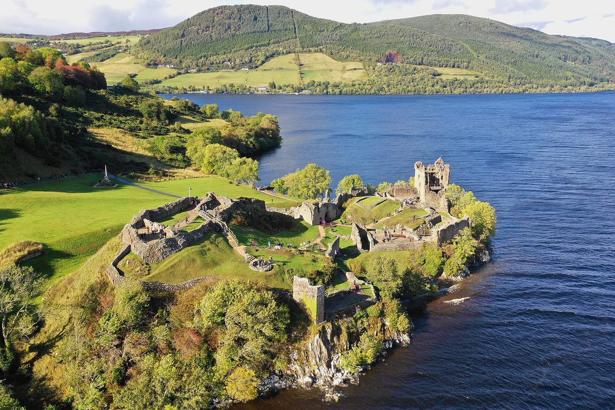
Loch Ness from the A82. The road follows the west shore, and as a drive it gives you less of the loch than the name promises. Urquhart Castle’s car park is a scrum from mid-morning and the monster exhibitions at Drumnadrochit are exactly what you’d expect. If you’re driving between Fort William and Inverness you’ll do it anyway, but don’t build a day around it.
Skye as a day trip. People routinely drive Inverness to Skye and back in a day. That’s five hours of driving before you’ve seen anything, on an island where the Old Man of Storr car park fills by nine and the Fairy Pools charge for parking. Give Skye two nights or leave it out.
The Glen Etive photo spot. A pull-in on a fragile single-track road that now attracts queues. The view from the A82 junction is very nearly as good.
Chasing the whole NC500 in under a week. You’ll spend the trip watching the odometer, and you’ll arrive at the good bits tired.
Trusting satnav times. Your device is calculating from posted speed limits. It has no idea that the road is single track, that there are twelve motorhomes ahead of you, that the Three Sisters car park has spilled onto the carriageway or that the A83 is on convoy control. Add 30% as a baseline and 50% in July and August.
Two things that genuinely deserve the hype: Rannoch Moor in evening light, and the Applecross coast road early on a clear morning.
If you’re arriving from the capital, the Edinburgh to the Highlands drive covers the approach routes north, which are a different problem from the ones on this page.
Frequently asked questions
How many days do you need for a Scottish Highlands road trip?
Five days is the realistic minimum for a western loop taking in Glen Coe, the Road to the Isles and Skye. Seven to ten lets you add Applecross, Torridon and either Argyll or the Cairngorms at a sane pace. Under five days, stay south and do Glen Coe and Argyll properly rather than covering ground.
Is the North Coast 500 worth doing?
Only if you have eight or more days and travel outside July and August. The route is genuinely good but it’s oversubscribed, accommodation is expensive and booked far ahead, and local communities are under real pressure. For a first Highlands trip, the A82, A830 and Applecross give you comparable scenery with far less driving.
What is the most scenic drive in Scotland?
The A82 between Bridge of Orchy and Glencoe village is the one I’d pick if I only had one: Rannoch Moor into Glen Coe, a short drive on a good two-lane road. If you want something wilder and slower, the Applecross coast road from Applecross to Shieldaig is the better drive, and slower.
Do you need a 4×4 in the Highlands?
No. Every road described here is surfaced and a standard car handles all of them. A small car is actively better on single track because it’s easier to place and reverse. In winter, tyres matter far more than drive layout, and most hire cars come on all-season rubber at best, so plan around conditions instead.
Can you drive the Bealach na Bà in a campervan?
A small van, yes, with care. Anything long, wide or towing, no. The local community asks larger motorhomes to use the coast road via Shieldaig instead. Take that advice.
What happens if a local driver comes up behind me on a single-track road?
Pull into the next passing place on your left and wave them past. You don’t need to wait for oncoming traffic, and you shouldn’t speed up to stay ahead. Passing places exist as much for letting faster traffic through as for two-way passing, and never blocking one is the rule locals care about most.
When is the best time of year to drive the Highlands?
Late May and late September are the sweet spots: long daylight, moderate traffic, and either before or after the worst of the midges. June is excellent but busier. July and August bring the crowds and peak midge season, and they’re the months to compare accommodation rates carefully before you book. Winter is atmospheric and quiet but daylight is short and high passes close without much notice.
Are there tolls on Highland roads?
No road tolls. The Skye Bridge has been free since 2004 and there are no toll roads anywhere on these routes. You will pay for some car parks, particularly at Glen Coe, Glenfinnan and popular Skye sites, and for vehicle ferries such as the Corran crossing, Mallaig to Armadale and the Glenelg turntable ferry.
Final thoughts
The Highlands reward slowness in a way that very few places do. Cutting a day to fit in another loch rarely pays off, and the unplanned stops tend to be the ones that stay with you.
Pick three or four of the roads above rather than all eight. Leave the NC500 to people with a fortnight. Pull over and let the van behind you past. Do those three things and you’ll come home with a much better trip than the one your satnav had in mind, and almost certainly with a list of the roads you want to drive next.
The North Coast 500 is the route most people mean when they say Highland road trip, and it rewards a bit of arithmetic before you book. Our seven-day NC500 itinerary gives honest driving hours rather than raw mileage, while the road-by-road route guide settles the clockwise-or-anticlockwise question and explains how passing places actually work.
Before you commit to the loop, it is worth reading our honest take on whether the NC500 is actually worth it — it is a fine drive, but it suits some trips far better than others, and four days is not enough.
Castles are the usual reason a Highland route bends where it does, so it helps to know which castles sit near which roads before you commit to a direction.
About the author: This guide was written and is maintained by the ScotlandTourism.org editorial team — travel writers who’ve spent years exploring Scotland’s cities, Highlands and islands, from bagging Munros to chasing the perfect dram. We update our guides regularly to keep prices, opening details and advice current.
Last updated: September 2026. Prices and opening times change — always check the official site before you travel.
Photo credits
All images are used under their respective Creative Commons or public-domain licenses:
- Scottish highlands road trip loch lomond shore — James T M Towill, CC BY-SA 2.0, via Wikimedia Commons
- Scottish highlands road trip rannoch moor — Andrewmckie, CC BY-SA 4.0, via Wikimedia Commons
- Scottish highlands road trip glencoe valley — Thomas Haid, CC BY 3.0, via Wikimedia Commons
- Scottish highlands road trip glenfinnan viaduct — de:Benutzer:Nicolas17, CC BY-SA 2.5, via Wikimedia Commons
- Scottish highlands road trip morar sands — JoachimKohler-HB, CC BY-SA 4.0, via Wikimedia Commons
- Scottish highlands road trip eilean donan — W. Bulach, CC BY-SA 4.0, via Wikimedia Commons
- Scottish highlands road trip bealach road — James Emmans, CC BY-SA 2.0, via Wikimedia Commons
- Scottish highlands road trip applecross peninsula — Steven Brown, CC BY-SA 2.0, via Wikimedia Commons
- Scottish highlands road trip passing place — Walter Baxter, CC BY-SA 2.0, via Wikimedia Commons
- Scottish highlands road trip oban harbour — GraemeE17, Public domain, via Wikimedia Commons
- Scottish highlands road trip braemar — Holger Uwe Schmitt, CC BY-SA 4.0, via Wikimedia Commons
- Scottish highlands road trip ullapool harbour — Victuallers, CC BY-SA 4.0, via Wikimedia Commons