Most people plan an Isle of Skye itinerary the same way. They open a map, see a compact-looking island, count the famous sights and decide four of them make a comfortable day. By evening they have spent far more of it in the car than out of it, and watched the light go from a queue on the Dunvegan road.
Skye does not punish you for wanting to see a lot. It punishes you for the order you see it in. The island is not a circle with attractions dotted round the edge — it is a string of long peninsulas radiating out from a mountainous centre, and getting from one to the next often means heading back inland first. Get that one idea straight and everything else about planning a trip here becomes simple.
How many days do you need on the Isle of Skye?
Three days is the honest answer: enough for Trotternish, the west coast and one slow day at Elgol or in the Cuillin. Two days covers the headline sights without rushing. One day means picking a single peninsula — make it Trotternish — and accepting that the rest of the island waits for another trip.
That framing runs through everything below. Rather than a numbered list of sights in a hopeful order, this guide is organised the way Skye is actually built: by peninsula, with real drive times between them. Once you can see which clusters share a road, the 1-, 2- and 3-day plans more or less write themselves. For wider context on the island’s geography, history and where it sits in a Scottish trip, our complete Isle of Skye travel guide is the place to start.
Skye at a glance: the six clusters
| Area | Headline sights | Round trip from Portree | Time it needs | Best for |
|---|---|---|---|---|
| Trotternish (north-east) | Old Man of Storr, Kilt Rock, Quiraing, Fairy Glen, Uig | Moderate | A full day, comfortably | First-timers, photographers, anyone with one day |
| Duirinish (west) | Dunvegan Castle, Neist Point, Coral Beach | Long | A full day | Castles, cliffs, sunset |
| Waternish (north-west) | Stein, Trumpan Church, Waternish Point | Moderate | A half day, bolted onto Duirinish | Seafood, quiet lanes, low cloud days |
| Minginish (centre-west) | Fairy Pools, Glen Brittle, Talisker, Sligachan | Moderate | A full day with a walk, or a half day | Walkers, climbers, whisky |
| Strathaird and Elgol (south) | Elgol, Loch Coruisk boats, Torrin, Broadford | Longest | A full day, or half a day if you skip the boat | Cuillin views from the shore |
| Sleat (south-east) | Armadale, Tarskavaig, Ord, Point of Sleat | Longest | A half day if you arrive or leave by ferry | Woodland, empty beaches, arrival days |
Portree sits in the palm of the hand, which is why it appears in every row. Base yourself elsewhere and the numbers shift, sometimes a lot.
Why most Skye itineraries fall apart: the map is lying to you
Skye covers about 640 square miles, which sounds manageable. What the map hides is that much of the road network is single track with passing places, and that the shape of the coast funnels every journey through a handful of junctions.
Here is the routing that ruins trips. Follow the standard advice — Fairy Pools in the morning, Quiraing after lunch, Neist Point for sunset — and from Portree you drive south to Glen Brittle, back out and all the way north to the Quiraing, across the island to Neist, then home in the dark. Most of the day goes behind the wheel, to stand in three car parks. In June, with 18 hours of light, you might survive it. In October you are on a cliff-edge single track with a queue of headlights behind you.
The alternative is not doing less. It is doing the same amount in a shape that follows the roads. Trotternish alone gives you six worthwhile stops inside a two-hour loop; Duirinish gives you a castle, a beach and a lighthouse headland on one road out and back.
What single-track roads actually cost you
Single track means one lane with passing places at intervals. Pull into one on your left, or stop opposite one on your right and let the other car through, and never park in one. If someone faster is behind you, pull in and wave them by — ten seconds of your time, and the single biggest courtesy on the island.
For planning, assume you will average 25 to 30mph on single track once the stopping and reversing is counted. Sat-nav times assume an empty road, and on the narrow run out to Neist Point a couple of motorhomes in July can make a nonsense of them. Allow extra time on every drive on the island.
The A87 from the Skye Bridge through Broadford and Portree to Uig is the exception: mostly a good two-way road that moves. The A863 down the west side and the A850 to Dunvegan are mostly two-lane as well. Everything beyond those — Glen Brittle, Elgol, Neist, Waternish, the Quiraing pass, most of Sleat — is single track for at least part of its length. If you have not driven roads like this before, our guide to getting around Scotland covers the etiquette in more detail, and the wider Highlands road trip routes guide sets Skye in the context of the drives either side of it.
Real drive times between the clusters
These are the numbers I plan with. They assume daylight, dry-ish weather and no major hold-ups, and they are deliberately more pessimistic than your phone will be.
| Journey | Distance | Realistic time | Road |
|---|---|---|---|
| Kyle of Lochalsh to Portree | — | About 45 min before delays | A87 |
| Portree to Old Man of Storr car park | 7 miles | About 12 min before delays | A855 |
| Portree round the full Trotternish loop | Longest in this table | Most of a day with stops | A855 and A87, single track over the Quiraing |
| Portree to Dunvegan Castle | 23 miles | About 35 min before delays | A850 |
| Dunvegan to Neist Point | About 11 miles | Slower than the mileage suggests | Via Glendale |
| Portree to Fairy Pools car park | 23 miles | About 35 min before delays | A863, then B8009 through Carbost |
| Broadford to Elgol | — | About 45 min | B8083, single track |
Put the Quiraing and Neist Point on the map and the logic of the whole guide falls into place. They sit on different peninsulas, and the drive from one to the other is a long one. Any plan that puts them in the same day is a plan built on a map, not on tarmac; run the journey through a route planner from your own base before you commit to it.
Trotternish: the peninsula to choose if you only choose one
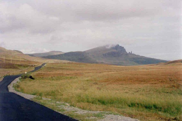
Trotternish is the long finger running north from Portree, and it carries a landslip ridge some 20 miles long, which is why so much famous scenery is squeezed into one loop. The A855 runs up the east coast, a single-track road cuts west over the ridge at Staffin, and the A87 brings you back through Uig. One loop, six or seven stops, no backtracking.
Drive it anti-clockwise: north up the east coast, over the Quiraing pass late morning, down the west side in the afternoon with the sun ahead of you rather than behind. It also gets you to the Storr before the coaches, which start rolling out of Portree around half past nine.
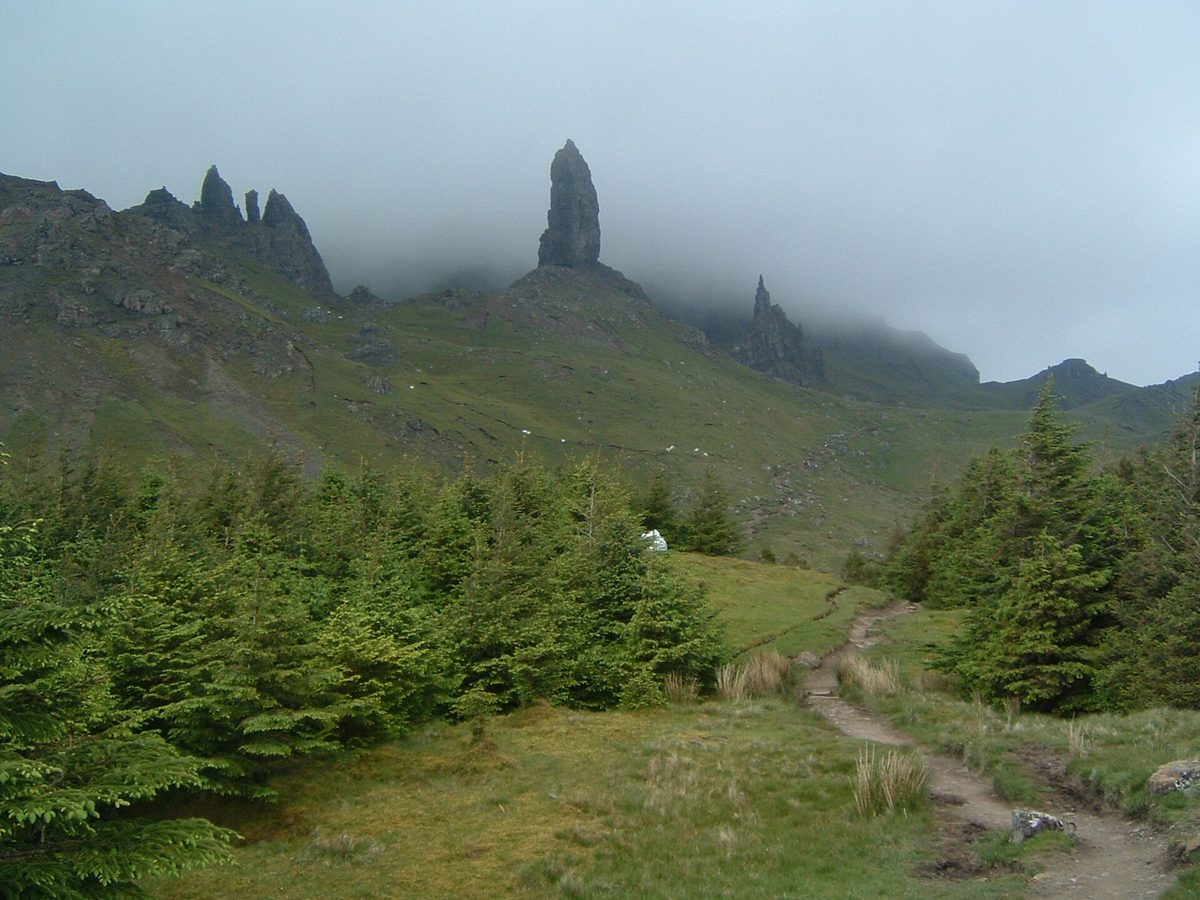
Old Man of Storr
The basalt pinnacle below the Storr cliffs is one of the best-known images of Skye, and the walk to it is a popular one. The rebuilt path makes a 3.8km return route; allow at least two hours up and back, more if you go on to the higher viewpoint.
There is space for around 140 cars, charged by time — roughly £6 for up to six hours and £8 for up to twelve at the time of writing, by card, cash or the RingGo app. It fills, and in peak season it can be very busy; if there is no space, come back later rather than pulling onto the verges, which are peat and take real damage from parked cars. Our Old Man of Storr walking guide covers the path, the timings and the quieter upper loop.
Lealt Falls and Kilt Rock
Two roadside stops, five and ten minutes further north, that cost you almost no time. Lealt has a viewing platform over a gorge with the remains of a diatomite works below. Kilt Rock is a railed viewpoint along columnar cliffs, with Mealt Falls dropping straight into the sea — two minutes from the car for a genuinely good view, which is rare anywhere.
Both car parks are small and both were free at the time of writing. Kilt Rock takes a coach every few minutes in season; if it looks full, carry on, because the view from the road is much the same.

The Quiraing
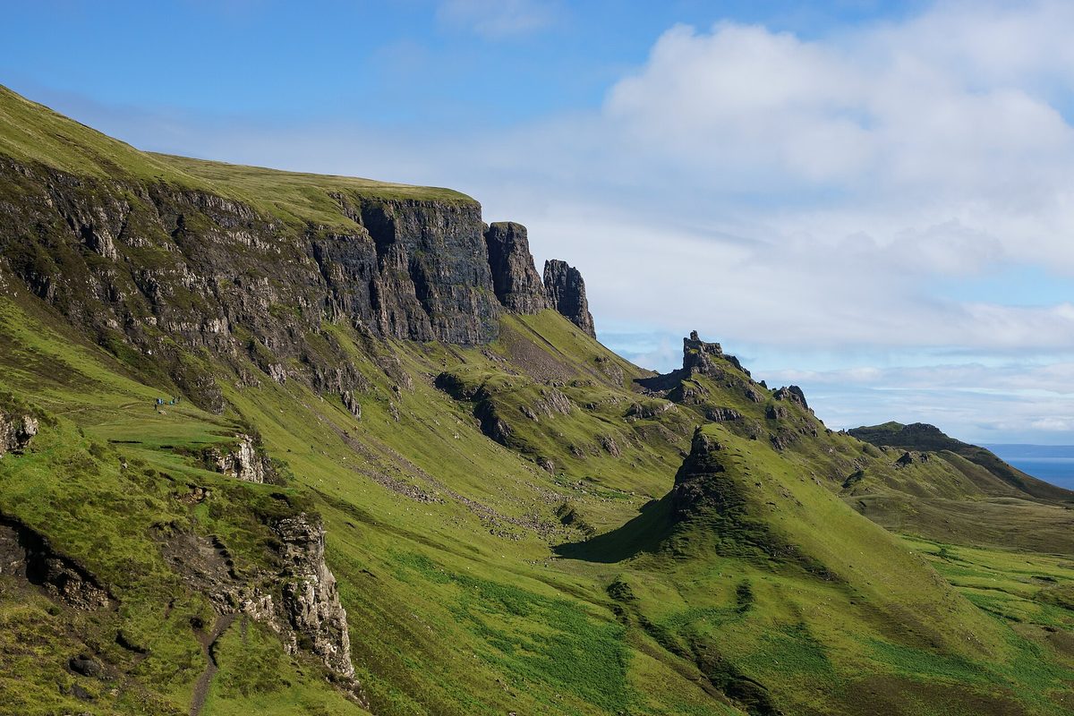
Make me pick one place on Skye and it is this. The Quiraing is the northern, most chaotic end of the Trotternish landslip: a wall of cliffs concealing a plateau, a pinnacle called the Needle and a flat green shelf called the Table. The single-track road up from Staffin climbs hard, and the view from the top over Staffin Bay to the mainland mountains repays the drive even if you never leave the car park.
Highland Council runs the main car park, all 40 spaces of it, and charges — roughly £3 for three hours or £6 for six, between 8am and 8pm at the time of writing. Forty spaces for one of Scotland’s most photographed landscapes; you can see the problem. The full circuit is about 6.8km (four miles) and takes about two hours of walking, longer with photo stops, with some exposure along the way, but the first 20 minutes of path gives you most of the drama. Our Quiraing walk guide covers the loop, the shortcuts and the eroding sections.
Duntulm, Kilmuir and the top of the island
Come down off the pass and the road rounds the northern tip past Duntulm Castle, a MacDonald stronghold now largely fallen into the sea and fenced off — two minutes from the layby is plenty. A couple of miles on, the Skye Museum of Island Life is a row of thatched blackhouses showing crofting life as it was into the twentieth century, with Flora MacDonald’s grave in the churchyard above.
Twenty minutes and a few pounds, and it does something no viewpoint can: it explains why the landscape is so empty. Stop if the Clearances interest you at all. Drop this stretch if you are chasing daylight.
Uig and the Fairy Glen
Uig sits in a horseshoe bay and is where the ferries leave for Harris and North Uist — useful to know if you are threading Skye into a longer run through the Scottish islands. Above the village, a mile up a side road, the Fairy Glen is a cluster of grassy cones and rock outcrops that look like a landscape at one-third scale.
Genuinely odd, and worth half an hour. Two warnings: parking is limited, so use the car park or the marked roadside overflow spaces; and do not add stones to the spirals people have built there, which damages the ground and leaves volunteers to clear them away. Take the photo, leave the rocks.
Duirinish and Waternish: the long west
West of Dunvegan the island splits into two more fingers, Duirinish and Waternish, both reached off the A850. This is where the driving starts to hurt, because the good things sit at the far end of long single-track roads.
The efficient version is a straight out-and-back from Portree: castle in the morning, Coral Beach or Waternish at lunchtime, Neist Point for late afternoon. Roughly three hours of driving, and worth every minute.
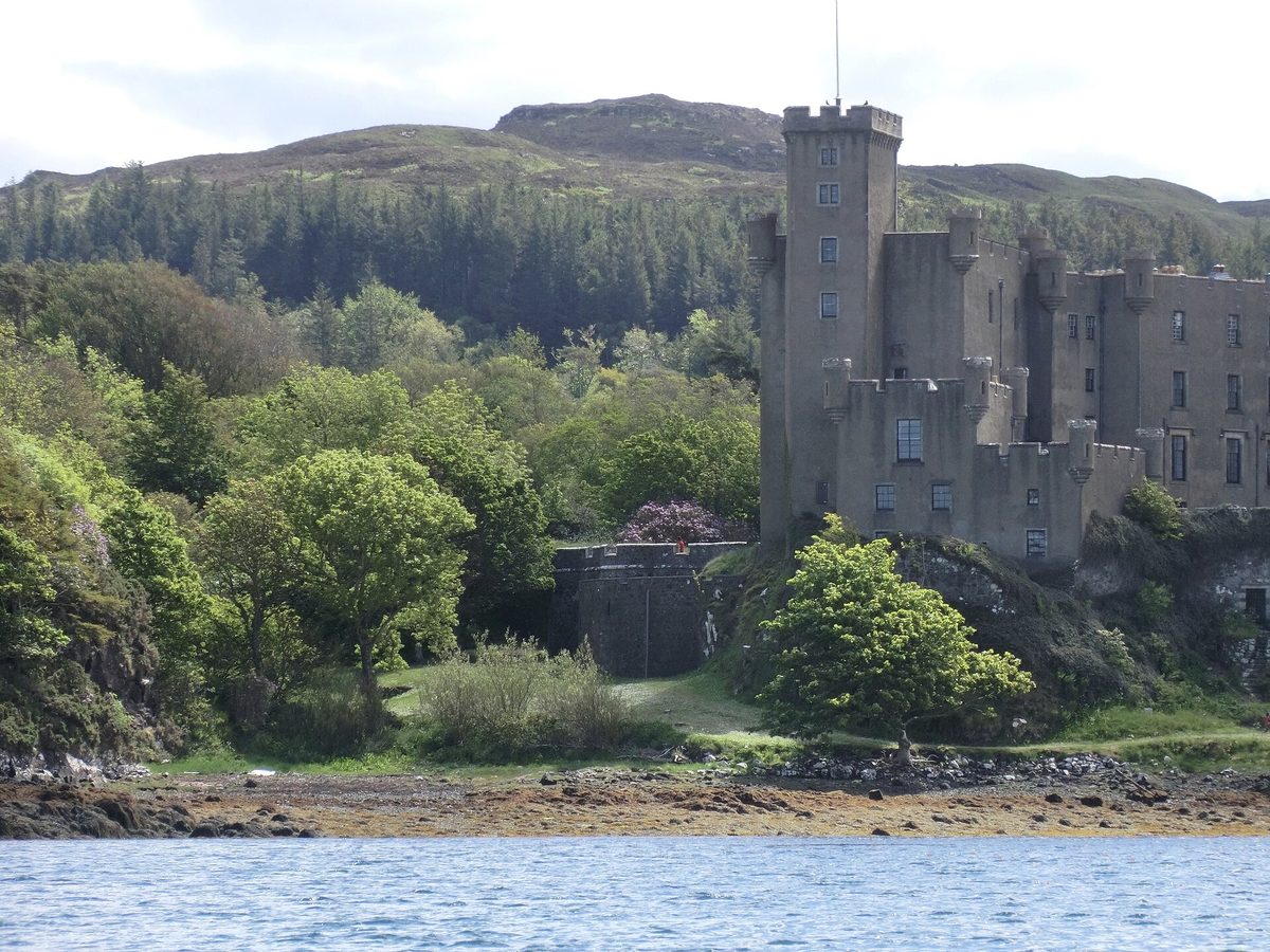
Dunvegan Castle
Seat of the Chiefs of MacLeod, lived in for some 800 years, on a rock above Loch Dunvegan with five acres of gardens behind it. The gardens are the better half — sheltered, unexpectedly lush, and a good place to be when the weather is grim.
Tickets run to the mid-teens of pounds for castle and gardens at the time of writing, and the castle usually shuts for winter from around late October to Easter, so check before driving out. Seal trips leave the jetty in season and take about half an hour. Our guide to the best castles in Scotland puts Dunvegan alongside the mainland heavyweights.
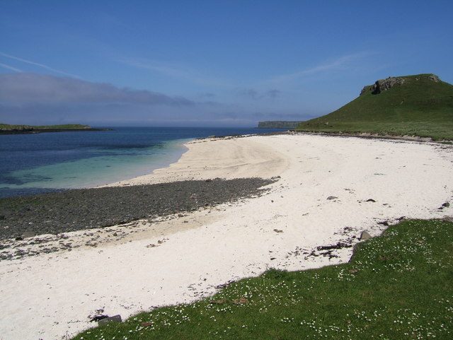
Coral Beach at Claigan
North of Dunvegan on single track to the car park at Claigan, then a short, flat walk through a couple of gates, and you come out on a bay of bleached white maerl — calcified seaweed, not coral — that turns the water an improbable turquoise in sun. In cloud it is a grey beach. In sun it looks Caribbean, though the water stays cold.
The walk is easy and often muddy, so bring boots rather than trainers. It slots neatly between the castle and Neist, and there are more like it scattered round the country in our round-up of the best beaches in Scotland.
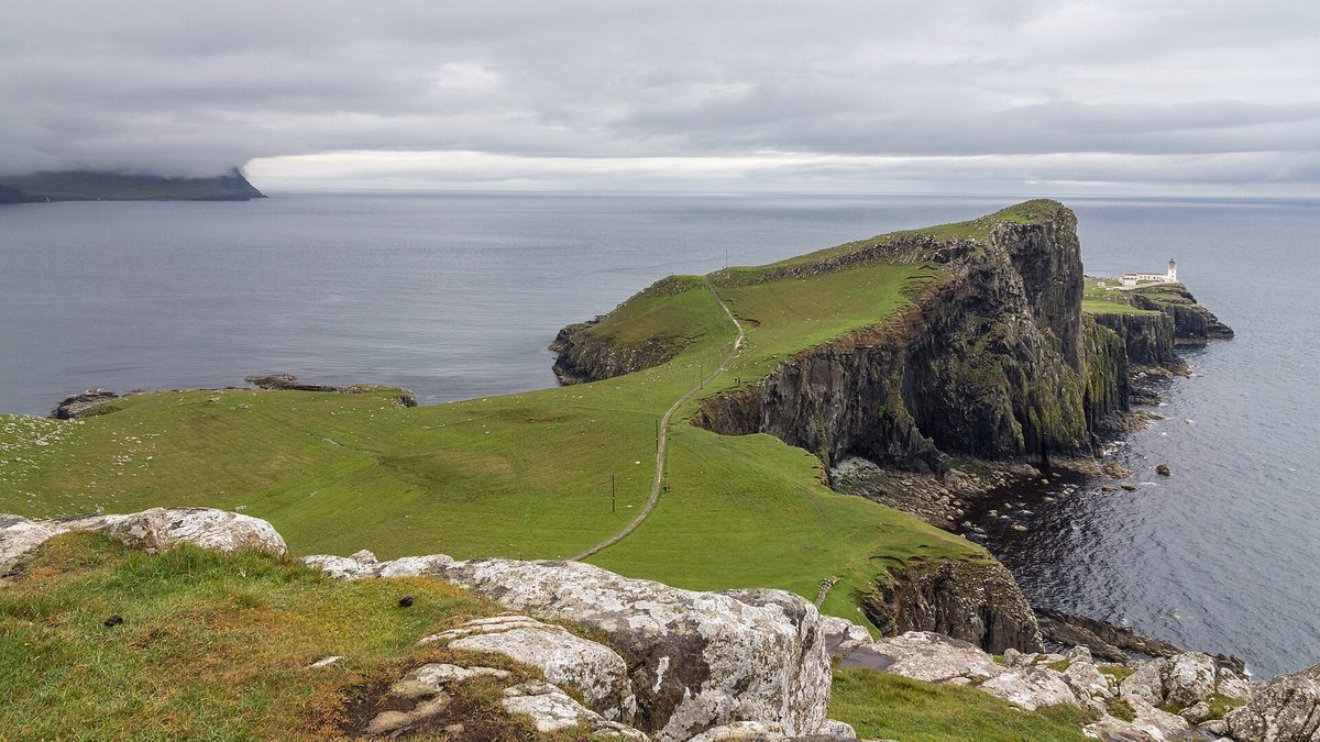
Neist Point
Skye’s westernmost point is a hammer-headed promontory with a lighthouse at the end and the Outer Hebrides on the horizon. The path down is steep and concreted in places, starting with steps you will feel on the way back up. Twenty-five minutes to the lighthouse, thirty-five to return.
Two honest notes. The road out from Dunvegan runs about 11 miles by way of Glendale, and it is slow going. And the worst hour to be on it is the one either side of sunset, when the whole island has had the same idea and two streams of cars meet head-on in the dark. If you want that sunset, arrive 90 minutes early and be relaxed about the crawl back out.
Waternish: Stein, Trumpan and the road that ends
Most itineraries skip Waternish, and I understand why — it has no single headline sight. What it has is Stein: a row of whitewashed cottages along the shore, dating from the late eighteenth century onwards, with a very good seafood restaurant and the oldest inn on the island. At the road’s end sits Trumpan Church, a roofless ruin with a grim clan massacre attached to it and a view north to the Outer Hebrides.
Add it to your Duirinish day when the tops are in cloud, or when you want lunch somewhere that is not a queue. Book the restaurant weeks ahead in summer; it is small and it fills.
Minginish: the Cuillin, the Fairy Pools and Talisker
Minginish is the wedge between Loch Harport and the Black Cuillin, where Skye stops being scenic and turns serious. The Cuillin ridge is the hardest mountain terrain in Britain — gabbro that shreds boots and sends compasses spinning — and it looms over everything on this side of the island.
Everything here hangs off the A863 and the B8009 through Carbost, and the Fairy Pools are about 35 minutes from Portree before any hold-ups. A half day if you keep moving, a full one if you walk.
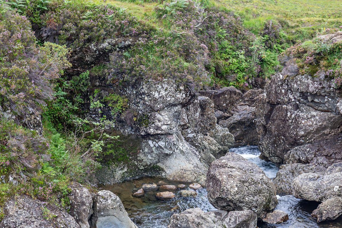
The Fairy Pools
A chain of clear pools and small falls on the Allt Coir’ a’ Mhadaidh, running down from the Cuillin into Glen Brittle. The walk to the first waterfall is about 20 minutes on a well-made path from the car park, then as far up the burn as you fancy.
Let me be straight about this one. The Fairy Pools are pretty rather than spectacular, and they photograph far better than they look, especially in the low water of a dry August. The managed car park charges around £8 at the time of writing, money that goes into paths and toilets, and it fills by mid-morning in season. At eight, with the light coming down the glen, it is lovely; at noon in July you are queuing to photograph a stream. Our Fairy Pools guide covers parking, swimming and the timings that make it worthwhile.
Glen Brittle and the Cuillin
Carry on past the Fairy Pools car park and the single-track road drops to Glen Brittle campsite and a beach at the foot of the mountains. It is the trailhead for Coire Lagan, a rough four-hour return walk to a lochan in a rock bowl beneath Sgurr Alasdair, and for Eas Mor, a waterfall that outshines its famous neighbour.
The ridge itself is not a hiking proposition for most visitors. Several Cuillin Munros need scrambling ability and the Inaccessible Pinnacle needs a rope. For a summit without technical climbing, Bruach na Frithe is the usual choice — or hire one of the guides based at Sligachan and Glen Brittle. Our overview of hiking in Scotland shows where Skye’s mountains sit on the scale of difficulty.
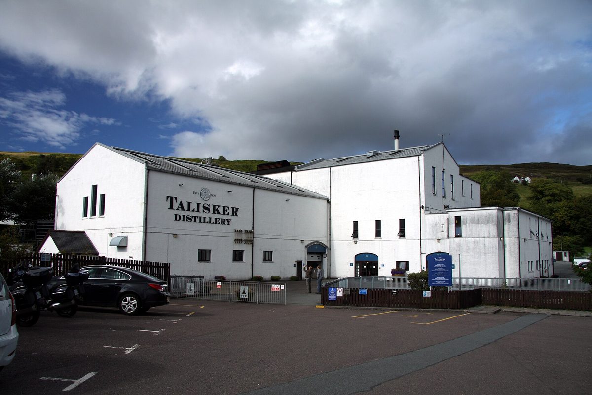
Talisker Distillery and Carbost
Talisker has been making whisky on the shore of Loch Harport since 1830. Tours run most of the year, take about an hour and need booking ahead in season. The whisky is peaty and peppery and tastes of the place, which is more than a lot of distillery visits manage. Torabhaig down in Sleat, open since 2017, is the fallback when Talisker sells out.
Both appear in our guide to Scotch whisky distilleries. Say at the start who is driving — either place will hand over a dram to take away.
Sligachan
Not a village so much as a junction with a hotel, a campsite and an old stone bridge, at the point where the Red Cuillin and the Black Cuillin face each other across a glen. You will pass through it repeatedly, because the A87 and A863 meet here.
Stop at least once. The old bridge with Sgurr nan Gillean behind it is one of the great views in Scotland, and it is a short walk from the road. The hotel serves food all day and keeps a long whisky list, and there is a mountain rescue base next door, which tells you something about the hills above.
Broadford and Elgol: the half day that earns its keep
Most itineraries either skip this corner or bolt it on badly. The Strathaird peninsula, running south-west from Broadford to Elgol on the B8083, is crossed by a single-track road that takes about 45 minutes each way. Add the boat and you have spent most of a day.
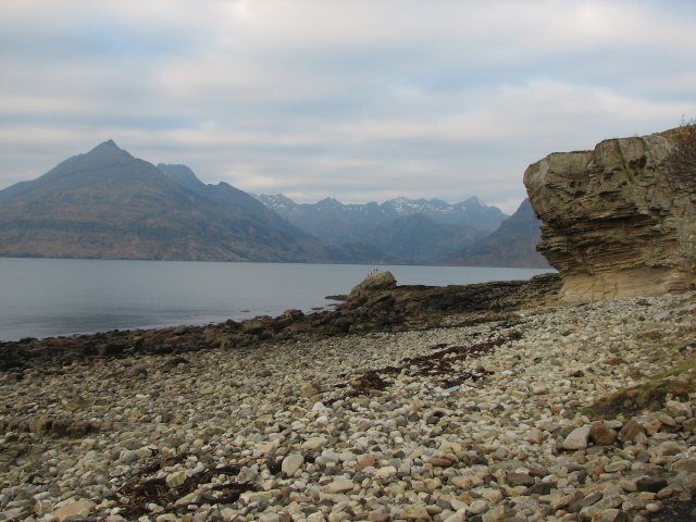
Do it anyway, at least once. The view from Elgol across Loch Scavaig to the Cuillin is the best view on Skye and one of the best in Britain: the whole black ridge rising straight out of the sea, no foreground, nothing in the way. It does not disappoint in the flesh, which is unusual.
The road to Elgol
Leaving Broadford, the B8083 runs along Loch Slapin past the marble quarry at Torrin with Blaven filling the windscreen, then climbs and drops through crofting townships to the pier at Elgol. Single track for most of its length, with plenty of passing places, and one of the genuinely enjoyable drives in Scotland if you are not in a hurry.
Parking at Elgol is limited to a small pay-and-display area near the pier. The village is a working crofting and fishing community, so keep gates and turning areas clear. The shingle beach where the classic photograph is taken is five minutes’ walk below the pier.
Boats to Loch Coruisk
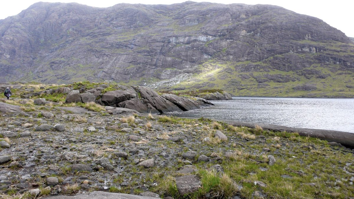
Give Elgol a full day and the boat is why. A handful of operators run from the pier into Loch Scavaig and put you ashore for an hour beside Loch Coruisk, a freshwater loch held in the middle of the Cuillin horseshoe and reachable no other way but a long rough walk.
Bella Jane’s standard return trip from Elgol takes about three hours, with seals on the way out and about an hour and a half ashore at Loch Coruisk. It sails from April to the end of October, depend on the weather, and book out days ahead in summer — reckon on somewhere around £30 to £40 a head at the time of writing. If the forecast is marginal, ring the operator in the morning rather than driving out on spec.
Broadford, Torrin and the corner nobody stops in
Broadford is Skye’s second settlement and the place most people drive straight through. It has a Co-op supermarket, a petrol station and a bay to stretch your legs on.
The road along Loch Slapin to Torrin gives you Blaven from every angle. Blaven itself — Bla Bheinn, if you prefer — is the one Cuillin Munro a fit hill-walker can manage without scrambling: a hard five to six hours return from the Loch Slapin car park.
Sleat: the peninsula everyone drives past
Sleat is the long southern arm of the island, sometimes called the Garden of Skye because it is greener and more wooded than anywhere else. The A851 runs down its spine from Broadford to Armadale, where the castle is about 25 minutes from Broadford and two minutes from the ferry landing.
Nobody plans a day here. But arrive or leave via the Mallaig ferry and Sleat costs you nothing extra, which changes the calculation entirely.
Armadale and the ferry connection
Armadale Castle is a ruin, but the estate around it holds gardens, woodland trails and a museum telling the story of Clan Donald and the Lordship of the Isles. A good two hours in bad weather, and it sits beside the ferry slip, which makes it the obvious way to fill the gap before a sailing.
The CalMac ferry between Armadale and Mallaig sails several times a day through the summer season and thins out sharply in winter. Book a vehicle space ahead — it does sell out — and check the current timetable rather than a guidebook, because sailings shift through the year. The full picture on bridges, ferries, trains and buses is in our guide to how to get to the Isle of Skye.
The Tarskavaig back road, and Point of Sleat
Halfway down the peninsula a single-track loop peels west through Tarskavaig and Ord. From the beach at Ord you get another view of the Cuillin, this time across Loch Eishort. The loop is slow, narrow going and worth every minute of it. Dunscaith Castle, a fragment of ruin on a sea stack near Tokavaig, sits along the way; the setting is better than the scramble to reach it.
For a proper walk, drive to the road end at Aird of Sleat and head for Point of Sleat: about five miles return over rough moorland, two and a half to three hours, finishing at a small lighthouse and a beach you will probably have to yourself. It is the day for people on a second visit who have done the famous things.
The itineraries: combining peninsulas that share a road
Each plan groups clusters that connect without doubling back, and each assumes you are sleeping on Skye rather than driving in from the mainland that morning. If you are not staying on the island, subtract two hours from every day.
One day on Skye: Trotternish, and nothing else
One day means one peninsula, and I will not pretend otherwise. Any itinerary promising the Fairy Pools, the Quiraing and Neist Point in a single day is selling you a driving tour.
Pick Trotternish. Highest concentration of good things per mile on the island, a loop that returns you to Portree without retracing, and stops ranging from two-minute viewpoints to a three-hour walk, so you can flex as the day goes.
- 08:00 — Leave Portree north on the A855. Old Man of Storr car park in about 12 minutes on a clear road, before the coaches.
- 08:15–10:00 — Walk up to the Storr and back.
- 10:15–11:00 — Lealt Falls, then Kilt Rock and Mealt Falls. Ten minutes at each.
- 11:15 — Coffee or an early lunch in Staffin, then up the single-track road to the Quiraing.
- 11:45–13:30 — The Quiraing. Either the first section of path out and back, or the full circuit if you have the legs and the weather.
- 13:45–15:00 — Over the pass and round the top: Duntulm, the Skye Museum of Island Life, Kilmuir.
- 15:15–16:15 — Uig and the Fairy Glen.
- 16:45 — Back in Portree on the A87. Dinner, and a walk round the harbour.
That is a full, satisfying day with about two hours of driving in it. If the cloud is down on the ridge and the Storr is invisible, flip the plan: go west to Dunvegan and Neist instead, where the interest is at sea level.
Two days on Skye: Trotternish plus Minginish
Keep day one exactly as above and give day two to the centre of the island. Both days start from the A87, Trotternish turning off at Portree onto the A855 and Minginish at Sligachan onto the A863, so you never cross Skye twice.
Day two: out of Portree by eight, Fairy Pools by quarter to nine while the car park is half empty, an hour and a half up the burn. Carbost by half eleven for a Talisker tour and lunch. The afternoon splits by weather — Glen Brittle beach and Eas Mor if it is clear, Dunvegan Castle and its gardens if it is not. Home via Sligachan, stopping at the old bridge in the evening light.
Two days is the shortest trip I would call satisfying: the ridge, the mountains, a distillery and a castle, with about four hours of driving spread across two days instead of crammed into one.
Three days on Skye: the west, or Elgol
Three days is where Skye starts to feel like a place rather than a tick-list. Days one and two stay as above; day three is a genuine fork.
Option A — the west. Dunvegan Castle and gardens, then Coral Beach, lunch at Stein on Waternish and Neist Point for the second half of the afternoon and sunset. Around three hours of driving. Take it if you want variety: a castle, a beach and the best sunset on the island.
Option B — Elgol and Loch Coruisk. South to Broadford, along Loch Slapin past Torrin with Blaven above you, down the B8083 to Elgol for a late-morning boat into Loch Scavaig. About an hour and a half ashore at Coruisk on the standard trip, back by mid-afternoon, then the long slow drive home. Three hours of driving plus the boat.
With settled weather I would take Option B every time — the Elgol boat is the thing people still talk about years later. With an unsettled forecast, take Option A, because the castle and Stein give you somewhere to be when it rains.
Arriving by the Mallaig ferry: the Sleat variation
Come in on the Armadale ferry rather than over the bridge and the whole shape changes. Your arrival day becomes a Sleat day: Armadale Castle and gardens, the Tarskavaig and Ord loop, perhaps Torabhaig, then north up the A851 to Broadford and on to your base.
It works in reverse too. Drive Sleat slowly on your last morning, take an afternoon sailing to Mallaig and continue down the Road to the Isles — no backtrack to the bridge, and Sleat finally gets the half day it deserves.
Three days without a car
Harder, but not impossible. Buses link Kyle of Lochalsh, Broadford, Portree, Uig, Dunvegan and Armadale, with a limited service round Trotternish and a summer loop aimed at visitors. Frequencies are low and Sundays are thin, so read the timetable the night before rather than turning up hopefully.
The realistic version: base in Portree, use buses for Trotternish and Dunvegan, and buy a day tour for the Cuillin and Elgol side, which the buses do not usefully serve. Our guides to organised tours in Scotland and to building a Scotland itinerary without a car cover the practicalities.
Planning practicalities
Getting to Skye is the easy part: the bridge from Kyle of Lochalsh is free and open all year, the CalMac ferry from Mallaig lands at Armadale, and the seasonal turntable ferry from Glenelg crosses to Kylerhea between April and mid-October. Allow around five hours’ driving from Edinburgh or Glasgow, two and a half from Inverness.
Where to base yourself
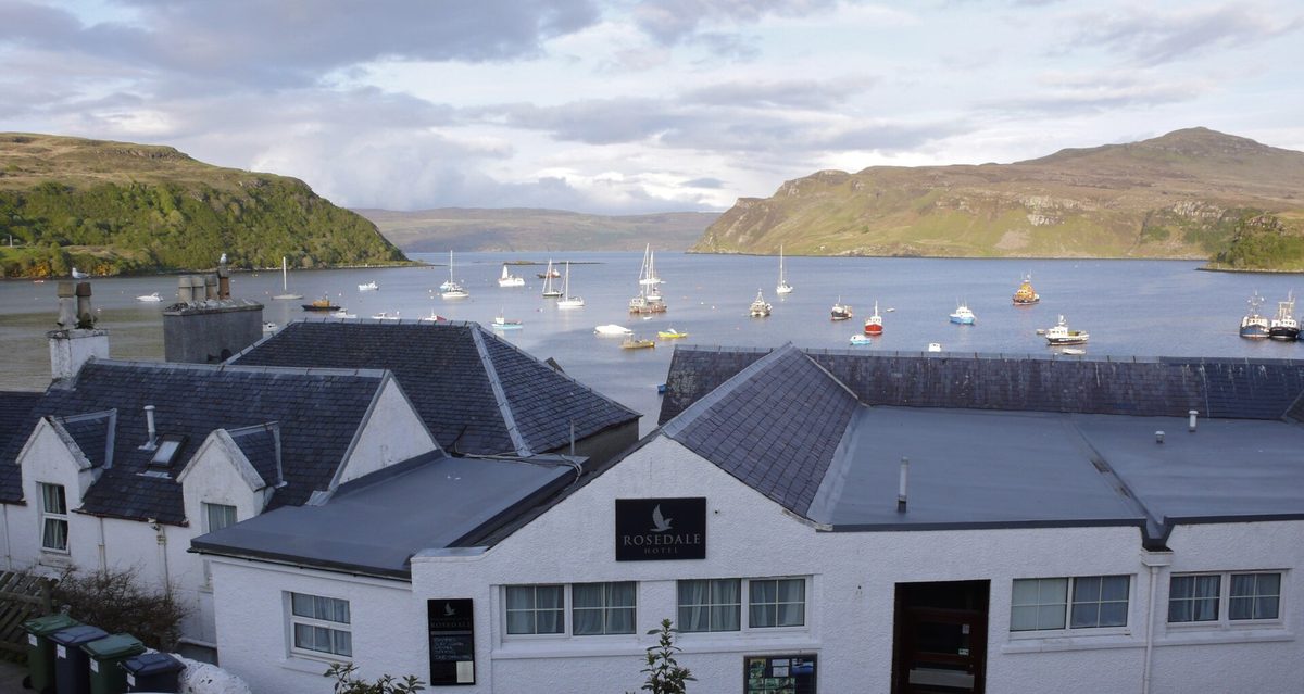
Portree, for a first trip. It has a good range of restaurants, pubs and cafes, it sits in the middle of the road network, and every cluster in the table above works from it. The trade-off is price, and the fact that it books out first.
Broadford is the sensible alternative: cheaper, about 30 minutes further from Trotternish, much closer to Elgol and about 15 minutes from the bridge. Dunvegan or Carbost suit a west-coast or mountain trip. Staying over on the mainland at Kyle of Lochalsh saves money but costs an hour of driving a day — on a two-day trip, a whole afternoon. Our comparison of the best base towns in the Highlands weighs Portree and Broadford against the mainland options.
Book early either way. July and August accommodation goes months ahead and prices climb as summer approaches.
What to book, and how far ahead
- Accommodation: three to six months for July and August, six weeks for the shoulder months.
- Elgol boat trips: several days ahead in summer, and reconfirm on the morning.
- Talisker tours: a week or two ahead in season.
- Dinner in Portree or Stein: yes, actually book. Turning up at seven in August is optimistic.
- CalMac ferries with a car: as soon as you know your dates.
- Nothing else. Car parks cannot be reserved; you just have to be early.
Fuel, food and phone signal
Fill up in Portree or Broadford. Fuel elsewhere on the island is limited, so do not set off round Trotternish on a quarter of a tank.
Signal is patchy to non-existent in Glen Brittle, on the Elgol road and along much of west Trotternish, so download offline maps before you set out. Carry food and water rather than assuming a cafe will appear: outside Portree, Broadford, Dunvegan and Carbost the gaps are long, and plenty of places close early in the shoulder season.
Season by season: midges, daylight and the shoulder months
Season changes a Skye itinerary more than anything else, because it changes how many hours you have and how pleasant it is to stand still.
June, July and August
Close to 18 hours of daylight around midsummer, with a twilight that never fully darkens, so a three-day plan can absorb an extra stop each evening. It also means full car parks from mid-morning, expensive rooms and a steady stream of motorhomes on the single track.
And the midges. From about the start of June into September the Highland midge is active — worst at dawn and dusk, in still damp air, near water and bracken. They will not touch you on a breezy clifftop; they will make Glen Brittle at 8pm genuinely unpleasant. Repellent and a head net costing a couple of pounds solve most of it. Our guide to Scotland’s midge season runs through the timings and what actually works.
September and October
My favourite window. Crowds thin from the second week of September, midges fade after the first cold nights, the light goes low and gold, prices drop, and the bracken turns rust-orange along the whole Trotternish ridge. You still have about 14 hours of daylight at the start of September, falling to about ten and a half by mid-October.
The catch: it gets wetter and windier as autumn goes on, and seasonal businesses — boat trips, Dunvegan Castle, the Glenelg ferry — wind down through October, so check individual dates. Our guide to the best time to visit Scotland compares the trade-offs country-wide.
November to February
People underestimate winter in both directions. Skye can be extraordinary then — snow on the Cuillin, empty car parks, big skies — or four days of horizontal rain in which you see nothing at all.
The hard limit is daylight. Portree’s shortest day gives you under seven hours: the sun up around nine, gone before four in the darkest fortnight of December. That halves a winter itinerary. One cluster a day, no exceptions, and no evening driving on unfamiliar single track unless you are comfortable with it. Ice is a real factor on the Quiraing pass and the Elgol road, gritted late or not at all. Check Scotland’s weather month by month, and hold a plan B for every day.
April and May
My other good window. Late spring and early summer are normally the driest part of the year in the north of Scotland, midges have not started in earnest, daylight is already long and the seasonal places are opening up, so check the dates for the ones you want. It is the month I would pick if I could only go once.
When the weather closes in: a wet-day plan
Assume that on a three-day trip, one day will be wet enough to change your plans. That is why a rigid hour-by-hour itinerary is the wrong tool for this island.
The distinction that matters is rain versus cloud. Rain is survivable: you get wet, the waterfalls improve, the light does interesting things. Low cloud is the killer, because the Storr, the Quiraing and the Cuillin simply vanish and you drive to a car park to look at fog. If the ridge is in cloud at nine in the morning, swap the day.
Things that work in bad weather
- Dunvegan Castle — the one substantial indoor attraction on the island, with the gardens sheltered by trees.
- Talisker or Torabhaig — an hour indoors, a dram at the end, and the drive to Carbost is pleasant in rain.
- The Skye Museum of Island Life and the Staffin Dinosaur Museum — small, cheap and genuinely interesting.
- Portree — the harbour, a bookshop and a long lunch. Not exciting, but civilised.
- Coastal drives — Elgol, Waternish and the Sleat back road are all at sea level and stay visible when the tops do not.
- Raasay — the ferry from Sconser takes about 25 minutes and the island has a distillery, a hotel and a good short walk. A proper wet-day escape.
Things that improve in rain
Oddly, the Fairy Pools — in spate the falls double in volume and the whole burn roars. Lealt and Mealt likewise. And the drive over the Quiraing pass in blowing cloud, the road appearing and disappearing in front of you, is a memory in its own right even if you never see the view.
What underwhelms, and the mistakes I see most
A guide that likes everything equally is not much use, so:
The things that do not live up to the photographs
The Fairy Pools are the main offender: a pleasant riverside walk, not a wonder, and the gap between the long-exposure photographs and a queue on a grey Tuesday is wider here than anywhere else on Skye. Go early or do not bother.
Dunvegan Castle’s interior is a modest run of rooms for the ticket price; the gardens are the reason to go. Duntulm Castle is barely a ruin at all now, a fenced-off fragment you look at for two minutes. And Neist Point at sunset in August has become an event rather than a viewpoint — the headland is lovely, the car park at 8pm is not. Go in the morning if you value quiet over light.
The mistakes
Day-tripping from Inverness or Fort William. Well over two hours each way from Inverness, around three from Fort William, on roads that do not reward hurrying. You will get the Storr car park and a photo stop. If a day trip is all you have, take a coach tour and let someone else drive.
Trusting sat-nav timings. Allow extra time. Every time.
Booking the bed before the plan. Two nights in Broadford and three Trotternish days means 80 minutes of driving before each morning starts.
Parking on verges. It damages peat, blocks the road for farm and emergency traffic, and now earns penalty notices at the busy sites. If the car park is full, drive on and come back.
Underestimating the Cuillin. Not walk-up hills. Do Coire Lagan, admire the rest from below, or hire a guide.
Cramming Skye into a five-day trip that also takes in Edinburgh and Loch Ness. It is a long way from everywhere. Our broader Scotland itinerary planner shows how many days you realistically need before adding islands.
Frequently asked questions
Is 3 days on the Isle of Skye enough?
Yes, for the main sights. Three days covers Trotternish, the Minginish side with the Fairy Pools and Talisker, and then either the west coast or Elgol, without more than about two hours a day driving. A fourth day adds Sleat or a second walk.
Can you see the Isle of Skye in one day?
You can see one part of it well. Trotternish is the answer: the Old Man of Storr, Kilt Rock, the Quiraing and the Fairy Glen in a single loop from Portree. Trying to add the Fairy Pools or Neist Point on the same day means most of the day at the wheel and very little time outside the car.
What is the best base for an Isle of Skye itinerary?
Portree, for a first visit. It is central, has a good range of places to eat, and puts the Old Man of Storr about 12 minutes away by car. Broadford is cheaper and better placed for Elgol and the bridge but adds roughly 30 minutes each way to every northern day. Book either one months ahead for summer.
Do you need a car on the Isle of Skye?
It makes an enormous difference. Buses connect the main villages and there is a seasonal Trotternish service, but frequencies are low and the best places — Elgol, Glen Brittle, Neist Point — are barely served. Without a car, base in Portree, use buses for Trotternish, and book a day tour for the rest.
What is the best month to visit the Isle of Skye?
May or September. May falls in the driest part of the year, midges have not properly started and daylight is long. September brings autumn colour, thinner crowds and lower prices, with midges tailing off after the first cold nights. The longest days come around the June solstice; July and August are still long and light, and they are peak midge season.
How long does the Trotternish loop take?
The pure driving time is not the useful number. With the Storr walk, Kilt Rock, a couple of hours at the Quiraing, the Fairy Glen and lunch, it fills a comfortable eight- to nine-hour day. Drive it anti-clockwise from Portree for better light and fewer coaches.
Is the Elgol boat trip to Loch Coruisk worth it?
If the weather is decent, it is the best few hours on Skye. Boats run from Elgol pier; on Bella Jane’s standard return trip, which sails from April to the end of October and lasts about three hours, you get an hour and a half ashore beside a loch you cannot otherwise reach without a long rough walk. Budget most of a day for it, and book ahead.
Do I need to pay for parking on Skye?
At the popular sites, yes. The Old Man of Storr, the Quiraing and the Fairy Pools all charge, typically in the region of £3 to £8 depending on how long you stay, payable by card, cash or app. The money goes into path repair and toilets. Roadside verge parking is not an alternative and can now earn you a penalty notice.
Final thoughts
The best Skye trips often include almost no new sights: a long morning at the Quiraing with the cloud coming and going, an afternoon abandoned to rain in a pub in Stein, a boat out of Elgol on a flat calm day. As a list it would look unimpressive.
Which is the argument of this whole guide. Skye rewards depth over distance, and the way to get depth is to stop crossing the island. Pick your peninsula, give it the day it deserves, and make the drive between clusters a decision you take once rather than four times. Do that and you come home having been somewhere, rather than having driven past it.
If your itinerary has a spare evening, spend it in the far west: our guide to Neist Point explains the drive out past Glendale and the timing that makes it worthwhile. And if you are still fixing dates, the best time to visit Skye comes down to four measurable things rather than the usual seasonal platitudes.
About the author: This guide was written and is maintained by the ScotlandTourism.org editorial team — travel writers who’ve spent years exploring Scotland’s cities, Highlands and islands, from bagging Munros to chasing the perfect dram. We update our guides regularly to keep prices, opening details and advice current.
Last updated: September 2026. Prices and opening times change — always check the official site before you travel.
Photo credits
All images are used under their respective Creative Commons or public-domain licenses:
- Old man of storr — Jörn Albring, Public domain, via Wikimedia Commons
- Trotternish road — Simon Johnston, CC BY-SA 2.0, via Wikimedia Commons
- Quiraing b — Colin, CC BY-SA 4.0, via Wikimedia Commons
- Kilt rock — Colin, CC BY-SA 4.0, via Wikimedia Commons
- Portree b — Anthony O’Neil, CC BY-SA 2.0, via Wikimedia Commons
- Dunvegan castle — Lobster1, CC BY-SA 3.0, via Wikimedia Commons
- Neist point — JoachimKohler-HB, CC BY-SA 4.0, via Wikimedia Commons
- Coral beach — F Leask, CC BY-SA 2.0, via Wikimedia Commons
- Fairy pools — Balon Greyjoy, CC BY-SA 3.0, via Wikimedia Commons
- Talisker — Chmee2, CC BY-SA 3.0, via Wikimedia Commons
- Elgol — Callum Black, CC BY-SA 2.0, via Wikimedia Commons
- Coruisk c — Anthony O’Neil, CC BY-SA 2.0, via Wikimedia Commons