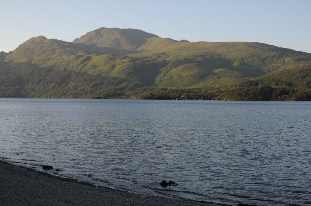
I once stood at the edge of Loch Achray at six in the morning in late October, watching Ben Venue arrive upside down in the water, and I have stood on the same patch of gravel at two in the afternoon in July looking at a grey chop and wondering what the fuss was about. Same loch. Same viewpoint. Completely different day out. That gap between the photograph and the visit is the whole problem with lists of the most beautiful lochs in Scotland.
Almost every guide hands you fifteen names and a paragraph each. Very few tell you where to park, which shore to stand on, how far you walk, or what time of day and year it works. Lochs are not monuments. They are conditions. So this guide is organised around access and light rather than a ranking, and it starts with the vocabulary, because a lot of visitors are quietly confused about what a loch even is.
The short answer
For a first trip, the four that repay the least effort are Loch an Eilein in the Cairngorms, Glencoe Lochan, Loch Lomond from the east shore at Balmaha, and Loch Assynt at Ardvreck Castle. For the most dramatic water in Scotland, it is Loch Coruisk on Skye and Loch Maree in Wester Ross. Go early. Still water is a dawn thing.
The most beautiful lochs in Scotland at a glance
| Loch | Region | Where to stand | Walk from the car | Best conditions |
|---|---|---|---|---|
| Loch an Eilein | Cairngorms | North-east shore, 5 minutes from the car park | 3 miles / 5 km full circuit | Calm early morning; late October for birch colour |
| Glencoe Lochan | Lochaber | The far end of the Lochan Trail, looking back at the Pap of Glencoe | 1 mile / 1.6 km loop, about 30 minutes | Windless dawn or the last hour of light |
| Loch Maree | Wester Ross | A832 laybys near Talladale, looking north-east to Slioch | Roadside, or the Beinn Eighe trails | Morning side-light; September and October |
| Loch Coruisk | Isle of Skye | The outflow slabs, five minutes from the boat landing | Boat from Elgol, or a serious 7-mile walk in | April to October only; a dry, clear day |
| Loch Assynt | Sutherland | Ardvreck Castle promontory, off the A837 | 5 minutes on grass and gravel | Low evening sun from the west; free parking |
| Loch Lomond | Trossachs | Conic Hill above Balmaha | 2 miles return, 1.5–2 hours, steep | Clear afternoons; avoid summer weekends |
| Lochan na h-Achlaise | Rannoch Moor | The A82 laybys on Black Mount | Under a minute | Dawn calm; superb in snow and in autumn |
Loch, lochan, sea loch: the words explained
A loch is simply a lake. The word is Gaelic and it covers both freshwater lakes and long arms of the sea, which is where the confusion starts. No distinction of size or grandeur is built into it: Loch Ness is a loch and so is a puddle in a field with a name on the map.
A lochan is a small loch — the -an ending is a Gaelic diminutive. Glencoe Lochan and Lochan na h-Achlaise both earn it. Nobody polices the boundary.
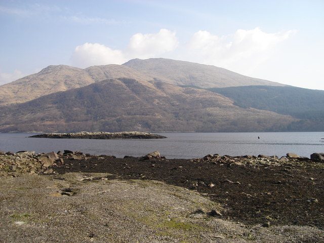
A sea loch is a fjord. It is a glacial valley that the sea flooded when the ice melted, so it is salt water, it has tides, and it usually has a shallow rock sill near its mouth. This is why Loch Long, Loch Etive, Loch Fyne and Loch Linnhe have seaweed on the rocks and a visible tide line. Loch Etive gives the clearest demonstration: at Connel, under the old cantilever bridge on the A828, the tide pours over a rock ledge and produces the Falls of Lora, a tidal rapid that reverses twice a day.
Scotland has essentially one lake, the Lake of Menteith near Aberfoyle, and even that is a linguistic accident rather than a rule — it was once Loch Inchmahome. The handful of other Scottish “lakes” are man-made.
As for why the big ones are all long, narrow and pointing the same way: ice. Glaciers scoured out old river valleys and over-deepened them, which is why Loch Morar reaches over 300 metres deep while sitting almost at sea level. The striking line is the Great Glen Fault, a tear in the crust running north-east to south-west across the country. Loch Ness, Loch Oich, Loch Lochy and Loch Linnhe sit in a dead-straight row along it, which is how the Caledonian Canal joined them up. Look at a map of the Scottish Highlands and that diagonal slash is the first thing you see.
The small perfect ones you can walk round in an hour
These are the ones I send people to first. They are enclosed, human-scale and forgiving of bad weather, because a lochan under cloud still looks like something, whereas a twenty-mile loch under cloud looks like a grey field.
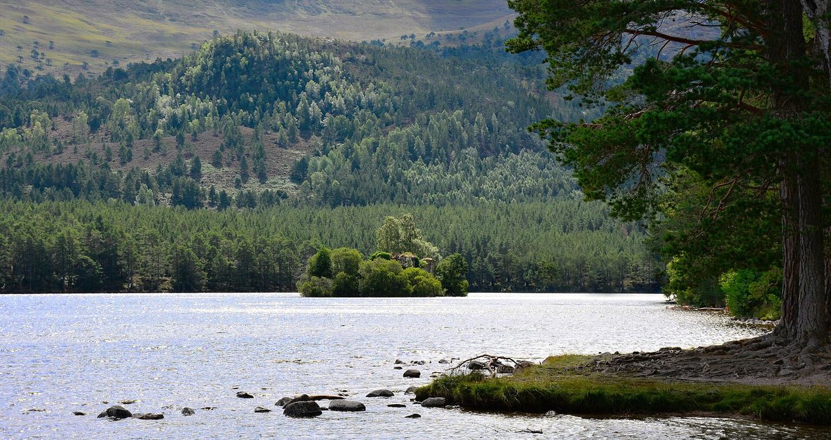
Loch an Eilein, Cairngorms
If I had to pick one, it would be this. A ruined island castle a hundred metres offshore, a full ring of old Caledonian pines, the Rothiemurchus hills behind. The circuit is 3 miles (5 km) on a firm, level path, about an hour and a half at a wandering pace.
The car park is attended and charged — around £5 per car or £2 per person at the time of writing, which funds path maintenance. The access road is single-track and the bridge is unsuitable for motorhomes and coaches. Best view: turn right from the car park and walk five minutes to where the shore opens out, and the castle sits square in the gap with the hills stacked behind. Go at dawn for reflections, and watch for red squirrels and crested tits, which really are common here. It pairs neatly with the rest of the things to do around Aviemore.
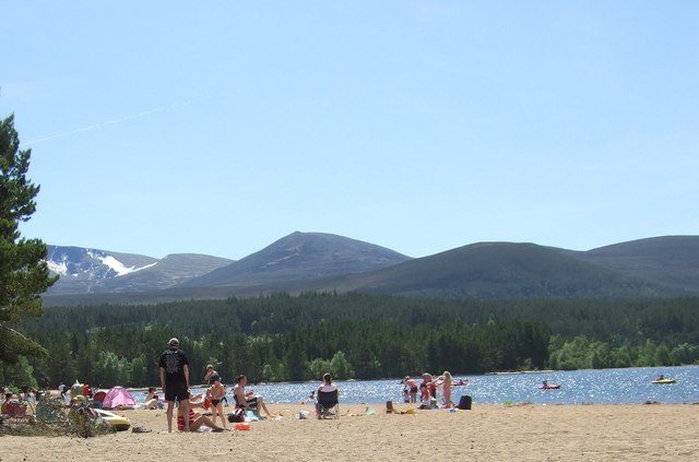
Loch Morlich, Cairngorms
Loch Morlich has a real sandy beach at roughly 340 metres above sea level, one of the highest in Britain, with the Cairngorm plateau rising behind it in a long grey wall. The shore circuit is roughly four miles on forest track and beach.
The beach car park is now enforced pay and display, run with Highland Council, and Forestry and Land Scotland season passes are not valid there — check current charges first. The photograph everyone wants is from the west end of the beach looking east to Cairn Gorm. It works best in the morning, and it works best of all in April, with snow still in the corries and paddleboarders below it.
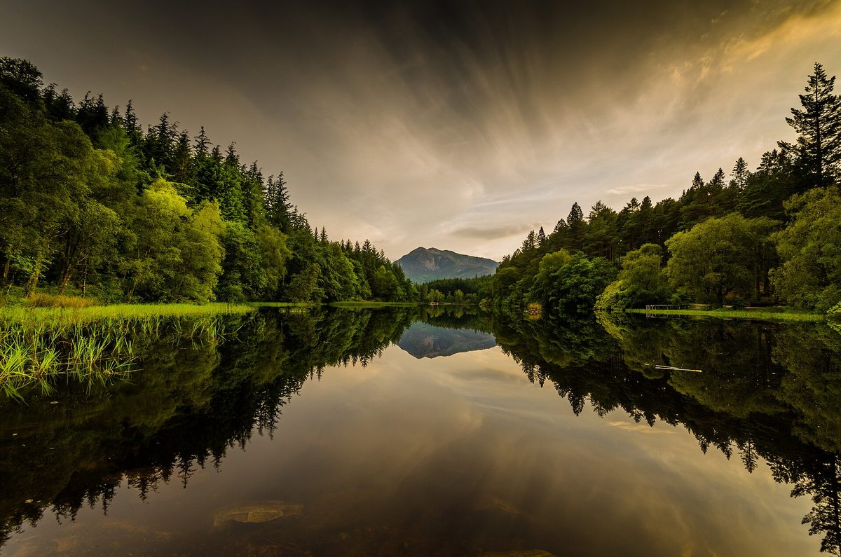
Glencoe Lochan, Lochaber
The most reliable reflection in Scotland, and it is free. Glencoe Lochan sits about 800 metres east of Glencoe village up a signposted single-track road (nearest postcode PH49 4HT). Forestry and Land Scotland run the car park and there is no charge. The all-ability Lochan Trail is 1 mile (1.6 km) on a firm surfaced path and takes half an hour.
The lochan and its conifers were laid out in the 1890s by Lord Strathcona, and the story locally is that he built it to remind his Canadian wife of home. It did not work; she went back anyway. Stand at the north-west corner looking south-east and the Pap of Glencoe drops into the water. Windless mornings before eight are the whole game. It is fifteen minutes from most of the walks and viewpoints in Glencoe.
Loch Ard, Trossachs
Loch Ard sits west of Aberfoyle in Queen Elizabeth Forest Park and gets a fraction of the traffic of Loch Katrine next door. The view is from the minor road along the north shore, looking west with Ben Lomond filling the far end; there are laybys, and you want the one where the reeds come into the water. Come on a summer Saturday, when Loch Lomond is heaving, and you will have a far better time. There is a forest sculpture trail for bored children, and it folds into any day in the Loch Lomond and Trossachs National Park.
The epic set-pieces
These justify a long drive, and most ask something in return — a boat, a rough road, or a full day on your feet.
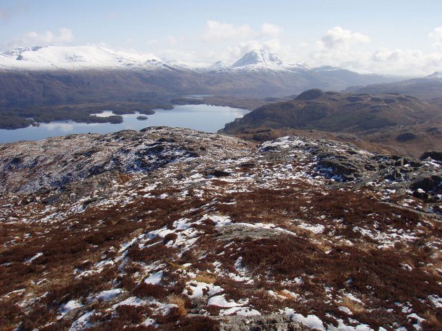
Loch Maree, Wester Ross
The fourth largest freshwater loch in Scotland and, to my eye, the best-composed. Slioch rises straight off the north-east shore in one clean 980-metre lift, the loch is scattered with wooded islands, and the old pinewood of Beinn Eighe frames the lot.
The A832 runs the full length of the loch between Kinlochewe and Gairloch. Drive it eastbound in the morning if you can, because that puts the light on Slioch; the best pull-ins are around Talladale and at the Victoria Falls turning. Beinn Eighe National Nature Reserve is Britain’s oldest, established in 1951, and its visitor centre near Kinlochewe is normally open April to October, 10am to 5pm, free. The two waymarked trails start from a separate lochside car park about two miles further on: the Woodland Trail is about 1.5 km and takes an hour; the Mountain Trail climbs 6.5 km to the Conservation Cairn in three to four hours and lays the whole loch out below you with the Torridon peaks behind. Best-value short mountain walk in the north-west, easily.
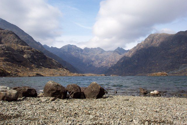
Loch Coruisk, Isle of Skye
Nowhere else in Britain looks like this. Coruisk is a freshwater loch in a bare rock bowl, enclosed by the Black Cuillin ridge, with no road, no building and no phone signal. From the landing stage it is a five-minute scramble to the outflow slabs, where the view is.
Two operators sail from the pier at Elgol at the end of the B8083: Bella Jane and Misty Isle. Sailings run roughly April to October, the standard trip is about three hours with an hour or so ashore, and fares have been in the region of £25 to £30 per adult in recent seasons — check before you go. Book ahead in July and August, and accept that trips are cancelled in swell. The walk-in alternatives are not casual: the path from Sligachan is around 7 miles each way over rough ground, and the coastal route from Elgol includes the Bad Step, a slabby traverse above the sea that stops a lot of people. Take midge repellent either way; the outflow is sheltered and boggy, exactly what they like. There is far more to plan around on Skye, but this is the one I would not miss.
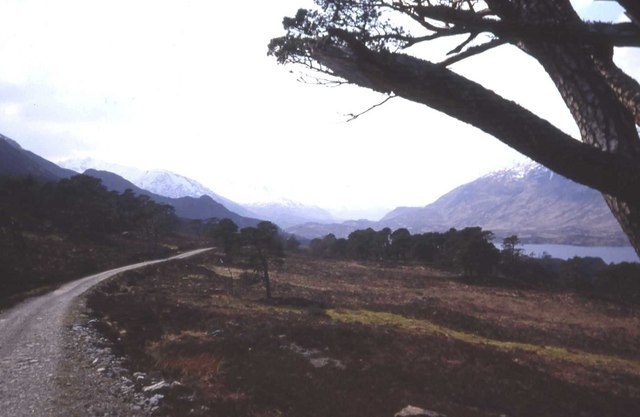
Loch Affric, Glen Affric
Glen Affric is the best surviving fragment of the old Caledonian pine forest, and Loch Affric sits at the head of it under a ring of Munros. A single-track road runs about 10 miles west from Cannich to the River Affric car park at the road end. Forestry and Land Scotland run pay and display in the Glen Affric car parks, with one ticket covering them all for the day — a few pounds, and worth checking the current rate and payment method before you set off.
The full circuit is about 11 miles (18 km) and mostly level, but unbridged burns on the north side turn nasty after heavy rain, so check the forecast and be willing to turn back. With only an hour, walk fifteen minutes west from the car park to where the track lifts above the water and the pines frame the loch. Autumn is the season: gold birch, copper bracken, deer down off the hill. One of the finest days of low-level walking in Scotland.
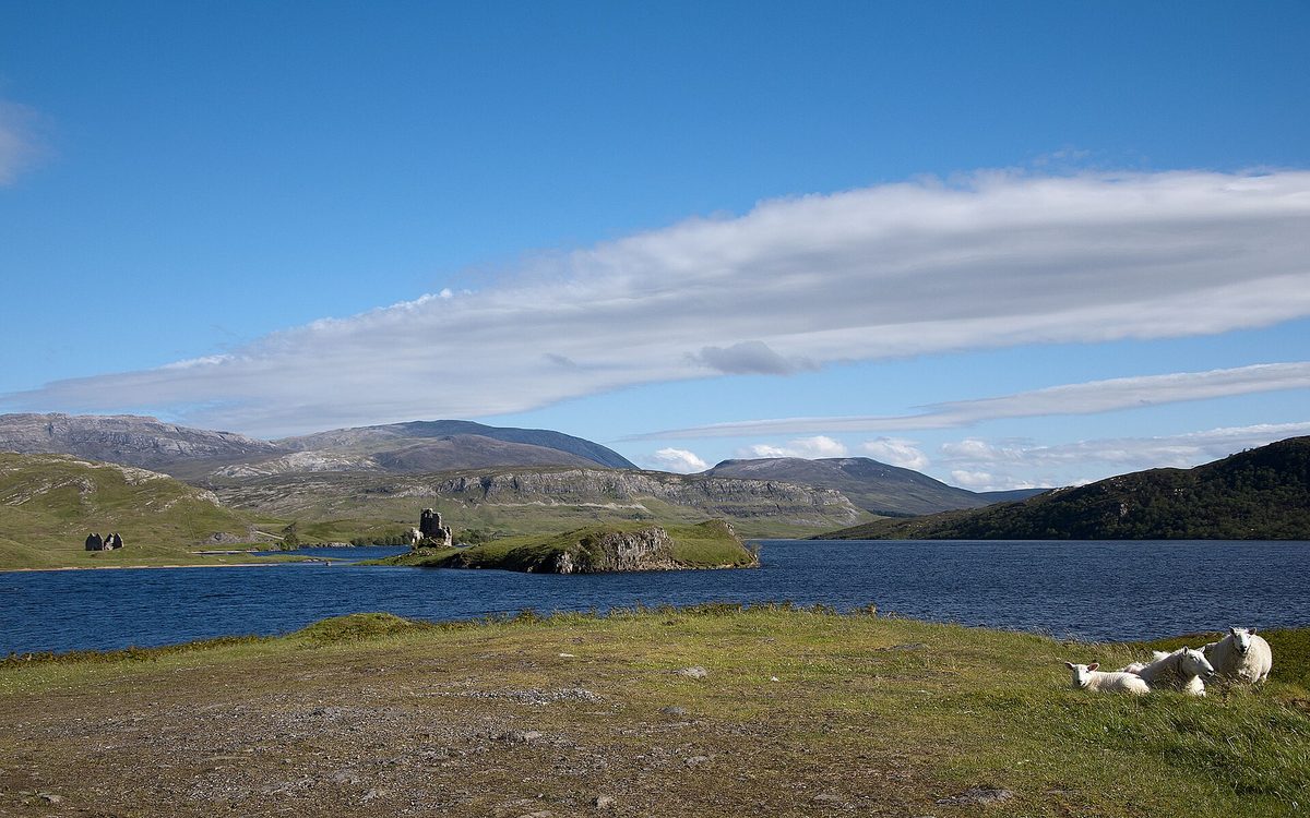
Loch Assynt and Ardvreck Castle, Sutherland
The easiest photograph on this list and one of the best. Ardvreck Castle, a MacLeod stronghold from the late fifteenth century, sits on a low promontory poking into Loch Assynt with the stepped bulk of Quinag behind. There is a free signposted car park directly off the A837 and a five-minute walk over grass to the ruin; the council reworked the laybys along this stretch in 2026, so parking is more orderly than it was.
Go in the evening. Late sun from the west lights the castle and the water while Quinag drops into silhouette; in the morning you shoot into the light and it falls flat. The roofless shell next door is Calda House, burned in the eighteenth century. No ticket office, no fence, no facilities — one of the more atmospheric of Scotland’s castle ruins precisely because nothing has been done to it. The North Coast 500 route runs past the door.
Loch Etive, Argyll
Loch Etive is the sea loch to see, partly because it is beautiful and partly because it shows you what a sea loch is. It runs about 18 miles inland from Connel to the foot of Glen Etive, tidal the whole way, with Ben Cruachan on one flank.
Two ways in. From the south, the minor road at Taynuilt drops to a pier on the shore; boat trips have run from here in season, though operators change, so check locally. From the north, the single-track road down Glen Etive off the A82 ends at a slipway after about 12 miles of superb driving. That road is now badly congested with campervans, the passing places are not laybys, and there is nowhere to turn at the bottom except the slipway — so go early or go elsewhere. Fort William is the obvious base, with plenty else to fill a day in the Fort William area.
The famous ones, and whether they earn it
Loch Lomond — yes, but only from the east
Loch Lomond has a reputation problem caused entirely by the A82, which runs up the western shore through trees and gives you almost no view while you concentrate on not clipping a coach. Drivers do that road, conclude the loch is overrated, and leave.
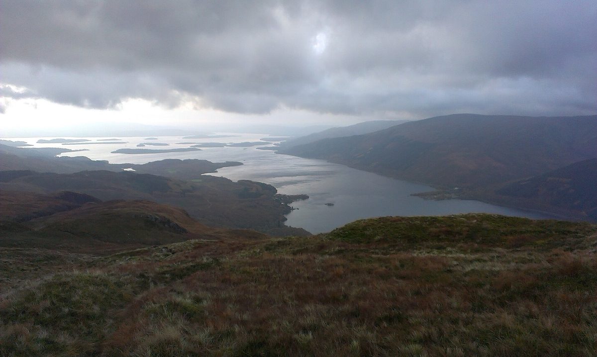
The east shore is a different loch. Drive to Balmaha, park in the village car park, and walk up Conic Hill — about 2 miles return, an hour and a half to two hours, steep and slippery when wet. From the top you get the southern basin, the chain of islands, and one of the clearest bits of geology in Britain: those islands sit on the Highland Boundary Fault, the line where the Lowlands stop and the Highlands begin, and you can trace it across the water with a finger. Go on a weekday. Balmaha on a warm Sunday is chaos.
Loch Ness — honestly, no
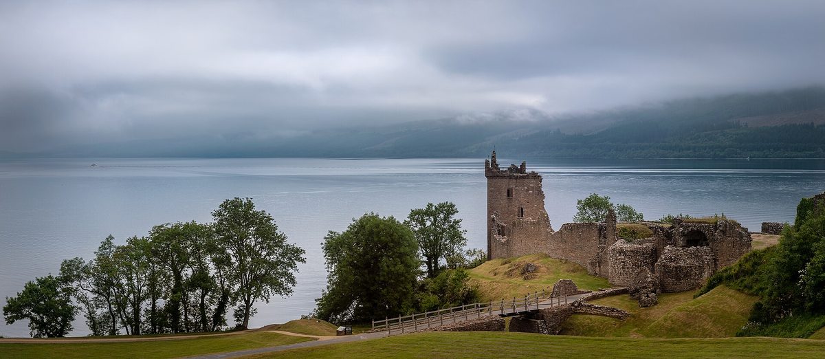
I will take the criticism for this. Loch Ness is a remarkable object: 23 miles long, around 226 metres deep, holding more freshwater than every lake in England and Wales combined. As a view, it is the weakest big loch in the Highlands. The banks are low and thickly wooded, the loch is dead straight, and from the A82 you get long, flat sightlines with nothing to give the eye scale. Its fame is monster-driven rather than scenery-driven, and the visitor operation around it reflects that.
If you are going anyway — and most people do — do it properly. Urquhart Castle is worth the ticket for the position rather than the ruins. The south side on the B862 and B852 is far quieter than the main road, Dores Beach gives you the one classic straight-down-the-loch view, and the Suidhe Viewpoint puts you high enough to see something. Our guide to Loch Ness and Inverness covers the practicalities.
Loch Katrine and Loch Awe — yes, with a caveat
Loch Katrine earns its place through the Steamship Sir Walter Scott, launched in 1900 and still sailing from Trossachs Pier, typically from late March to late October. A loch seen from the water reads completely differently from one seen from a road. The caveat: the shore road beyond the pier is closed to cars, so without the boat or a bike you see very little.
Loch Awe is Scotland’s longest freshwater loch at 25 miles, and the reason to go is Kilchurn Castle at the north end, a fifteenth-century Campbell stronghold on a spit of land that floods. Park in the layby on the A85 near the Loch Awe junction and walk in under the railway — fifteen minutes, and muddy. Do not attempt the field crossing in winter.
Island lochs and the machair lochs of the Hebrides
The islands do lochs differently. On Skye, Loch Cill Chriosd on the B8083 between Broadford and Elgol is the quiet one worth stopping for: pale marl water, a ruined church on the bank, Beinn na Caillich behind. Two minutes from a layby, and it photographs far better than it has any right to.
On Lewis and Harris the pattern changes again. The west coast is a lace of small freshwater lochs sitting immediately behind the machair and the white shell-sand beaches, so you get turquoise sea, dune grassland and dark peaty water within a few hundred metres of each other. There is no single viewpoint to name — drive the B8011, or the coast road south of Tarbert, and stop when it looks right. That combination is unique to the Scottish islands.
Reflection lochs: where photographers actually go
If you want mirror water you want small, sheltered and shallow, and you want to be there before the wind gets up.
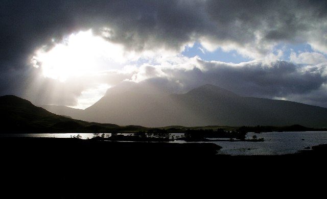
Lochan na h-Achlaise and Loch Ba, Rannoch Moor. Both sit within a couple of miles of each other on the A82 across Black Mount, with laybys practically on the shore. Loch Ba is the one with the little island of stunted pines. In still conditions the Black Mount hills come straight back off the surface; in snow it is the best roadside view in Scotland. No shelter, no facilities, patchy signal.
Loch Tulla. Two minutes further south, the signposted viewpoint above Bridge of Orchy gives you loch, pinewood and hills in one frame without leaving the tarmac. Best in the last hour of daylight.
Loch Achray, Trossachs. Small, tree-lined and directly on the A821 Duke’s Pass. Ben Venue sits at the west end and reflects cleanly on a calm morning. Being small, it settles faster than the big lochs, so it is a fair bet even on a breezy day.
Light, season and the midge problem
Still water is a dawn phenomenon. Overnight the air settles and the surface goes glassy. Then the sun warms the hillsides, convection begins, and by mid-morning there is a ripple on everything. The reflection window runs from first light to roughly two hours after sunrise, and it closes earlier on warm days. Evening can work, but it is less reliable, because the wind has to die rather than simply not have started.
Autumn is the best season, and it is not close. From late September through October the birch goes yellow, the bracken goes rust-orange, the deer are roaring, the sun stays low all day so you get side-light instead of the flat overhead glare of June, and the crowds thin. The trade-off is short days and wet roads. See our notes on Scotland in October and the broader question of the best time to visit Scotland.
Winter is underrated. Snow on the tops, water like slate, sunrise at a civilised hour, almost nobody about. Roads are the constraint, not the light.
And now the midges. Here is the cruel arithmetic. Highland midges are out from roughly late May to early September, worst in July and August. They are most active at dawn and dusk. They cannot fly in wind above about 6mph and they hate direct sun. So the exact conditions that give you a mirror-flat loch at six in the morning — damp, still, overcast, sheltered, beside water — are the conditions that put a cloud of them round your head within ninety seconds.
You cannot dodge it, so equip for it. Carry repellent, and carry a head net too, because on a bad morning at Loch Coruisk or the shore of Loch Affric, repellent alone will not let you stand still long enough to compose a picture. Cover wrists and ankles. Keep the car doors shut. If it is unbearable, drive two miles to somewhere more exposed — any breeze ends it instantly. Our breakdown of midge season in Scotland has the month-by-month detail, and it is worth reading before you book a July trip.
Planning a loch trip
How long you need. Two or three lochs a day is realistic if they are clustered, one a day if they are not. Highland roads are slower than the map suggests, single-track sections eat time, and Inverness to Assynt is a good three hours before you have taken a single photograph. Do not build an itinerary that needs you at two dawns in different counties.
Grouping them sensibly. Aviemore covers Loch an Eilein, Loch Morlich and Loch Insh from one base. Glencoe and Fort William give you Glencoe Lochan, Loch Etive, Loch Linnhe and Rannoch Moor. Inverness reaches Loch Ness and Glen Affric. Ullapool serves Assynt and Loch Maree. Aberfoyle or Callander covers Loch Ard, Achray, Katrine and Venachar without ever joining the A82 queue.
What to book. Very little, which is one of the pleasures of this. The exceptions are the Elgol boats and the Loch Katrine steamship in July and August — a week or two ahead usually does it. Accommodation is the real bottleneck in the north-west, where there simply is not much of it, so sort out where you are staying months in advance for summer.
Getting there without a car. Harder, not impossible. The West Highland Line runs along Loch Lomond and across Rannoch Moor, and Corrour — the highest and most remote station in Britain, with no public road to it — puts you a mile from Loch Ossian, which is about as pure a loch experience as exists. That is one of the great rail journeys in Scotland in its own right. Buses reach Balmaha, Aviemore and Glencoe; beyond that you need a car, and our guide to getting around Scotland sets out the trade-offs.
Two safety notes. Scottish lochs are cold all year and deep close to shore, so if you swim, go with someone and get out sooner than you think you need to. And check the forecast for wind direction, not only rain — on the big lochs a stiff westerly makes the shore unpleasant even in sunshine. Our month-by-month weather notes are a sensible starting point.
What underwhelms, and the mistakes I see
Driving the A82 up Loch Lomond and calling it a visit. You will see trees and the back of a motorhome. Cross to the east shore or do not bother.
Expecting Loch Ness to look like the postcards. The postcards are aerial shots of Urquhart Castle. From the ground it is a long grey corridor.
Arriving at 11am. The commonest mistake by a distance. By late morning the wind is up, the light is flat and the car parks are full. An hour earlier changes everything, and it costs nothing.
Assuming there is a loop path. Loch an Eilein, Loch Morlich and Glencoe Lochan have one. Loch Maree, Loch Assynt and Loch Etive emphatically do not, and people set off along a shoreline expecting to come back the other way.
Trying to see too many. Four lochs seen properly beats twelve seen through a windscreen. That applies to the whole country, and it is the first thing in our tips for a first trip to Scotland.
Frequently asked questions
What is the difference between a loch and a lochan?
Size, loosely. A lochan is a small loch — the -an ending is a Gaelic diminutive. There is no official threshold, so it comes down to local usage and what got written on the first maps. Glencoe Lochan and Lochan na h-Achlaise are lochans; Loch Ness and Loch Lomond very much are not.
Why does Scotland have only one lake?
Because the Gaelic word “loch” was already in use everywhere, and English speakers adopted it rather than replacing it. The Lake of Menteith near Aberfoyle is the exception, and it was historically called Loch Inchmahome; the name shifted at some point, probably through a Scots word for low-lying ground. Scotland’s other so-called lakes are man-made.
Which is the most beautiful loch in Scotland?
For sheer drama, Loch Coruisk on Skye, because nothing else in Britain has mountains that close to water. For a view you can reach in five minutes, Loch Maree with Slioch behind it. For a loch you can walk round in an afternoon and remember for years, Loch an Eilein. Past that point, ranking is guesswork.
Why do some lochs have tides?
Because they are sea lochs — glacial valleys flooded by the sea when the ice retreated, which makes them fjords in everything but name. Loch Long, Loch Fyne, Loch Etive and Loch Linnhe are all salt water and all rise and fall twice a day. Look for seaweed on the rocks; that is the giveaway.
When is the best time of year to photograph Scottish lochs?
Late September to late October. The sun stays low all day, the birch and bracken turn, the midges have largely gone and the roads are quieter. Winter is the runner-up, for snow and slate-coloured water. June has the longest days but the flattest overhead light and the worst insects.
Are Scottish lochs safe to swim in?
Many people do, and Loch Morlich and Loch Lomond have popular spots, but treat it seriously. The water is cold year-round, depth increases fast near the shore, and there are no lifeguards. Never swim alone, get in gradually, and keep your session much shorter than you would in the sea abroad.
How many lochs are there in Scotland?
More than 30,000 by most counts once you include the small hill lochans, and the exact figure depends where you set the minimum size. Only a few dozen see any real number of visitors, which is rather the point of driving one glen further on.
Final thoughts
The lochs that stay with me are not the biggest. They are the mornings: standing on gravel at Glencoe Lochan at half past six with the whole surface flat, or walking the last mile into Glen Affric with the pines throwing long shadows over the track. None of that needs a hard walk or an expensive ticket. It needs an alarm clock and an acceptance that the day might not deliver.
Pick three or four, base yourself somewhere sensible, and give each one a proper morning. Do that and the lochs stop being a list of names and start being the reason people keep going back to the most beautiful corners of Scotland.
Loch Ness is the one everyone asks about. A side-by-side comparison of the cruise operators is the quickest way to work out which pier suits your trip, and Urquhart Castle on its promontory is the reason most people book one at all.
About the author: This guide was written and is maintained by the ScotlandTourism.org editorial team — travel writers who’ve spent years exploring Scotland’s cities, Highlands and islands, from bagging Munros to chasing the perfect dram. We update our guides regularly to keep prices, opening details and advice current.
Last updated: September 2026. Prices and opening times change — always check the official site before you travel.
Photo credits
All images are used under their respective Creative Commons or public-domain licenses:
- Loch Maree and its wooded islands seen from the hills of Wester Ross, with snow on the… — Roger McLachlan, CC BY-SA 2.0, via Wikimedia Commons
- Ardvreck Castle on its promontory in Loch Assynt, Sutherland, seen from the A837 — Paul Hermans, CC BY-SA 3.0, via Wikimedia Commons
- The sandy beach on Loch Morlich in Glenmore Forest Park, with the Cairngorm plateau behind — geojoc, CC BY-SA 2.0, via Wikimedia Commons
- Glencoe Lochan at dusk, its trees and hills mirrored in still water — Jonathan Combe from Scotland, CC BY 2.0, via Wikimedia Commons
- Lochan na h-Achlaise on Rannoch Moor with the Black Mount hills under broken light — Lynne Kirton, CC BY-SA 2.0, via Wikimedia Commons
- The single-track road into Glen Affric, with Loch Affric and old Caledonian pines ahead — Trevor Rickard, CC BY-SA 2.0, via Wikimedia Commons
- Loch Lomond and its chain of islands seen from the hills above the east shore — Zsolt Fodor, CC BY-SA 4.0, via Wikimedia Commons
- The island castle ruin on Loch an Eilein, ringed by the old pine forest of… — Mike McBey, CC BY 2.0, via Wikimedia Commons
- Loch Coruisk in its rock basin beneath the Black Cuillin ridge on the Isle of Skye — Martin Thackeray, CC BY-SA 2.0, via Wikimedia Commons
- Urquhart Castle on the long, wooded bank of Loch Ness in the Great Glen — Joe deSousa, CC0, via Wikimedia Commons
- The tidal shoreline of Loch Etive, a sea loch reaching inland from Argyll — John McLuckie, CC BY-SA 2.0, via Wikimedia Commons