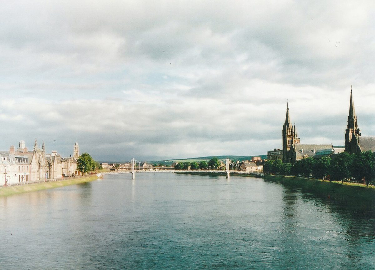
Most people plan this route the same way. They look up a North Coast 500 7 day itinerary online, see a day’s mileage that looks like a comfortable morning, and book a table for lunch at one o’clock. Then they meet the single-track roads, the passing places and the motorhome coming the other way, and lunch turns into a cereal bar in a lay-by.
That is the thing nobody puts in writing. The loop is around 516 miles, which sounds like nothing spread over a week. But roughly a third of it is single track, your realistic average on the west coast is closer to 25mph than 50mph, and you will stop — constantly and unpredictably, because a sea eagle went over or the light did something on Suilven. So this guide gives you the miles and the honest driving hours for every day, plus how long the day actually takes door to door once you have stopped.
How long does the NC500 really take over seven days?
Seven days works out at about 74 miles a day before detours, and on single-track roads that takes far longer than the mileage suggests. Budget seven to eight hours door to door on the west coast days and five to seven on the east. Ignore the total your sat-nav gives for the loop: the official North Coast 500 planning advice warns against relying on online driving times, because single-track roads take longer than expected.
Your North Coast 500 7 day itinerary at a glance
| Day | Route | Driving day | Sleep here |
|---|---|---|---|
| 1 | Inverness → Lochcarron (A832 / A890) | Moderate | Lochcarron or Kishorn |
| 2 | Lochcarron → Shieldaig, via Bealach na Bà, Applecross and the coast road | Hardest of the week | Shieldaig or Torridon |
| 3 | Shieldaig → Ullapool (A896 / A832 / A835) | Long | Ullapool |
| 4 | Ullapool → Kylesku, via Assynt and the B869 | Long and slow | Kylesku or Scourie |
| 5 | Kylesku → Tongue, via Durness (A894 / A838) | Moderate | Durness or Tongue |
| 6 | Tongue → John o’Groats (A836 / A99) | Moderate | John o’Groats, Wick or Thurso |
| 7 | John o’Groats → Inverness (A99 / A9) | Long, on main roads | Home, or a night in Inverness |
The advertised 516 miles already takes in the Applecross section and the B869 through Assynt. Side trips such as Red Point and Dunnet Head come on top of it, so plan for more driving than the headline figure and budget fuel accordingly.
Which direction? I go west first, and I will argue about it
Here is a small piece of chaos to get out of the way. Half the internet calls the west-coast-first start “clockwise” and half calls it “anticlockwise”, depending on which way up they are holding the map. Ignore the label. What matters is which way you point the car leaving Inverness: west towards Lochcarron and Applecross, or north up the A9 towards Dornoch.
I go west first, and I think most guides get this backwards. Two reasons.
The first is fatigue. The technical driving on this route is all on the west coast: the Bealach na Bà, the Applecross coast road, the B869 in Assynt, the twisty stretch past Gruinard. Those are the days where you need to be reading the road three passing places ahead. Do them on days two, three and four, when you are fresh and your reversing is sharp, rather than on day seven when you have been driving all week and just want to be home. The A9 run south from Caithness is a proper road with dual sections and it will forgive a tired driver. The Bealach will not.
The second is smaller but real: heading east along the north coast puts the sea on your left, which means the driver gets the view rather than the passenger, and the lay-bys you want are on your side of the road. Going the other way you spend the whole of Sutherland crossing traffic to pull in.
The counter-argument, which is fair, is that going west first means you descend the Bealach’s hairpins on day two rather than climbing them — and climbing is easier for nervous drivers because you cannot see the drop. If heights genuinely frighten you, flip my itinerary and run it in reverse. Everything else still applies.
Day 1: Inverness to Lochcarron
Driving day: moderate
Day one is deliberately soft. You have probably flown into Inverness or driven up from Edinburgh, you are collecting a hire car, and there is no glory in doing 150 miles before you have found the wiper stalk. Leave Inverness on the A862 through Muir of Ord, pick up the A832 at Marybank, and follow it through Contin, Garve and Achnasheen before dropping onto the A890 down Glen Carron to Strathcarron and Lochcarron.
It is all two-lane road today. Enjoy it, because from tomorrow lunchtime you will not see much of it again until Wick.
The stops that earn their place
Rogie Falls, just past Contin, is a free forestry car park and a ten-minute walk to a suspension bridge over a set of falls. Between July and September you can sometimes watch salmon throwing themselves up it. Thirty minutes, no more.
Attadale Gardens near Strathcarron are open April to October, 10am to 5pm, and cost £12.50 per adult, paid on arrival, with children up to 15 free. Twenty acres of rhododendrons, water gardens and a fern collection, and unusually for a Highland garden they are properly maintained. Worth an hour if the sun is out.
Plockton is a short detour from Strathcarron and the one worth making on day one. Palm trees on the seafront, a sheltered bay, and two decent pubs. It is off the official route, which is precisely why it is not full.
Where to sleep on night one
Lochcarron has the Lochcarron Hotel and a handful of B&Bs strung along the loch, and it puts you a short drive from Tornapress, at the foot of the Bealach, for an early start. Kishorn is smaller and closer still; the Kishorn Seafood Bar there does the best langoustines on this side of the route, though check seasonal hours before you count on it.
Wet-weather Plan B: drive south from Strathcarron on the A890 and A87 to Eilean Donan Castle. It is off-route, it is reputedly the most photographed castle in the country, and it is entirely indoors once you are past the bridge. If you want more of that sort of thing, our guide to the best castles in Scotland covers which ones are worth the entry fee.
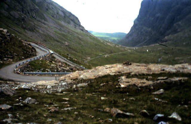
Day 2: Lochcarron to Shieldaig — the hardest driving day on the NC500
Driving day: the hardest of the week, and it fills the whole day
This is the day that breaks people’s schedules, and it is the single most important thing I can tell you about planning a week on this route.
You start at Tornapress, at the head of Loch Kishorn, where a blue sign tells you the road ahead rises to 2,053ft with gradients of 1 in 5 and hairpin bends, and that it is not advised for learner drivers, large vehicles or caravans. That sign is not decoration. The Bealach na Bà is the greatest continuous road climb in the UK, topping out at 626 metres on single track with passing places, gradients of about 20 per cent and tight hairpins near the top where a badly judged approach will have you reversing downhill towards nothing.
In clear weather it is one of the great drives in Europe. Cloud can cut visibility to almost nothing and leave you no view at all, and it will not stop you meeting a hired motorhome whose driver has never reversed a vehicle that size.
The escape route nobody mentions until it is too late
You do not have to drive the Bealach. From Tornapress the A896 continues north through Glen Shieldaig to Shieldaig village, a short, easy drive on a road that is wide and unremarkable. From Shieldaig you can then drive the Applecross coast road westwards as an out-and-back if you still want the peninsula.
Take the low road if: the cloud base is below about 1,500ft, it is raining hard, you are driving anything longer than a large estate car, you are towing, or the person in the passenger seat has gone quiet. There is no medal for the pass.
Applecross, and the inn everybody gets wrong
The descent into Applecross village is gentler than the climb and opens onto the Inner Sound with Raasay and the Skye Cuillin laid out in front of you. It is the best twenty minutes of road on the whole loop.
The Applecross Inn sits on the seafront and it is genuinely good — langoustines landed a few hundred metres away, hand-dived scallops, a proper bar. It is also, between June and August, completely full. People turn up at half past one expecting a table and wait ninety minutes or leave. Book weeks ahead for dinner and do not assume lunch is walk-in. If you have not booked, the Applecross Walled Garden a mile inland has a restaurant in an old potting shed and is a far better bet than standing in a queue.
The bit that eats your afternoon
From Applecross the coast road runs north through Sand, Lonbain, Fearnmore and Kenmore before rejoining the A896 at Shieldaig. Google will tell you fifty minutes. Allow ninety without stops and two hours with them.
It is single track almost throughout, with blind crests, sheep that have no fear of cars, and the best sea views on the west coast, which means you will stop. Fearnmore in particular, where the road turns the corner of the peninsula and Skye and the Torridon hills appear at the same time, is worth pulling in for. Watch for the point where the tarmac narrows and the passing places get further apart — that stretch is where most of the reversing happens.
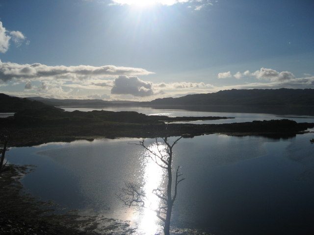
Bedding down at Shieldaig or Torridon
Shieldaig is a single row of white cottages facing the loch and it is a lovely place to end this day. Tigh an Eilean is the hotel; there are a few self-catering cottages and the Torridon estate is 20 minutes further on, with rooms in both the main hotel and The Stables. Book Torridon early — it is one of the properties that fills first.
Wet-weather Plan B: skip the pass, take the A896, and spend the saved hours at the Applecross Heritage Centre by the old church, then the Torridon Countryside Centre for the geology, which is genuinely extraordinary and reads better in bad weather anyway. If you want to understand what you are looking at all week, the background in our guide to the Scottish Highlands is a good primer.
Day 3: Shieldaig to Ullapool
Driving day: long, with plenty to stop for
Your longest west-coast day, and the one where the landscape shifts from mountains to something stranger. You run east on the A896 to Kinlochewe, then north-west on the A832 along Loch Maree, out to Gairloch, round the coast through Poolewe and Gruinard, and inland at Dundonnell to meet the A835 at Braemore Junction before dropping down to Ullapool.
The single-track sections today are short and mostly between Laide and Dundonnell.
Worth stopping for on the Wester Ross coast
Beinn Eighe National Nature Reserve, just past Kinlochewe, was Britain’s first NNR. The visitor centre is small but the trails from the Loch Maree car park are the point: the Woodland Trail is a mile on the flat, the Mountain Trail is four miles and climbs about 550m into a Cambrian quartzite landscape that looks like nowhere else in the country. If you only do one walk on the west coast, do the Mountain Trail.
Victoria Falls at Slattadale is a short walk from the car park. It is fine. Do it because it is free and it breaks the drive, not because you have driven for it.
Red Point sits at the end of a long dead-end road from Gairloch, with two red-sand beaches looking across to Skye. It costs you an hour and it is the most reliably empty beach on the west coast. In July that is worth a great deal.
Corrieshalloch Gorge, at Braemore Junction, is National Trust for Scotland and has a suspension bridge over a deep box canyon with the Falls of Measach at the head of it. Entry to the gorge is free, and the Gateway to Nature Centre has a takeaway cafe. It is better in rain than in sun, because the falls need water.
A night in Ullapool, and a wet-weather fallback
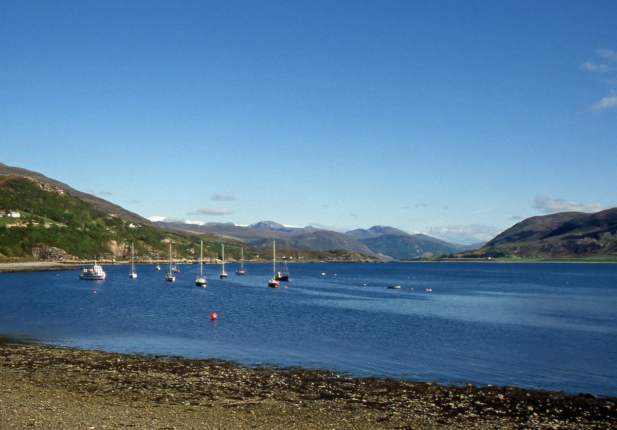
Ullapool is the largest settlement in Wester Ross and the natural overnight stop on this side of the route. Whitewashed terraces along Loch Broom, a working harbour, the Stornoway ferry coming and going. Eat at the Seafood Shack (a takeaway hut, seasonal, and better than most restaurants on the route), the Arch Inn or the Ceilidh Place. Fill the tank here.
Wet-weather Plan B: Gairloch Museum in the old nuclear bunker, and Corrieshalloch, which as I say improves in the wet. Inverewe House at Poolewe closes for the winter, from October to February, so check its opening on the National Trust for Scotland site before you count on it. Ullapool Museum will fill an hour before dinner.
Day 4: Ullapool to Kylesku, the long way round Assynt
Driving day: long and slow, with the B869 to drive
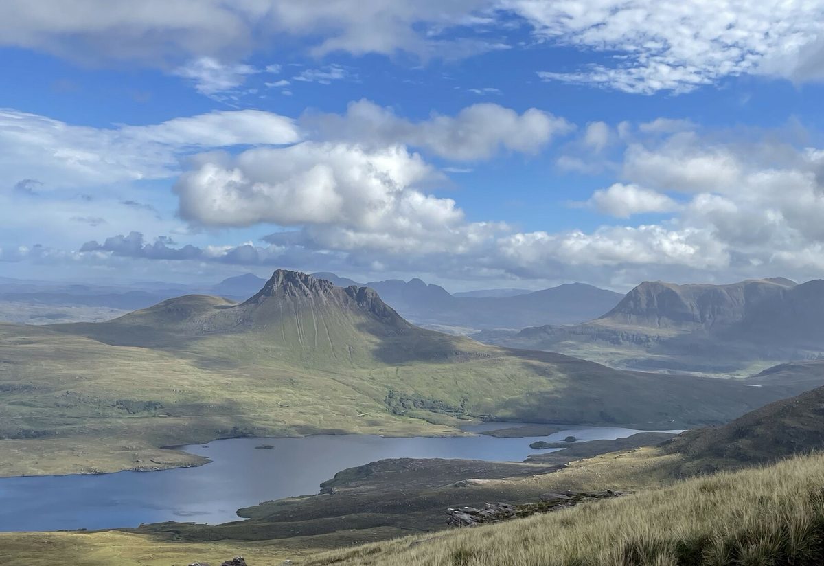
If I had to keep one day of this route and lose the rest, it would be this one. Assynt does not look like Scotland. It looks like somebody scattered individual mountains across a flooded moor and forgot to join them up — Stac Pollaidh, Cul Mor, Suilven, Quinag, each standing on its own with nothing around it.
You head north on the A835, cut west onto the A837 at Ledmore, then take the B869 coast road from Lochinver and rejoin the A894 just short of Kylesku.
Worth stopping for in Assynt
Knockan Crag is free, has a car park directly off the A835, and a mile-long interpretive trail. It is where nineteenth-century geologists worked out that older rock was sitting on top of younger rock, which broke the science of the day. Forty-five minutes and it changes how you look at everything else that week.
Stac Pollaidh is 612m of sandstone with a well-built path and one of the best effort-to-view ratios in Scotland. The circuit takes two and a half to three hours; the car park is small, charges a few pounds, and is full by ten o’clock in July. If you want more like this, our roundup of the best hikes in Scotland has the walks that are worth rearranging a trip for.
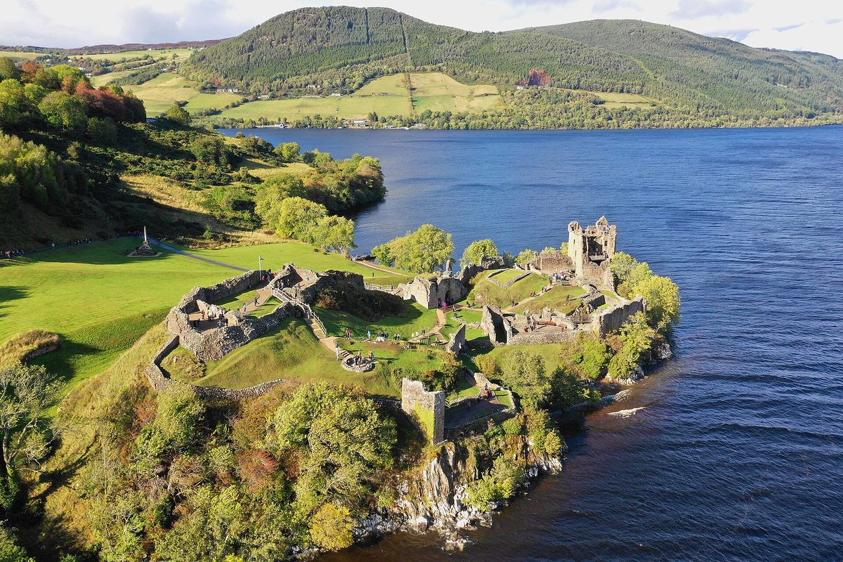
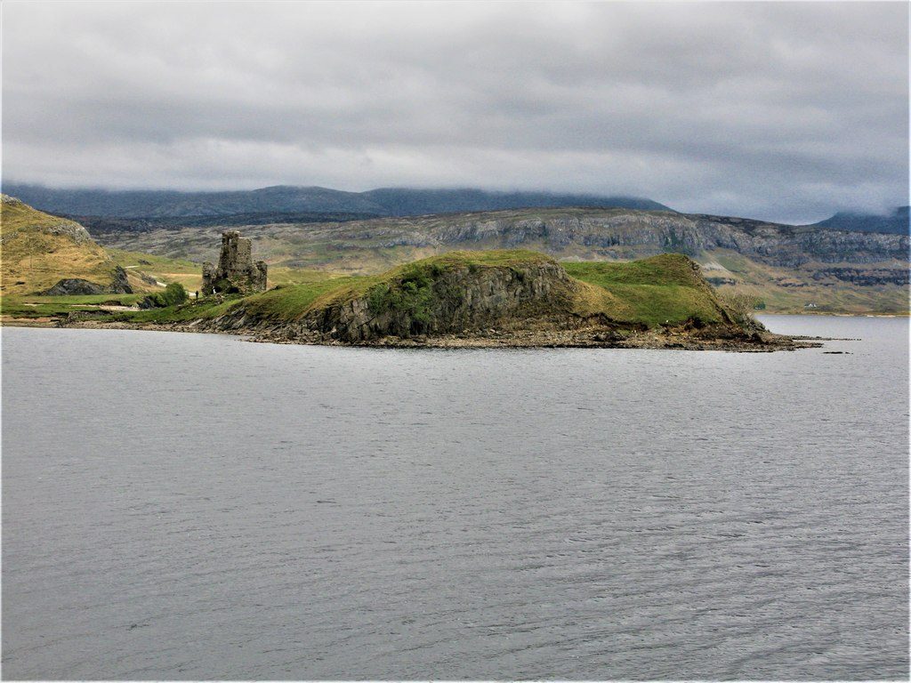
Ardvreck Castle on Loch Assynt is a roadside ruin with a car park and no admission. Fifteen minutes, and on a still evening the reflection is the shot everybody takes home.
The B869 is the reason today takes so long. It runs as single track from Lochinver round to the A894, and the official NC500 route advice sends larger motorhomes another way. In a normal car it is fine and it is glorious. Allow an hour and a half without stops, and you will not manage without stops, because this is where the beaches are.
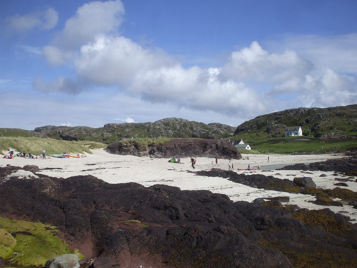
Achmelvich is white sand and, on a bright day, water the colour of the Caribbean at about eight degrees. There is a campsite, a small car park with a charge, and a walk round the headland to the Hermit’s Castle, built in the 1950s and reputed to be the smallest castle in Europe. Clachtoll, two miles further, has a broch, a split rock and fewer people. Both are on our list of Scotland’s finest beaches and both deserve it.
Lochinver Larder sells take-away pies, venison and cranberry among them, for around £6. Buy two: one for now and one for tomorrow’s lunch.
Where to sleep in Assynt
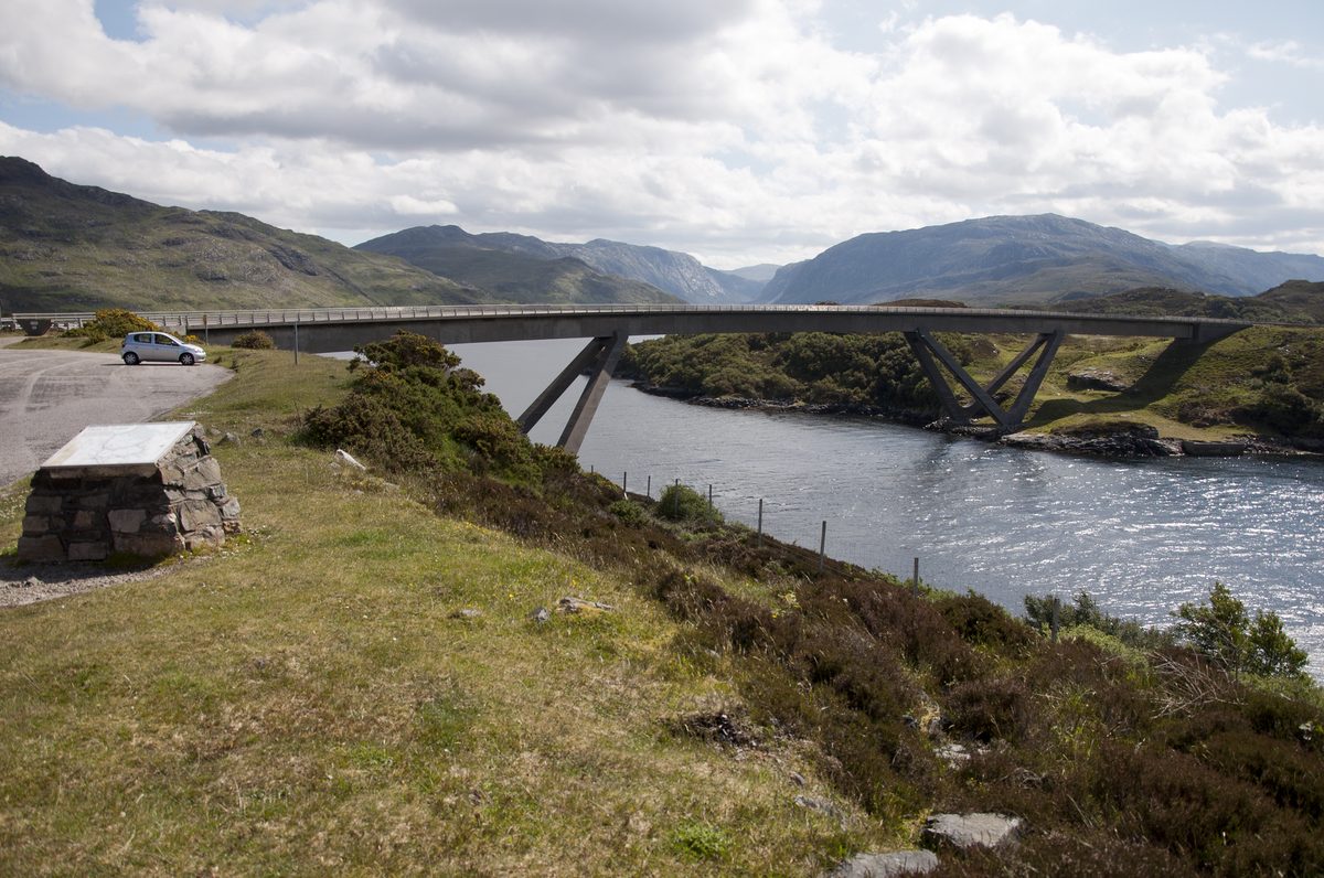
The Kylesku Hotel sits directly under the bridge and does the best food on the north-west coast. It also books out further ahead than anywhere else on the route; see the booking section below. Scourie Hotel and Newton Lodge are the alternatives, both fine, both quieter.
Wet-weather Plan B: drive the B869 anyway. Rain does not spoil Achmelvich the way it spoils a mountain, and the road itself is the attraction. If you want to be indoors, Highland Stoneware in Lochinver lets you watch the pottery being decorated, and the Assynt Visitor Centre at the harbour is free.
Day 5: Kylesku to Tongue, via Durness
Driving day: moderate, by way of Durness
A gentler day, and you will need it. North on the A894 over the Kylesku Bridge, through Scourie and Laxford Bridge, then east on the A838 round to Durness, Loch Eriboll and the Kyle of Tongue causeway.
The road quality improves markedly north of Rhiconich. You are still on single track in places but the sightlines are longer and the passing places are frequent.
Worth stopping for between Scourie and Tongue
Handa Island, reached by a small boat from Tarbet between roughly April and September, is a seabird reserve with guillemots, razorbills and puffins on the stacks. The crossing was about £20 return at the time of writing, often cash only, and the island circuit takes three hours. It costs you half a day and it is worth it in June.
Oldshoremore and Sandwood Bay sit at the end of the B801 past Kinlochbervie. Oldshoremore is a five-minute walk from the car park. Sandwood is an eight-mile round trip on foot from Blairmore, four miles each way across exposed moorland, and there is no road to it — which is a large part of its appeal.
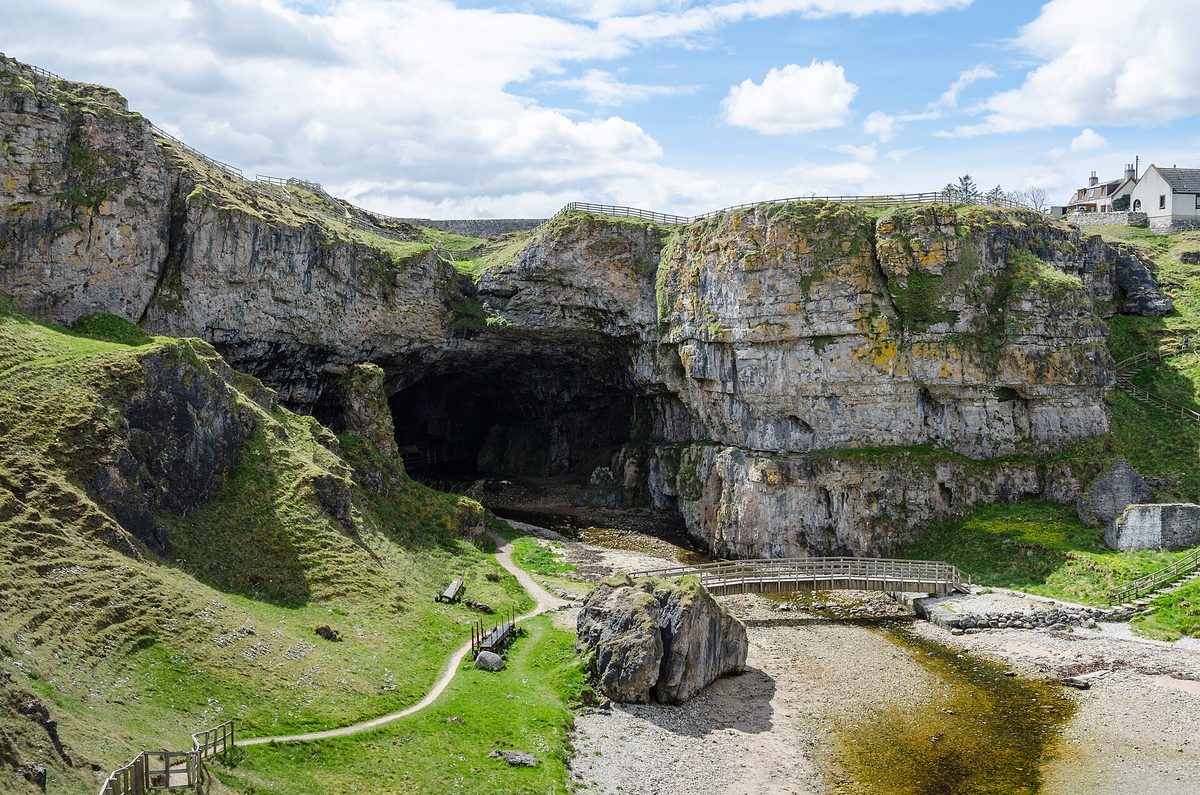
Smoo Cave at Durness is free to walk into and the scale of the entrance is genuinely startling — a 15-metre limestone arch with a burn falling through the roof of the inner chamber. The boat-and-wade tour into the second chamber was around £15 for adults at the time of writing, runs seasonally, and gets cancelled when the river is high. Check on the day.
Balnakeil, a mile from Durness, has a beach, a ruined church and a craft village built in the shell of a Cold War early-warning station. Cocoa Mountain there does a hot chocolate that has become a minor institution.
Durness or Tongue for the night
Durness and Tongue are your two options. Durness has more beds and puts Cape Wrath within reach if you are adding a day; Tongue has the Tongue Hotel and a hostel, and the causeway view at sunset is the better one. Both fill absurdly early in July.
Wet-weather Plan B: this is the easiest day to rescue. Smoo Cave is a cave. Balnakeil Craft Village is indoors. The drive round Loch Eriboll in low cloud is atmospheric rather than disappointing, and Ceannabeinne beach has an interpretive trail through a cleared township that reads well in weather.
If you have an eighth day, spend it here
Cape Wrath is the north-west corner of mainland Britain. Unless you are an experienced walker coming in on the Cape Wrath Trail, getting there means a small passenger ferry from Keoldale and then a minibus along the eleven-mile track. The round trip takes three to four hours and gets cancelled for weather and for live firing. It is not a stop you can slot into day five — it needs a morning of its own.
Day 6: Tongue to John o’Groats
Driving day: moderate, along the top of the country
The north coast, eastbound, sea on your left the whole way. The A836 runs through Bettyhill, Strathy and Melvich, past the decommissioning reactor domes at Dounreay, into Thurso, and then out to the two headlands that everybody argues about.
This is the first day since Inverness that feels like ordinary driving. Take advantage and stop more.
Dunnet Head or Duncansby? Do this instead
Dunnet Head is the actual most northerly point of mainland Britain — not John o’Groats, whatever the signpost implies. There is a Stevenson lighthouse, an RSPB reserve with puffins in early summer, and on a clear day the whole of Orkney across the Pentland Firth. If you only have time for one headland, make it this one.
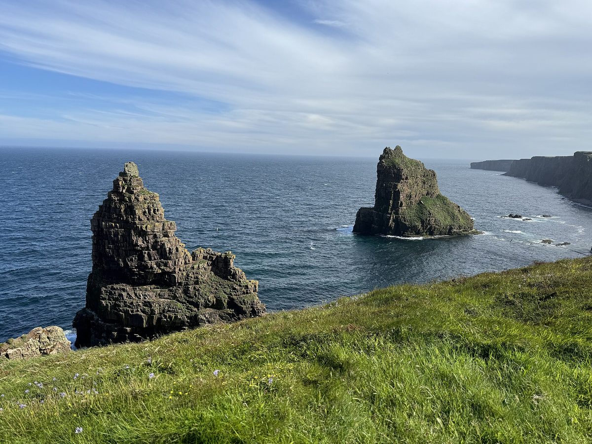
Duncansby Head, two miles beyond John o’Groats, has the lighthouse and a twenty-minute walk over grass to the Duncansby Stacks — three enormous sandstone pyramids standing in the sea. It is free, it is never crowded, and it comfortably outperforms John o’Groats itself. If you have driven all this way, do both headlands and give John o’Groats fifteen minutes for the photograph.
The other stops that earn their place
Strathnaver Museum in Bettyhill, in a former church, tells the story of the Sutherland clearances from the ground where they happened. It reopened after a major refurbishment and it is the most affecting hour on the north coast.
Dunnet Bay Distillers make Rock Rose gin and run tours from a shed behind their house. Book ahead; they are small.
The Castle of Mey was the Queen Mother’s and opens roughly May to September, with a short closure each summer for the royal visit. Entry was in the region of £15 at the time of writing. The walled garden is the good part.
Thurso, Wick or John o’Groats?
Thurso has the most beds and the best places to eat; John o’Groats has the self-catering lodges and puts Duncansby ten minutes away for a sunrise; Wick shortens tomorrow by twenty miles.
Wet-weather Plan B: the North Coast Visitor Centre in Thurso, a Dunnet Bay Distillers tour, and the Castle of Mey. If the sky clears after dark between roughly September and March, this coast sits far enough north for the aurora — our guide to the northern lights in Scotland covers when to bother looking, and the same skies make Caithness one of the better spots for stargazing under dark skies.
Day 7: John o’Groats to Inverness
Driving day: long in miles, mostly on two-lane main roads
Your longest day on paper and your easiest in practice, because the A99 and A9 are proper roads and you can hold a sensible speed. That is exactly why I want it at the end of the week rather than the start.
The east coast has a reputation for being the dull leg. It is not dull; it is just quieter and the drama is smaller in scale. There is more history per mile here than anywhere else on the loop.
Worth stopping for on the Caithness coast
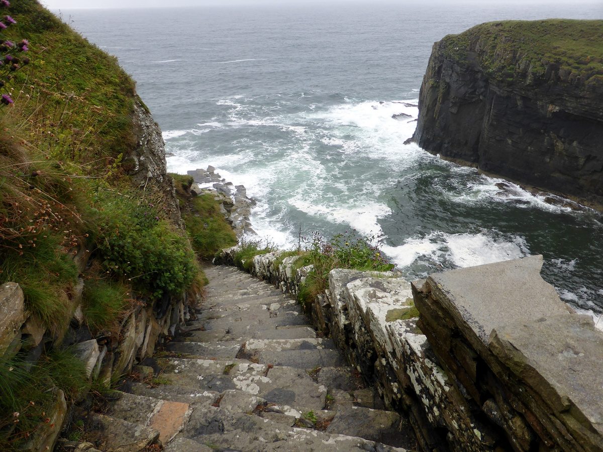
Whaligoe Steps, near Ulbster, is my favourite thing on the east coast and most people drive straight past the turning. A flight of stone steps, 365 by the traditional count, descends the cliff to a natural harbour where herring boats once landed and women carried the herring back up. Park at the cafe. There is no handrail for much of it and the steps are slick in the wet. Allow an hour and go slowly.
The Hill o’ Many Stanes at Mid Clyth is about 200 small standing stones set in fanned rows about 4,000 years ago for reasons nobody has established.
Badbea, on the cliffs north of Helmsdale, is the ruin of a village where cleared families were resettled on ground so exposed they tethered their children and livestock to stop them blowing off. Ten minutes from a lay-by. It puts the rest of the week in proportion.
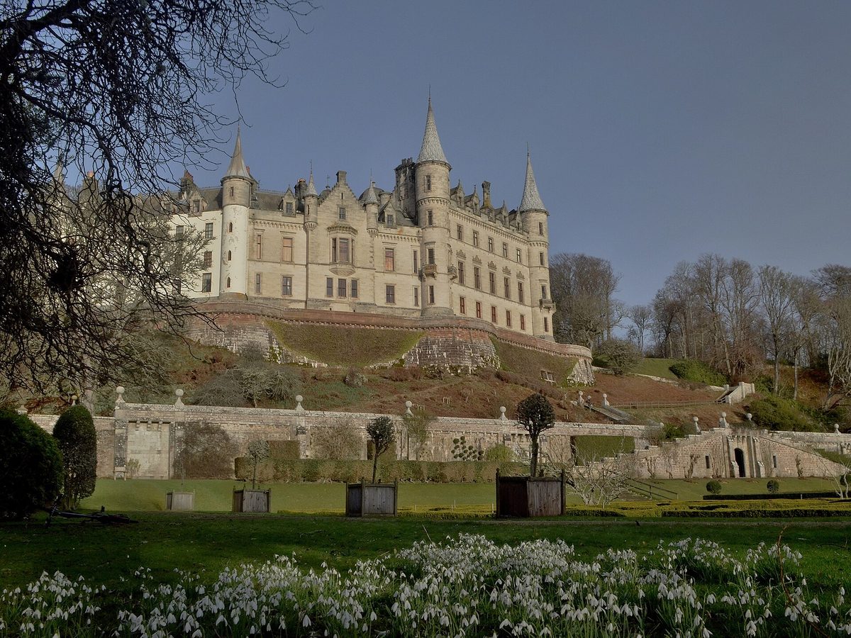
Dunrobin Castle at Golspie is the one castle on this route I would pay to go inside. 189 rooms, French-influenced spires, terraced gardens copied from Versailles, and falconry displays twice a day in season. Open April to October; adult admission is £16 for 2026.
Whisky, if you have a designated driver: Old Pulteney in Wick, Clynelish at Brora, Glenmorangie at Tain, all within today’s drive. Our guide to Scotland’s whisky distilleries explains which tours are worth booking and which are a shop with a dram.
The Black Isle finish
If you are ahead of schedule, come off the A9 after the Cromarty Bridge and run out to Chanonry Point on the Black Isle. It is one of the best land-based places in Europe to see bottlenose dolphins, and the timing matters: an hour or so after low tide, on a rising tide, is when they come in to fish the narrows. Then it is fifteen minutes over the Kessock Bridge into Inverness, and if you have an evening spare, Loch Ness and Inverness will fill it easily.
What to book, and how far ahead
This is where a week on the NC500 goes wrong more often than on the roads. There are perhaps forty serious places to stay between Applecross and Thurso and several hundred thousand people driving the route each year. The arithmetic does not work in July.
- Rooms for July and August: six to nine months ahead for anywhere you actually want. Kylesku Hotel and the Torridon go earliest — treat twelve months as normal for those two.
- Applecross Inn: rooms months out; a dinner table four to six weeks out in summer. Walk-ins at peak lunchtime are optimistic.
- Durness in July: months. There are very few beds and a lot of demand. Tongue is the overflow and it fills too.
- Shoulder season (May, September): six to eight weeks is usually enough, and the route is far more pleasant. See our take on the best time to visit Scotland for the trade-offs, and May in Scotland in particular, which is the month I would choose.
- Campsites: Sango Sands at Durness, Clachtoll and the Applecross site all book up. Do not assume you will find a pitch on the day in August.
- Hire cars: book with Inverness pickup as early as you book flights. Availability collapses from May and prices roughly double.
- Cape Wrath and Handa: weather-dependent, so you cannot really book, but check the operators’ own pages the night before.
If your dates are flexible, going outside July and August solves most of this at a stroke. Our notes on the cheapest time to visit Scotland and on September in Scotland both apply directly to this route.
Fuel, signal and the practical things that catch people out
Fuel
Nowhere on the west or north coast should be treated as guaranteed. Scourie and Durness both have pay-at-pump facilities, and in theory they are available around the clock, but I would not stake a holiday on a card reader in a gale at eleven at night.
My rule: Ullapool is your last certain fill before the north coast. Top up there, top up again at Scourie or Kinlochbervie before the Durness stretch, and never drive past a pump on the west coast with less than half a tank. Between Scourie and Ullapool on the main A894 and A835, if you skip the Lochinver detour, there is a long stretch without fuel, so fill up before you start it. Expect to pay noticeably more per litre out west than in Inverness — budget for it rather than driving on fumes to save it.
Electric vehicles are viable but need planning. Rapid chargers exist at Inverness, Ullapool, Durness, Thurso and Dornoch among others, but several are single units, and a queue in July is a real risk. Check live status before you commit to a leg.
Mobile signal
Patchy to absent through Assynt, along the Applecross coast road and around Loch Eriboll. Download offline maps for the whole route before you leave Inverness. Do not rely on live traffic or on being able to phone your accommodation to say you are running late — because you will be running late.
Single-track etiquette
Passing places are for passing and for letting faster traffic overtake, not for parking or picnicking. If the passing place is on your left, pull into it; if it is on your right, stop opposite it. Locals drive this route to get to work and to hospital appointments — let them past immediately and cheerfully. And learn to reverse fifty metres in a straight line before you come. It is the single most useful skill on this trip.
Midges and weather
Midges are a genuine factor between roughly late May and early September, worst at dawn and dusk in still, damp conditions on the west coast. They are not a reason to avoid the route, but they are a reason to carry repellent and to eat dinner indoors in July. Our guide to midge season has the detail. For what to expect overhead, Scotland’s weather month by month is worth a read before you pick dates.
What underwhelms, and what people get wrong
The Falls of Shin
You will see it signposted and it appears on a lot of NC500 lists. It is a modest waterfall on the Shin, roughly fifteen miles off the loop near Lairg, with a viewing platform and a visitor centre. The salmon leaping in summer is a nice ten minutes. It is not worth a thirty-mile round trip out of a seven-day schedule, and the detour comes out of a day you have already filled. Skip it unless you are taking the inland Lairg road anyway.
John o’Groats
Let us be straightforward. John o’Groats is a car park, a signpost you pay to have your name put on, a gift shop, a couple of cafes and a row of holiday lodges. It is not the most northerly point of mainland Britain — Dunnet Head is, by about two miles of latitude. It is not the most northerly settlement either. Its significance is that it is the far end of the Land’s End run, which matters enormously if you have cycled there and not at all if you have driven.
Go, take the photograph, buy the ice cream, and give it fifteen minutes. Then drive the two miles to Duncansby Head, which is free, empty and spectacular, and understand that you have just seen the good version.
Turning up without a booking in July
Every summer, people drive this route intending to find somewhere at five o’clock. Some of them end up doing an extra 60 miles at nine at night to reach a bed, which is how tired people meet single-track roads in poor light. Book. All of it.
Trusting your sat-nav’s arrival time
Every driving figure your phone gives you for the west coast is optimistic, because the algorithm assumes you keep moving and that the road is empty. Add generously to anything it tells you between Lochcarron and Durness, and then add your stops on top.
Bringing the wrong vehicle
A large motorhome will get round the NC500. It will not get round comfortably, it should not attempt the Bealach na Bà or the B869, and it will make you unpopular. If you are hiring, a small campervan or an ordinary hatchback is a much better trip. Our guide to getting around Scotland covers hire, ferries and the alternatives.
Treating it as a driving challenge
The people who enjoy this route least are the ones who set out to complete it. The ones who enjoy it most stop at the third beach in a row because the light is good and accept that they will not reach Durness by six. If you want more of that sort of thinking before you go, our first-timer’s tips for Scotland and the wider North Coast 500 route guide both take the same line.
Frequently asked questions
Is 7 days enough for the North Coast 500?
Yes — seven days is the length I would recommend to most people. Spread over a week, the 516-mile loop comes to roughly 74 miles a day before detours, which leaves real time for walks, beaches and lunch. Five days works but you will be looking at the west coast through glass. Ten days is better still if you want a rest day or an island.
How many hours a day will I actually be driving?
It depends far more on the road than on the mileage, so treat any sat-nav figure as a minimum. Day two, from Lochcarron over the Bealach na Bà to Shieldaig, is the slowest of the week: the pass is single track with gradients of about 20 per cent, and with stops the day is gone. The east-coast run home covers more ground but is mostly on two-lane main roads, so it goes more quickly.
Should I drive the NC500 clockwise or anticlockwise?
Go west first, out of Inverness towards Lochcarron. That puts the technically demanding driving — the Bealach na Bà, the Applecross coast road, the B869 — on days two to four while you are fresh, and leaves the fast, forgiving A9 for the end of the week. Reverse it only if descending steep hairpins genuinely worries you.
Is the Bealach na Bà safe to drive?
In a normal car, in reasonable weather, with a driver who can reverse: yes. It rises to 2,053ft with 1-in-5 gradients and hairpins, and it is signed as unsuitable for learner drivers, large vehicles and caravans. In low cloud or heavy rain there is no view and real risk, so take the A896 low road through Glen Shieldaig instead: quicker, easier and no drama.
Where do I need to book months in advance?
For July and August: the Kylesku Hotel, the Torridon, the Applecross Inn and anywhere in Durness. Six to nine months is normal and twelve is not excessive for the first two. Hire cars from Inverness should be booked as early as flights. In May or September, six to eight weeks is usually enough.
Where can I get fuel on the NC500?
Inverness, Lochcarron, Gairloch, Ullapool, Lochinver, Scourie, Kinlochbervie, Durness, Bettyhill, Thurso, Wick, Helmsdale, Dornoch and Tain all have pumps, but many are attached to shops with limited hours. Treat Ullapool as your last certain fill before the north coast and top up at Scourie or Kinlochbervie. Never pass a station below half a tank.
Can I do the NC500 in a motorhome?
Yes, but the size matters. The official NC500 advice is that anything larger than a VW T5 conversion (about 16 to 18ft) should not attempt the Bealach na Bà, and it gives bigger motorhomes an alternative to the B869 through Assynt. A small campervan is the sweet spot. Whatever you drive, book campsites in advance and use the passing places properly.
What is the best month to drive the North Coast 500?
May, then September. May gives you long days, the fewest midges of the warm months and roads that are busy but not gridlocked. September gives you autumn light and quieter accommodation. July and August have the most reliable weather and the most caravans; if you go then, book everything and start early each morning.
Final thoughts
The NC500 is a genuinely great week’s driving, and it is spoiled almost exclusively by people trying to do it too fast. The route does not reward efficiency. It rewards the afternoon you lose at Clachtoll because the tide went out and the sand went on for a mile, or the hour on the Applecross coast road when you stopped four times in five miles because you kept thinking the last view was the best one.
Build the week around the honest numbers rather than the sat-nav ones, book the four or five places that matter, keep the tank above half, and take the low road when the cloud is down. Do that and you will get to the end of day seven wanting to turn round at Inverness and drive it the other way.
If you are still working out where this fits in a bigger trip, our Highland road trip routes, our advice on how many days to give the Highlands and the full North Coast 500 guide are the places to start. And if you have a spare few days at the end, Skye is two hours from Lochcarron — our Isle of Skye itinerary picks up where this one leaves off.
About the author: This guide was written and is maintained by the ScotlandTourism.org editorial team — travel writers who’ve spent years exploring Scotland’s cities, Highlands and islands, from bagging Munros to chasing the perfect dram. We update our guides regularly to keep prices, opening details and advice current.
Last updated: August 2026. Prices and opening times change — always check the official site before you travel.
Photo credits
All images are used under their respective Creative Commons or public-domain licenses:
- Kylesku Bridge curving over Loch a Chairn Bhain in Sutherland on the North Coast 500 — Paul Hermans, CC BY-SA 3.0, via Wikimedia Commons
- Hairpin bends of the Bealach na Ba mountain pass road to Applecross on the North Coast 500 — ronnie leask, CC BY-SA 2.0, via Wikimedia Commons
- Applecross Bay looking across the Inner Sound towards Raasay and Skye — Ceitidh MacMaster, CC BY-SA 2.0, via Wikimedia Commons
- Ullapool harbour on Loch Broom, the main town on the west coast of the North Coast 500 — Giorgio Galeotti, CC BY 4.0, via Wikimedia Commons
- Stac Pollaidh seen across Loch Lurgainn in the Coigach hills of Assynt — Simon Bonney, CC BY-SA 2.0, via Wikimedia Commons
- Clachtoll Beach in Assynt, one of the best beaches on the North Coast 500 — John Lord, CC BY-SA 2.0, via Wikimedia Commons
- The vast limestone entrance to Smoo Cave at Durness on the north coast of Scotland — Florian Fuchs, CC BY 3.0, via Wikimedia Commons
- The Duncansby Stacks sea stacks near John o Groats in Caithness — MaxKaane, CC BY-SA 4.0, via Wikimedia Commons
- The stone Whaligoe Steps zigzagging down the cliff to the old herring harbour in Caithness — Sandy Gerrard, CC BY-SA 2.0, via Wikimedia Commons
- Dunrobin Castle at Golspie on the east coast leg of the North Coast 500 — Andrew Tryon, CC BY-SA 2.0, via Wikimedia Commons
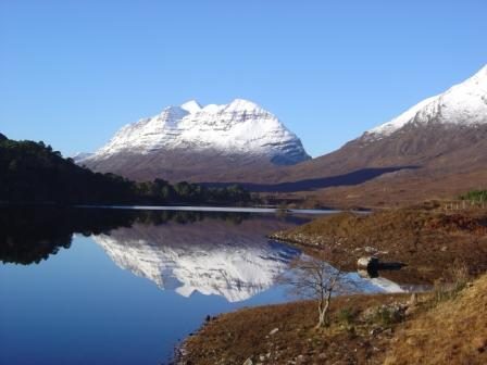
- The Torridon mountains rising above Loch Torridon in Wester Ross — Tom Forrest, CC BY-SA 2.0, via Wikimedia Commons
- Ardvreck Castle ruins on the shore of Loch Assynt on the NC500 — G Laird, CC BY-SA 2.0, via Wikimedia Commons