The first time I drove out to Neist Point I did exactly what everybody does. I arrived at ten past nine on a June evening, found the car park solid, wedged the car half onto the verge 300 metres back down the road, jogged down the concrete steps in trainers, and stood beside the lighthouse in perfectly decent light wondering why the view looked nothing like the photograph that had made me drive 31 miles out from Portree in the first place.
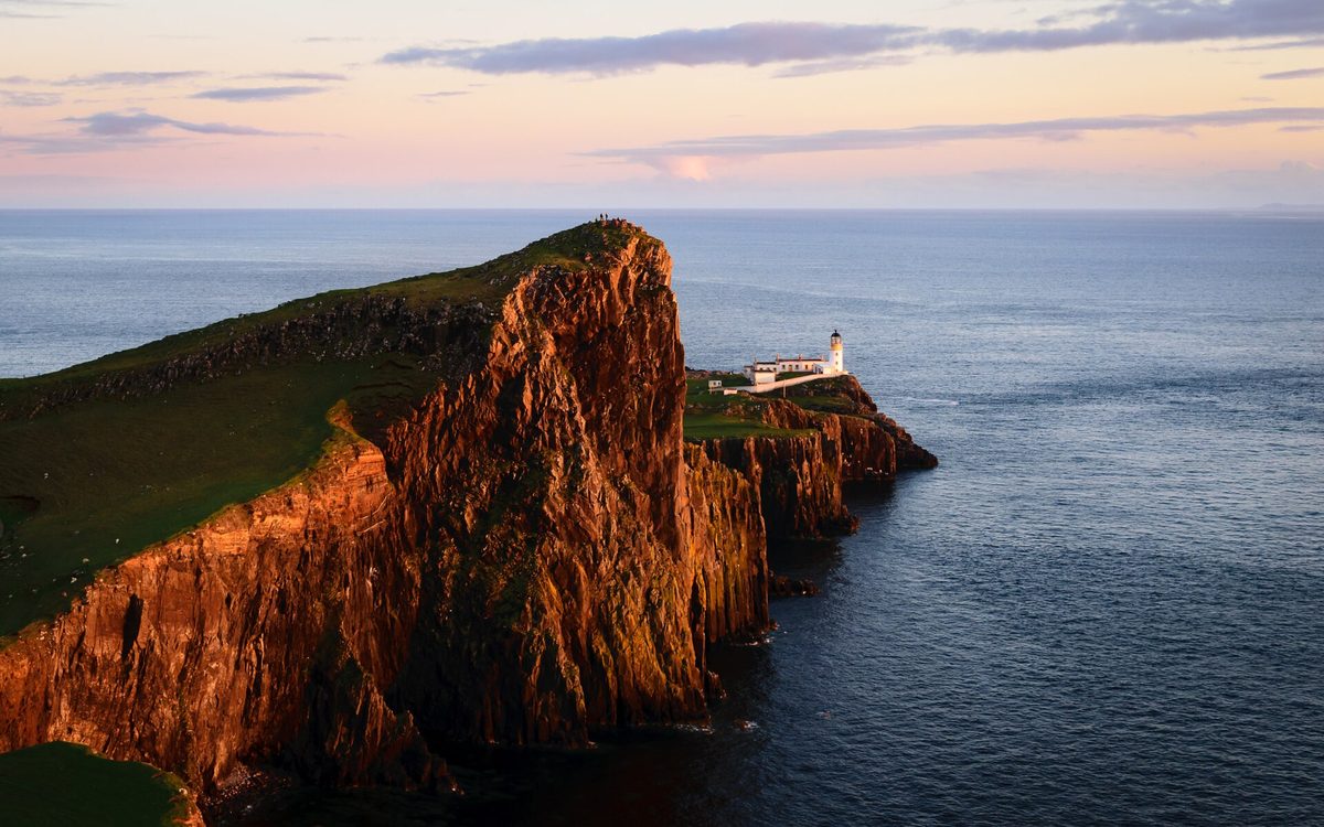
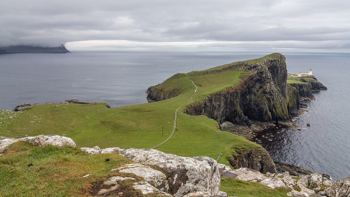
It took a second visit to work out what I’d got wrong. The famous image of this place — tilted green headland, great rock prow, small white lighthouse tucked in behind it — is not taken from the lighthouse at all. It comes from a scruffy patch of clifftop about five minutes’ walk from the car park, in the opposite direction to the path everyone follows. What follows is the guide I wish I’d had: the road, the parking, the two completely different walks, and an honest month-by-month account of what sunset actually does here.
The short version
Neist Point is the most westerly headland on the Isle of Skye, reached by single-track road beyond Glendale and about an hour and a quarter from Portree. The classic lighthouse photograph is taken from the clifftop five minutes north of the car park, not from the lighthouse path. Allow two hours, wear proper boots, and aim for April to September.
Neist Point at a glance
| The question | The honest answer |
|---|---|
| Where exactly | End of the unclassified road past Waterstein, Duirinish peninsula, north-west Skye. Grid ref NG132478; coordinates 57.4296, -6.7791. Postcode IV55 8WU gets you close but not to the door |
| Drive from Portree | 31 miles. Google says 50 to 60 minutes; allow 1hr 15m in summer, more behind a campervan |
| Drive from Dunvegan | 10.5 miles, about 30 minutes, almost all of it single-track |
| Car park | Free at the time of writing, roughly 40 spaces plus a run of laybys on the approach road. Full solid from about 5pm in June and July |
| Walk to the lighthouse | Around 3km there and back, 45 minutes to 2 hours, about 140m of climb on the return |
| Walk to the classic viewpoint | 200 to 400 metres on rough grass north-west of the car park. Five to ten minutes, no steps |
| Facilities | None. No cafe, no toilets, no bins, no visitor centre, no reliable phone signal |
| Best months | April to September for light and safety; late August and September for the best sunset alignment and civilised timings |
The last nine miles: driving out to Neist Point
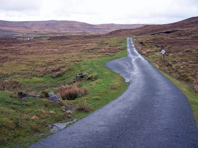
Nearly every problem people have here starts on the road, not on the path. Skye’s main arteries are fine, but the run out to the Point is a proper Hebridean single-track finale and it eats time in a way that route planners simply do not model.
Portree to Neist Point: allow 1hr 15m, not 50 minutes
From Portree, Skye’s main town and the island’s usual base, you take the A87 north-west, then the A850 to Dunvegan, then the B884 west towards Glendale, then an unclassified road out past Waterstein. It is 31 miles. Your phone will promise you 50 to 60 minutes. In July, behind a hire campervan whose driver has never reversed into a passing place, I have taken an hour and forty.
The B884 is where the pace drops. It is single-track with passing places for most of its length, it climbs and dips, and it carries a steady two-way flow of visitors in the evening. There is no alternative route. If you are heading out for sunset, add half an hour to whatever the app says and then add another fifteen minutes for the bit where you inevitably stop to photograph the coast at Milovaig.
Single-track etiquette, briefly
Passing places are for passing and for letting faster traffic overtake, not for parking while you take pictures. The convention is that whoever is nearest a passing place pulls in or reverses to it; if the passing place is on your right, you stop opposite it and let the other car come through. Give a small wave. If somebody is sitting behind you, pull in and let them past — there will be locals on that road who drive it four times a day and have a job to get to. Our wider notes on driving and getting around Scotland go into this properly, and it is worth ten minutes of your reading time before you set off.
The car park, and when it fills
The car park sits at the very end of the tarmac, on the clifftop above the headland. It holds somewhere around 40 cars if everybody parks sensibly, which they do not. There are additional spaces along the road on the approach, added in recent years and a genuine help, but they fill too.
Here is the timing that actually matters. In June and July the car park is effectively full from about 5pm until well after sunset, because sunset is not until roughly 22:20 and everyone is holding their space for five hours. In May and September you can usually get in at 6pm. In April and October it is rarely a problem. Between November and March you may well have the place to yourself, which tells you something about what the weather is doing.
If it is full, park in a layby with all four wheels off the carriageway and walk. Do not park on the grass verge, on a passing place, or across the turning area at the end — there are working crofts out here, the road is a lifeline, and blocking it is how a place ends up with barriers and charges.
The photograph everyone comes for is not where you think
This is the single most useful thing in this guide, so I will be blunt about it. Roughly half the people who drive out here walk down the concrete path, spend twenty minutes at the lighthouse, walk back up, and drive away having never seen the view they came for.
The five-minute clifftop viewpoint
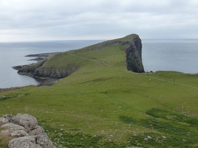
From the car park, ignore the shed and the gate and the obvious path. Instead walk north-west, uphill and to the right, onto the rough grassy clifftop. There is no sign, no proper trail and no fence. Within 200 to 400 metres the ground rises just enough for the whole headland to open up beneath you: the long green ramp of the point, the vertical prow of An t-Aigeach, and the lighthouse sitting at the far end with the Atlantic behind it.
That is the shot. That is the photograph on every Skye calendar and every travel poster. It takes five to ten minutes to reach, it involves no steps, and it is doable in trainers, though the ground is boggy after rain and there is loose sheep-cropped turf near the edge, so keep well back. The same rough path continues north as the clifftop walk towards Milovaig if you want to extend it.
The 45-minute walk to the lighthouse
The concrete path down to the lighthouse is a different experience, and a good one, but it is not a photography walk. Once you drop onto the headland the lighthouse is hidden behind An t-Aigeach for the first stretch, and when it finally appears you are close and low, looking at a functional white tower and a fenced compound rather than a landscape.
What the lighthouse walk gives you instead is scale. You walk out along a narrow spine of land with sea on both sides, past the old aerial ropeway that used to carry supplies down, past the crane and the boat landing, out to a point where the next stop west is the Outer Hebrides. It is one of the better short walks anywhere in the Hebrides, and it feels genuinely remote in a way that few roadside stops manage.
Do both, in this order
Arrive with two hours in hand. Do the lighthouse walk first, while your legs are fresh and while the light is still high. Come back up, have a flask of something in the car, and then walk out to the clifftop viewpoint for the last hour before sunset. That way the climb is done before you are cold and tired, and you are standing in the right place when the light goes.
The walk down, and the climb that catches people out
Going down is the easy half
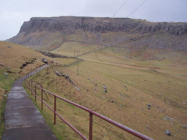
Through the gate at the end of the car park, the concrete path swings left then right and drops down the cliff face in a series of ramps and steps, with a metal handrail on most of the descent. The surface has been patched and repaired over the years and the handrail sections replaced where the winter gales have had them, but it remains steep, and in wet weather the concrete is slick. In frost it is genuinely dangerous.
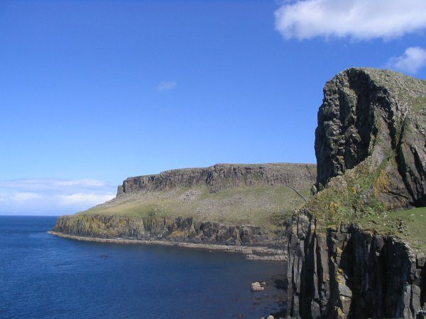
At the bottom you pass a shed and the remains of the wire system used to lower equipment, then the path levels out along the headland. Grassy paths break away to the right towards the cliff edge above An t-Aigeach, the Stallion’s Head, whose 100-metre prow carries some of the hardest rock climbs on Skye. They are worth a look. They are also completely unfenced, so stay a good few metres back and keep children close.
Coming back up is the part nobody warns you about
The return involves about 140 metres of ascent, most of it in one continuous pull up the cliff face. That is not a lot in absolute terms — it is a fraction of what the climb up to the Old Man of Storr asks of you — but it arrives all at once, at the end, often into a headwind, and frequently at nine o’clock at night when you have already been driving all day.
I have watched perfectly fit people stop three times on that climb. I have watched a grandmother in sandals decide, halfway up, that she would wait at the bottom until somebody fetched the car, which of course is not possible. Budget twenty to twenty-five minutes for the ascent, take it slowly, and if you have any doubt about your knees or your lungs, do the clifftop viewpoint instead and skip the descent entirely. You lose almost nothing.
Footwear, wind and weather
Boots or proper trail shoes with grip. Not trainers, not sandals, and absolutely not flip-flops, which I have seen more than once. A waterproof jacket regardless of the forecast, because the Atlantic here does what it likes.
The wind is the real hazard. Neist is one of the most exposed spots on Skye, and there are unprotected cliff edges on three sides of the headland. In a strong wind, or in low cloud when you cannot see the edges, do not go down. Nobody who knows the place would. Check the Skye forecast and the seasonal weather patterns before you commit to the drive, and be willing to turn the evening into something else.
One consolation: because it is so windy, Neist Point is close to midge-free even in the worst of the season. If you have been chased off every other viewpoint on the island, this is where you get a break. Our guide to Scotland’s midge season explains why the exposed western headlands stay clear when the sheltered glens do not.
The lighthouse itself: what you can and cannot do
Be clear on this before you drive out. The tower was designed by David Alan Stevenson, first lit on 1 November 1909, and built for a total of around £4,350. The tower itself is around 19 metres tall, the light sits roughly 43 metres above the sea, and the station was automated in 1990; it is now monitored remotely by the Northern Lighthouse Board from Edinburgh.
You cannot go inside. The former keepers’ cottages around the tower are in private hands and have been let as holiday accommodation at various points, so the whole compound is fenced and the buildings are somebody’s home or someone’s booking. There is no cafe, no shop, no interpretation panel and no toilet. What there is: a working light, a lot of weather, and a field of small stone cairns built by visitors in front of the compound. I would leave the cairns alone rather than add to them; the point does not need more of them.
Sunset at Neist Point, month by month
Everyone tells you Neist Point is a sunset spot. Almost nobody tells you where the sun actually goes down, and it moves a long way through the year. The headland runs roughly south-west from the clifftop viewpoint, and the open Atlantic sits to the west and north-west, which means the geometry changes completely between June and December.
| Month | Approx sunset | Sun sets roughly | Verdict |
|---|---|---|---|
| Mid-April | 20:35 BST | West-north-west, about 290 degrees | Good. Quiet car park, sun drops into open sea |
| Mid-May | 21:30 BST | North-west, about 305 degrees | Good, and the light lingers for ages |
| Mid-June | 22:25 BST | North-west, about 317 degrees | Latest and busiest. Sun sets well right of the lighthouse |
| Mid-July | 22:05 BST | North-west, about 313 degrees | Similar to June, marginally earlier, still packed |
| Mid-August | 21:05 BST | West-north-west, about 296 degrees | Very good. Sun swinging back towards the frame |
| Mid-September | 19:50 BST | Almost due west, about 275 degrees | The sweet spot. Best alignment, sensible hour |
| Mid-October | 18:35 BST | West-south-west, about 254 degrees | Fine, but you will be climbing back up in the dark |
| Late December | 15:40 GMT | South-west, about 222 degrees | Poor. The sun goes down behind the headland itself |
April to July: long, late and crowded
Midsummer here is a strange business. Sunset on the solstice is around 22:30 and the sky never fully darkens, so you can be walking the clifftop at half past eleven at night in usable light. It is memorable. It also means you will not be back in Portree until well after midnight, and if you are driving on to Broadford or the mainland that is a very long day.
The other catch is direction. In June the sun sets around 317 degrees, which from the clifftop viewpoint is well over to your right, out over open water towards Harris rather than anywhere near the lighthouse. You get lovely side-lighting on the headland and a lot of colour in the northern sky, but not the sun-behind-the-tower composition people imagine. If you are visiting in May, one of the driest months in the Highlands, you get much of the same light with a fraction of the crowd.
Late August and September: the sweet spot
This is when I would come. By mid-September the sun sets almost due west, at around 19:50, which puts it close to the line of the headland and drops it straight into the sea in the same half of the frame as the lighthouse. You get a proper hour of golden light beforehand, you are back at the car by half past eight, and you can still get a meal somewhere afterwards.
The car park is manageable, the midges are fading, and the sea is at its warmest, which is also when whale sightings peak. If you have flexibility, September in Scotland is close to ideal for the west coast generally, and it is the month I would build a Skye trip around.
October to March: manage your expectations
October still works, but sunset moves to 18:35 and then, after the clocks change at the end of the month, to around 17:00 and falling fast. You will be climbing that concrete path in the dark. Take a head torch, not a phone light.
By December, sunset is roughly 15:40 and lands at about 222 degrees, which from the viewpoint is behind the headland rather than out to sea. The sun disappears behind the very thing you came to photograph, at an hour when the light is thin and the cloud base is usually somewhere around your ankles. Add ice on the concrete steps and a black single-track drive home, and midwinter is simply not the season for this particular place. Come to Skye in December by all means, but plan Neist Point for another trip.
Sunset times and bearings above are approximate for the Point’s own longitude and will shift by a few minutes and a few degrees either side of mid-month. If you are planning a specific composition, check your exact date with a sun-position app before you drive.
The blue-hour trap
The mistake I see most often is people staying too long. The colour after sunset is excellent here, and it is tempting to hold position for another twenty minutes. Then you realise you are on an unlit, unfenced clifftop, the car park has half emptied, your phone has no signal, and you have a single-track road ahead of you with deer on it. Set yourself a time to leave, and leave.
Whales, sharks and seabirds from the headland
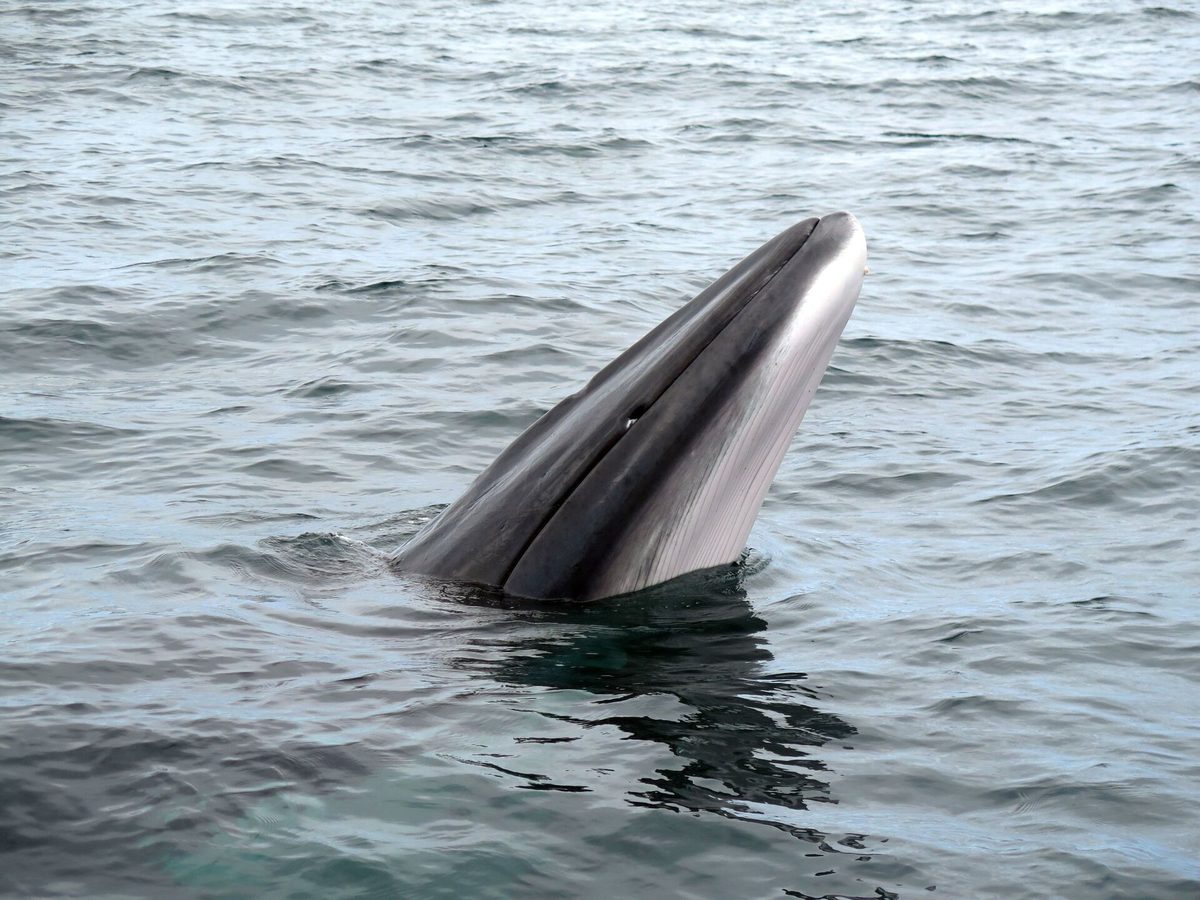
Neist is one of the better land-based cetacean watching spots on Skye, and hardly anyone comes here for it. The headland pushes out into deep water, so animals pass genuinely close, and you can scan from a fixed clifftop without paying for a boat.
Minke whales and basking sharks, July to September
Minke whales are the regular visitors, most reliably from July through September when the water is warmest and the feeding is good. Basking sharks turn up over the same window, and in a good year you can see the dorsal fin and the tail tip cutting slowly along the surface, sometimes for several minutes at a time. Harbour porpoise are around most of the year, and common dolphins pass in pods.
The technique is simple: find a spot with your back to the wind, sit still, and scan the water rather than sweep it. Look for blows, for a dark curved back rolling through, and for gannets diving repeatedly in one patch, which usually means something is pushing fish up from below. Binoculars change everything. Give it forty minutes rather than five.
Birds, sheep and everything else
The cliffs hold fulmars, shags, guillemots and razorbills through the breeding season, with gannets working the water offshore. There are ravens, and there is usually a great skua bullying something. This is not a puffin colony, so do not drive out expecting one.
The land is common grazing for the Waterstein township, so there will be sheep on the path and sometimes cattle on the clifftop. Keep dogs on a short lead the entire time, close every gate, and give cattle a wide berth if there are calves. The long grass also carries ticks between spring and autumn; check yourself afterwards.
There is nothing at Neist Point, so eat first
I mean this literally. No cafe, no van, no vending machine, no toilet, no bin. The nearest public toilets are in the village car park at Dunvegan, 10.5 miles and half an hour back east. Bring water, bring food, and take your rubbish home.
Glendale and Colbost
The Red Roof Cafe and Gallery at Glendale is the closest option to the Point, a small place on the road out with home baking and decent coffee. It keeps short seasonal hours and is not an evening venue, so treat it as an afternoon stop on the way rather than a plan for after sunset.
Further back at Colbost, the Three Chimneys is Skye’s best-known restaurant, in a converted croft house on the loch. It is expensive and it books out weeks ahead in season, but the seasonal lunch service is a more affordable way in. Reserve well in advance either way. If you want a sense of what the island’s kitchens do with local langoustine, scallops and venison, our guide to Scottish food and drink is a decent primer.
Dunvegan as the practical base
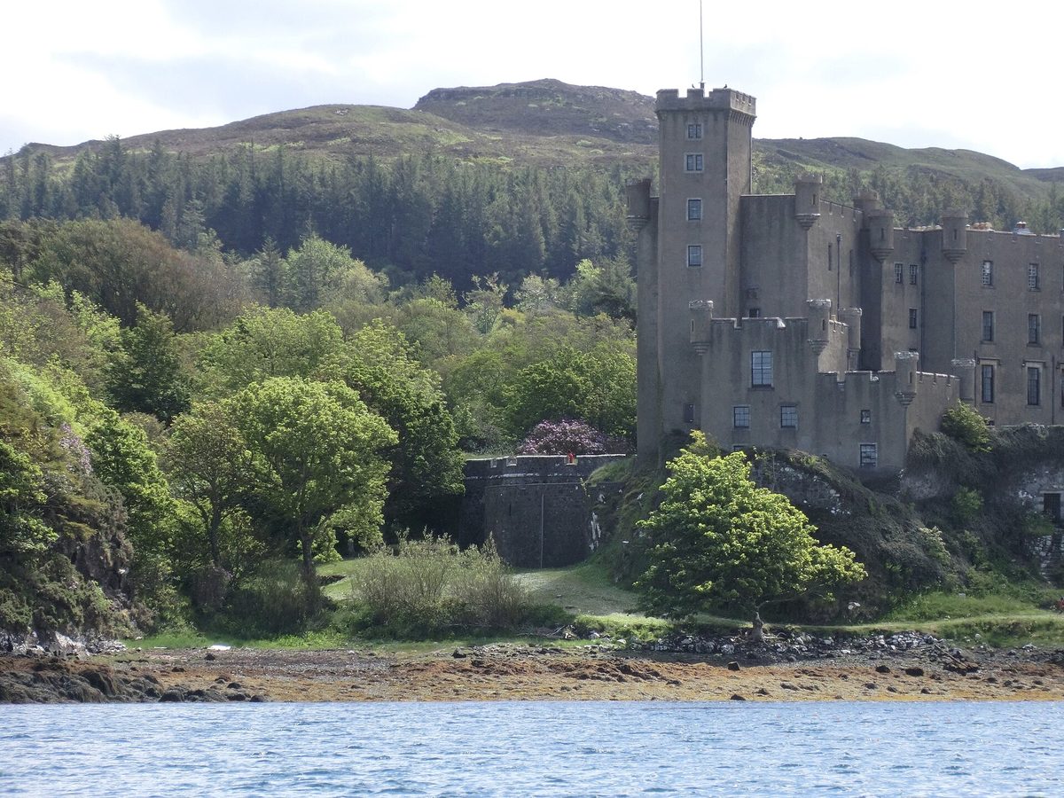
Dunvegan has the last shop, the last fuel and the last public toilets before the Point, and a couple of hotels and pubs that serve food later than anything further west. It also has Dunvegan Castle, seat of the MacLeods, which pairs neatly with Neist if you want a full day on the Duirinish side rather than a dash out for sunset. Prices and opening hours move around, so check before you go.
Planning your visit
How long to allow
Two hours at the Point itself covers the lighthouse walk, the clifftop viewpoint and some time sitting still. Three hours if you want sunset properly, plus two and a half hours of driving from Portree and back. In practice, Neist Point is a half-day commitment from anywhere on Skye, and an evening commitment if you are going for the light. Treat it as its own outing rather than a stop between two other things.
It slots neatly into the west side of a Skye trip alongside Dunvegan and the Coral Beach. Our day-by-day Isle of Skye itinerary shows how to group it so you are not crossing the island twice, and the wider Isle of Skye guide covers what else the Duirinish peninsula holds.
Getting there and where to sleep
You need a car, or a tour. There is no bus to Neist Point; the nearest service reaches Glendale, roughly 5km short, and it is not frequent. If you are working out ferries, the bridge and driving times, start with how to get to the Isle of Skye.
Staying at Dunvegan or Glendale rather than Portree cuts an hour off the round trip and makes an evening visit far more relaxed, which matters more here than at most Skye sights. Our notes on where to stay on Skye compare the bases; book months ahead for June to August, because the west side has very little accommodation stock.
Without your own transport, a guided day is the realistic answer. Several operators include Neist Point on west-coast routes, and a good driver will time the arrival around the car park rather than fighting it. See our roundup of Isle of Skye tours, or, if you are planning the whole trip on public transport, the car-free Scotland itinerary.
What to bring
Boots, waterproof, warm layer, hat, head torch, binoculars, water, food, and a paper map or offline maps downloaded before you leave Dunvegan. Mobile coverage at the Point is poor to non-existent on most networks; do not assume you will be able to look anything up, call anyone or summon a taxi. If you use a tripod, bring one that will not blow over.
What underwhelms, and the mistakes I see most
Honesty first: the lighthouse compound itself is the least interesting part of Neist Point. It is a working navigation aid behind a fence, next to private houses. If your mental image is of a romantic ruin you can wander round, adjust it now. The landscape is the attraction; the building is a full stop at the end of it.
The second disappointment is arriving in flat grey cloud, which happens a great deal. Without light on the rock, the headland goes dull and the whole thing can feel like a long drive for a windy walk. That is the deal on Skye, and it is why I would rather do this on a promising evening in September than on a fixed date in June.
The mistakes, in rough order of frequency. Walking down to the lighthouse and never finding the viewpoint. Arriving at 21:00 in July and finding nowhere to park. Wearing trainers. Underestimating the climb back up. Leaving no daylight margin in October. Parking on a passing place. Bringing a dog off the lead through sheep. And assuming there will be a toilet, which there is not, at any point in the last ten miles.
One more, which is less a mistake than a missed opportunity: not sitting still. Most people spend eleven minutes at Neist Point, photograph it, and drive off. Give it an hour with a flask and a pair of binoculars and it is a completely different place. If you enjoy that kind of slow coastal walking, our overview of hiking in Scotland has more in the same vein, and the Quiraing circuit and the Fairy Pools walk are the natural companions on the other side of the island.
Frequently asked questions
How long is the walk to Neist Point lighthouse?
About 3km there and back, taking 45 minutes at a brisk pace and closer to two hours if you stop and explore the headland. The path is concrete with steps and a handrail. The return involves roughly 140 metres of ascent in one sustained climb, which is the hard part and worth budgeting twenty minutes for.
Where is the best viewpoint for the classic Neist Point photograph?
On the clifftop north-west of the car park, uphill and to the right as you face the sea, roughly 200 to 400 metres over rough grass. There is no sign and no made path. From there the headland, the An t-Aigeach prow and the lighthouse all line up. It takes five to ten minutes and no steps.
Can you go inside Neist Point lighthouse?
No. The tower is an automated Northern Lighthouse Board station, monitored remotely since 1990, and the former keepers’ cottages beside it are privately owned and have been used as holiday accommodation. The compound is fenced with no public access, and there is no visitor centre, cafe or toilet anywhere on the headland.
Is parking at Neist Point free, and how early should I arrive?
Parking was free at the time of writing, with roughly 40 spaces plus laybys back along the road. In June and July arrive by 4pm to be certain of a space, or accept a walk in from a layby. In May, September and October, an hour and a half before sunset is usually enough.
Is the Neist Point walk suitable for children or for anyone with limited mobility?
The clifftop viewpoint suits most people, including children, provided you stay well back from unfenced edges. The lighthouse path is steep with steps and a long climb back; it is manageable for active children but hard work with pushchairs, dodgy knees or vertigo. In wind or low cloud, skip the descent entirely.
What is the best time of year to visit Neist Point?
April to September for daylight, safety and sea conditions, with late August and September the pick for sunset alignment and sensible timings. Midsummer gives you light until nearly 23:00 but the heaviest crowds. Midwinter sunsets fall behind the headland at around 15:40 and the path is often icy. See our guide to the best time to visit Scotland.
Can you see whales from Neist Point?
Yes, with patience. Minke whales and basking sharks are seen from the headland most reliably between July and September, along with harbour porpoise and occasional dolphins. Bring binoculars, pick a sheltered spot, and scan slowly for blows or for diving gannets. Sightings are never guaranteed, but the deep water close inshore gives you a real chance.
Is there phone signal at Neist Point?
Not dependably. Coverage on the Duirinish peninsula is patchy at best and most networks give you nothing at the Point itself. Download offline maps and any booking details before you leave Dunvegan, tell someone your plan, and do not rely on being able to call for help or a lift from the car park.
Final thoughts
Neist Point rewards a bit of planning far more than most Skye stops. Get the timing right, park without stress, walk out to the clifftop first, and it delivers one of the great views in the Highlands and Islands for very little effort. Get it wrong and you have driven three hours for a car park row and a walk in the wrong direction.
My advice, in one line: go on a September evening, leave Portree by five, do the lighthouse walk first and the viewpoint second, and take a flask. Then go back and read the rest of our Skye planning guide for everything else the island is holding back.
About the author: This guide was written and is maintained by the ScotlandTourism.org editorial team — travel writers who’ve spent years exploring Scotland’s cities, Highlands and islands, from bagging Munros to chasing the perfect dram. We update our guides regularly to keep prices, opening details and advice current.
Last updated: August 2026. Prices and opening times change — always check the official site before you travel.
Photo credits
All images are used under their respective Creative Commons or public-domain licenses:
- Neist Point lighthouse and the An t-Aigeach headland lit by the setting sun, Isle of Skye — Dean Ferrier, CC BY-SA 3.0, via Wikimedia Commons
- The Neist Point headland and lighthouse seen from the clifftop viewpoint above the car park — JoachimKohler-HB, CC BY-SA 4.0, via Wikimedia Commons
- The single-track road running from Glendale out towards Waterstein and Neist Point — Richard Dorrell, CC BY-SA 2.0, via Wikimedia Commons
- The township of Glendale on the Isle of Skye, the last settlement before Neist Point — Richard Dorrell, CC BY-SA 2.0, via Wikimedia Commons
- The concrete path and handrail on the steep climb back up from Neist Point lighthouse — Richard Dorrell, CC BY-SA 2.0, via Wikimedia Commons
- The path along the Neist Point headland towards the lighthouse — Chris Downer, CC BY-SA 2.0, via Wikimedia Commons
- The cliffs of An t-Aigeach, the Stallion’s Head, on the Neist Point walk — S C Grove, CC BY-SA 2.0, via Wikimedia Commons
- A minke whale surfacing in Hebridean water, seen off western Scotland in summer — Nils, CC BY 4.0, via Wikimedia Commons
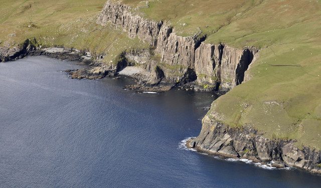
- Sea cliffs on the Duirinish peninsula near Waterstein Head, north of Neist Point — Iain A Robertson, CC BY-SA 2.0, via Wikimedia Commons
- Dunvegan Castle on the Isle of Skye, the last village before the road out to Neist Point — Lobster1, CC BY-SA 3.0, via Wikimedia Commons