The first time I walked up to the Old Man of Storr I did everything wrong. I left Portree at half past ten on a July morning, drove the seven miles north on the A855 with the sun out and the windows down, and arrived to find the car park solid, a queue of cars nosing in and reversing back out again, and a line of vehicles strung along the verge like a bad festival. I parked badly. I felt bad about it. And by the time I got to the top, the pinnacle I had come to see was inside a cloud.
I have been back six or seven times since, in every season, and I have come round to a view that almost nobody writing about this walk seems willing to say plainly: the walk is not the hard part. The path is superb now. The hard part is the car park, and the hard part after that is the weather doing something completely different a few hundred metres above the road. Get those two things right and the Old Man of Storr is one of the finest short walks anywhere on the Isle of Skye. Get them wrong and you will drive away with a photograph of grey.
The short answer
It is a 3.8km there-and-back walk climbing roughly 300 metres, taking most people 1.5 to 2.5 hours. The path is rebuilt gravel and stone throughout. Parking is pay-and-display and fills solid between roughly 10am and 3pm in summer, so arrive before 9am or after 4pm. Boots, not trainers.
At a glance
| Detail | What to expect |
|---|---|
| Distance | About 3.8km / 2.4 miles return to the main viewpoints. Roughly 5km if you take the longer circuit behind the pinnacles. |
| Ascent | Around 290 metres to the lower viewpoint, closer to 340 metres if you continue to the high knoll. |
| Time | 1.5 hours at a brisk pace with no stops; 2 to 3 hours realistically, with photographs. |
| Difficulty | Moderate. No scrambling, no exposure, but relentlessly uphill and stepped near the top. |
| Parking | Pay-and-display on the A855. Around £6 for up to six hours at the time of writing. Cash, card or the Ringo app. |
| Best window | Before 9am or after 4pm. Avoid 10am to 3pm from May to September. |
| Facilities | Free toilets, motorhome waste point, EV chargers, bike storage, rangers, summer kiosk across the road. |
| Underfoot | Gravel path low down, hand-built stone steps higher up. Grippy in the wet, punishing on the knees coming down. |
The car park is the actual difficulty of this walk
Every guide to this walk gives you the same three numbers — 3.8km, an hour and a half, moderate — and then a photograph. Almost none of them tell you the number that will actually determine whether your morning works, which is how many cars can physically be at the Storr at once, and how many want to be.
Here is that number, and it comes from the Highland Council’s own committee papers rather than from a blog. The site has around 100 off-street spaces in the car park proper, plus about 40 marked on-street spaces along the road. That is where the “140-space car park” figure you see everywhere comes from — except it is not one car park of 140. It is a car park of 100 and a roadside of 40, and they behave completely differently.
Now the demand side. Council modelling for 2025/26 projected something in the order of 82,000 six-hour tickets sold off-street in a year and another 22,000 on-street. Call it a hundred thousand-odd paid stays across 140 spaces. Averaged flat across the year that is roughly 290 cars a day. But nobody visits Skye flat across the year. Compress most of that into the summer half and into a six-hour window in the middle of each day, and you can see why the thing jams.
The site also gets somewhere around 220,000 visitors a year, on the Council’s own 2023 estimate. That is a lot of people funnelling through a single gravel path on a peninsula served by one two-lane road.
What it costs and how to pay
Charges at the Storr were — and here you need to be careful, because the internet is full of stale prices — £5 for up to six hours and £7 for up to twelve hours through 2025. In February 2026 the Council’s Isle of Skye and Raasay Committee considered a £1 rise on both tariffs from 1 April 2026, taking them to £6 and £8. Budget on the higher figures and check the machine when you arrive, because I would rather you had a pound spare than a penalty notice.
You can pay by cash or card at the ticket machines, or through the Ringo app. If you are relying on the app, do it before you set off up the hill: phone signal on the site is patchy and varies wildly by network, which is also why the rangers ask you not to treat your phone as your only navigation.
Where does the money go? Path maintenance runs to about £40,000 a year and the public toilets about £32,000. The site is deliberately run so that parking income pays for the paths and the loos rather than the general Council budget. I mention this because I have watched people at the machine grumble about paying to walk up a hill, and it is worth knowing that the hill you are about to walk up exists in usable condition largely because of that ticket.
The 100 and the 40 behave differently, and this matters
The off-street car park is the one everyone aims for and it is the one that gums up, because it has a single entrance, a lot of turning circles, and drivers doing slow laps hoping for a space. The marked on-street bays along the A855 are easier to get into and out of, and if you are in anything larger than a hatchback they are frankly the better option anyway.
Motorhomes and larger campervans cannot use the main car park at all — there is a height restriction — so the on-street bays are your only legitimate option. Same tariff. Plan for it rather than discovering it at the entrance with a queue behind you.
You cannot reserve a space. The official advice, and it is good advice, is that if the site is full you should drive on and come back later rather than improvise.
Where you absolutely must not park
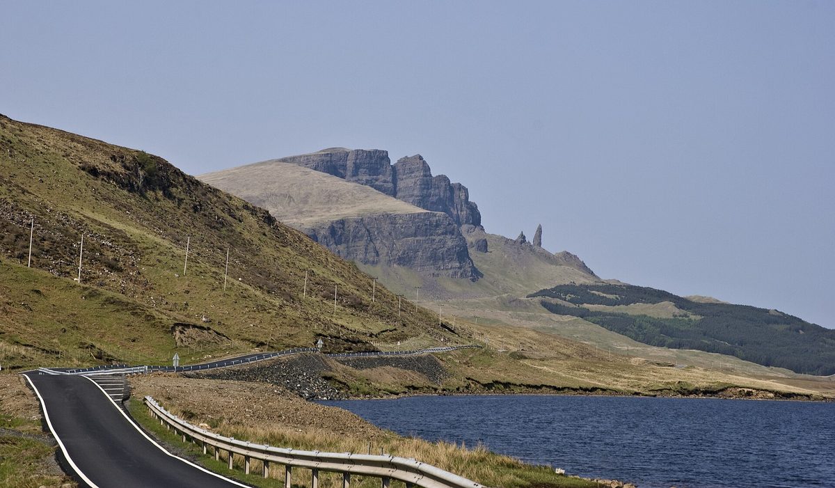
This is the bit that has become a genuine problem, and it is worth being blunt about. When the car park fills, people park on the grass verges of the A855 and in the passing places. Both are off-limits, and not for fussy reasons.
The A855 is the only through road on this side of the Trotternish peninsula. It carries the bus, delivery lorries, the crofters, and, when something goes wrong on a hill that receives 220,000 visitors a year, the ambulance. A verge full of hire cars turns a two-lane road into a single track with no passing places, on a blind curve, on a gradient. The Council is actively looking at roadside traffic safety measures at the Storr and has floated putting a dedicated attendant on the site to manage congestion, which tells you how the situation is viewed locally.
Verge parking also chews up the ground, which then needs repairing, which comes out of the same pot as the paths. And there is a quieter cost: it is precisely the behaviour that makes island communities resentful of visitors. Skye has been having that argument for a decade. Do not add to it for the sake of forty minutes.
If you arrive and it is full, the answer is genuinely simple. Drive fifteen minutes further north, do something else on the Trotternish loop, and come back at four o’clock when half the coaches have gone. You will have a better walk anyway.
Timing: the three windows that decide your day
If you take one thing from this guide, take this. There are three distinct windows at the Storr, and they are wildly different experiences of the same hill.
The sunrise window
Before about 8am you will have the place close to yourself, and the Storr faces east, so the sun comes up over the Sound of Raasay and lights the pinnacles from the front. This is not a coincidence that photographers stumbled on. It is the single reason the classic image of this place is a dawn image.
The practicalities depend enormously on the month. In late June, sunrise on Skye is somewhere around 4.30am, which makes this a commitment rather than an outing. In late September and October it slides to a civilised 7am-ish, which is why autumn is my favourite time to do this walk and why I would nudge anyone flexible towards a September trip over a July one. Check actual times for your dates rather than trusting a rule of thumb — Scotland’s daylight swings more than people expect, as our month-by-month weather guide lays out.
Bring a head torch if you are starting before first light. The path is good but it is stepped and uneven higher up, and walking down stone pitching in the dark with a phone torch in one hand is how people turn ankles.
The 10am to 3pm crush
This is when the coaches come. Day tours run out of Inverness, Fort William and Portree, and the Storr is on essentially all of them, because it is the one stop that delivers a famous view in under two hours of walking. Add independent drivers who have had a leisurely breakfast and you get a five-hour block where the car park is full, the path has a queue on the narrow bits, and the good viewpoints have twenty people on them.
It is not unbearable. The hill is big and the crowd thins as you climb, because a decent proportion of people stop at the first place the pinnacle comes into view. But you will not get a clean photograph, you will be giving way constantly on the upper path, and the parking is a lottery.
If this window is genuinely your only option — and if you are on a fixed-itinerary trip, it might be — go anyway. Just go in with the expectation that you are visiting a popular attraction rather than having a wild-hill experience.
The late-afternoon slot, which nobody uses
Here is the window I would actually recommend to most people, and it is the one the guides skip because everyone has copied the “go at sunrise” advice off each other.
From about four o’clock onwards the coaches have moved on. The car park empties out noticeably between four and five. In summer you still have hours of usable light — in June it does not properly go dark until near midnight — so there is no time pressure at all. And you get the whole hill back.
The trade-off is honest: by late afternoon the sun has swung round behind the Storr, so the pinnacles are increasingly backlit or in shadow rather than glowing. For a photograph of the rock itself, dawn wins comfortably. For a walk you actually enjoy, with room to stand where you like and stop where you like, late afternoon is the best hour of the day and it is not close. Evening light on the lochs and the sea below can be lovely even when the rock is in shade.
One warning. In October and later, an afternoon start needs planning — sunset comes around 6pm in mid-October and earlier still by November, and the descent is not somewhere to be caught out. Our guide to visiting Scotland in October goes into how much the light shortens.
The walk itself, section by section
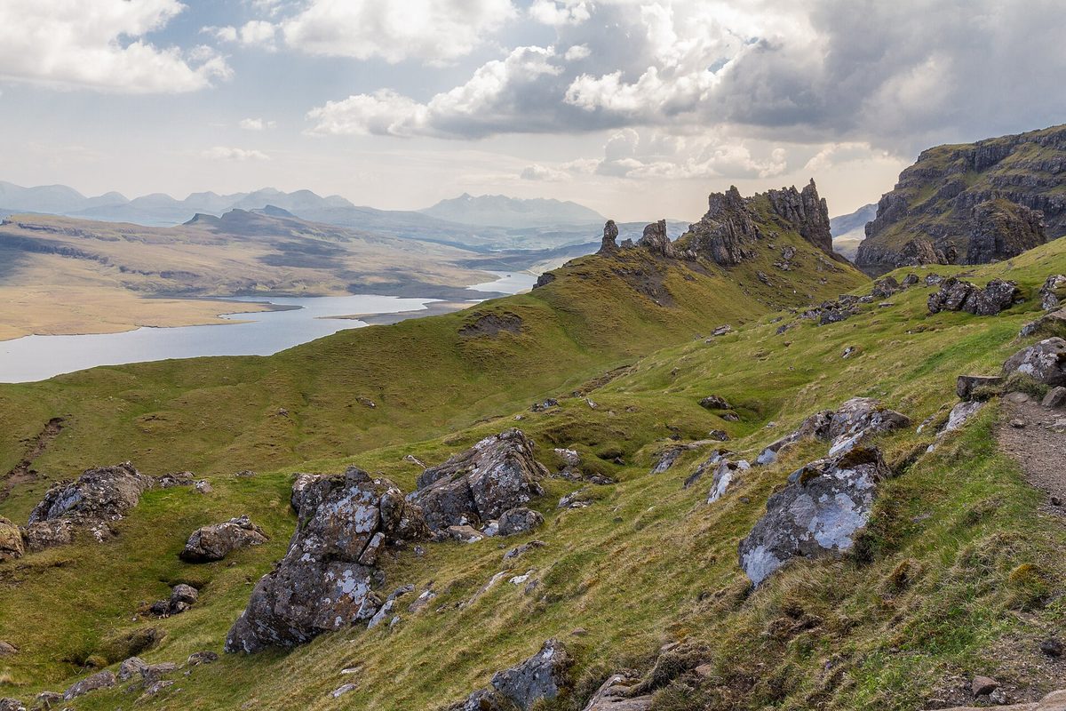
The route starts from the top corner of the car park and climbs steadily. There is no route-finding to speak of — the path is obvious, waymarked and, in places, fenced with double-height gates to keep the deer out. If you are used to Scottish hill walking, this will feel more like a well-made trail than a mountain.
The lower section: wide gravel, steady gradient
The first stretch climbs through what used to be forestry plantation and is now largely open. It is wide, well-drained gravel, and it goes up consistently without ever getting steep. Most people find this section easier than they feared and are slightly smug about it.
Look behind you rather than up. The views south over the Storr Lochs — Loch Leathan and Loch Fada — towards Portree and the Cuillin open up quickly, and on a clear day this is arguably the better half of the scenery.
The rebuilt upper path, and what stone pitching actually means for you
Higher up, the surface changes to hand-built stone steps. This is the part worth understanding, because it changes the walk in both directions.
The upper path was rebuilt as part of a Highland Council project delivered with the Skye Iconic Sites Partnership, with the second phase completed in February 2023 at a cost of around £220,000, funded through the Rural Tourism Infrastructure Fund administered by VisitScotland and by the Scottish Government’s rural payments division. The contractors built it by hand. The top section, around the area known as Photographer’s Knoll, was hand-pitched and restored specifically because the old desire lines up there were tearing the hillside apart. The whole area is a Site of Special Scientific Interest, and you will see biodegradable netting on the restored ground where vegetation is being encouraged back.
What this means going up: it is genuinely excellent. Stone pitching gives you grip in the wet that a mud path never will. On a drizzly Skye morning, where the old route would have been a churned brown slide, you now get positive footing the whole way. This is the single biggest improvement to the walk in twenty years.
What it means coming down: your knees will notice. Pitched steps are irregular by nature — hand-set stones, varying heights, sometimes a long stride between them. Descending 300 metres of that is harder on the joints than descending a smooth path, and it is the reason people who bounced up in an hour hobble down in fifty minutes looking unhappy. If you have dodgy knees, walking poles are worth more here than on most walks of this length.
Two other things. First, stay on the constructed path rather than cutting the corners — the shortcuts are exactly what the rebuild was fixing, and some of them are steeper and looser than they look. Second, there is signed rockfall risk from the crags above parts of the route. It is a real thing rather than lawyer-speak, particularly after heavy rain or a hard frost, and the sensible response is simply not to sit and eat your lunch directly beneath an overhanging face.
The lower viewpoint or the base of the pinnacle? Be honest with yourself
Here is a decision every party has to make and almost nobody makes deliberately.
At a certain point the path levels off and the Old Man comes fully into view for the first time. This is where a large share of visitors stop. It is a good view. It is not the view.
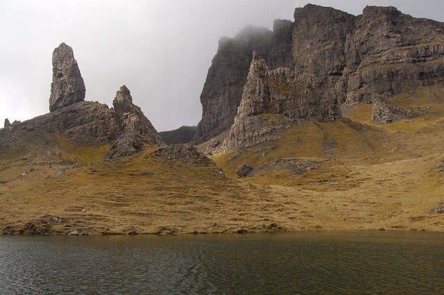
Keep going and you can walk right in among the pinnacles — the area known as the Sanctuary — and stand at the foot of the Old Man itself, roughly 50 metres of basalt going straight up above you. Beyond it stands Needle Rock, also called the Cathedral, with a window right through it near the top. Standing underneath these things gives you a sense of scale that no photograph transmits.
Should you push on? My honest answer: yes, if you have the legs and the weather, because the extra effort is modest relative to what you have already done. But there is a genuine case for stopping. The upper path is narrower, steeper and stepped, it gets busy enough that you are constantly stepping aside, and the last section adds a good chunk of the total ascent for a view that is different rather than automatically better. If you have children who are flagging, or you are already tired, or the cloud is down, stopping at the lower viewpoint is a perfectly good visit and not a failure.
What I would say is: decide, rather than drift. The people who look most disappointed on this hill are the ones who stopped by accident because they assumed they were at the top.
The longer circuit
If you want more, there is a variation that continues up behind the Old Man, passes behind Cathedral Rock to a small col, and takes in a knoll with a superb view back over the pinnacles before dropping down a separate constructed path. It adds perhaps a kilometre and a bit of ascent, takes the total closer to two and a half hours, and — this is the good part — sheds most of the crowd, because almost nobody does it.
It is rougher underfoot than the main route and I would not do it in poor visibility. Walkhighlands has the definitive stage-by-stage description if you want to follow it precisely.
The Storr makes its own weather, and it will catch you out
This is the thing I most want people to understand, because it is the difference between a good trip and a wasted morning, and hardly anyone mentions it.
You can stand in Portree in bright sunshine, look north, and see clear sky. You then drive fifteen minutes up the A855 and find the top third of the Storr wrapped in cloud that is not going anywhere. This is not bad luck. It is what a 719-metre escarpment does when moist Atlantic air is pushed up its face: the air cools as it rises, the moisture condenses, and a cloud forms and sits there. The cliffs generate it continuously. It can be a genuinely clear day on the coast and a whiteout at the Sanctuary.
The practical consequences:
Do not judge from Portree. As you drive north on the A855 you get a clear view of the Storr from several miles away, well before you commit. Look at the actual hill. If the pinnacles are in, they are in.
Check the mountain forecast, not the town forecast. A Met Office forecast for Portree tells you about sea level. Cloud base is the number that matters. If cloud base is forecast below about 400 metres you will be walking in it near the top.
It moves. Skye weather is fast. I have sat under a rock for fifteen minutes and had the whole thing clear off. If you are up there and it is grey, give it twenty minutes before you write it off, particularly with any wind. The number of people who turn round five minutes before it clears is remarkable.
Cloud is not automatically a loss. Some of the best conditions here are cloud tearing through the pinnacles rather than clear blue. What you want to avoid is uniform grey with nothing moving.
The wider point is that Skye demands flexibility. If you have three days on the island, do not pencil the Storr in for Tuesday morning and treat it as booked. Keep it as the thing you do on whichever morning looks best, and have a wet-weather alternative ready. That flexible approach runs through everything in our practical tips for travelling in Scotland.
Photographing the Old Man: where the shot actually is
There are three quite different photographs here and people routinely confuse them.
Where the crowd stands
Most people photograph the Old Man from the lower viewpoint, standing below it and shooting upwards. The problem is geometric: from there the pinnacle sits against the dark cliff face behind it, so it merges into the background and loses its outline. That is why so many people come home wondering why their pictures do not look like the ones they had seen.
Where the classic shot is taken from
The famous image — the Old Man standing clean against sky and sea, with Raasay and the mainland behind — is shot from higher and further round, from the grassy knoll near the trig point above the Sanctuary, the area the path builders call Photographer’s Knoll. It is another ten to fifteen minutes of climbing beyond where most people stop.
The reason it works is that you get high enough and far enough round that the pinnacle separates from the cliff and has open sky behind it. That separation is the whole photograph. Everything else — light, cloud, colour — is decoration on top of it.
Two courtesies up there. The path to the knoll is narrow and walkers have to give way to each other, so be patient. And it is restored, hand-built ground, so stay off the netted areas even if someone else is standing on them.
The one you can get without walking at all
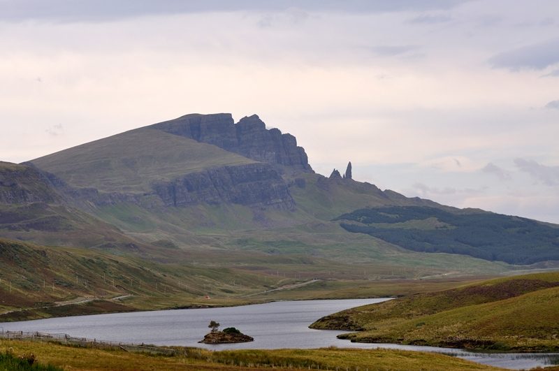
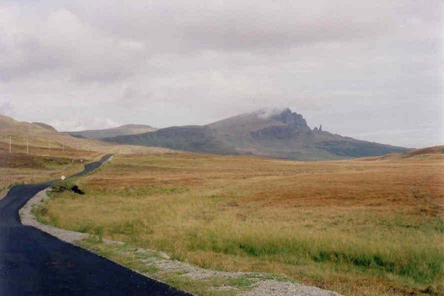
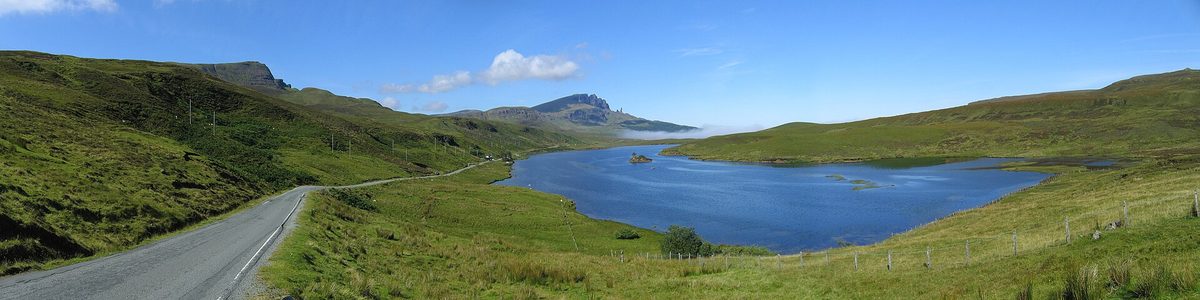
The wide landscape shot — the Storr as a whole ridge, reflected in water, with the road threading below — is a roadside photograph, taken from the A855 near Loch Fada, a couple of miles south of the car park. There is limited informal parking; pull in only where it is safe and legal to do so, and be aware some of these pull-offs are rutted enough to give a low hire car a bad day.
If someone in your group cannot manage the climb, this is a real consolation rather than a fob-off. It is a genuinely superb view and it is arguably the most recognisable image of Skye there is.
Drones
Plenty of the aerial footage you have seen of this place was filmed before rules tightened. If you want to fly here you need the appropriate CAA flyer and operator IDs, and you need to respect the site’s own signage and the other several hundred people around you. On a busy afternoon, launching a drone over a crowded viewpoint is not going to make you popular.
Footwear, and the trainers problem
I watch people set off up this path in white trainers every single time I come here, and a good number of them regret it.
The issue is not the ascent. Trainers will get you up. The issue is coming down irregular stone steps on wet rock with a soft, flat sole and no ankle support, and the fact that the upper sections hold water and stay greasy long after the rain stops. Add a bit of Skye wind and you have people descending sideways, grabbing at anything that will hold them.
Walking boots or decent trail shoes with a proper lugged sole. That is the whole recommendation. You do not need mountaineering kit for a 3.8km path.
The rest of what I would carry, in order of how often people wish they had it:
- A proper waterproof jacket. Not a showerproof windbreaker. It rains sideways here.
- A warm layer. The top is exposed and a couple of degrees cooler than the car park, but it is the wind that does the damage — it can be still at the bottom and genuinely unpleasant at the Sanctuary.
- Water. There is none on the route. Bottled water is sold on site year-round if you forget.
- Walking poles, if your knees are at all suspect. The descent is the crux.
- Midge repellent, from roughly June to August. The exposed top is usually breezy enough to be fine, but the car park on a still evening is another matter — see our guide to Scotland’s midge season for the honest picture.
- A head torch, for dawn or late starts.
Dogs are welcome but should be on a lead throughout: there is grazing stock on the hill and steep ground near the top.
Planning your visit
Getting there
The Storr sits on the A855 about seven miles north of Portree, which is a fifteen-minute drive. From the Skye Bridge at Kyle of Lochalsh it is roughly 40 miles and comfortably over an hour, so it is not a casual detour from the mainland — you want to be staying on the island or at least on the north side of it. Our rundown of the best towns to base yourself in covers how Portree compares to the alternatives.
The grid reference is NG508528 and the relevant map is OS Explorer 408. You will not need either for navigation on the main path, but they are worth having if you take the longer circuit.
Without a car
Stagecoach runs the 57A and 57C services on a loop round the Trotternish peninsula from Portree Square, and they stop at the Old Man of Storr car park. The catch is frequency: this is an infrequent rural service, not a shuttle, and the timetable changes between summer and winter. Check the current times on the Stagecoach site and plan around the return journey rather than the outbound one, because a missed bus here means a long wait or an expensive taxi.
It is entirely doable, though, and the Storr is one of the more bus-accessible famous walks in Scotland. If you are building a whole trip this way, our car-free Scotland itinerary and the wider guide to getting around the country are worth a read first. Joining a small-group day tour is the other realistic option, and there are plenty of organised tours covering Skye, though bear in mind they will deliver you squarely into the middle-of-the-day crush.
How long to allow, and what else to fit in
Allow three hours for the visit including parking faff, or four if you are photographing properly or taking the longer circuit. Do not schedule anything tight afterwards.
The Storr sits neatly on the Trotternish loop, so the obvious plan is to combine it with Kilt Rock and Mealt Falls (a roadside stop, ten minutes), the Quiraing (a proper walk), and the Fairy Glen near Uig. That is a full day. Trying to do the Storr, the Quiraing and the Fairy Pools in one day is the classic Skye over-reach and I would not attempt it.
For where the island fits into a bigger trip, our Highland road trip routes show how Skye connects to the mainland circuits, and if you are still working out the shape of the whole thing, start with how many days to give the Highlands.
Facilities on site
These are better than most people expect and better than most guides report, because the site has been steadily invested in.
There are free toilets with a baby-changing area. The accessible toilet needs a radar key. There is a free motorhome waste disposal point next to the toilets, bins, and both AC and DC EV chargers — though on a summer afternoon expect the chargers to be in use. Bike storage sits next to the toilets, uncovered, with a covered shelter further down the site towards Portree; bring your own lock. There is a defibrillator on the side of the Storr Rangers’ cabin in the car park.
For food, there is a small kiosk across the road in summer, on the southbound side of the A855 — take real care crossing, because traffic comes round there faster than you would like. In winter, tea and coffee are available inside the Storr centre. There is no Wi-Fi.
The Storr Countryside Rangers are on site and genuinely helpful. If you are unsure about conditions, ask them rather than guessing.
Is the Old Man of Storr overrated?
I get asked this a lot, usually by people who have seen the photographs and are suspicious. Let me give a straight answer.
No, it is not overrated. The rock formations are genuinely extraordinary, the setting above the Sound of Raasay is superb, and the amount of landscape you get for 300 metres of ascent on a made path is close to unbeatable in Britain. If you have one short walk in you on Skye, this is the correct one to choose. It has earned its place on any Scotland bucket list.
But it is busy, and busy changes the experience in ways the photographs cannot show you. The images that sold you on this place were taken at dawn by someone who was alone. If you arrive at noon in August you are visiting a well-managed tourist site with a queue on the narrow bits, and that is a different thing from what you were imagining. That gap between expectation and reality is where the “overrated” feeling comes from — not from the hill.
What genuinely underwhelms
The pinnacle from directly below, as a photograph. Standing at its foot is worth doing for the sheer scale of the thing, but through a lens it reads as a large lump of rock rather than the elegant spike you came for. It needs distance and separation to look like itself, which is why the walk up to the knoll matters.
The first half of the path. Honestly, it is a functional gravel track through cleared forestry. It is a means to an end.
The summit of the Storr itself. The actual 719-metre top is a fair bit further and considerably rougher, and unless you are hill-bagging it does not repay the effort. The good stuff is all on the pinnacle terrace.
The common mistakes
Arriving between 10am and 3pm and being surprised. Wearing trainers. Judging the weather from Portree. Stopping at the first viewpoint without realising there is more. Allowing ninety minutes because a website said the walk takes ninety minutes, and then having no time for the parking, the photographs or the descent. And parking on the verge.
The neighbours are emptier, and sometimes better
If crowds genuinely bother you, the Trotternish peninsula has alternatives within twenty minutes that see a fraction of the footfall.
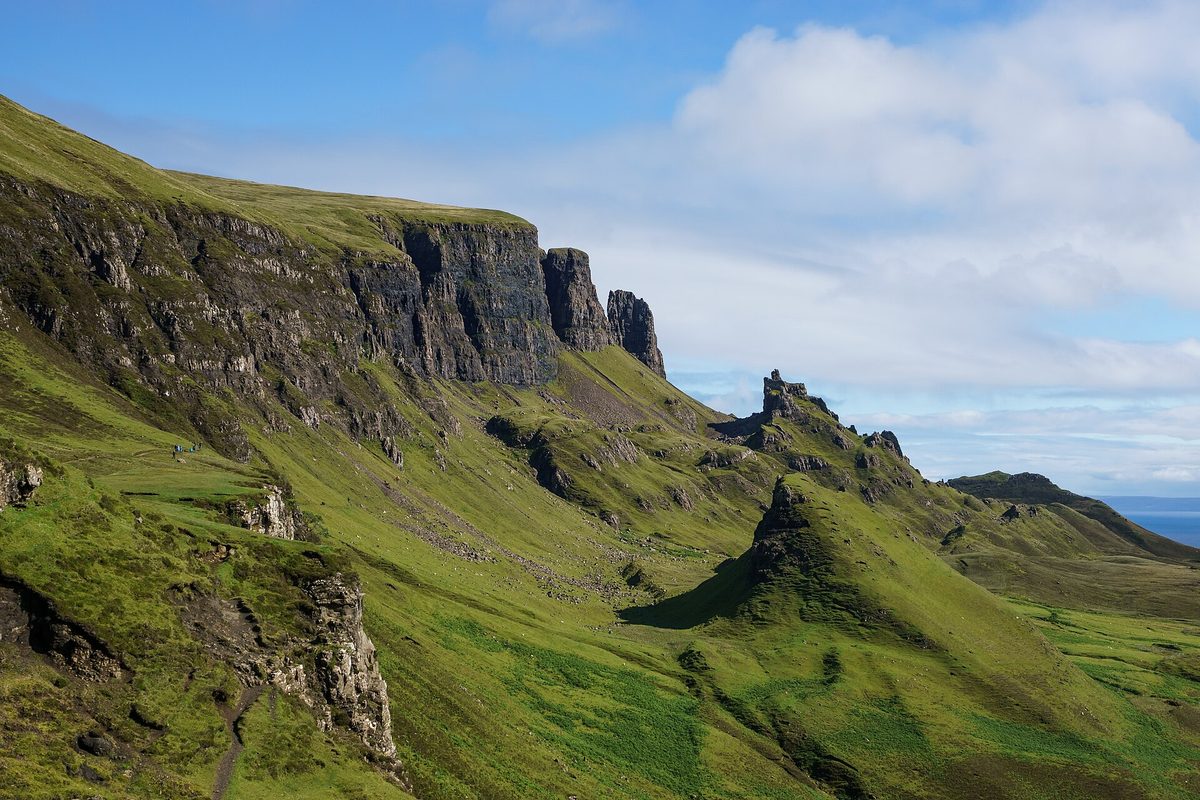
The Quiraing is the big one. It is a longer, rougher, more committing walk on a narrow path with real drops, and in terms of pure landscape drama I think it is at least the Storr’s equal and possibly its better. It is busy by Skye standards but nothing like the Storr, and the further round the circuit you go, the more the numbers thin out. Its own car park is small and the single-track road up from Staffin is not for nervous drivers.
The Trotternish Ridge proper, the long high spine running north from the Storr, is one of the great British ridge walks and is close to empty. It is a serious undertaking requiring navigation and a plan for transport at each end.
Rubha nam Brathairean (Brothers’ Point) is a short coastal walk south of Staffin, and on a summer afternoon you may see nobody at all.
Kilt Rock and Mealt Falls is not a walk — it is a viewing platform ten steps from a car park — but the waterfall dropping straight into the sea off columnar basalt cliffs is worth the five minutes.
These are all covered in more depth in our full Isle of Skye travel guide, and Skye itself is only one of many options if you want to compare it against the wider Scottish islands.

A note on what you are actually looking at
Worth two minutes, because it makes the walk better.
Skye’s basalt lavas were laid down around 60 million years ago, when this part of the North Atlantic was pulling apart and enormous volumes of lava poured out across the landscape. That heavy basalt ended up sitting on top of much weaker, older sedimentary rock. Weak foundations plus enormous weight equals failure, and the whole eastern edge of the Trotternish peninsula gradually slid seawards in the largest landslip in Britain — a process that ran on long after the volcanoes stopped and was helped along enormously by the last ice age.
The Old Man and its neighbours are pieces of that collapsed cliff, left standing as isolated towers while the softer material around them eroded away. You will occasionally see it described as the remains of a volcanic plug billions of years old. That is wrong by a wide margin, and it has been copied endlessly around the internet. Skye’s volcanic rocks are tens of millions of years old, not thousands of millions.
The rock is also notoriously poor for climbing — it was first climbed in 1955, by Don Whillans, and the general verdict on its quality has never been flattering. Look up and you will see why loose rock warnings exist.
It is a landscape that rewards knowing a little about it, which is true of a lot of Scotland’s most beautiful places and of the Highlands generally.
Frequently asked questions
How hard is the Old Man of Storr hike?
Moderate. It is 3.8km return with around 300 metres of ascent on a made path, with no scrambling and no exposure. The difficulty is that it climbs consistently from the first minute and the upper section is stone steps. A reasonably fit person will manage it comfortably; the descent is harder on the knees than the climb is on the lungs.
How long does the Old Man of Storr walk take?
About 1 hour 15 minutes to 1.5 hours moving time. Realistically allow 2 to 3 hours for the visit, because you will stop for photographs, and add time for parking. If you take the longer circuit behind the pinnacles, budget two and a half hours of walking.
How much is Old Man of Storr parking?
Pay-and-display, with tariffs of £5 for six hours and £7 for twelve hours through 2025, and a proposed £1 increase on both from April 2026. Budget around £6 for a typical visit. Pay by cash, card or the Ringo app. The walk itself is free and the site is open at all hours.
What time should I arrive at the Old Man of Storr?
Before 9am or after 4pm from May to September. The car park fills solid from about 10am to 3pm when the coach tours arrive. Sunrise gives the best light because the Storr faces east; late afternoon gives you the emptiest path. The middle of the day gives you neither.
Can you see the Old Man of Storr without hiking?
Yes. There is a good view from the A855 near Loch Fada a couple of miles south of the car park, and it is the angle used for most of the wide landscape photographs of the Storr. You will not get the close-up view of the pinnacles, but as a consolation for anyone who cannot manage the climb it is a genuinely fine one.
Do I need hiking boots for the Old Man of Storr?
Boots or trail shoes with a proper grippy sole, yes. Trainers will get you up but make the descent over wet, irregular stone steps unnecessarily unpleasant and slightly risky. You do not need anything technical — this is a made path, not a mountain route.
Why is the Old Man of Storr always in cloud?
Because the Storr escarpment forces moist Atlantic air upwards, where it cools and condenses, so the hill effectively manufactures its own cloud. It can be sunny in Portree fifteen minutes away and completely clagged in at the top. Check a mountain forecast for cloud base rather than a town forecast, and look at the hill itself as you drive up the A855.
Is the Old Man of Storr suitable for children?
Yes, for children who are used to walking. It is a wide path with no scrambling, and the steps higher up are the main obstacle for short legs. Allow considerably longer than the stated times, keep them away from the edges near the top viewpoints, and be prepared to stop at the lower viewpoint if enthusiasm runs out. Plenty of families do it.
Final thoughts
The Old Man of Storr deserves its reputation. What it does not deserve is being treated as a box to tick between two other stops, which is how most people end up experiencing it — arriving at eleven, circling a full car park, walking up in a queue and coming down disappointed.
The fix costs nothing. Move your visit two hours either side of the middle of the day, look at the actual hill before you commit, and wear proper shoes. Do that and you get a walk that is short enough to fit into a morning and good enough to be the thing you remember about Skye.
And if you turn up and it is full and grey, leave it. Drive north, look at the Quiraing, have a coffee at Staffin, and come back at five. The hill is not going anywhere, and it will almost certainly be better later.
Storr pairs naturally with the rest of Trotternish. The Fairy Glen above Uig is twenty minutes further north and takes under an hour to wander, and the light that flatters the Storr does the same for it.
About the author: This guide was written and is maintained by the ScotlandTourism.org editorial team — travel writers who’ve spent years exploring Scotland’s cities, Highlands and islands, from bagging Munros to chasing the perfect dram. We update our guides regularly to keep prices, opening details and advice current.
Last updated: September 2026. Prices and opening times change — always check the official site before you travel.
Photo credits
All images are used under their respective Creative Commons or public-domain licenses:
- Old man of storr the storr — Aaengst, CC BY-SA 3.0, via Wikimedia Commons
- Old man of storr sanctuary — Berit from Redhill/Surrey, UK, CC BY 2.0, via Wikimedia Commons
- Old man of storr storr lochs — JoachimKohler-HB, CC BY-SA 4.0, via Wikimedia Commons
- Old man of storr pinnacle — John Allan, CC BY-SA 2.0, via Wikimedia Commons
- Old man of storr a855 — Simon Johnston, CC BY-SA 2.0, via Wikimedia Commons
- Old man of storr loch fada — Klaus with K, CC BY-SA 3.0, via Wikimedia Commons
- Old man of storr portree — rboed*, CC BY 2.0, via Wikimedia Commons
- Old man of storr quiraing — Colin, CC BY-SA 4.0, via Wikimedia Commons
- Old man of storr kilt rock — Colin, CC BY-SA 4.0, via Wikimedia Commons