The first time I drove the loop I had a list of twenty-two places pinned on a map and I managed six of them in two days. Not because I dawdled — because I had no idea that pulling off a single-track road, parking, walking to the thing, looking at the thing and getting back into the traffic flow eats forty minutes even when the thing itself takes five.
So this is a different sort of guide to the best North Coast 500 stops. Every entry below gets three things the usual lists leave out: roughly how long it costs you door to door, how many minutes it sits off the main route, and a straight verdict on whether it earns the time. I’ve grouped them by the five driving legs of the loop rather than by castles-and-beaches, because that is how you’ll actually meet them.
Which North Coast 500 stops are actually worth it?
If you only stop six times on the whole loop, make them Dunrobin Castle, the Whaligoe Steps, Duncansby Stacks, Smoo Cave, Achmelvich or Clachtoll beach, and the Bealach na Bà in decent weather. Everything else is a bonus. John o’Groats is a car park with a signpost.
The best NC500 stops at a glance
| Stop | Leg | Detour off the route | Realistic time cost | Cost |
|---|---|---|---|---|
| Dunrobin Castle | Inverness to Golspie | None — on the A9 | 2–2.5 hours | Around £16 adult |
| Whaligoe Steps | East coast to Wick | 4–5 minutes each way | 45–60 minutes | Free |
| Duncansby Stacks | East coast to Wick | 5 minutes each way | 45–60 minutes | Free |
| Smoo Cave | Thurso to Durness | None — on the A838 | 30 minutes free chamber, 1 hour with the boat | Free / around £15 for the tour |
| Achmelvich Beach | Kylesku to Ullapool | 10–12 minutes each way | 1–1.5 hours | Free entry, paid car park |
| Ardvreck Castle | Kylesku to Ullapool | None — layby on the A837 | 8 minutes | Free |
| Corrieshalloch Gorge | Kylesku to Ullapool | None — Braemore Junction | 45 minutes | Around £5 to park |
| Bealach na Bà | Wester Ross to Inverness | It is the route, if you choose it | 1 hour including the top | Free |
Why North Coast 500 stops cost more time than you think
Here’s the thing nobody puts in the listicles. On a normal A-road, a stop costs you the time you spend at the stop plus two minutes of slowing down and speeding up. On the NC500, large sections are single track with passing places, and rejoining after a stop means waiting for a gap, then creeping along at 25mph behind a motorhome that is doing its best.
The practical effect is that a “quick fifteen minutes” at a beach becomes forty. Build that into your planning and you’ll enjoy the trip enormously. Ignore it and you’ll spend the week irritated, arriving at your accommodation at nine in the evening with a bag of crisps for dinner.
My rule of thumb after several laps: whatever the stop’s own time cost is, add fifteen minutes for the getting-in and getting-out. Then add the detour minutes twice, because you have to come back. A ten-minute detour to a beach that takes an hour is really an hour and thirty-five minutes of your day.
Which direction you drive changes very little about the stops themselves, but it changes a lot about traffic and light. It’s worth reading our guide to the NC500 route map and which direction to drive before you book anything, and the full North Coast 500 road trip guide covers the loop end to end. I’ve listed everything below anticlockwise from Inverness — up the east coast first, west along the top, south down the west coast, then back over the hills. Most people go the other way, west to Applecross first, so this order also means meeting fewer convoys head-on.
Leg 1: Inverness to Dornoch and Golspie
This first stretch is the easiest driving of the entire loop and most people rush it. It’s dual carriageway and fast single carriageway on the A9, with big bridges over the Beauly, Cromarty and Dornoch firths. You could be at Golspie in an hour and twenty minutes without stopping. Don’t — there are two genuinely good stops here and one of them is the best paid attraction on the whole route.
Chanonry Point, Fortrose — 25 minutes off the route
A narrow spit on the Black Isle where bottlenose dolphins come in close on a rising tide. It is not on the NC500 proper; you leave the A9 at Tore and come back the same way, which costs you the better part of an hour with the drive.
Time cost: 1.5 hours minimum, and you need to time it for an hour or two after low tide. Verdict: only if you’re staying in or near Inverness and Loch Ness the night before and can go early. Turning up mid-afternoon on the off-chance is a waste of a good hour, and the car park is tiny.
Dornoch — 5 minutes off the route
A small sandstone town with a thirteenth-century cathedral, a famous links golf course and a beach you can walk on for a mile. It’s the prettiest place on the east coast leg and a decent lunch stop. The cathedral is free and takes ten minutes.
Time cost: 45 minutes with a coffee, 20 if you just want the cathedral. Verdict: worth the short hop off the A9, particularly if you play — Royal Dornoch is one of the great links courses in Britain. If you’re not stopping for lunch, skip it.
Dunrobin Castle — roadside on the A9
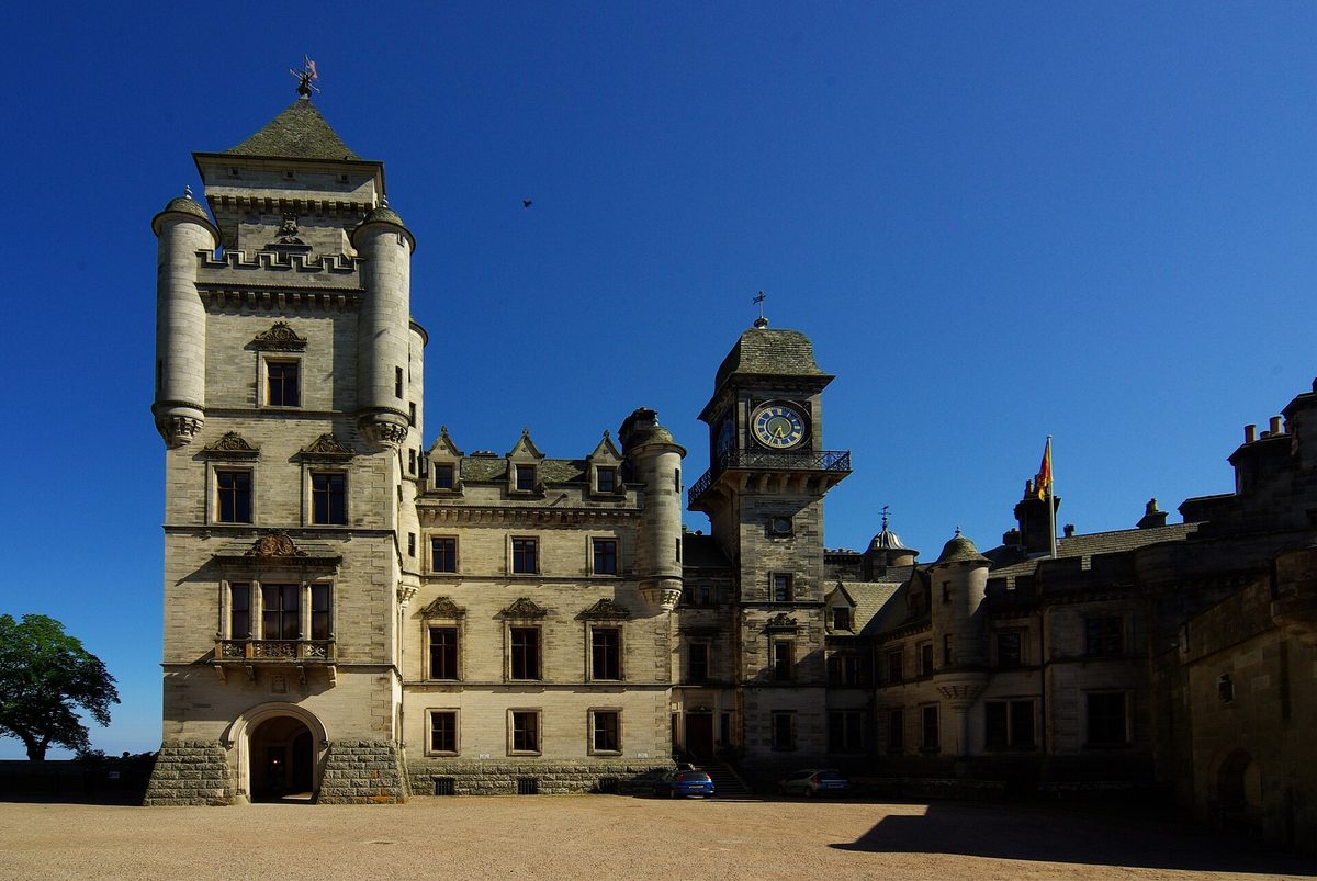
The one paid attraction on the NC500 I’d tell almost anyone to buy a ticket for. It has its own signed entrance a mile north of Golspie, so the detour cost is effectively zero, and 189 rooms make it the largest house in the northern Highlands.
Be clear about what you’re seeing, though. The fairytale silhouette with the conical turrets is not a medieval castle — it’s a Victorian remodel, largely the work of Sir Charles Barry in the 1840s, wrapped around a much older keep. If you arrive expecting draughty stone halls you’ll be surprised by how much of it feels like a French country house with tartan carpet.
The falconry displays are the reason to time your visit properly. They run twice daily through the open season, typically late morning and mid-afternoon, and last around twenty-five minutes. Birds are flown untethered in the gardens with the castle behind them, and it is a proper display rather than a photo opportunity. Check the current timings on the official Dunrobin Castle site before you set off, because arriving forty minutes after a display and having to wait is the most common mistake here.
Time cost: 2–2.5 hours to do it properly with a falconry display and the gardens; an hour if you’re rushing. Cost: around £16 for an adult at the time of writing, which includes castle, museum and gardens. Open: roughly April to October only, which catches people out badly in winter. Verdict: yes. If you only pay to go inside one thing on the loop, make it this. It also fits neatly into any of the Scottish castles worth planning a trip around.
Leg 2: the east coast to Wick and John o’Groats
Caithness surprises people. After the mountains of the west it looks flat and agricultural, and the standard reaction is disappointment. That’s a mistake: this leg holds the single most interesting stop on the loop, and the cliffs here are as dramatic as anything on the west coast — you just can’t see them from the road.
Whaligoe Steps — 4 to 5 minutes off the A99
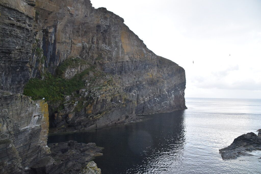
My favourite stop on the whole route, and the one most people drive straight past. A flight of stone steps — usually counted at 330, though the number varies depending on which crumbling ones you include — descends the cliff face to a tiny natural harbour where herring boats once landed their catch. Fishwives carried the baskets back up.
The problem is finding it. There’s no brown tourist sign worth the name, the turning is easy to miss near Ulbster, and the car park is a small unsurfaced patch beside the café that holds perhaps ten cars. Set your satnav to the Whaligoe Steps Café rather than the steps and you’ll be fine.
Going down is quick. Coming back up is the part to think about — it’s steep, the stone is slick in the wet, there’s no handrail for long stretches, and I would not take a nervous walker or a toddler down there. Boots, not trainers.
Time cost: 45 minutes to an hour including the climb back and a breather at the top. Cost: free. Verdict: do it. It’s free, it’s physical, and it tells you more about what life was actually like on this coast than any visitor centre on the route.
Castle Sinclair Girnigoe — 10 minutes off the A99
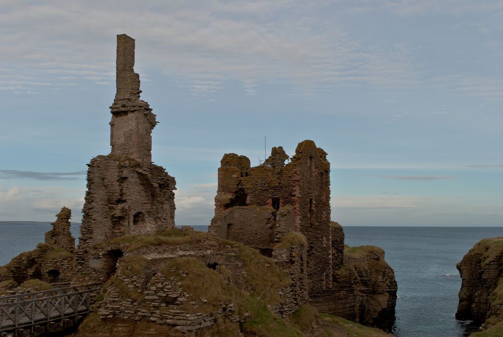
Signed from Wick towards Noss Head, down a straight single-track road to a car park by the lighthouse. From there it’s a flat ten-minute walk across a field to a ruin sitting on a promontory with sea on three sides, connected to the mainland by a bridge over a gulley.
There are good interpretation boards, no ticket office and no toilets. It’s an easy, atmospheric half-hour and it’s one of the few places on the east coast where you can stand somewhere genuinely precarious.
Time cost: 45 minutes to an hour with the walk both ways. Cost: free. Verdict: yes, if the weather is dry. In driving rain the field turns to slop and the ruin loses most of its appeal.
John o’Groats — on the route
I’ll be blunt: John o’Groats is a car park, a signpost, a row of pastel-coloured chalets, a couple of gift shops and a chip van. It is not the most northerly point of mainland Britain — that’s Dunnet Head, twelve miles west. It is not even especially far north compared with Duncansby Head, two miles east.
The famous signpost is a commercial operation: the version with your name and mileage home on it is a paid photograph, and there’s a free replica nearby that most people photograph instead. The harbour is pleasant. The ferry to Orkney leaves from here in season, which is genuinely useful if you’re extending the trip.
Time cost: 20 minutes. Cost: free, unless you want the personalised sign photo. Verdict: stop, take the photo, don’t linger. It is a box to tick, not a place to spend an afternoon, and everyone who tells you otherwise is selling something.
Duncansby Head and the Stacks — 5 minutes off the route
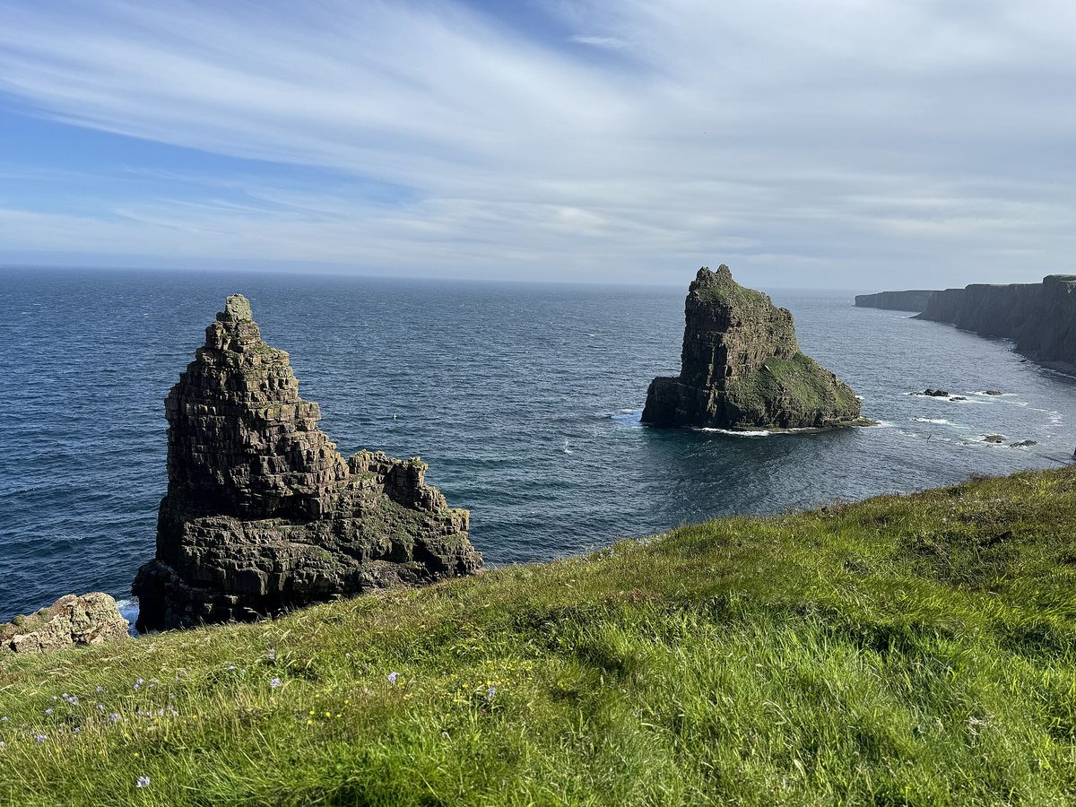
This is what John o’Groats should have been. Drive the two miles east past the chalets to the lighthouse car park, then walk south across sheep-cropped grass for fifteen minutes. The ground falls away and you’re looking down on the Duncansby Stacks — three enormous wedge-shaped sea stacks standing in green water, with a gash of a geo called the Long Geo cutting inland beside you.
The walk is flat, unmarked in places and completely open to the wind. There is no fence at the cliff edge. In June and July there are seabirds nesting on the ledges, including puffins in smaller numbers than Handa but close enough to see.
Time cost: 45 minutes to an hour return from the car park, longer if you sit. Cost: free. Verdict: the best free stop on the eastern half of the loop, and better than John o’Groats by a wide margin. If you have time for exactly one of the two, come here.
Leg 3: the north coast, Thurso to Durness
The A836 and A838 along the top are, for my money, the most underrated stretch of the NC500. Big skies, beach after beach, almost no trees, and the traffic thins out noticeably once you’re west of Thurso. It’s around 80 miles from Thurso to Durness and the road narrows to single track for much of the second half.
Dunnet Head — 12 to 15 minutes off the route
The actual most northerly point of mainland Britain, reached by a single-track road across peat bog to a lighthouse and a cliff-top viewpoint. On a clear day you see the whole Orkney archipelago laid out across the Pentland Firth.
Time cost: 45 minutes to an hour with the drive both ways. Cost: free. Verdict: worth it in clear weather and pointless in cloud, when you’ll drive twenty minutes to look at grey. Check what you can see from the main road first.
Castle of Mey — roadside on the A836
The Queen Mother bought this in 1952 and restored it, and it opened to the public after her death. It’s a modest castle by Scottish standards with a walled garden that does remarkably well given the wind.
Here’s my honest read: the whole experience is built around one twentieth-century personality. The guided tour is about her rooms, her possessions, her routines. If that interests you, it’s nicely done and the guides are excellent. If it doesn’t, you’re paying for a small castle with a nice garden and you’d get more from an extra hour at a beach.
Time cost: 1.5–2 hours. Open: a short season, typically May to September, and closed for a fortnight in late summer — check the official site before you commit. Verdict: skip it unless you care about the Queen Mother specifically.
The north coast beaches — mostly on or near the route
Melvich, Strathy, Farr, Torrisdale and Coldbackie all sit within a few minutes of the A836, and they’re all sand-and-machair beaches with almost nobody on them. You do not need to visit them all. Pick one, park properly, walk it end to end.
My pick is Torrisdale, where the Naver estuary comes out across the sand, but honestly you can’t go far wrong. If beaches are the point of your trip, our roundup of the best beaches in Scotland puts these northern ones in context against Harris and the west coast.
Time cost: 30–45 minutes each. Verdict: one is a highlight; four in a row is a slog, and you will stop being able to tell them apart.
Smoo Cave, Durness — on the A838
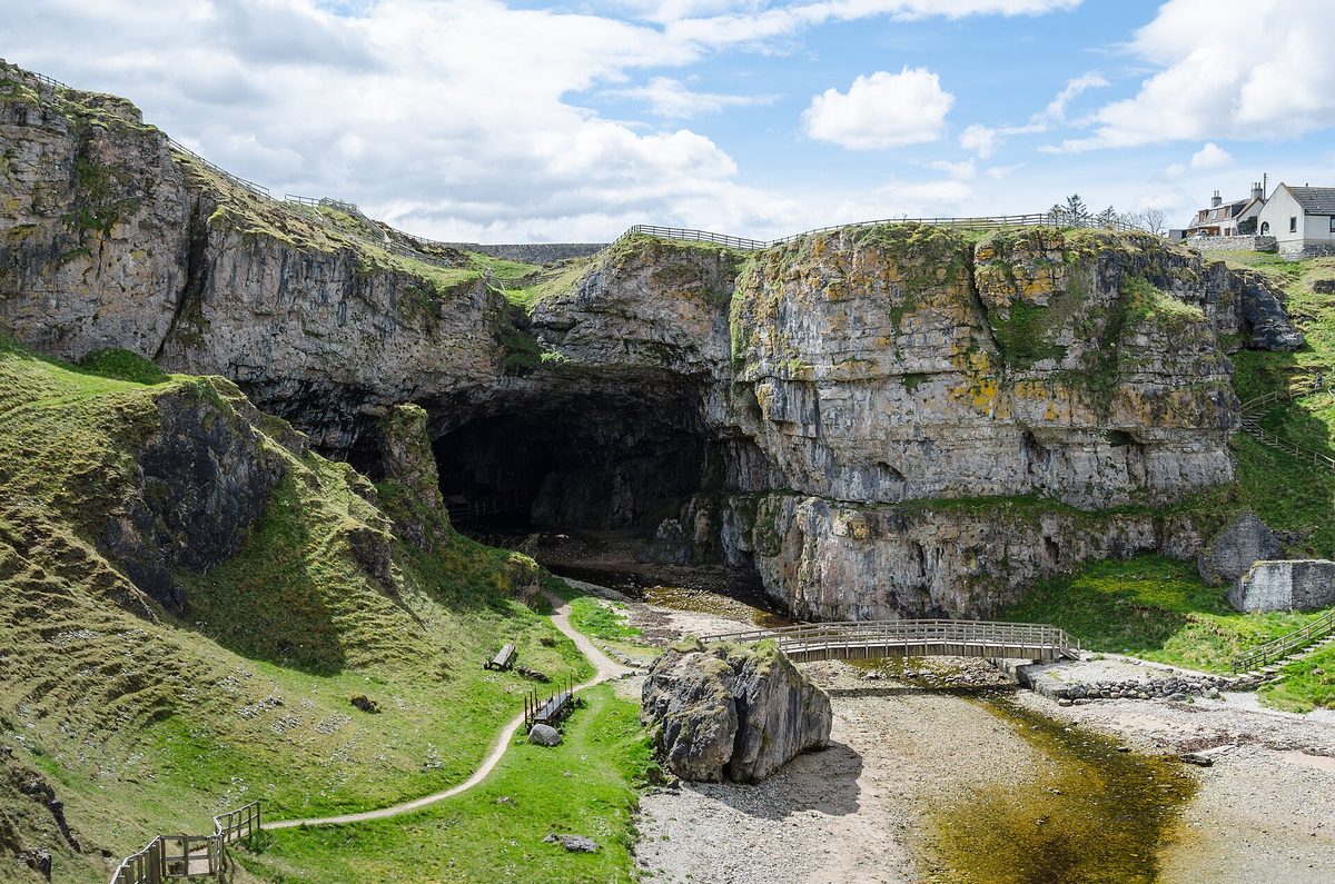
A limestone sea cave with an entrance around 15 metres high, right beside the road just east of Durness. Steps lead down from the free car park into the outer chamber, which is enormous, dry and impressive on its own.
The bit worth understanding is what’s beyond. A second chamber holds a waterfall where the Allt Smoo drops through a sinkhole, viewed from a walkway, and a boat trip run by a local operator takes you further in. That boat only runs when the burn is low enough — after heavy rain the water level rises and the tours stop, sometimes for days. It’s cash only, you can’t book in advance, and you find out on the day.
So plan for the free version and treat the boat as a bonus. In April or September with settled weather you’ve a good chance; in a wet week you have almost none.
Time cost: 30 minutes for the free chambers, about an hour if the tour is running. Cost: free to walk in; around £15 for an adult on the boat tour at the time of writing. Verdict: stop regardless. The free part alone justifies the fifteen minutes.
Durness beaches: Sango Sands and Balnakeil — 0 to 5 minutes off the route
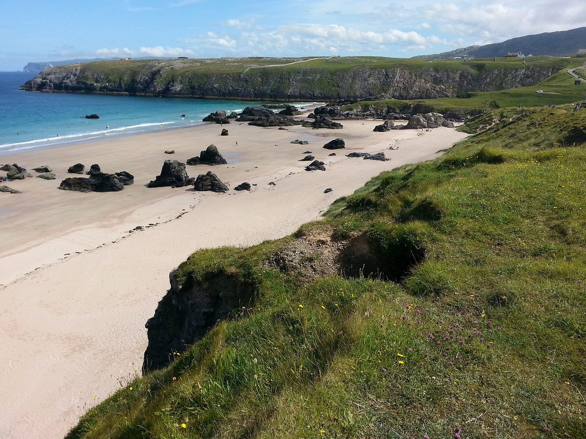
Sango Sands is directly below the village, a two-minute walk from the car park, with rock stacks scattered across pale sand. Balnakeil is a mile and a half west past the craft village, a longer and wilder curve of beach backed by dunes, with the ruins of Balnakeil Church at the near end.
Balnakeil is the better beach. Sango is the better use of twenty minutes. If you’re staying the night in Durness — and it’s one of the sensible overnight stops covered in our guide to where to stay on the NC500 — do Balnakeil in the evening when the light comes round.
Time cost: Sango 20 minutes, Balnakeil 45–60. Cost: free. Verdict: do at least one. Doing both is a pleasant hour and a half.
Leg 4: the north-west, Kylesku to Ullapool
This is the leg that makes the trip. From Durness the A838 runs south past Loch Eriboll and over some of the emptiest country in Britain, and by the time you reach Assynt you’re driving between mountains that look like nothing else in Scotland — Quinag, Suilven and Stac Pollaidh rising in isolation out of a floor of bog and lochan.
It’s also the slowest driving on the loop. Do not plan a long day here.
Kylesku Bridge — on the A894
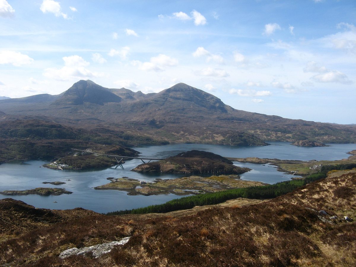
A curving concrete bridge across Loch a’ Chàirn Bhàin, opened in 1984, with a viewpoint car park at each end. It’s a five-minute stop that photographs beautifully, especially from the small pull-in on the north side looking back with Quinag behind.
Time cost: 15 minutes. Cost: free. Verdict: stop at one end, not both. Boat trips to Eas a’ Chual Aluinn, Britain’s highest waterfall, run from the old ferry slipway in season and take a couple of hours if you want the full version.
The B869 coast road: Clachtoll and Achmelvich — a 40-minute detour, plus beach time
South of Kylesku you have a choice. Stay on the A894 and A837 for the fast, straightforward run to Lochinver, or take the B869 through Drumbeg, Stoer and Clachtoll. The B869 is single track, relentlessly twisty, steep in places, and adds roughly forty minutes even before you stop.
Take it anyway, in a car. In a large motorhome, don’t — several sections have blind summits with nowhere to go, and this is the road where I’ve seen the most reversing-related unhappiness. If you’re weighing up vehicles, our comparison of NC500 campervan hire versus a car goes into which roads are realistically drivable in what.
Clachtoll is the easier of the two beaches: a small bay with a car park right behind it, a broch ruin along the shore and an Iron Age site excavated nearby. Ten minutes from car to sand.
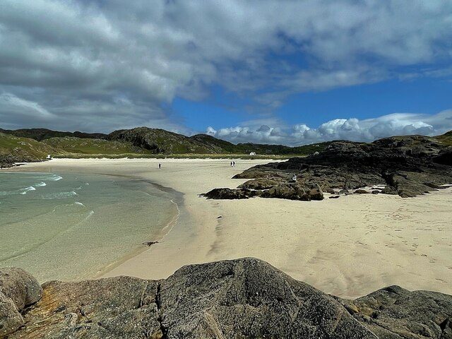
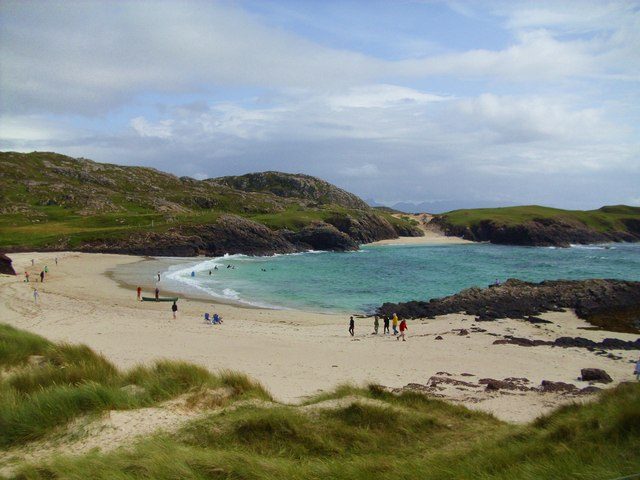
Achmelvich is the famous one — white shell sand, water that goes genuinely turquoise in sun, and a campsite behind the dunes. It’s about three miles down a very narrow spur off the B869, which is another ten to twelve minutes each way on top of the detour you’ve already taken. Parking is paid and fills by late morning in July.
Time cost: Clachtoll 45 minutes, Achmelvich 1–1.5 hours including the spur road. Verdict: pick one. Achmelvich if the sun is out and you want the postcard; Clachtoll if it’s grey or you’re short of time, because it’s quicker and nearly as good. Both are far better than any beach you’ll pay to visit.
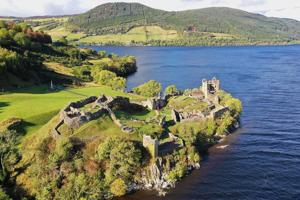
Ardvreck Castle — layby on the A837
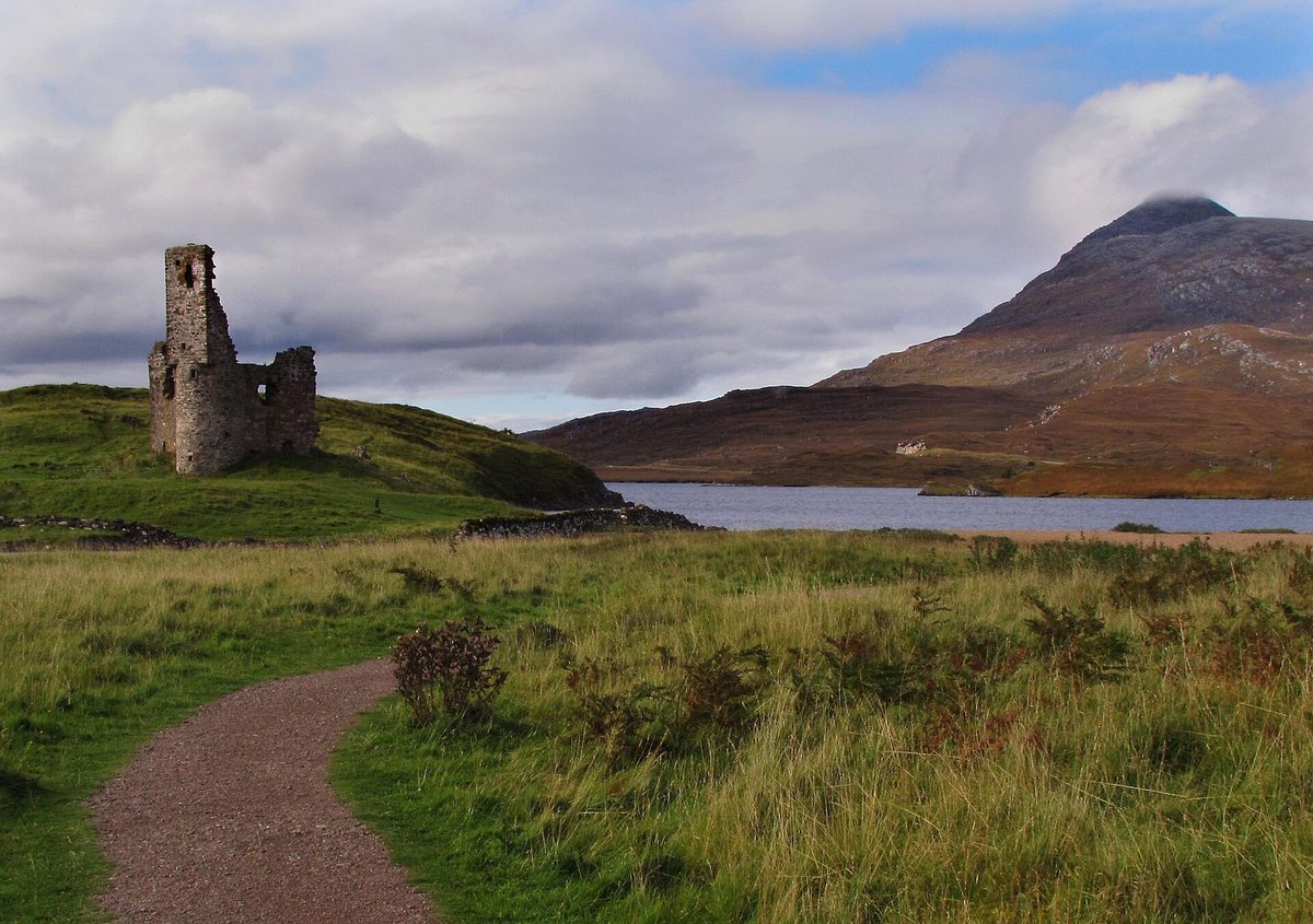
The most efficient stop on the entire NC500. A fifteenth-century tower ruin on a spit into Loch Assynt, with Quinag behind it. There’s a layby directly on the A837, a gate, and a flat two-minute walk. Look at it, photograph it, read the board about the Marquess of Montrose, walk back.
Time cost: 8 minutes. Genuinely. Cost: free. Verdict: unmissable purely on value for time. Add ten minutes if you want to walk on to the shell of Calda House next door.
Knockan Crag — layby on the A835
A small nature reserve where the Moine Thrust put older rock on top of younger rock and rewrote how geologists understood mountain building. There’s an unstaffed interpretation shelter, sculptures along the path and a short climb to a viewpoint over Cul Mor and the Assynt peaks.
Time cost: 40 minutes for the upper trail, 15 if you just read the boards. Cost: free. Verdict: quietly one of the better free stops, and a good leg-stretch between longer drives. Skip it if geology leaves you cold — the view is available from the car park.
Ullapool — on the A835
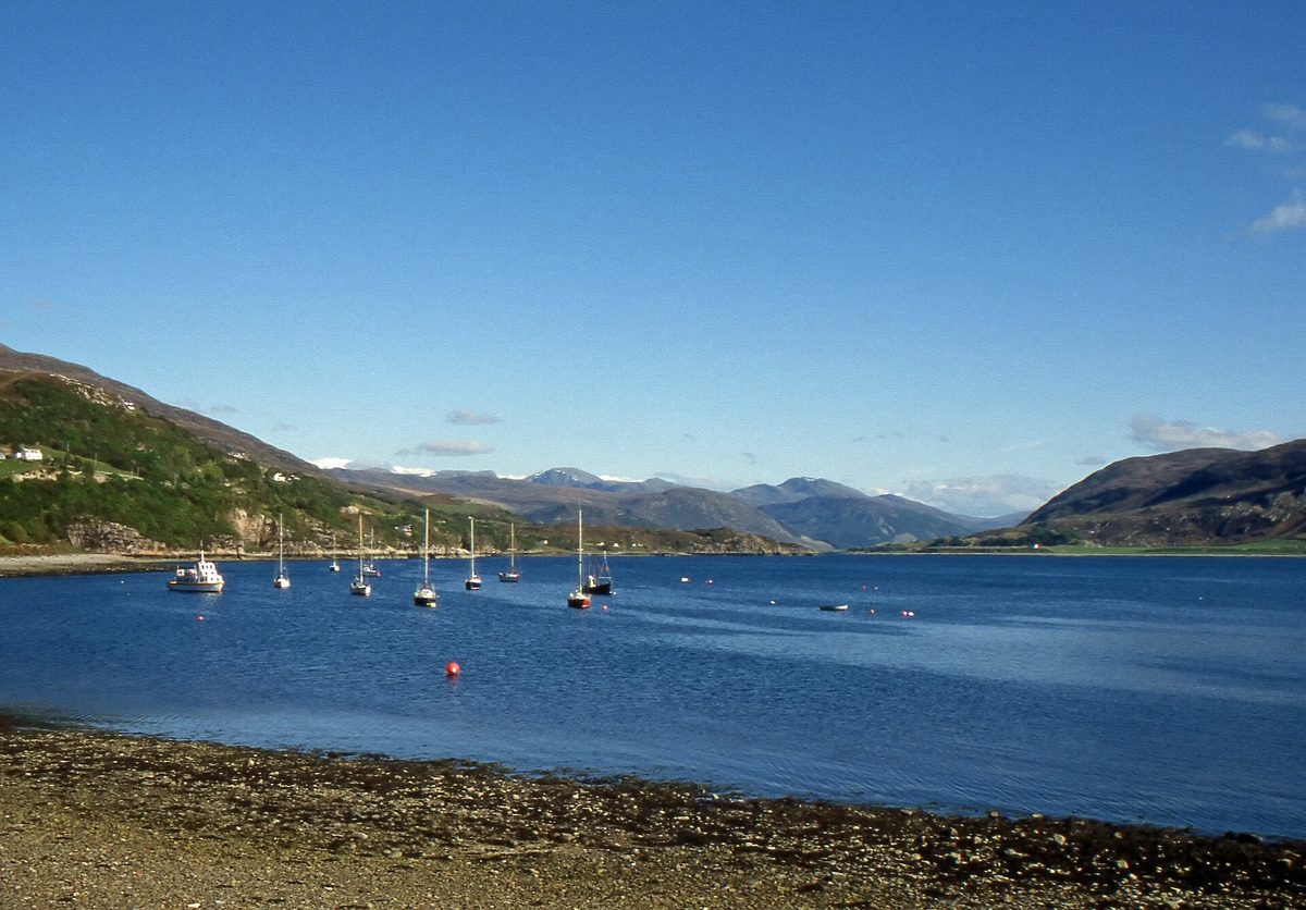
The biggest place between Inverness and Thurso: a proper working town of about 1,500 people, a ferry port for Stornoway, white houses along the shore of Loch Broom, and the best concentration of restaurants on the west coast of the loop.
An honest caveat. Ullapool on a warm evening in June with the boats in and the light on the water is one of the most pleasant places in the Highlands. Ullapool on a wet Tuesday in October, when the ferry has gone, half the places are shut for the season and the rain is coming sideways up Loch Broom, is a grey street with limited shelter. Both are the same town. Manage your expectations and book a table if you’re arriving in summer, because you won’t get one on spec.
Time cost: an hour for a wander and a coffee; a full evening if you’re staying. Verdict: stay the night here rather than passing through. It’s one of the strongest bases on the loop, alongside the options in our list of the best base towns in the Scottish Highlands.
Corrieshalloch Gorge — roadside at Braemore Junction
Twelve miles south of Ullapool, right at the junction where the A835 meets the A832, the River Droma has cut a box canyon around 60 metres deep and over a mile long. The Falls of Measach drop about 45 metres into it. You cross on a Victorian suspension footbridge that takes six people at a time and bounces gently, then walk on to a cantilevered viewing platform for the long view down the gorge.
There’s now a visitor centre with toilets, a café and electric charging. Parking is charged for non-members of the National Trust for Scotland, around £5 at the time of writing.
Time cost: 45 minutes for the full circuit. Verdict: yes, and it’s the best place to break the drive between Ullapool and Gairloch. It’s also one of the few stops that is arguably better in rain, when the falls are actually moving.
Leg 5: Wester Ross and Applecross back to Inverness
The final leg is the longest, the slowest and the most mountainous. From Braemore Junction the A832 loops out through Dundonnell, Gruinard, Gairloch and Torridon before you make the Applecross decision and turn back inland for Inverness. Give it a full day, not an afternoon.
Gruinard Bay and the Wester Ross beaches — on the A832
The A832 drops down to Gruinard Bay with a viewpoint layby at the top of the hill, and there are red-sand beaches at Little Gruinard and Mellon Udrigle just off the road. Gruinard Island offshore was the anthrax testing site in the 1940s and was only declared safe in 1990, which is a better story than most castles manage.
Time cost: 15 minutes at the viewpoint, 45 if you go down to the sand. Verdict: the viewpoint is a firm yes and costs you nothing.
Beinn Eighe and the Torridon road — on the route
Britain’s first National Nature Reserve, with a visitor centre near Kinlochewe and two waymarked trails from the roadside car park at Coille na Glas-Leitire — a woodland loop of about an hour and a mountain trail of three to four hours that climbs onto the quartzite.
Then the road down Glen Torridon, which for pure mountain drama is the best driving on the whole loop. Liathach rises straight off the roadside for a thousand metres. You don’t need to stop; you need to not be the driver.
Time cost: an hour for the woodland trail, half a day for the mountain one. Verdict: take the short trail if you want to say you walked in Torridon. The serious routes here are proper mountain days — see our guide to hiking in Scotland before you attempt one.
Bealach na Bà and Applecross — a route choice, not a detour
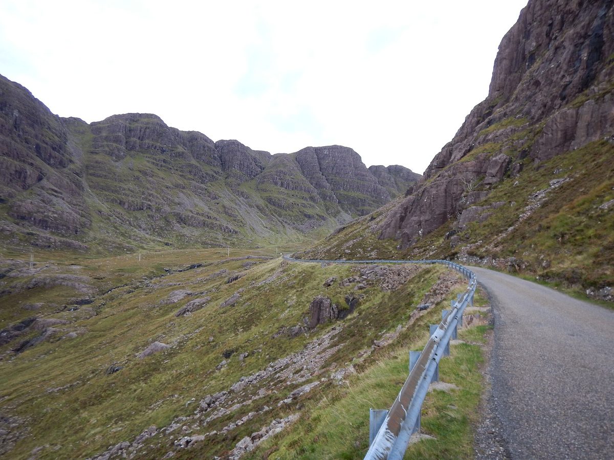
The famous one. The Bealach na Bà climbs from sea level at Tornapress to 626 metres (2,053 feet) in about six miles, with hairpins and gradients around 20 per cent. It’s the greatest continuous road climb in the UK and it’s single track with passing places the whole way.
Three honest points. First, it is signed as unsuitable for learner drivers, caravans and large vehicles, and that sign is not decorative — the hairpins near the top require reversing on a slope if you meet something big. Second, in low cloud you will drive the whole thing and see approximately nothing, which happens often; the car park at the summit is at cloud base more days than not. Third, the road closes in snow and ice, sometimes at short notice, and in winter you should assume it might be shut.
The alternative is the coast road north from Shieldaig through Kenmore and Applecross, and I want to be clear that this is not the consolation prize. It’s a longer, slower, extraordinarily scenic single-track road with views across to Skye and Raasay for miles. With a caravan or a big motorhome, it is the better drive and the only sensible one. With a car in clear weather, do the Bealach up and the coast road back down, or the other way round.
Applecross itself is a scattering of houses, a campsite and the Applecross Inn, which is deservedly popular and which you will not get into on a summer evening without booking well ahead.
Time cost: about 40 minutes to drive the pass plus 20 at the top; the coast road is closer to 1 hour 15 from Shieldaig. Verdict: the single best hour of driving on the NC500 in good visibility, and a waste of an hour in cloud. Check the forecast that morning and be willing to change plan.
Rogie Falls — 5 minutes off the A835
The last stop before Inverness, signed from the road near Contin. A short forest walk to a suspension bridge over a waterfall where salmon leap in late summer — roughly July to September is your window, and it’s a matter of luck.
Time cost: 30 minutes. Cost: free, small car park. Verdict: a decent way to break the last run home, and pleasant with children. Not worth planning around.
How many stops actually fit into one NC500 day?
Four. Maybe five if two of them are laybys.
I know that sounds low. Here’s the arithmetic. A realistic NC500 day covers 100 to 130 miles, which on these roads is four to five hours of actual driving. Add lunch somewhere — call it an hour by the time you’ve parked and been served. That leaves three to four hours of daylight for stops on a normal day, and every stop costs its own time plus the fifteen-minute in-and-out penalty.
So: one big stop of two hours (Dunrobin, or a beach you actually swim at), one medium stop of an hour (Whaligoe, Duncansby, Corrieshalloch), and two short ones of fifteen minutes (Ardvreck, Kylesku). That’s a full, satisfying day and you’ll be at your accommodation by six.
Try to add a fifth substantial stop and one of three things happens: you rush the good ones, you skip dinner, or you arrive somewhere in the dark having seen the last two attractions as a blur. In October, when it’s dark by half five in the north, you get roughly two-thirds of the day you’d have in June — our breakdown of the best time to drive the North Coast 500 is worth reading before you fix dates, and Scotland’s weather month by month will tell you what you’re likely to get.
This is also why the number of days matters so much. On a three or four day NC500 itinerary you’re choosing perhaps twelve stops from this list and driving hard between them. Stretch it to a five-day NC500 route and you can do most of the highlights without resenting the road. A seven-day NC500 itinerary lets you take the B869, do the Bealach twice and still have an afternoon on a beach.
Free versus paid on the NC500
Something worth saying plainly: the best things on this route are free.
Duncansby Stacks, the Whaligoe Steps, Achmelvich, Clachtoll, Balnakeil, Ardvreck Castle, Castle Sinclair Girnigoe, Kylesku, Knockan Crag, Dunnet Head and the entire Bealach na Bà cost nothing beyond fuel and, in a few places, parking. That’s the majority of the memorable moments on the loop.
What you actually pay for comes down to a short list. Dunrobin Castle, around £16 and worth it. The Smoo Cave boat, around £15 and dependent on the burn. Castle of Mey, a similar sort of figure and worth it only for a specific kind of visitor. Corrieshalloch parking at around £5. Distillery tours — Glenmorangie at Tain, Clynelish at Brora, Old Pulteney at Wick — typically £15 to £25 and covered properly in our guide to Scotch whisky distilleries. And boat trips: Kylesku, the Summer Isles from Ullapool, seabird cruises from Wick.
Parking is the sneaky cost. Several beach car parks now charge, honesty boxes are common, and machines don’t always take cards this far north. Carry a few pounds in coins. For the full picture on what a lap actually costs, including fuel across an area where petrol is noticeably dearer than the central belt, see our NC500 cost and budget breakdown.
What underwhelms, and the mistakes I see most
John o’Groats. Already covered, but it bears repeating because so many itineraries treat it as a destination. Twenty minutes, then drive to Duncansby.
The Castle of Mey if you have no particular interest in the Queen Mother. It’s a good visit for the right person and an expensive hour for everyone else.
Ullapool in bad weather out of season. Not the town’s fault. But if you’ve built a day around “an afternoon in Ullapool” in late October, have a wet-weather plan.
The Bealach na Bà in cloud. The road is an experience in itself, but if you’re going purely for the view and the summit is in the murk, take the Shieldaig coast road instead and enjoy something you can actually see.
Doing four beaches in a row. They stop registering. Alternate beaches with castles, gorges and towns and everything stays vivid.
As for mistakes: the big one is treating the NC500 as a driving challenge rather than a route between places. The second is not booking accommodation — in July and August the good places on the north and west coasts go months ahead, and the same applies to pitches, which is worth knowing before you rely on our guide to NC500 campsites and wild camping. The third is underestimating midges, which are at their worst from June to August in still, damp conditions on the west coast; our notes on Scotland’s midge season will save you an evening of misery.
And the fourth: driving too close to the car in front on single track. Leave a gap, use passing places to let faster locals through, and don’t stop in a passing place to take a photograph. It is the single thing that annoys people who live here.
Frequently asked questions
How many stops are there on the North Coast 500?
There’s no official list of North Coast 500 stops — the route is 516 miles of public road, and what counts as a stop is up to you. Most guides name between fourteen and twenty-five. Realistically you’ll make four or five proper stops a day, so a five-day loop means around twenty to twenty-five, including laybys and lunches.
What is the best stop on the NC500?
For time invested against reward, the Whaligoe Steps in Caithness. They’re free, they take under an hour, almost nobody stops, and the story of the fishwives carrying baskets up 330 steps stays with you. For sheer scenery, the Bealach na Bà on a clear day is hard to beat.
Should I drive the NC500 clockwise or anticlockwise?
Both work. Clockwise means heading west from Inverness and doing Applecross while you’re fresh, which is the more common choice. Anticlockwise, as I’ve ordered this guide, goes up the east coast first, saves the west for the end and puts the sea on your right all along the north coast. Going against the flow also means passing oncoming traffic rather than queueing behind it.
Can you see the main NC500 stops in three days?
You can see perhaps a dozen, but you’ll drive five or six hours a day to do it and the Applecross section will feel rushed. Three days works if you accept it as a driving trip with photo stops. Five days is the point at which it becomes a holiday.
Is Dunrobin Castle worth the entry fee?
Yes, if you time it for a falconry display. Around £16 buys the castle interior, the museum, the gardens and the display, and it’s the only major paid interior on the route. Bear in mind the interior is a Victorian remodel rather than a medieval castle, and it closes for the winter.
Which NC500 beaches are the best?
Achmelvich and Clachtoll in Assynt for white sand and clear water, Balnakeil near Durness for scale and emptiness, and Torrisdale on the north coast for the estuary. Achmelvich is the most photographed and the busiest; Clachtoll is easier to reach and nearly as good.
Do you need to book NC500 attractions in advance?
Very few require it. Dunrobin and the Castle of Mey sell tickets on the door, though booking online saves queueing in August. The Smoo Cave boat cannot be booked ahead at all. What you must book well in advance is accommodation, campsite pitches and dinner tables in Ullapool, Durness and Applecross in high season.
Are the NC500 stops suitable for a motorhome?
Most are, but several key ones aren’t. Achmelvich’s spur road, the B869 coast road and the Bealach na Bà are all difficult or prohibited for larger vehicles, and many beach car parks have low height barriers or tight turning. Plan around the A-roads and pick your detours carefully.
Final thoughts
The NC500 is not a difficult trip to enjoy. It is quite an easy trip to get wrong, and almost always for the same reason: too many stops, too few days, and no allowance for how slowly you actually move on a road with passing places.
Pick fifteen or twenty of the places above, spread them across your legs so you’re never doing three castles or four beaches in a row, and accept that you will drive past things. You’ll drive past a lot of things. That’s fine — the road itself is half the point, and the north-west corner of Scotland is not going anywhere.
If it’s your first Highland road trip, our first-time in Scotland tips and the wider Scottish Highlands travel guide will fill in the gaps around the loop itself. Take the extra day if you can find it.
About the author: This guide was written and is maintained by the ScotlandTourism.org editorial team — travel writers who’ve spent years exploring Scotland’s cities, Highlands and islands, from bagging Munros to chasing the perfect dram. We update our guides regularly to keep prices, opening details and advice current.
Last updated: October 2026. Prices and opening times change — always check the official site before you travel.
Photo credits
All images are used under their respective Creative Commons or public-domain licenses:
- Dunrobin Castle near Golspie, the grandest of the North Coast 500 stops — jack_spellingbacon, CC BY 2.0, via Wikimedia Commons
- The cliffs and tiny natural haven at the foot of the Whaligoe Steps in Caithness — N Chadwick, CC BY-SA 2.0, via Wikimedia Commons
- The clifftop ruins of Castle Sinclair Girnigoe at Noss Head near Wick — Peter Moore, CC BY-SA 2.0, via Wikimedia Commons
- The Duncansby Stacks near John o Groats, a short walk from the lighthouse car park — MaxKaane, CC BY-SA 4.0, via Wikimedia Commons
- The huge sea-cave mouth of Smoo Cave near Durness on the NC500 north coast — Florian Fuchs, CC BY 3.0, via Wikimedia Commons
- Sango Sands beach at Durness, one of the easiest beach stops on the North Coast 500 — Clive Nicholson, CC BY-SA 2.0, via Wikimedia Commons
- Kylesku Bridge curving across Loch a Chairn Bhain in Sutherland — Reboelje, Public domain, via Wikimedia Commons
- Ruined Ardvreck Castle beside the A837 on the shore of Loch Assynt — Carol Bleasdale, CC BY-SA 2.0, via Wikimedia Commons
- White sand and clear water at Achmelvich Beach in Assynt — Graham Hogg, CC BY-SA 2.0, via Wikimedia Commons
- Clachtoll Beach on the Assynt coast, a short walk from the car park — Gordon Hatton, CC BY-SA 2.0, via Wikimedia Commons
- Boats moored on Loch Broom at Ullapool, the largest town on the NC500 west coast — Giorgio Galeotti, CC BY 4.0, via Wikimedia Commons
- The Bealach na Ba mountain road climbing towards the pass above Applecross — James Emmans, CC BY-SA 2.0, via Wikimedia Commons