The first time I drove the north coast 500 route I did the thing everybody does: I looked at a map, saw a neat blue loop around the top of Scotland, and assumed it was a road. It isn’t. It’s about thirteen existing roads stitched together by a marketing team in 2015, and they range from a 70mph dual carriageway outside Inverness to a strip of tarmac above Loch Eriboll where you can go twenty minutes without meeting a car.
That gap between the tidy map and the actual driving is where most trips go wrong. People budget three days for 516 miles because 516 miles is nothing on a motorway. Then they meet the Bealach na Bà in the rain, or a Dutch motorhome coming the other way on the B869 with nowhere to go, and the whole schedule collapses. So this guide does two things properly: it walks the loop road number by road number and tells you what each one is like under the wheels, and it gives you a straight answer on which way round to drive it.
The short answer
The NC500 is a 516-mile signed loop from Inverness using the A9, A99, A836, A838, A894, A837, A835, A832, A896 and the B869, plus the Bealach na Bà pass. Roughly a third is single-track with passing places. Drive it anticlockwise unless you’re in a large campervan or towing.
The route at a glance
| Leg | Main roads | Approx. miles | Road character | Fuel on the leg |
|---|---|---|---|---|
| Inverness – Lochcarron | A862, A832, A835, A890 | 70 | Fast two-lane, then wide single carriageway | Muir of Ord, Contin, Garve, Lochcarron |
| Lochcarron – Applecross | A896, Bealach na Bà | 18 | Single-track, 20% gradients, hairpins | Applecross (limited hours) |
| Applecross – Shieldaig | Unclassified coast road | 25 | Single-track, slow, spectacular | None |
| Shieldaig – Ullapool | A896, A832, A835 | 95 | Narrow two-lane, improving northwards | Kinlochewe, Gairloch, Laide, Dundonnell, Ullapool |
| Ullapool – Kylesku | A835, A837, B869 or A894 | 55–61 | Two-lane to Ledmore, then narrow; B869 single-track | Lochinver, Drumbeg (seasonal) |
| Kylesku – Durness | A894, A838 | 35 | Narrow two-lane, then single-track | Scourie, Kinlochbervie (detour), Durness |
| Durness – Thurso | A838, A836 | 79 | Single-track to Tongue, then mixed | Tongue, Bettyhill, Melvich, Thurso |
| Thurso – Inverness | A836, A99, A9 | 140 | Standard two-lane and fast A9 | Everywhere |
What the north coast 500 actually is
There is no NC500 road
This matters more than it sounds. The North Coast 500 was launched in March 2015 by the North Highland Initiative as a tourism product, not a piece of infrastructure. Nothing was built. Nothing was widened. The route simply strings together roads that have carried crofters, fish lorries and post vans for decades, and in the case of the Bealach na Bà, since 1822.
So when you read that the loop is 516 miles, understand that it’s 516 miles of wildly inconsistent road. The A9 between Wick and Inverness will let you cruise at 60mph for an hour. The Applecross coast road will have you in second gear for twenty-five miles. Pure driving time for the loop is around 13 to 15 hours if nothing goes wrong, but nobody drives it that way — in practice, budget 20 hours behind the wheel and treat any online estimate as optimistic.
The signage exists, but you cannot navigate on it
You will see brown NC500 signs. They appear at major junctions, at the Kessock Bridge, at Laxford Bridge, around Tongue. They are helpful and they are also incomplete. There are long stretches — the run west from Kinlochewe, chunks of Caithness — where you can drive for an hour without seeing one, and there are junctions where the sign points along the main route and says nothing about the variation you actually meant to take.
Treat the signs as reassurance, not instruction. Know your next road number before you set off each morning. If you find yourself hunting for a brown sign at a Y-junction in Sutherland with no phone signal, you’ve already made the mistake.
The route road by road
I’ve described this clockwise because that’s the direction the official maps use, and because it makes the geography easier to follow. Read it backwards if you’re going anticlockwise, which — spoiler — is what I’ll be recommending shortly. Distances are approximate and rounded; treat them as planning figures, not gospel.
Inverness to Lochcarron: A862, A832, A835, A890 — about 70 miles
Out of Inverness over the Kessock Bridge, or west on the A862 through Beauly to Muir of Ord. Either way you’re on comfortable two-lane road with overtaking opportunities for the first half hour. At Muir of Ord pick up the A832 to Contin, then the A835 to Garve.
Garve is where it changes. The A832 west to Achnasheen runs through Strath Bran — long, straight, empty, and quietly one of my favourite bits of driving in Scotland precisely because nobody rates it. At Achnasheen the A890 heads south-west down Glen Carron alongside the Kyle of Lochalsh railway line, narrowing as it goes, with a short single-track section at the head of Loch Carron near Strathcarron. Then the A896 into Lochcarron village.
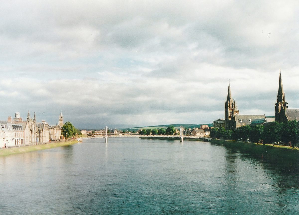
Road character: fast to Garve, wide single carriageway to Achnasheen, narrower and twistier on the A890. No real difficulty. If you’re arriving into Inverness the night before, it’s worth knowing what else sits on your doorstep — there’s more to the area than the loop, as our guide to Inverness and Loch Ness sets out.
Lochcarron to Applecross: A896 and the Bealach na Bà — about 18 miles
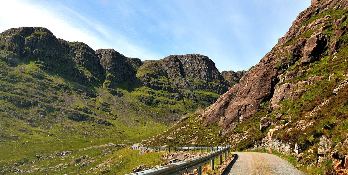
Seven miles up the A896 from Lochcarron to Tornapress, where a small car park and a very direct warning sign mark the bottom of the pass. From here it’s roughly 11 miles over the Bealach na Bà to Applecross village.
The numbers: it climbs from sea level to around 626m (2,053ft), the greatest ascent of any road climb in Britain, with gradients approaching 20% and three tight hairpins near the top. It is single-track with passing places the whole way. There is no barrier on much of it. In cloud you will see nothing at all, and cloud is the default condition — the summit weather station records a daily mean of about 4°C across the year.
It is not technically difficult in a normal car with functioning brakes and a driver who can use first gear. It is genuinely unsuitable for anything long. Learner drivers, caravans, anything towing and large motorhomes should not attempt it, and that isn’t politeness — it’s the official advice from the route operator and from local recovery firms.
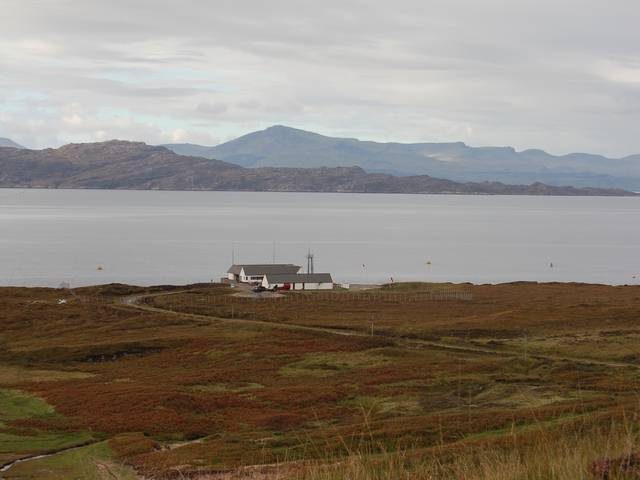
Applecross to Shieldaig: the coast road — about 25 miles
This is the road I’d drive if I only had one day in the north-west. It opened in 1975, it has no road number worth mentioning, and it runs from Applecross north through Sand and Cuaig, round the top of the peninsula at Fearnmore, then south-east down the shore of Loch Torridon to Shieldaig.
Every yard of it is single-track. It is also relentlessly bendy, with blind crests every few hundred metres and a surface that varies from decent to patched. Twenty-five miles will take you well over an hour and you should want it to — the views across the Inner Sound to Raasay and the Skye Cuillin are the reason you came.
There is no fuel, no shop and, for most of it, no phone signal. Fill up before you leave Applecross or Shieldaig.
Shieldaig to Gairloch: A896 and A832 — about 40 miles
The A896 east from Shieldaig runs under Beinn Alligin and Liathach through Torridon, which is mountain scenery on a scale that makes people pull over involuntarily. It’s narrow two-lane with passing bays in places, and the surface is fair. At Kinlochewe you join the A832 north-west along Loch Maree.
The Loch Maree stretch is one of the great underrated drives — a proper two-lane road hugging the shore for about twelve miles with Slioch across the water. Then Gairloch, which is a working village with shops, a bank of a sort, and reliable fuel.
Gairloch to Ullapool: A832 and A835 — about 55 miles
North through Poolewe (Inverewe Garden is right on the road), Aultbea, Laide, then round Gruinard Bay on a stretch that dips and climbs with sea views on your left. The A832 then turns inland through Dundonnell and climbs Destitution Road — named for the famine relief scheme that built it in the 1840s — over open moor to Braemore Junction.
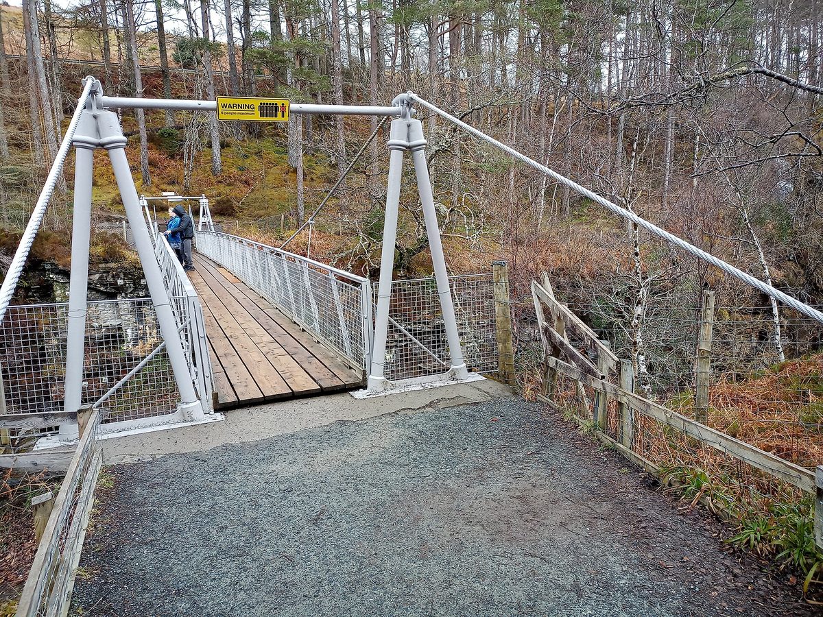
At Braemore you meet the A835 and everything changes. This is a fast, wide, well-surfaced road down Loch Broom into Ullapool, and after a day of single-track it feels like a motorway. Corrieshalloch Gorge is right at the junction and worth twenty minutes for the suspension bridge over the Falls of Measach.
Ullapool is the most useful town on the west coast: fuel, a Tesco, a chandlery, restaurants, the CalMac ferry to Stornoway. Whatever you need, buy it here.
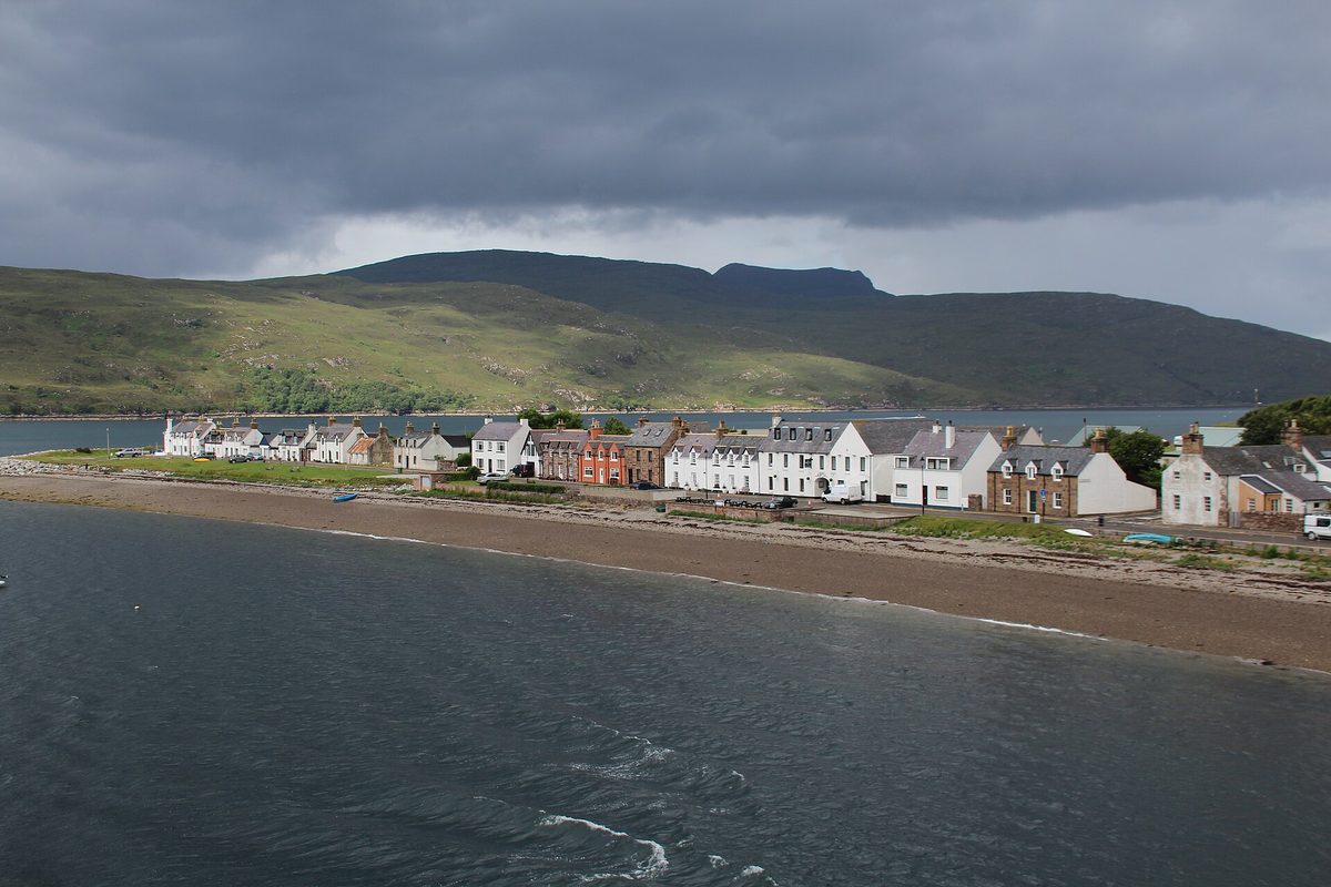
Ullapool to Lochinver: A835 and A837 — about 37 miles
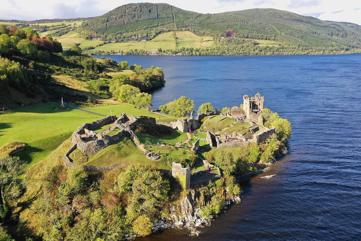
North on the A835 past Ardmair and Drumrunie, with Stac Pollaidh’s ridge on your left looking like something a child drew. The A835 stays good as far as Ledmore Junction, then you turn onto the A837 west past Ardvreck Castle on Loch Assynt — a ruined tower on a spit of land, free to visit, ten minutes from the car park.
The A837 into Lochinver is narrow two-lane with passing stretches. Lochinver has fuel, a good pie shop and a harbour that still lands fish.
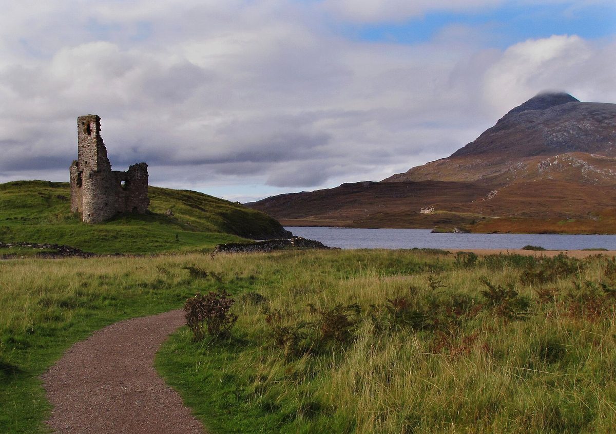
Lochinver to Kylesku: the B869 or the A894 — 24 or 18 miles
This is your first real decision point. The B869 loops north-west through Achmelvich, Clachtoll, Stoer, Clashnessie and Drumbeg before rejoining the A894 near Kylestrome. It is single-track throughout, and it is steep — there are pitches around Drumbeg that catch people out, with tight bends on gradients that demand first gear.
It’s also the best twenty-four miles of the entire loop. Achmelvich and Clachtoll are white-sand bays you’d expect somewhere warmer, and they rank with any of Scotland’s best beaches. In a car, take it. In anything larger than a VW-sized camper, don’t — the official advice is explicitly to use the A894 instead, and the A894 through Unapool is a perfectly good narrow two-lane road anyway.
Kylesku to Durness: A894 and A838 — about 35 miles
The A894 crosses Kylesku Bridge, a curved concrete span that opened in 1984 and replaced the ferry. There’s a lay-by on the south side and a viewpoint on the north; use the north one.
North through Scourie (fuel, campsite, boats to Handa Island for seabirds) to Laxford Bridge, where you turn right onto the A838. From Laxford to Durness is about 19 miles of single-track road through some of the emptiest country in Britain — bare gneiss, lochans, no trees, almost no houses. It is also where a lot of drivers first understand what a passing place is for.
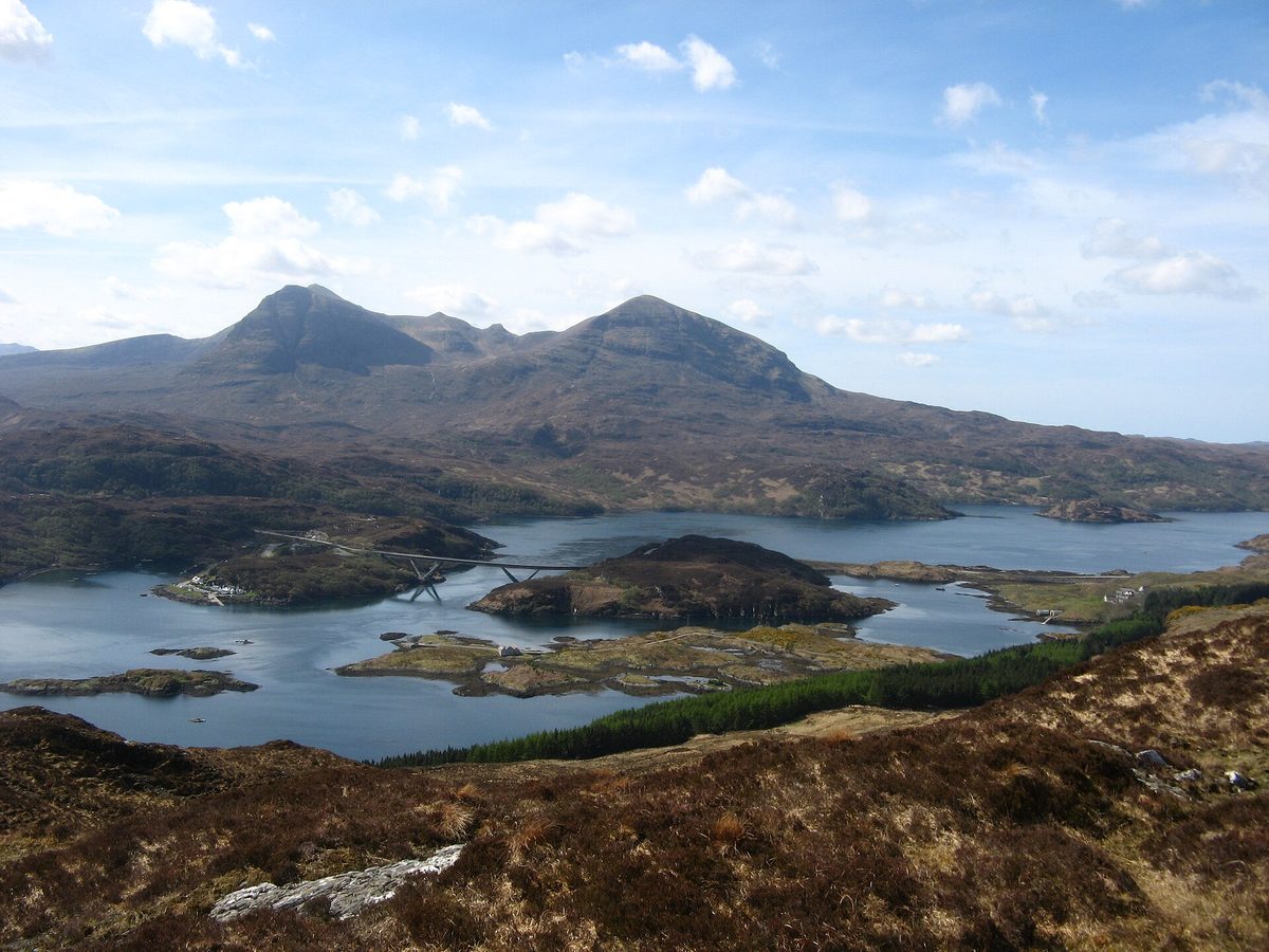
Durness to Tongue: A838 round Loch Eriboll — about 37 miles
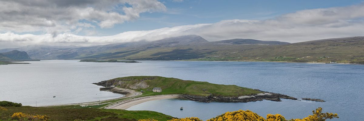
Look at a map and Durness to Tongue seems short. It isn’t, because the A838 has to run all the way down one side of Loch Eriboll and back up the other — a deep sea loch that adds close to fifteen miles to the journey. Wartime sailors called it Loch ‘Orrible. On a still morning it is anything but.
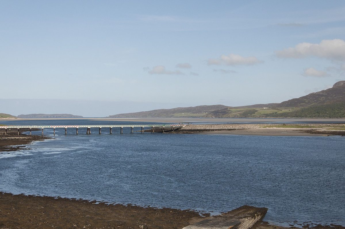
Single-track with passing places for most of it, with a two-lane section approaching the Kyle of Tongue. That kyle is crossed by a causeway and bridge opened in 1971 — before that the road took the long way round the head of the loch, and you can still see the old line.
Durness itself deserves a night: Smoo Cave sits at the edge of the village, Balnakeil beach is a mile away, and the Cape Wrath minibus leaves from the Keoldale ferry slip in season.
Tongue to Thurso: A836 — about 42 miles
East from Tongue on the A836 to Bettyhill, then along the top of Sutherland and into Caithness through Melvich, Reay and Dounreay to Thurso. The road alternates: some genuinely narrow single-track sections east of Tongue, then longer two-lane stretches as you go east, and a good fast run into Thurso.
This is the leg where the landscape softens from mountain to moor and then to farmland, and where the wind becomes a permanent feature. It’s also prime aurora-watching country between about September and March, with nothing but the Pentland Firth between you and the pole.
Thurso to Wick: A836 and A99 — about 37 miles via John o’ Groats
Standard two-lane through Castletown and Mey (the Castle of Mey is signed off to the left) to John o’ Groats, then south on the A99 to Wick. Easy driving. The single-track road out to Duncansby Head is short, has passing places, and ends in a car park by the lighthouse.
Wick to Inverness: A99 and A9 — about 103 miles
South on the A99 through Lybster to Latheron, where it becomes the A9. This is the fastest 100 miles on the loop: two-lane, well surfaced, with sections of overtaking lane and a couple of short dual stretches near Inverness. Berriedale Braes, once a notorious hairpin descent, was realigned in 2020 and is now unremarkable.
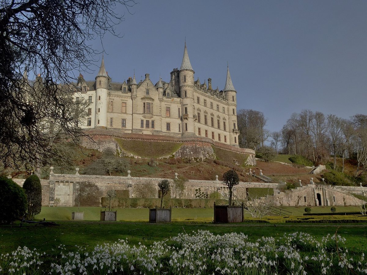
Helmsdale, Brora, Golspie, Dornoch, Tain, Alness, Dingwall. Dunrobin Castle sits right beside the road north of Golspie with 189 rooms and French turrets, and Clynelish and Old Pulteney are both a short detour if you’re collecting Highland distilleries. If you’re rationing time, this is the leg to compress.
Clockwise or anticlockwise? A real answer
First, what the words mean
Half the confusion online comes from people using the terms differently, so let’s pin them down. Clockwise from Inverness means heading west first — Muir of Ord, Garve, Achnasheen, Lochcarron, Applecross — then north up the west coast, east along the north coast, and south down the A9 home. That’s the direction the official maps are drawn in. Anticlockwise means north up the A9 first to Wick and John o’ Groats, west along the north coast, south down the west coast, and home through Applecross and Achnasheen.
The practical differences are real, and they aren’t the ones most guides list.
The case for anticlockwise
The scenery builds. You spend day one on the A9 through farmland and firths — pleasant, undemanding, no drama — and by the time you reach Assynt on day four or five the landscape is doing things you didn’t know Britain could do. Finishing on Torridon and Applecross rather than starting there means the trip peaks at the end instead of the middle.
More importantly, you learn the roads in the right order. Anticlockwise gives you the easy A9 while you’re still getting used to the hire car, then the mixed A836 across the north coast, then the single-track A838 round Loch Eriboll, then the narrow A894, then the B869, and only then the Bealach na Bà. By the time you reach the hard driving you’ve had three or four days of passing-place practice. Clockwise asks you to do the hardest road on the loop on day one or two, in a car you don’t know, possibly on the wrong side of the road for you.
It’s also quieter. Tour coaches and most guided groups run clockwise. Going the other way means you meet oncoming traffic rather than queue behind it, and you arrive at the big lay-bys off-peak.
The case for clockwise
Going clockwise, you drive the north coast west to east, which puts the sea on your left. In the UK that means every seaward viewpoint and lay-by is on your nearside: you indicate, pull in, stop, pull out. Anticlockwise, you’re crossing the carriageway each time and waiting for a gap to rejoin. In a car it’s a minor irritation. In a seven-metre motorhome it’s the difference between stopping ten times a day and stopping twice.
Clockwise also front-loads the decision that matters most for big vehicles. You reach Tornapress on day one or two, when you’re still close enough to Inverness to change your plan cheaply, and the signed alternative via Shieldaig is right there. And you finish on the A9 rather than on the Bealach, which is the better way to end a tiring week.
My verdict
Go anticlockwise. For the great majority of people — a car, six or seven days, some but not endless driving experience — anticlockwise is the better trip. You build skill before you need it, the scenery improves rather than declines, and you spend less time behind coaches.
The calculation flips if you’re short of time. On a three- to five-day loop I’d go clockwise instead and bank the Bealach na Bà on day one while you’re fresh, because it leaves the fast A9 for the final afternoon when you may have a flight to catch — the reasoning is set out in our five-day NC500 itinerary.
Go clockwise if you’re in a large campervan, a motorhome or anything towing. The nearside lay-bys alone justify it, and the early Bealach decision point is worth having. If you’re still weighing the vehicle question, our comparison of campervan hire against a car and B&Bs goes through the trade-offs properly.
What I’d avoid is the answer you’ll see everywhere else, which is that both are equally good and it doesn’t matter. It matters. It just doesn’t matter enormously.
One tweak if the Bealach worries you
Here’s the wrinkle. Going anticlockwise, you come into Shieldaig from the Torridon side, drive the coast road round to Applecross, and then cross the Bealach eastbound — which means descending the hairpins to Tornapress. Most drivers find the climb the easier direction: the engine does the holding, sightlines up the switchbacks are better, and you aren’t nursing brakes down a 20% gradient for two miles.
If that bothers you, drive the Applecross section as a loop instead. From Shieldaig, carry on south on the A896 to Tornapress, climb the Bealach westbound to Applecross, then take the coast road north back to Shieldaig and pick up the A896 again. It costs you about 35 extra miles and a repeated stretch of the A896. For a nervous driver in a hire car, that’s a fair trade.
How single-track roads actually work
Roughly a third of the loop is single-track, and almost nobody explains the etiquette before people arrive. It isn’t complicated, but getting it wrong is the single biggest source of friction between visitors and the people who live here.
What a passing place is for
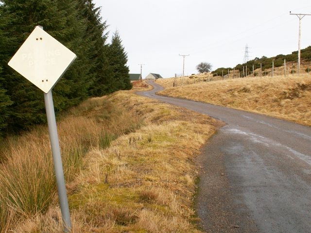
A passing place is a widened bay marked by a white diamond or square sign on a post. It has two jobs, and most visitors only know about one of them.
The first is letting oncoming vehicles through. The second, equally important, is letting faster traffic behind you overtake. If there’s a car in your mirror and you’re doing 30mph because you’re sightseeing, pull into the next passing place on your left and let it go. That car may be a district nurse, a delivery driver, or somebody who has driven this road four thousand times. You are not obliged to hold them up because you paid for a holiday.
Who gives way
The working rule: the vehicle nearer the passing place gives way. If the passing place is on your left, pull into it and wait. If it’s on your right, stop opposite it and let the oncoming driver use it — do not drive into a passing place on the right-hand side of the road, because you’ll be facing into oncoming traffic and blocking the bay for the person it was meant for.
Judge it early. The moment you see an oncoming vehicle, work out who reaches a bay first and act. Dithering in the middle of the road while you both slow to walking pace is how these encounters turn awkward.
Reversing, and how to do it without panic
Sometimes you both misjudge it and meet mid-section with no bay between you. Somebody has to reverse. In practice the vehicle with the shorter distance back goes, and if one of you is a lorry, a bus or a campervan, that’s the car — a loaded artic cannot reverse round a blind bend safely and you can.
Do it slowly, straight, with your mirrors, and stop if you lose the line. The verges here are soft peat and there’s often a drainage ditch you can’t see. If you cannot reverse your vehicle several hundred yards on a narrow road, the official advice is blunt: you shouldn’t be driving that road in that vehicle.
The rest of it
- Never park in a passing place. Not for a photo, not for two minutes, not to check the map. Use a proper lay-by or a car park.
- Say thanks. A raised hand off the wheel, or a quick flash of the headlights if it’s dull. It costs nothing and it changes the mood of the whole road.
- Don’t travel in convoy. Most passing places hold one vehicle. Three vans nose to tail simply cannot be passed. Leave at least one passing place between you.
- Halve your sight distance. On single-track you should be able to stop in half the distance you can see to be clear, because the other driver needs the other half.
- Watch for stock. Long stretches are unfenced. Sheep on the road are normal; deer at dusk are common; Highland cattle simply do not care about you.
The official route versus the variations worth taking
The signed 516 miles is one version of the loop. Several variations are either necessary or better, and knowing them in advance saves a lot of roadside deliberation.
The Bealach bypass via Shieldaig
If you’re in a big vehicle, or the weather has closed in, or you simply don’t fancy it, skip the pass. From Tornapress continue north on the A896 to Shieldaig. You can then either carry on east to Torridon and rejoin the route, missing Applecross entirely, or turn west at Shieldaig and drive the coast road out to Applecross and back. The bypass is single-track in stretches but has no severe gradients and no hairpins. It adds roughly fifteen miles compared with the pass.
The B869 Drumbeg loop
Covered above, but worth restating as a decision: B869 in a car, A894 in anything bigger. The B869 rejoins the main route at Kylestrome, so you lose nothing but time either way — about 45 minutes of it.
Bettyhill and the north coast, or the inland cut to Lairg
At Tongue you can leave the loop entirely. The A836 runs south through Altnaharra to Lairg, and from Lairg the A839 and A9 take you back to Inverness. It cuts out the whole north coast and all of Caithness, turning the 516-mile loop into something closer to 380 miles.
I wouldn’t recommend it as a plan, because the north coast between Bettyhill and Thurso is genuinely good and Caithness has Duncansby, Dunnet Head and the Whaligoe Steps. But it is an excellent escape route if the weather turns, if somebody in the car has had enough, or if you’ve only got three days. The Altnaharra road itself is a lovely empty single-track drive down Strath Vagastie past Ben Klibreck.
The John o’ Groats spur
Here’s an unpopular opinion I’ll stand behind: John o’ Groats is the weakest stop on the route. It’s a car park, a signpost you pay to photograph, and a handful of gift shops. It isn’t even the most northerly point of mainland Britain — that’s Dunnet Head, about fifteen miles west.
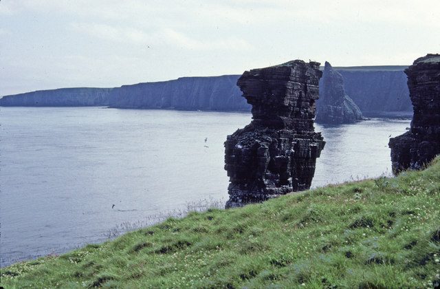
Go anyway, but go for the right reason: drive the extra mile and a half to Duncansby Head, park at the lighthouse, and walk fifteen minutes south across the grass to the Duncansby Stacks. Sheer sandstone spires, a gannet-covered geo, and usually nobody there. That’s the payoff for coming to the corner.
Spurs worth the detour
- Coigach and Achiltibuie — a single-track road west from Drumrunie on the A835, about 15 miles each way, with the Summer Isles at the end.
- Chanonry Point — on the Black Isle, one of the best land-based dolphin-watching spots in Europe on a rising tide.
- Kinlochbervie and Sandwood Bay — off the A838 north of Laxford; the bay itself is a four-mile walk each way from Blairmore.
- Cape Wrath — foot ferry from Keoldale near Durness, then a minibus over the moor. Seasonal, weather-dependent, and unlike anything else in Britain.
Navigation, signal and fuel
Download offline maps before you leave Ullapool
Mobile coverage on the loop is patchy in a way that surprises people who’ve travelled in genuinely remote places elsewhere. The east coast and Caithness are fine. Thurso and Wick are fine. Ullapool is fine. Between Laxford Bridge and Durness, along much of Loch Eriboll, on the Applecross coast road and across large parts of Assynt, you may have nothing at all, and which network you’re on makes a real difference.
Download offline map areas for the whole of the north Highlands before you go — Google Maps and OS Maps both allow it. Screenshot your accommodation addresses and phone numbers. Better still, carry a paper map; the Collins NC500 pocket map or an Ordnance Survey Landranger sheet will show you passing places, gradients and dead ends that a phone map flattens into nothing.
Fuel, and the gaps that matter
You will not run out of fuel if you’re sensible, but people do. The rule I use: never leave a town on the west or north coast with less than half a tank.
Reliable stops include Inverness, Dingwall, Tain, Golspie, Helmsdale, Wick, Thurso, Bettyhill, Tongue, Durness, Scourie, Lochinver, Ullapool, Gairloch, Kinlochewe and Lochcarron. Several of the smaller ones are card-operated pumps rather than staffed forecourts, and a few have restricted winter hours or close on Sundays. The longest genuinely awkward gap is Durness to Ullapool if you don’t stop at Scourie or Lochinver — that’s about a hundred miles of hills and hairpins, which your car will drink through faster than it would motorway miles.
Expect to pay meaningfully more per litre than in Inverness — often 10 to 20p more at the time of writing. Electric vehicles need more planning again: chargers exist at Ullapool, Durness, Thurso, Wick, Lochinver and elsewhere, but many are single units and a queue of one puts you an hour behind.
Don’t follow sat nav blindly
Set your device to avoid unpaved roads and, if you’re in something large, set the vehicle dimensions. Sat navs on this route have a habit of routing drivers down estate tracks and over the Bealach in vehicles that shouldn’t be there. Check the day’s roads on Traffic Scotland before you set off in winter — the Bealach is not formally closed in snow, but it can be gated at short notice.
Planning the drive
How many days you actually need
Five days is the realistic minimum for the full loop. Seven is the number I’d give anyone asking, and ten turns it from a drive into a holiday. Our seven-day NC500 itinerary splits the mileage the way I’d split it myself; if you’re tighter for time, the five-day version works, and there’s a three-to-four-day plan that’s honest about what you have to cut. For the wider question of how the north fits into a Highlands trip, see how many days to give the Highlands.
Whatever you choose, plan around 120 to 150 miles a day maximum on the west and north coasts, and don’t plan the same daily distance for the A9 legs — that’s the mistake that produces 9pm arrivals.
When to go
May and September are the sweet spots: long daylight, fewer vehicles than July, and accommodation that hasn’t sold out. May in particular gives you the best statistical shot at dry weather. September brings the light back and thins the traffic. June and July are busy and midgy — read up on midge season before you plan any evening outside on the west coast. Winter is beautiful and hard: short days, real ice, and a lot of closed cafes. Our overview of the best time to visit Scotland covers the month-by-month picture.
What to book, and how far ahead
Accommodation is the constraint, not the road. There simply isn’t much of it between Ullapool and Thurso, and what exists sells out. For a June to August trip, book beds three to six months ahead. For May or September, two to three months. Campsites on the west coast need booking in peak season too — the days of rolling up at Clachtoll in July are gone.
Hire cars out of Inverness airport should be booked as early as you can; supply is limited and prices climb steeply in summer. If you’d rather anchor the trip in one or two places and drive out and back, our guide to the best base towns in the Highlands and the broader where to stay in Scotland guide will help. And if you’re still deciding whether to drive at all, getting around Scotland lays out the alternatives.
What underwhelms, and the mistakes I see most
The honest bits, because the route has them.
The east coast is the weak leg. Between Wick and Inverness the A9 is efficient and largely unremarkable. Dunrobin, Whaligoe and Dornoch are the redeeming stops. Don’t give this section a full day unless you want to.
John o’ Groats. Covered above. Twenty minutes, then leave.
The Bealach in cloud. If the summit is in cloud — and it often is — you will drive eleven demanding miles and see roughly forty metres of them. There’s no shame in checking the forecast and taking the Shieldaig road instead.
Treating it as a challenge. The route has a bad reputation locally for exactly this: convoys, speeding, drivers boasting about lap times. The average free-flow speed on these roads is around 48mph for a reason. Journey times for people who live here have doubled or tripled in summer. Don’t add to it.
Booking too little time and too little accommodation. The two mistakes compound. People arrive with three days and no beds booked, then spend the trip driving to whatever was available fifty miles away.
Wild camping badly. Scotland’s access rights are generous and they don’t extend to emptying a chemical toilet in a lay-by. If you’re in a van, use campsites and designated aires.
Ignoring the rest of Scotland. The NC500 is one of several superb Highland drives, and it isn’t automatically the right one for you — our roundup of Highland road-trip routes makes the case for a few others. For everything about the loop itself — where to stay, what to see, what it costs — start with our main North Coast 500 guide.
Frequently asked questions
How long is the north coast 500 route exactly?
The signed loop is 516 miles (830km) from Inverness Castle back to Inverness Castle. Most people cover 550 to 600 miles once you add the B869, spurs to Duncansby Head, Achiltibuie or Chanonry Point, and the inevitable detours to accommodation off the route. Plan fuel and time on the higher figure.
Is the whole NC500 single-track?
No. Roughly a third is single-track with passing places, concentrated on the Applecross peninsula, the B869 Drumbeg loop, the A838 between Laxford Bridge and Tongue, and stretches of the A836 east of Tongue. The A9, A99 and the A835 into Ullapool are proper two-lane roads where you can make good time.
Can I drive the NC500 in a normal car?
Yes. No four-wheel drive is needed and every mile is tarmac. A smaller car is genuinely easier on the single-track sections and the Bealach na Bà. What matters more than the vehicle is whether you’re comfortable reversing it and judging its width on a narrow road.
Which direction is better for a campervan?
Clockwise. The north coast lay-bys end up on your nearside, so photo stops are simple pull-ins rather than crossing manoeuvres, and you reach the Bealach na Bà decision early while you can still adjust the plan. Anything longer than a VW-sized camper should take the Shieldaig alternative and the A894 rather than the B869.
Do I need to start in Inverness?
No. It’s a loop, so you can join it anywhere. Inverness makes sense because of the airport, the train, the car hire desks and the supermarkets, but starting at Ullapool, Thurso or Dornoch is perfectly workable and can help you dodge the herd, which tends to leave Inverness on Saturday and Sunday mornings.
What happens if I meet a lorry on a single-track road?
Whoever is closer to a passing place uses it — but in practice, if the other vehicle is a lorry, bus or large motorhome, expect to be the one who reverses. They physically cannot. Back up slowly using your mirrors, keep straight, and stay off the soft verges, which hide ditches almost everywhere in the north-west.
Is there mobile signal all the way round?
No, and don’t plan as though there is. Expect long dead stretches between Laxford Bridge and Tongue, on the Applecross coast road and across Assynt. Download offline maps, save your bookings offline, and carry a paper map as backup. Coverage varies significantly by network, so don’t assume a travelling companion’s phone will work either.
Is the route worth doing if I only have three days?
Only if you shorten the loop. Three days for 516 miles means driving from breakfast to dinner. Better to use the Tongue–Lairg inland cut and do a 380-mile version, or drive Inverness to Durness and back down the west coast, and leave Caithness for another trip. There’s no prize for completing it.
Final thoughts
The north coast 500 route is not one road and it doesn’t drive like one. It is a fast A-road, a mountain pass, a coastal lane, an empty moorland run and a farmland cruise, and the trips that go well are the ones where the driver knew which of those was coming next.
Get the direction right, learn what a passing place is for before you need one, download the maps, keep the tank above half, and give it seven days if you possibly can. Do that and the loop delivers exactly what people claim for it. Rush it and you’ll have driven 516 miles to look at the back of a motorhome.
Everything else — where to sleep, what to see, what it costs — is in our complete guide to the NC500, and it’s worth reading alongside our general first-timer’s tips for Scotland if this is your first trip north.
Once the direction is settled, the next job is deciding what you actually stop for. Our rundown of the best stops on the North Coast 500 gives each one a time cost and a detour cost in minutes, which is the arithmetic that decides how many fit into a day.
About the author: This guide was written and is maintained by the ScotlandTourism.org editorial team — travel writers who’ve spent years exploring Scotland’s cities, Highlands and islands, from bagging Munros to chasing the perfect dram. We update our guides regularly to keep prices, opening details and advice current.
Last updated: August 2026. Prices and opening times change — always check the official site before you travel.
Photo credits
All images are used under their respective Creative Commons or public-domain licenses:
- Hairpin bends and steep gradients on the Bealach na Ba, the toughest climb on the north coast 500 route — Mike McBey, CC BY 2.0, via Wikimedia Commons
- Looking across the Inner Sound from the Applecross peninsula coast road on the NC500 — John Allan, CC BY-SA 2.0, via Wikimedia Commons
- Ullapool on Loch Broom, the main fuel and supply stop on the west coast of the NC500 map route — GerritR, CC BY-SA 4.0, via Wikimedia Commons
- Ardvreck Castle on Loch Assynt beside the A837 between Ledmore Junction and Lochinver — Carol Bleasdale, CC BY-SA 2.0, via Wikimedia Commons
- The curved Kylesku Bridge carrying the A894 across Loch a Chairn Bhain on the NC500 — Reboelje, Public domain, via Wikimedia Commons
- Loch Eriboll, the long sea loch the A838 detours around between Durness and Tongue — Skinner doc, CC BY-SA 4.0, via Wikimedia Commons
- The Kyle of Tongue causeway carrying the A838 across the kyle on the north coast leg — Pa, CC BY-SA 3.0, via Wikimedia Commons
- Dunrobin Castle beside the A9 near Golspie on the east coast leg of the north coast 500 route — Andrew Tryon, CC BY-SA 2.0, via Wikimedia Commons
- Passing place sign on a single-track road, the key to driving the NC500 direction of travel — Jim Bain, CC BY-SA 2.0, via Wikimedia Commons
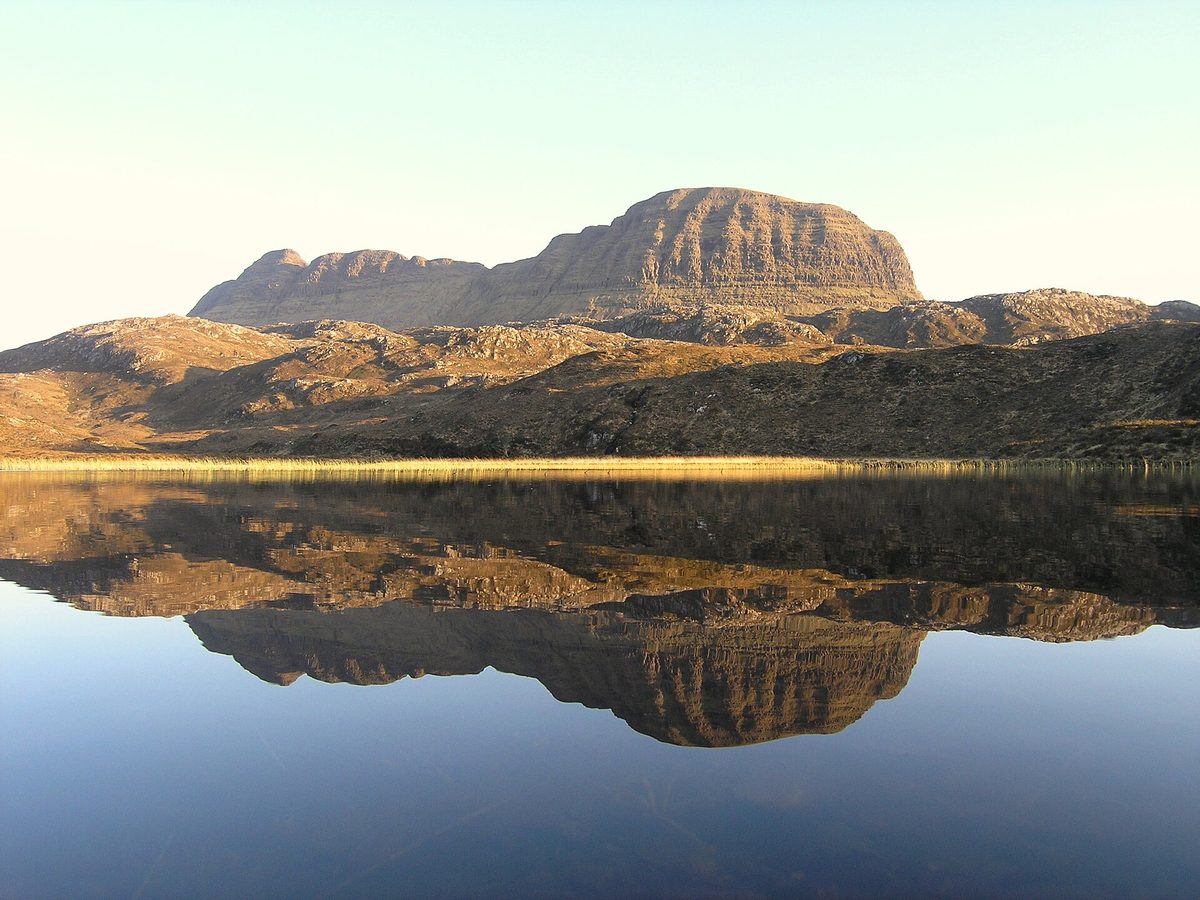
- Suilven reflected in a lochan in Assynt, near the B869 loop on the north coast 500 route — Andrew Tryon, CC BY-SA 2.0, via Wikimedia Commons
- Duncansby Stacks near John o Groats at the north-east corner of the NC500 map — Christine Matthews, CC BY-SA 2.0, via Wikimedia Commons
- Suspension footbridge over Corrieshalloch Gorge beside the A835 near Braemore Junction — Victuallers, CC BY-SA 4.0, via Wikimedia Commons