Arthur’s Seat is the 251-metre extinct volcano sitting in the middle of Edinburgh, and it is the most underestimated hill in Scotland. The first time I climbed it I wore trainers, in November, into a wind coming off the Firth of Forth like a slap. I reached the trig point, held on to it, took a photo I have never once looked at, and went straight back down.
Since then I have been up it in most months of the year and from every side of the park. I have also watched a great many visitors set off from the palace gates in white trainers with a can of ginger, assuming an hour. Some of them are right. Plenty are not. This is the guide I wish someone had handed me: five genuinely different routes, honest timings, the truth about Salisbury Crags, and the sunrise and sunset figures that quietly decide whether your plan works at all.

The short answer
Arthur’s Seat is a free, unticketed 251-metre hill in Holyrood Park, open 24 hours a day with no booking and no gate. Allow one to two hours return from the Palace of Holyroodhouse, or 45 minutes to an hour from the Dunsapie Loch car park, which starts you halfway up. The last 60 metres are bare rock and turn slick in rain. It is also the best thing in the city you can do without paying anything at all.
The routes at a glance
| Start point | Return distance | Ascent | Time (return) | Surface | Best for |
|---|---|---|---|---|---|
| Holyrood Palace, via the Dry Dam | ~3.5 km | ~210 m | 1h15 – 2h | Gravel, then grass, steps and bare rock | First-timers walking down from the Royal Mile |
| Holyrood Palace, the long way via Piper’s Walk | ~4.5 km | ~230 m | 1h45 – 2h30 | Wide grass track, gentler gradient | Spreading the climb out; quieter |
| Dunsapie Loch car park | ~1.6 km | ~130 m | 45 min – 1h | Short grass and worn rock | Limited time, limited legs, poor weather windows |
| Duddingston village | ~3 km | ~180 m | 1h15 – 1h45 | Rough grass, minimal waymarking | A quiet start and a very old pub at the end |
| St Leonard’s / Holyrood Park Road | ~3.5 km | ~165 m | 1h15 – 1h45 | Grass; one very steep option | Staying in Newington or the Southside |
| Royal Commonwealth Pool (Crags only) | ~3 km | under 100 m | 1h – 1h15 | Grass path along the clifftop | The view, without the summit |
Those timings assume you stop to look at things, because you will. They are not race times. I have gone Dunsapie to summit in eighteen minutes when I was late for something, and I have taken two and a half hours from the palace with a seven-year-old and a bag of crisps.
What you are actually climbing
Arthur’s Seat is the eroded remains of a volcano that was active in the early Carboniferous. Lava from the system has been dated to between 341 and 335 million years old, which makes it older than almost anything you will see on a normal holiday. The volcano itself has long since been ground down; what is left is the plumbing, the hard vents and sills that survived when a glacier scoured west to east through what is now Edinburgh and took the softer rock with it.
That glacier is why the whole city looks the way it does. It carved a crag-and-tail: hard rock on the western face, a long ramp of debris trailing east. Edinburgh Castle sits on exactly the same structure about a mile and a half away, and the Royal Mile runs down its tail — which is a fact that makes a lot more sense once you have stood on Arthur’s Seat and looked at the shape of the place from above. If you are working out how the city fits together, our Edinburgh travel guide lays out the geography before you arrive.
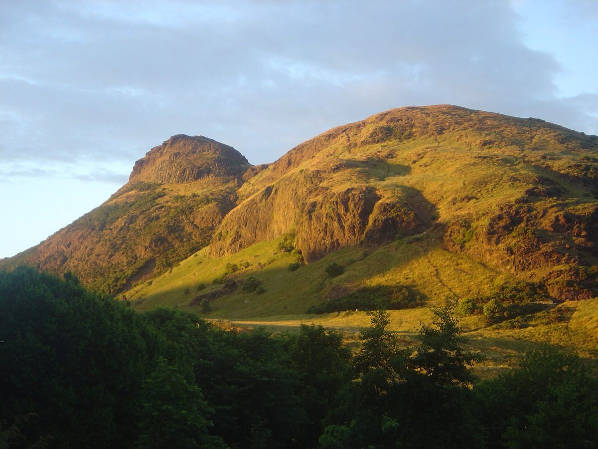
The hill sits inside Holyrood Park, a roughly circular royal park about a mile across, managed by Historic Environment Scotland. It is a Scheduled Monument and a Site of Special Scientific Interest in its own right, and there is an Iron Age hill fort on the summit and another on Crow Hill just to the south. Robert Louis Stevenson called it “a hill for magnitude, a mountain in virtue of its bold design”, which is the most accurate three-line review anyone has managed.
Salisbury Crags is a completely different walk
This is the single thing readers get wrong, and it causes more confusion than anything else in the park. Salisbury Crags are the long line of dark cliffs you see from Waverley, from the Royal Mile, from half the city. They are not Arthur’s Seat. They are a separate ridge, lower, sitting between the summit and the town, and walking along the top of them is a different outing that takes about an hour and involves nowhere near the same effort.
People book a morning to “do Arthur’s Seat”, walk the Crags path, get a superb view of the castle, and come away thinking they have climbed the hill. They have not. The Crags top out well below 150 metres; the summit is 251. Between the two lies Hunter’s Bog, a grassy hollow that hides the summit entirely once you drop into it. If you want the actual summit you have to cross that hollow and go up the other side.
Both are worth doing. If you only have an hour, honestly, the Crags give you the better photograph of Edinburgh — you are looking straight along the Old Town from the side. The summit gives you the bigger sweep, all the way to Fife and, on a clear day, the Ochils and the outline of the Pentlands. Different jobs.
The Radical Road: still closed, and no, your guidebook is wrong
The Radical Road is the path that runs along the foot of the Salisbury Crags cliffs, below the rock face rather than above it. It was paved in the aftermath of the Radical War of 1820 using the labour of unemployed weavers from the west of Scotland, at the suggestion of Walter Scott, and for two centuries it was one of the best short walks in any British city.
It has been shut since September 2018, when roughly 50 tonnes of rock came off the crag onto it. At the time of writing, in August 2026, it is still shut. Historic Environment Scotland’s own Holyrood Park page states plainly that the Radical Road is closed due to falling rock hazard, and says it is working towards reopening parts of the path. Rock climbing on the Crags was banned outright in 2019 and those areas remain closed too.
I am labouring this because an extraordinary number of guides, blogs and printed maps still route people along the Radical Road as though nothing happened. Some of them illustrate it with photographs taken before 2018. If you turn up expecting to walk it, you will find barriers and signage, and you will have to reroute on the spot.
There is a plan. HES has committed to a partial reopening — the section from the Hawse to the northern end of the South Quarry — specifically so visitors can reach Hutton’s Section and Hutton’s Rock, where James Hutton worked out in the 1780s that the Earth was vastly older than anyone then believed. 2026 is the 300th anniversary of Hutton’s birth, which is why the date matters to them. The timetable has slipped more than once. In the meantime HES runs pre-bookable ranger-guided access to that area, which is genuinely the only legitimate way in and is worth doing if geology interests you at all.
Check the Historic Environment Scotland page the week you travel. Do not trust anything else on this, including this guide six months from now.
Five ways up, and how to choose
Almost every article gives you two routes: an easy one and a hard one. That is a poor way to think about it. The right approach depends far more on where you are staying and which side of the park you can reach without a 25-minute walk before the walk. Here is each one properly.
1. From Holyrood Palace, up the Dry Dam
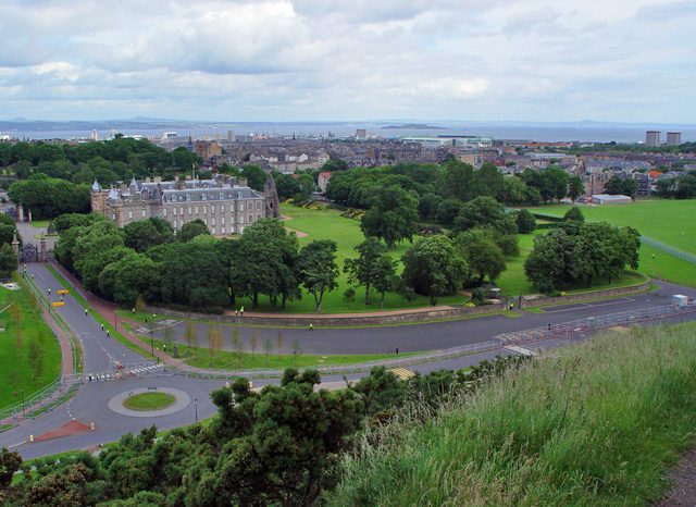
The default, and the one most visitors do without knowing it has a name. Start at the Broad Pavement car park beside the Palace of Holyroodhouse, at the foot of the Royal Mile. Walk south-east on the wide path past St Margaret’s Loch, then bear right and up into the shallow valley between Whinny Hill and the main massif — that is the Dry Dam. It funnels you neatly to the col below the summit, where you turn right and take the steps and rock to the top.
Roughly 3.5 km there and back, about 210 metres of climbing, an hour and a quarter to two hours. Surface starts as compacted gravel, becomes grass, then stone steps, then bare rock for the final stretch. It is the busiest option by a wide margin. If you have just come down the length of the Royal Mile, you are already at the start line and it makes complete sense.
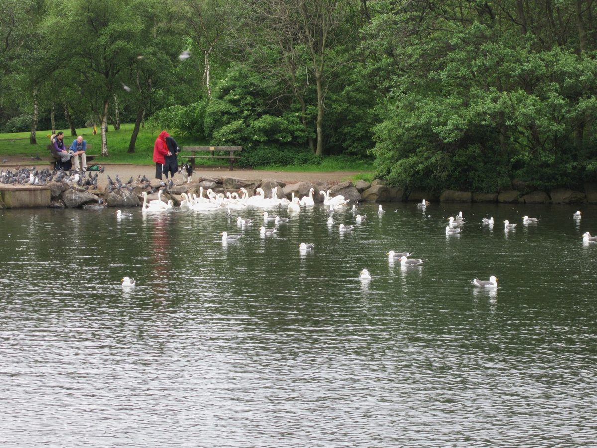
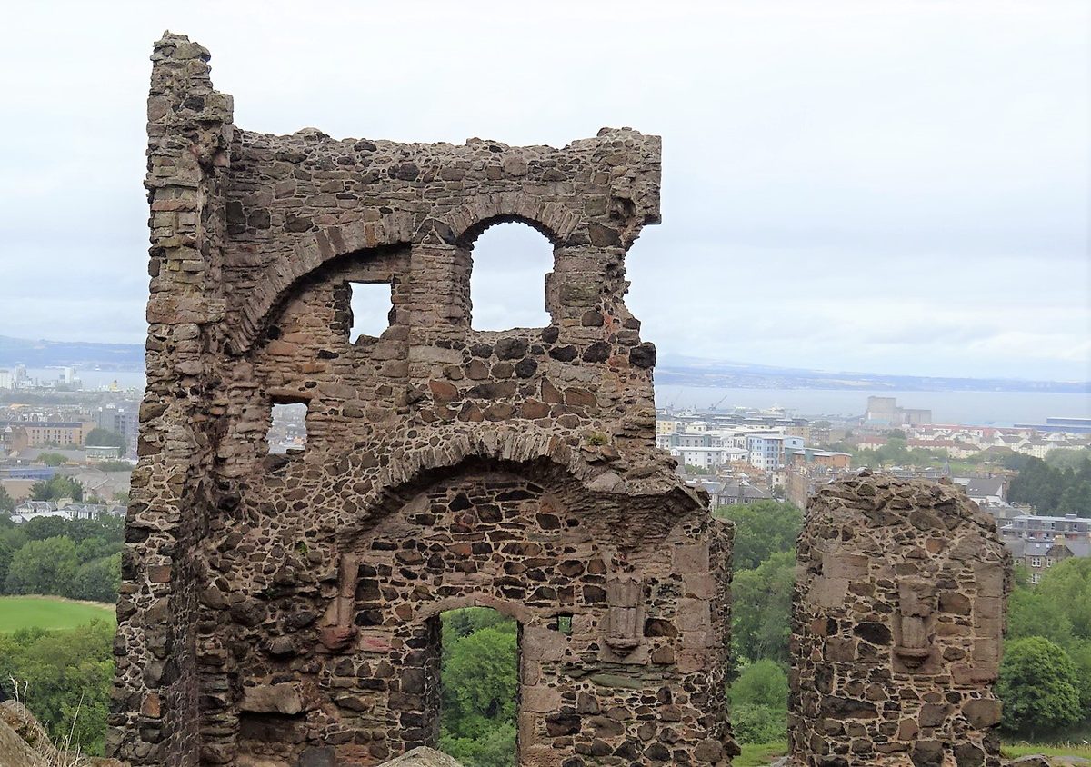
One detour I would always take: five minutes uphill from St Margaret’s Loch sit the ruins of St Anthony’s Chapel, a fragment of fifteenth-century wall standing on a shelf of Whinny Hill. Almost nobody bothers, because it is off the direct line. From up there you look straight over Leith to the Forth, and it costs you ten minutes.
2. From Holyrood Palace, the long way via Piper’s Walk
Same start, different shape. Instead of cutting into the Dry Dam, keep going along the lower path and swing round the northern and eastern flank of the hill, climbing steadily on a broad grass track known as Piper’s Walk. You gain height gradually and approach the summit from the east, which is the gentler side.
It adds about a kilometre. Call it 4.5 km return and up to two and a half hours. In exchange you get a far more even gradient, considerably fewer people, and the best of the walk-in views — the Forth opens up on your left the whole way round. If someone in your group is not confident on steep ground but is happy to keep walking, this is the route. Go up Piper’s Walk and come down the Dry Dam and you have a proper circuit.
3. From Dunsapie Loch: the shortcut nobody mentions
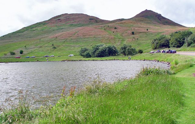
This is the route that changes the whole calculation, and I rarely see it given proper billing. Dunsapie Loch sits on the eastern side of the park on Queen’s Drive, at around 110 to 120 metres above sea level. From the car park there, the summit is about 700 metres away and only around 130 metres above you. You are starting halfway up the hill.
Forty-five minutes to an hour return, at a gentle pace, with a stop at the top. The path is short grass giving way to worn rock, steep in places but nothing that needs hands. It is the obvious choice if you have a narrow weather window, if you are short on time, or if you are walking with someone who simply cannot manage 200 metres of ascent.
The catch, and it is a real one, is access. Historic Environment Scotland only opens the High Road and the Dunsapie Loch car park to vehicles from Tuesday to Thursday, 9.30am to 3pm. That is three days a week and a five-and-a-half-hour window. Outside those hours you cannot drive to it. You can always walk or cycle to Dunsapie on the road, but that is a climb of its own from the palace end — about 25 minutes uphill on tarmac, which rather undoes the point.
Two ways round it. Get a taxi to drop you at Dunsapie on a Tuesday, Wednesday or Thursday morning and walk down the far side afterwards. Or come on foot from the Meadowbank side of the park, which is much closer to Dunsapie than the palace is. Either way, check the HES roads page first, because closures for rockfall, ice, events and fire damage are frequent.
4. From Duddingston village
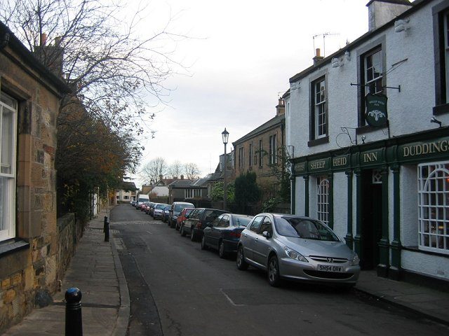
Duddingston sits at the south-east corner of the park, and it is the prettiest start of the lot — a conservation-village cluster of old houses around Duddingston Kirk, with Duddingston Loch behind it and a bird reserve on the water. From the village you climb north-west onto the flank of the hill on rough grass. Around 3 km return, 180-odd metres of ascent, an hour and a quarter to an hour and three-quarters.
Two warnings. The waymarking is essentially nil on this side; you are picking your line across open hillside, and in low cloud that is a genuine navigational problem for anyone who does not know the hill. And the ground is rougher than the palace routes, with more tussock and mud.
What you get in return is solitude for the first half hour, ancient cultivation terraces stepping across the slope above the road, and the Sheep Heid Inn at the finish — reckoned to be among the oldest pubs in Scotland, and a very good argument for doing the walk in this direction. If Scottish pubs and what to order in them is a subject of interest, our guide to Scottish pubs, food and whisky covers the ground.
5. From St Leonard’s and the Royal Commonwealth Pool
The local’s approach, and the one to use if you are staying in Newington, the Southside or anywhere off Dalkeith Road. Enter the park at Holyrood Park Road, beside the Commonwealth Pool, and you are immediately at about 85 metres with the whole south face in front of you.
From there you have a choice. Bear right and up the steep eroded gully on the western face — locals call it the Gutted Haddie — which is direct, unpleasantly loose underfoot and not something I would send anyone up in the wet. Or keep left along the base of the Crags and round into the Dry Dam, which is longer and much kinder. Roughly 3.5 km return either way, 165 metres of ascent, an hour and a quarter upwards.
The variant worth knowing: from this same entrance you can walk the top of Salisbury Crags out and back and never go near the summit. Under an hour and a quarter, under 100 metres of climbing, and the finest single view of Edinburgh Castle and the Old Town skyline in the city. When the summit is in cloud, this is the walk to do instead.
How long it really takes
“One hour to the top” is the number everyone repeats. It is true for a reasonably fit adult, on the palace routes, in dry weather, not stopping. It is not true for most people most of the time. Some honest ranges, one way, from the Palace of Holyroodhouse:
- Regular hillwalker, dry: 35–45 minutes up, 25–30 down.
- Average fitness, dry, taking photographs: 55–75 minutes up, 40 down.
- Not used to hills, or carrying a small child part of the way: 1h30 or more, plus rests.
- Children aged five to eight, under their own steam: 1h15–2h, with bribery.
- Anyone in wet conditions: add 20 to 30 per cent to the descent, not the ascent.
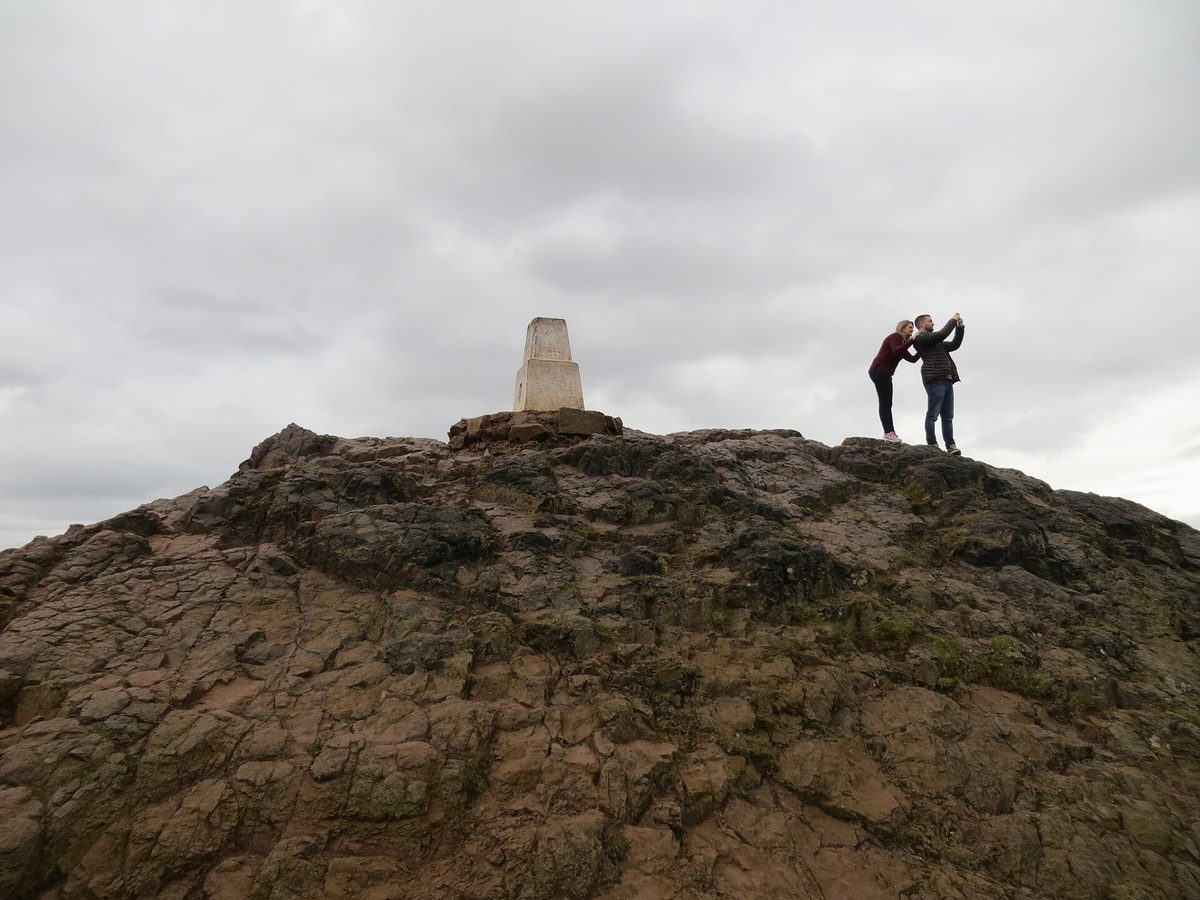
That last one surprises people. Going up in the rain is merely damp. Coming down is where the time goes and where injuries happen. The summit block is rock polished smooth by decades of boots, and wet basalt with a film of mud on it behaves like a bar of soap. I have watched perfectly competent adults reduced to descending the last 40 metres on their backsides. That is the correct decision, incidentally, and not remotely embarrassing.
Budget two hours from your hotel door to your hotel door if you are staying near the Royal Mile, and three if you want to sit at the top for a while. It slots neatly into a morning; our two-day Edinburgh itinerary puts it first thing on day two for exactly that reason.
Wind, weather, and the things that actually go wrong
The summit is 251 metres of exposed rock with nothing upwind of it but the North Sea and the open Forth. That is the entire safety briefing, but people ignore it because the hill is inside a city and looks tame from Princes Street.
Wind is the real hazard
Gusts are what cause trouble up there, far more than steepness or navigation. The summit funnels wind, and the final rock section has genuine drops on the northern and western sides. In a strong westerly you can be walking comfortably at the col and then be physically shoved as you step onto the summit block. If the forecast for Edinburgh shows sustained winds above roughly 30mph, treat the top section as off the table and enjoy the lower hill instead. Above 40mph, do not go up at all. There is no shame in it and the hill will still be there tomorrow.
Check a mountain forecast rather than a city one. City forecasts are made for street level and will understate what is happening 250 metres up on an exposed dome. Add a couple of degrees of chill and a good deal more wind to whatever the Edinburgh figure says.
No water, no toilets, no shelter
There is nothing on the hill. Not a tap, not a hut, not a wall you can sit behind properly, and no food or drink anywhere in the park interior. Carry your own water — more than you think in summer, because the south face bakes.
The only public toilets are at the Holyrood Park Education Centre on the north side, behind the Palace of Holyroodhouse, and they keep seasonal hours: roughly 8am to 5pm in April and September, until 6pm in May, later on summer weekends, and only 8am to 3pm from October through March. Go before you set off. Once you are on the hill the nearest alternative is back down at the palace or up in the cafés on the Canongate.
Gorse fires are now a regular event
This is new and underreported. Holyrood Park has had repeated large gorse fires in recent years, including a substantial blaze in August 2025 that closed the High Road for around ten weeks, and another in July 2026 that shut Queen’s Drive for a couple of days. The August 2025 fire burned away the gorse that had been holding rock in place above the road, which meant geologists had to inspect the crag before anything could reopen.
The practical consequence for you is simple: park roads and paths in Holyrood Park close at short notice and sometimes for months. Fires are not treated as suspicious but they are believed to be caused by human activity, so do not, under any circumstances, take a disposable barbecue up there. Fires, barbecues and camping are all prohibited in the park anyway.
Sunrise, sunset and the problem of being at 56 degrees north
Edinburgh sits at just under 56°N, and the seasonal swing in daylight is the single most underestimated planning factor for this walk. In late June the sun is up before half past four in the morning. In late December it has gone by twenty to four in the afternoon. Same hill, entirely different day.
Rough figures for the middle of each month, in local clock time, with British Summer Time applied where it applies:
| Month (mid) | Sunrise | Sunset | Daylight | What that means for the walk |
|---|---|---|---|---|
| January | 8.34am | 4.11pm | 7h40 | Start by 1.30pm at the latest |
| February | 7.39am | 5.16pm | 9h35 | Afternoon walk is comfortable again |
| March | 6.29am | 6.15pm | 11h45 | Clocks go forward late in the month |
| April | 6.08am | 8.19pm | 14h10 | Evening light is excellent |
| May | 5.01am | 9.18pm | 16h20 | Best month overall, in my view |
| June | 4.26am | 10.00pm | 17h35 | Sunrise is brutally early; sunset is easy |
| July | 4.47am | 9.49pm | 17h00 | Late evenings, warm rock |
| August | 5.43am | 8.50pm | 15h05 | Fringe crowds down below, hill still quiet at 7am |
| September | 6.43am | 7.31pm | 12h50 | The sweet spot for sunrise attempts |
| October | 7.43am | 6.13pm | 10h30 | Clocks go back at the end of the month |
| November | 7.48am | 4.05pm | 8h15 | Sunset walks start needing a torch |
| December | 8.37am | 3.38pm | 7h00 | Effectively a lunchtime-only hill |
Treat those as approximate and check a table for your actual date — they shift by several minutes a day around the equinoxes.
Sunrise attempts, and coming down in the dark
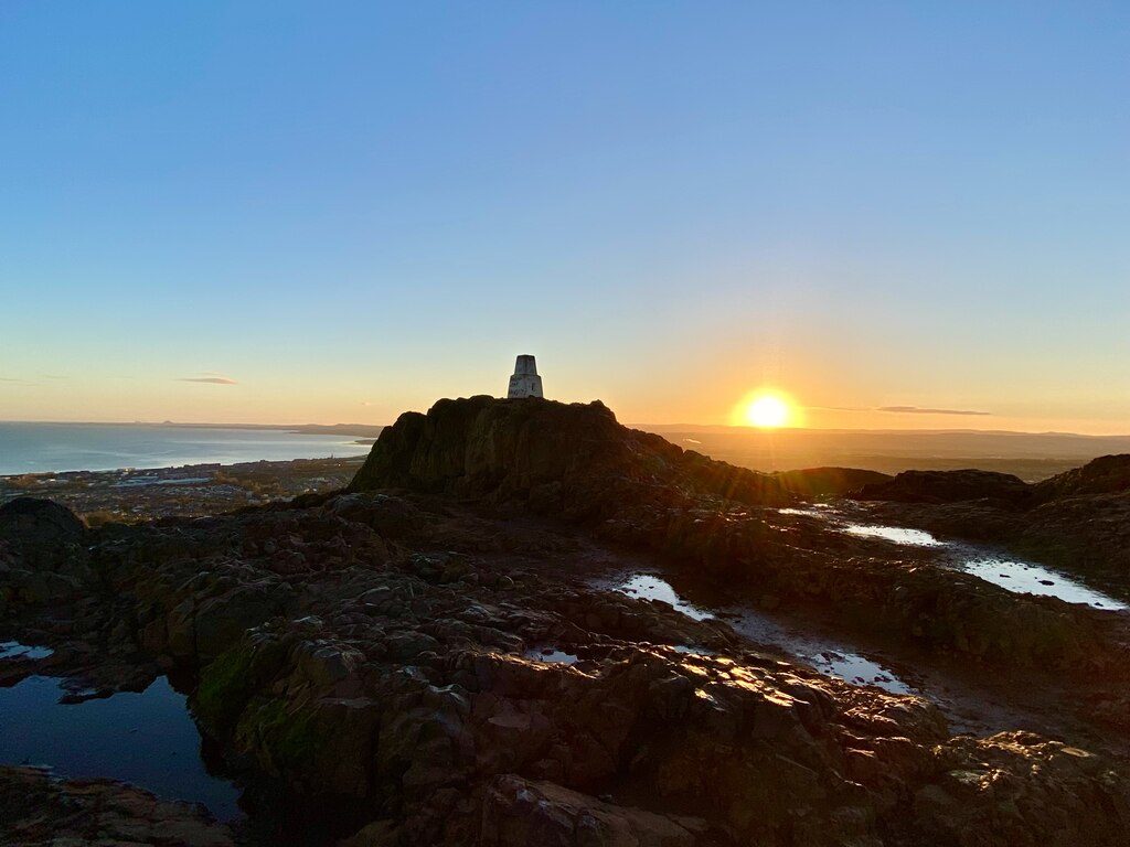
A June sunrise on Arthur’s Seat sounds romantic until you work out that you need to leave your hotel at about a quarter past three. First useful light in midsummer arrives around 3.30am, well before the sun itself. It can be done and it is memorable, but it is a genuinely antisocial undertaking.
September is the far better month for it. Sunrise around a quarter to seven, decent light from about six, and a walk-up in the dark that lasts maybe twenty minutes rather than an hour. Late February works too, for the same reason from the other side of the year.
For sunsets, the trap is different. Watching the sun go down from the summit is the easy part. Getting off the summit rock afterwards is where people come unstuck, because the light drops fast and the descent is the technical bit. From roughly October to March you should assume you are coming down in near-darkness.
Take a head torch. Not a phone. A phone in your hand means one hand not available for balance, and it dies in the cold. A cheap head torch weighs almost nothing and completely changes the descent. If you do not have one, come down from the summit before sunset, then watch the last of it from the lower slopes or the top of the Crags, where the ground is easy. That is what I do most of the time, and the view from there is arguably better anyway because you get the city lights coming on beneath you. Anyone with a serious interest in night skies will find far darker ground elsewhere in Scotland — our guide to stargazing and dark sky sites covers where to go.
Getting there, parking, and the practical stuff
On foot from the city centre
From Waverley station it is about 20 minutes’ walk down the Canongate to the palace gates, and another 45 minutes or so to the top. From the castle end of the Royal Mile, add another 15 minutes to reach the palace. That walking approach is the honest reason the palace routes are so popular: no transport, no timetable, straight out of the door.
By bus
Lothian Buses service 35 runs the length of the Royal Mile; get off at the Scottish Parliament stop and the park entrance is a couple of minutes away. For the southern side, services 2, 14, 30 and 33 all serve the Royal Commonwealth Pool stop on Dalkeith Road, which puts you at the St Leonard’s entrance in five minutes. Buses along London Road serve the Meadowbank corner, which is the closest public transport gets to Dunsapie. Route numbers do get changed, so check the Lothian journey planner rather than relying on a number you read somewhere.
A Lothian Network DAYticket was around £12 for adults and £6 for children at the time of writing, and under-22s resident in Scotland travel free with the relevant bus pass. Contactless capping usually works out cheaper for one or two journeys. Our broader notes on getting around Scotland go into ticketing in more detail.
Driving and the car parks
Do not assume you can drive to where you want to start. The park’s road system is heavily restricted and it catches people out constantly.
- Saturdays and Sundays: all park roads close to vehicles during the day. Barriers start going on between about 8.15 and 9am and everything reopens by 10pm. Access to the Broad Pavement, Meadowbank and Duddingston car parks is maintained.
- The High Road and Dunsapie Loch car park: open to vehicles Tuesday to Thursday only, 9.30am to 3pm.
- Duddingston Low Road: closed to vehicles because of rockfall risk at the time of writing. Pedestrians can use it, behind safety fencing; cyclists are asked to dismount.
- Broad Pavement car park, next to the palace, charges around £1 an hour from 8.30am to 5.30pm daily, with no charge on Saturdays, Sundays, Good Friday, Easter Monday, 25 and 26 December and 1 January. Historic Scotland membership does not exempt you.
- No overnight parking anywhere in the park. Speed limit is 20mph throughout.
Honestly, unless you specifically want the Dunsapie shortcut on a Tuesday-to-Thursday morning, leave the car. Edinburgh is a poor city to drive in and Holyrood Park is worse. If you are touring the rest of the country by road, our Scotland itinerary planning guide is the better place to sort out where the car actually earns its keep.
Dogs
Dogs are welcome throughout the park and it is a genuinely good dog walk. Two things to know. Ground-nesting birds use the open slopes in spring and early summer, and there is signage asking for leads in certain areas during nesting season — please follow it, because these birds have nowhere else in the city to go. And the final summit rock is not fun for a small or elderly dog; there are steps and scrambly bits where you will end up lifting them. Big dogs are fine. Terriers get carried.
Buggies and small children
You cannot get a buggy to the summit by any route. Full stop. What you can do is take one along the flat lower path from the palace as far as St Margaret’s Loch, which is tarmac and gravel and perfectly manageable, and around the base of the hill on Queen’s Drive. For an actual family hill day the Dunsapie route is the one — short enough that a four-year-old will do it under their own steam, provided the wind is behaving. There is more of this sort of thing in our guide to Scotland with children.
Footwear, and what actually matters
You do not need boots. You do need something with a grip pattern that is not worn smooth. That is the whole of it. Trail shoes are ideal. Ordinary trainers are fine in dry weather. Fashion trainers with flat soles are the specific problem, and they are what I see most often on the summit rock, usually accompanied by a nervous shuffle.
Bring a windproof layer regardless of the forecast at street level, and something waterproof between roughly October and April. The rest is optional. This is not a Munro; it is a big hill in a city, and treating it as an expedition is as wrong as treating it as a stroll. If you are planning to go on to bigger ground afterwards, our overview of hiking in Scotland covers what changes when the hills get serious.
The best views are not all at the top
The summit cairn is where everyone points the camera, and it is a fine 360-degree panorama: the Forth bridges to the north-west, Fife across the water, the Pentlands to the south, the whole city laid out west. On an exceptional day you can pick out the Highland hills beyond Stirling. But some of the better individual views are on the way, and most people walk straight past them.
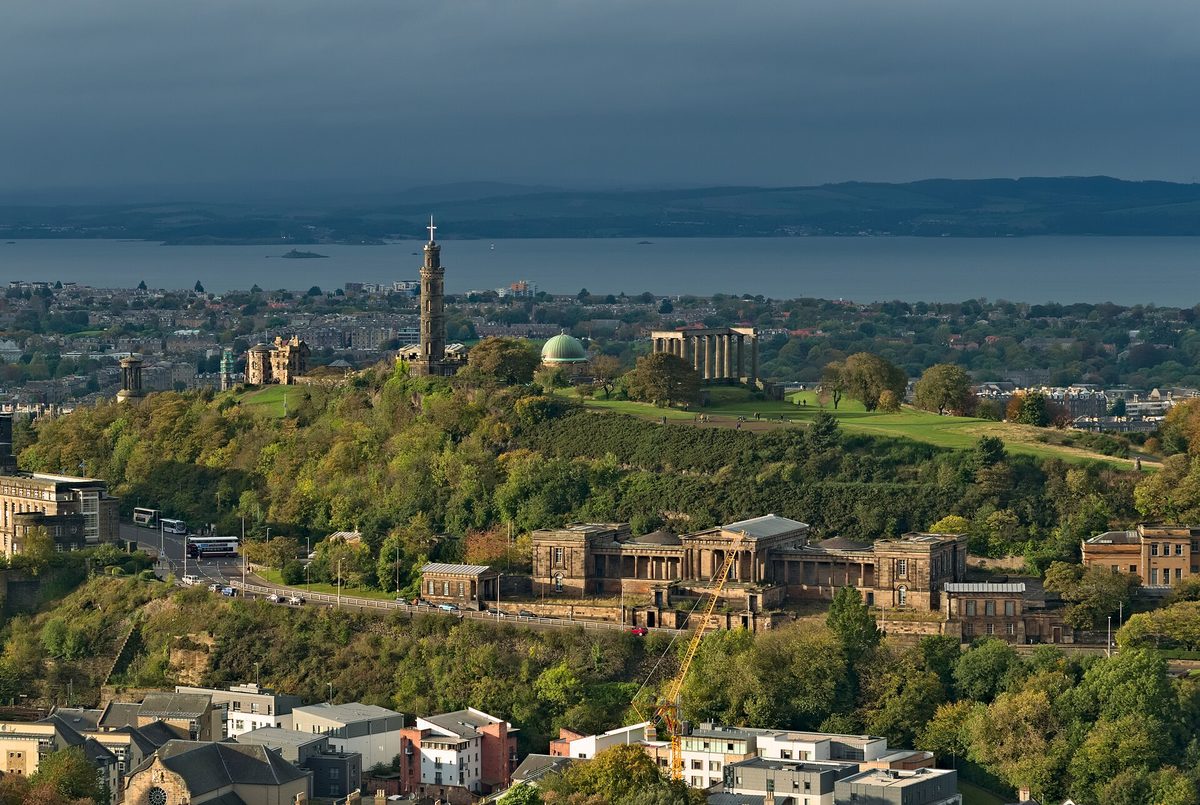
The top of Salisbury Crags, looking north-west, gives you Calton Hill with the Nelson Monument and the unfinished National Monument, the Old Royal High School below it, and the Forth beyond — all stacked in one frame. It is the best composition in the park and it is 20 minutes from the road.
St Anthony’s Chapel, on its shelf above St Margaret’s Loch, frames Leith and the docks through a broken fifteenth-century window. From the eastern slope above Dunsapie you get Duddingston Loch and the East Lothian coast running away towards North Berwick Law and the Bass Rock. And the col below the summit, where the Dry Dam meets the final climb, is where the whole of the Old Town suddenly appears at once; if the wind is up and you are not going higher, stop there and you have not really missed anything.
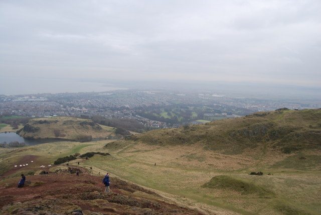
For what it is worth, I think the finest half hour in the park is the descent from the summit towards Dunsapie at about seven in the evening in May, with the light coming from behind you and the whole eastern half of the park in shadow. Nobody photographs that. Edinburgh has a good claim to be among the most beautiful places in Scotland, and this is where you see why.
What underwhelms, and the mistakes I see most
Let me be fair about the shortcomings, because they are real.
The summit is crowded and it is small. On a sunny Saturday in August there can be a hundred people on a rock platform the size of a modest living room, and you will queue to touch the trig point. If a quiet summit matters to you, go at 7am or in February.
The path erosion is bad and getting worse. The main lines are worn to bare rock and mud in a way that is genuinely ugly close up. Repair work goes on constantly, including on the Zig Zag path. Stay on the worn line rather than making a new one round the edge; that is what widens the scars.
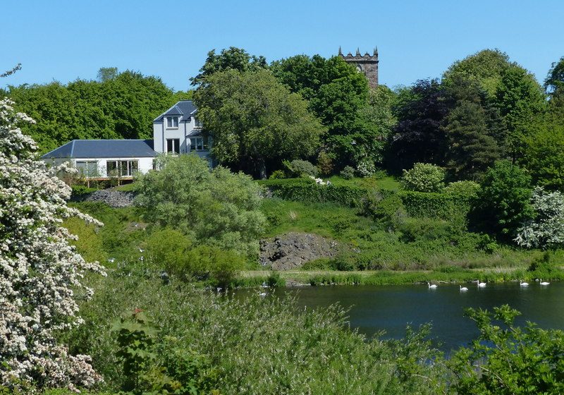
It is not a wilderness experience. There is a main road along one edge, an entire city to the west and aircraft overhead. That is part of the charm — a volcano in a capital city is a strange and good thing — but if you are expecting Highland solitude you will be disappointed. For that, look to the Scottish Highlands.
The mistakes, in rough order of how often I see them:
- Assuming one hour, flat. It depends entirely on the route and the weather. Read the table again.
- Walking the Crags and thinking that was the summit. Covered above, and it happens daily.
- Setting off at 3pm in November. You have 65 minutes of light. That is not enough for the palace routes.
- Carrying no water in July. There is none up there and the south face is a suntrap.
- Going up in a gale because it is “only 251 metres”. Height has nothing to do with it. Exposure does.
- Planning to drive to Dunsapie on a Sunday. The road is shut. Every Sunday.
- Descending the same steep way they came up. Go up the steep side and down the gentle one. Always.
One more, which is less a mistake than a missed opportunity: people come down and go straight back to the shops. Duddingston, ten minutes from the eastern foot, is a village that has somehow survived inside Edinburgh, and it is the best thing in the park after the hill itself.
Frequently asked questions
How long does it take to climb Arthur’s Seat?
Between 45 minutes and two hours return, depending on the route. From the Palace of Holyroodhouse allow an hour and a quarter to two hours for the round trip. From the Dunsapie Loch car park, 45 minutes to an hour. Wet weather adds most of its time to the descent, not the climb.
Is Arthur’s Seat free, and do I need to book?
Yes, it is completely free, and no booking is needed. Holyrood Park is open 24 hours a day, all year, with no gates and no admission charge. It is one of the better things you can do in Scotland for nothing, and the only cost you might incur is car parking or a bus fare.
Is it Arthur’s Seat or Arthurs Seat, and where does the name come from?
Both spellings are used, and arthurs seat without the apostrophe is extremely common online. Nobody is certain about the origin. It may connect to King Arthur legends, as several British hills do; an earlier recorded name was Craggenmarf, and the first Arthurian form on record is “Arthurissete” from 1508. The Gaelic is Suidhe Artair.
Is the Radical Road open?
No. It has been closed since a major rockfall in September 2018 and remains closed at the time of writing in August 2026. Historic Environment Scotland plans a partial reopening between the Hawse and the South Quarry, but the timetable has slipped repeatedly. Pre-booked ranger-guided access is currently the only legitimate route in.
How difficult is the hike up Arthur’s Seat?
Moderate rather than hard. The distances are short and no route requires scrambling, but the final 60 metres are bare rock with real drops nearby, and the gradient on the direct routes is steep enough to leave most people breathing hard. Wind and wet rock are what turn an easy walk into an awkward one.
Can you see Arthur’s Seat from Edinburgh Castle?
Yes, clearly — it dominates the eastern view from the castle ramparts, with Salisbury Crags in front of it. Both sit on the same volcanic system. If you are combining the two in a day, our Edinburgh Castle ticket guide explains how to time the visit around the crowds.
What is the best time of year to climb Arthur’s Seat?
May and September, for my money. Long enough days to be flexible, moderate temperatures, and the wind is generally less brutal than in winter. June gives you the most daylight but also the most people. Winter is fine and often beautifully clear, but you are working with seven hours of light. Our notes on the best time to visit Scotland apply here too.
Are there toilets or anywhere to buy water on Arthur’s Seat?
Not on the hill. The nearest public toilets are at the Holyrood Park Education Centre behind the Palace of Holyroodhouse, with seasonal opening hours that end as early as 3pm in winter. There is no water, no café and no shelter anywhere on the hill itself. Fill a bottle before you leave the city.
Final thoughts
Arthur’s Seat is the rare city attraction that rewards being taken slightly more seriously than it looks. Pick the route that suits where you are staying rather than the one everyone photographs. Check the wind. Check the daylight. Bring a torch between October and March. And do not walk the Crags and call it done.
Get those things right and you have one of the best hours in Britain, ten minutes from a bus stop, for nothing. Not many places manage that. When you have finished, walk back down into the city and start on the rest of it — there is a good deal more in our complete guide to Edinburgh, and if the hill has given you the taste for it, the big-ticket list for the rest of the country is where to look next.
About the author: This guide was written and is maintained by the ScotlandTourism.org editorial team — travel writers who’ve spent years exploring Scotland’s cities, Highlands and islands, from bagging Munros to chasing the perfect dram. We update our guides regularly to keep prices, opening details and advice current.
Last updated: August 2026. Prices and opening times change — always check the official site before you travel.
Photo credits
All images are used under their respective Creative Commons or public-domain licenses:
- A walker sitting on the bare summit rock of Arthur’s Seat looking out — Jeremyberyllium93, CC BY-SA 4.0, via Wikimedia Commons
- Salisbury Crags and the summit of Arthur’s Seat in evening light above — David Monniaux, CC BY-SA 3.0, via Wikimedia Commons
- Looking down from Salisbury Crags over the Palace of Holyroodhouse and — Peter Church, CC BY-SA 2.0, via Wikimedia Commons
- Swans and gulls on St Margaret’s Loch in Holyrood Park — Graham Robson, CC BY-SA 2.0, via Wikimedia Commons
- The ruins of St Anthony’s Chapel above St Margaret’s Loch — Rosser1954, CC BY-SA 4.0, via Wikimedia Commons
- Dunsapie Loch and its car park on the east side of Holyrood Park — Peter Church, CC BY-SA 2.0, via Wikimedia Commons
- Duddingston village and the Sheep Heid Inn at the south-east corner of — Richard Webb, CC BY-SA 2.0, via Wikimedia Commons
- Walkers on the bare rock summit of Arthur’s Seat beside the trig point — John Ferguson, CC BY-SA 2.0, via Wikimedia Commons
- Sunrise from the trig point on the summit of Arthur’s Seat — Iain Lees, CC BY-SA 2.0, via Wikimedia Commons
- The view from Salisbury Crags across to Calton Hill — Daniel Kraft, CC BY-SA 3.0, via Wikimedia Commons
- Walkers descending the eastern slope of Arthur’s Seat towards Dunsapie — N Chadwick, CC BY-SA 2.0, via Wikimedia Commons
- Duddingston Kirk above Duddingston Loch — Mat Fascione, CC BY-SA 2.0, via Wikimedia Commons